Name/Title
Ox Bow Bend showing location of Artist ColonyEntry/Object ID
2021.41.48Description
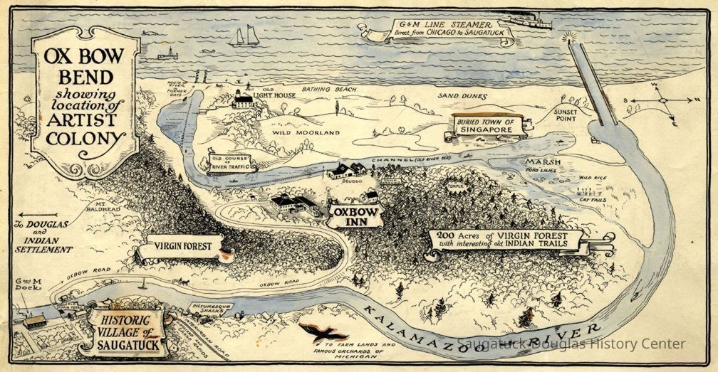
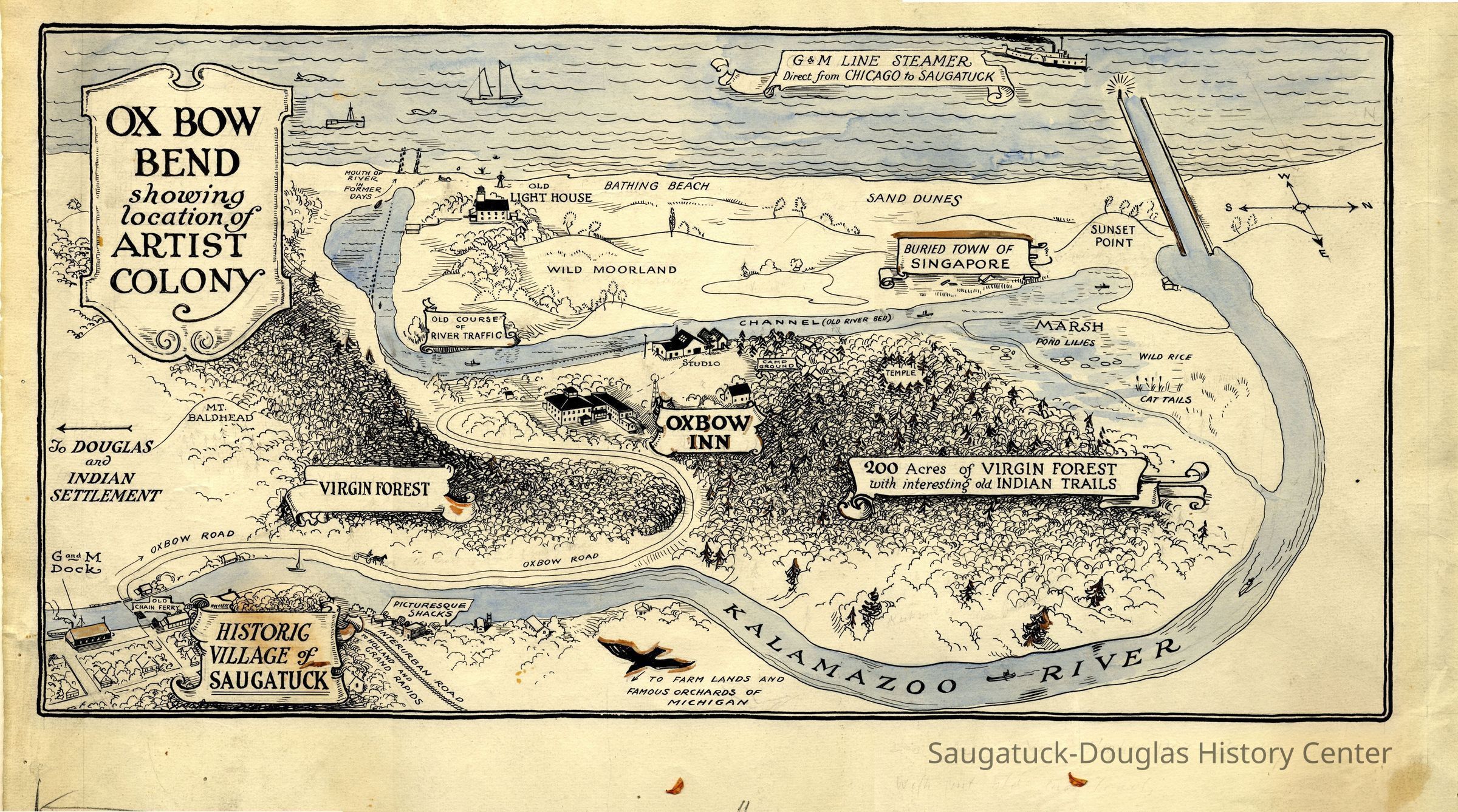
Scan of an artistic map by the Graham and Morton line showing the attractions along the Kalamazoo River. A banner at the top of the map labels a "G & M Line Steamer direct from Chicago to Saugatuck" entering the new harbor channel. "The Buried Town of Singapore" label is in the wrong location. It should be on the north side of the new channel. Other sites listed include mouth of river in former days, old course of river traffic, old light house, wild moorland, sunset point, wild rice, cat tails, pond lilies, temple, camp ground, Oxbow Inn, 200 acres of virgin forest with interesting old Indian trails, to farm lands and famous orchards of Michigan, more virgin forest, Oxbow Road, picturesque shacks, Interurban road [railroad] to Holland and Grand Rapids, historic village of Saugatuck, old chain ferry, to Douglas and Indian Settlement, G and M dock and Mt. Baldhead.Context
Graham & Morton Transportation Co. terminal was located in Saugatuck from c1912 to 1925 so likely this charming map was from that period.Collection
Maps, 1880 Tourism steamship era -1930, 1910 Ox-BowCataloged By
Winthers, SallyAcquisition
Accession
2021.41Source or Donor
Schmiechen, James A.Acquisition Method
DonationDimensions
Dimension Description
digital assetLocation
* Untyped Location
Digital data in CatalogItRelationships
Related Person or Organization
Person or Organization
Graham & Morton Transportation Co. 1874-1950, Goodrich Transit Co. warehouse/East Shore Pavilion Skating Rink/Brittian Boatyard, Ox-Bow/Summer School of Art, Ox-Bow Inn/Riverside Hotel/Shriver family homeCreate Date
August 24, 2025Update Date
September 6, 2025