Name/Title
Water Works System 1927Entry/Object ID
2024.04.115Description
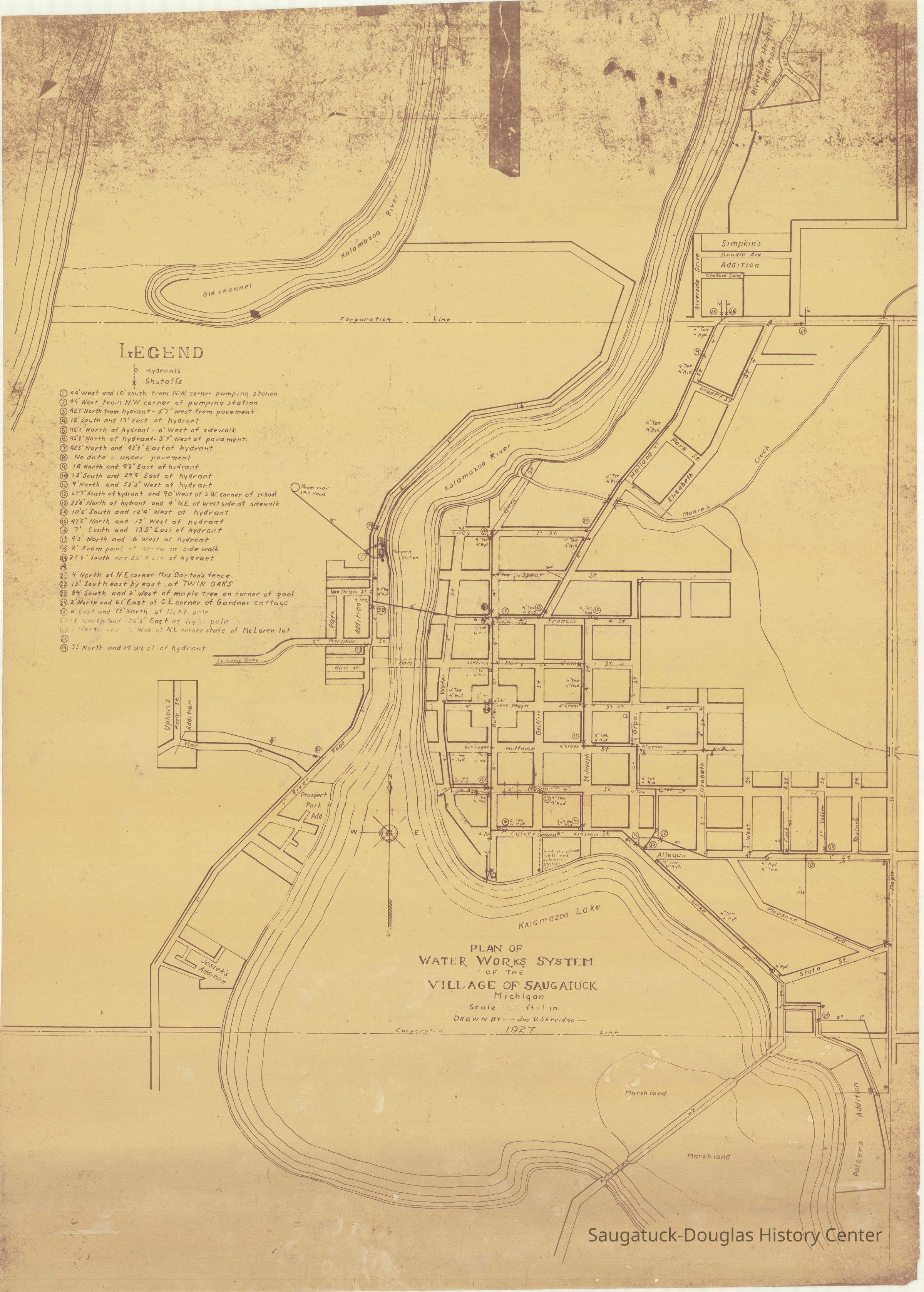
CD with seven scans of a "Plan of Water Works System of the Village of Saugatuck" 1927
The map shows the locations of municipal water system hydrants, shutoffs and lines (with diameters) from the reservoir on Lone Pine Dune to locations across the Village of Saugatuck. Outside the flats and hill water lines run to the Riverside Heights addition, Simpkin's addition, Park addition, Upham's addition, Prospect Park addition, Jesiek's addition and Palzer's addition.
The seven .jpg scans of the map vary in resolution and if color or black and white:
1 - Original - Max-RES (BEST for Printing - But may be TOO Big).jpg - 131.6MB
2 - Original - Hi-RES.jpg - 73MB
3 - Original - Med-RES.jpg - 48.7MB
4 - Original - Lo-RES (BEST for OVERALL).jpg - 9.3MB
5 - Original - Very Lo-RES.jpg - 4MB
6 - Black & White - Med-RES.jpg - 44.2MB
7 - Black & White - Lo-RES.jpg - 7MB
Scan 4 has been included with this entry.
Writing on the CD face indicates the map was scanned on 12-18-2014 by Aaron Sheridan when he was employed by Saugatuck Township.Collection
Maps, Utilities and public infrastructureCataloged By
Winthers, SallyAcquisition
Accession
2024.04Acquisition Method
Found in CollectionNotes
CD mixed in with oral interview DVDxMap Details
Maker or Creator
Sheridan, Joseph U. 1906-1983Scale
266 or 206 = 1 inchDate Published
1927Location
Box
119 B CDs Donated ContentRelationships
Related Person or Organization
Person or Organization
735 Park/S-D History Museum/Shorey Cottage/Pump House, Lone Pine Hill/DuneCreate Date
November 1, 2024Update Date
November 2, 2024