Name/Title
Map 1831/32Entry/Object ID
2023.50.102Scope and Content
Scans of William G. Butler map and text
Copy of digital content from SDHC newsletter insert, page 372-3.
Location of original documents unknown.Context
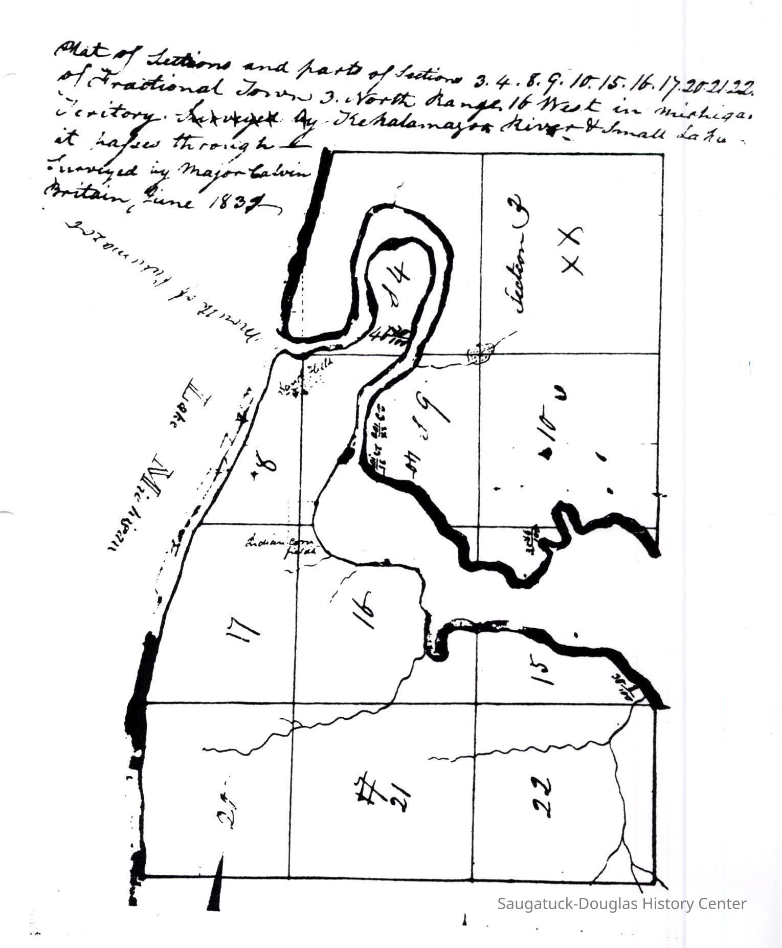
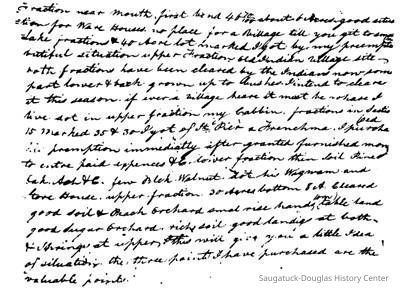
A recently discovered map drawn of the land around Saugatuck in 1831 or 1832. The notes are in the hand of William G. Butler, the first settler who arrived in 1830. It is unclear who the letter was written to, or when. Below is a somewhat speculative transliteration of the words. The meaning is often unclear because of lack of punctuation. Butler writes that there was an old Indian village at the site.Collection
SDHS NL Inserts, 1830 Settlement, pioneer era, MapsCataloged By
Winthers, SallyAcquisition
Accession
2023.50Acquisition Method
Found in CollectionNotes
SDHS Newsletter insert pages 372-373Location
* Untyped Location
Digital data in CatalogItRelationships
Related Person or Organization
Person or Organization
Butler, William Gay 1799-1857, Britain, Calvin 1800-1862General Notes
Note
This information was OCR text scanned from SDHS newsletter supplements. Binders of original paper copies are in the SDHC reference library.Create Date
January 6, 2024Update Date
September 18, 2024