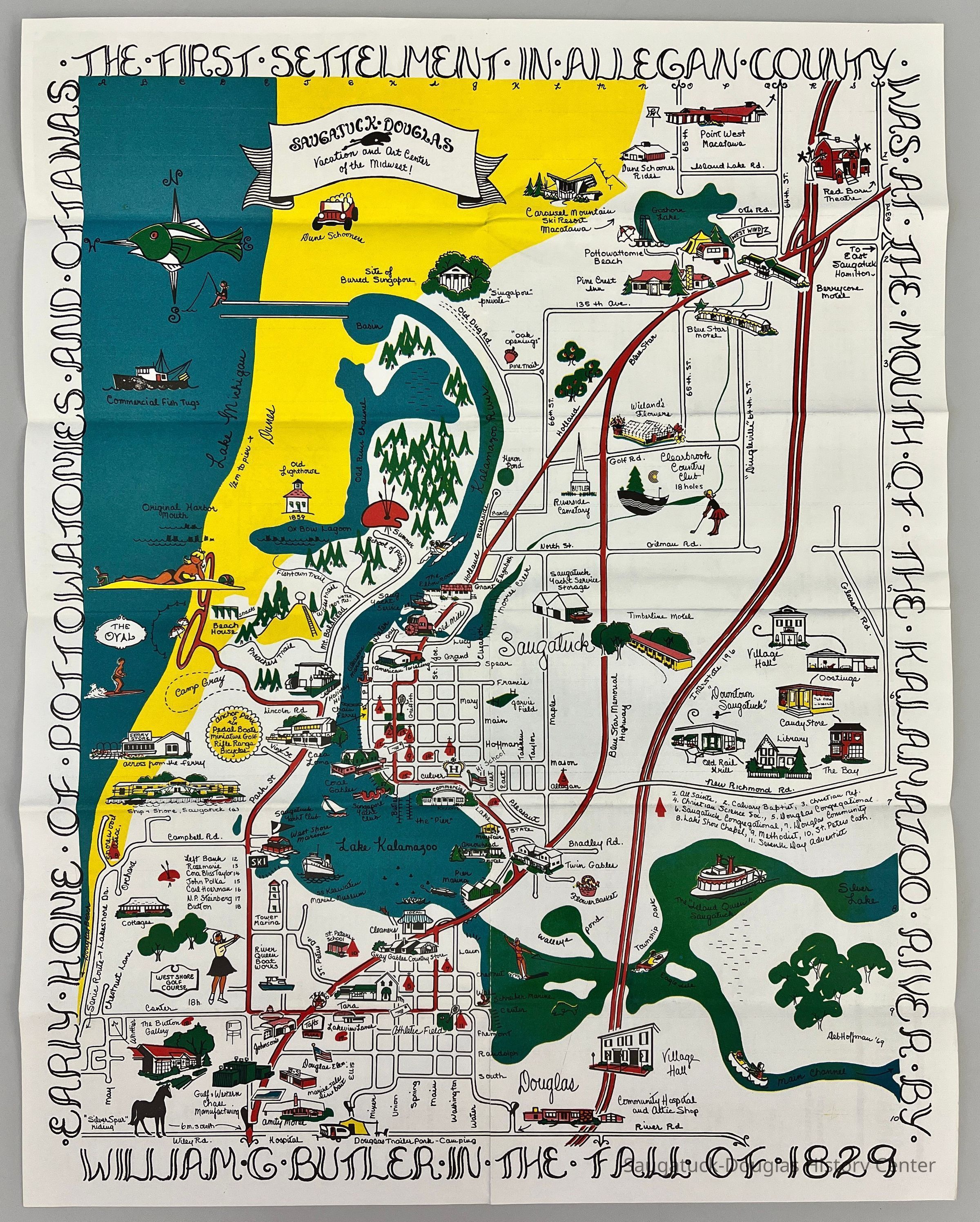
Name/Title
Hoffman Caligraphic Frame MapEntry/Object ID
2024.04.02Description
Color illustrated map drawn by Debbie Hoffman. The border around the map includes the text "Early home of the Pottowatomies and Ottawas, the first settlement in Allegan County, Was at the mouth of the Kalamazoo River by, William Butler in the fall of 1829" [sic] The map is sprinkled with cartoons of historic buildings and tourist attractions.
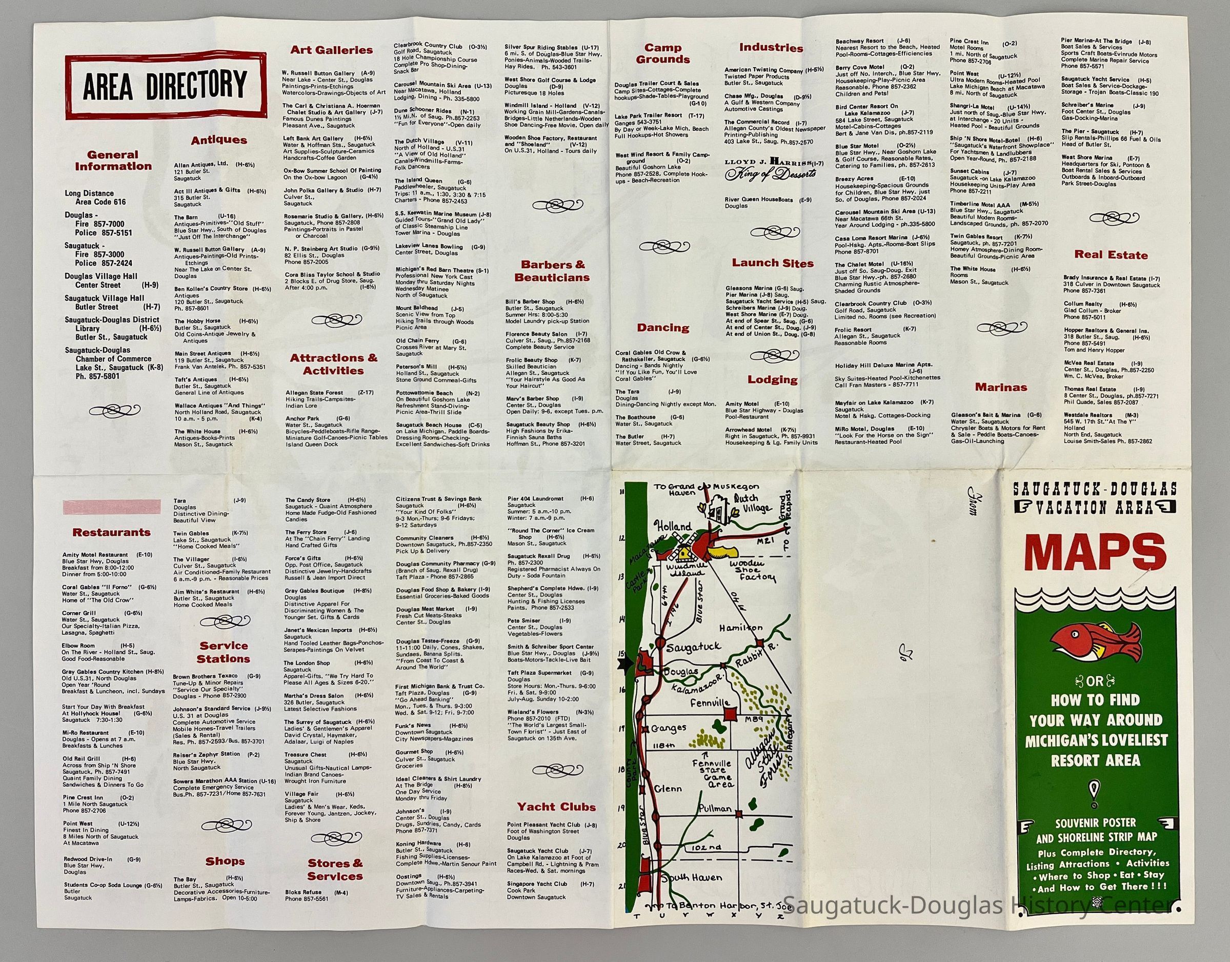
Map used on fold out guide produced by the Saugatuck-Douglas Chamber of Commerce.Context
Drawn, produced and sold by Debbie Hoffman to local stores in the late 1960/early 1970s. The family left the area in 1977Collection
MapsCataloged By
Winthers, SallyAcquisition
Accession
2024.04Acquisition Method
Found in CollectionDimensions
Height
22-1/2 inWidth
17-1/2 inLocation
Drawer
Flat Files drawer 12 tourism mapsRelationships
Related Person or Organization
Person or Organization
Hoffman, Debbie, Chamber of Commerce, Saugatuck-DouglasCreate Date
February 13, 2024Update Date
February 20, 2024