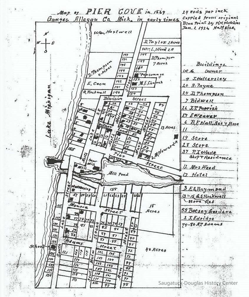
Name/Title
Map of Pier Cove in 1869Entry/Object ID
2018.30.02Scope and Content
8 1/2 x 11 photocopy of the property lines of the Pier Cove development. Some names and with corresponding lot numbers are included.Collection
Development, land, MapsCataloged By
Voss, MaryAcquisition
Accession
2018.30Source or Donor
Foster, BetsyAcquisition Method
DonationLocation
Filing cabinet
Files Accession NumberCondition
Overall Condition
Not ratedRelationships
Related Person or Organization
Person or Organization
Pier Cove 1839-General Notes
Note
Notes: Copied from original blueprint by H.H. Hutchins Jan. 1, 1926
(half size)
Status: OK
Status By: Mary Voss
Status Date: 2019-07-22Create Date
July 22, 2019Update Date
April 1, 2024