Name/Title
Douglas Business DirectoryEntry/Object ID
2020.01.05Description
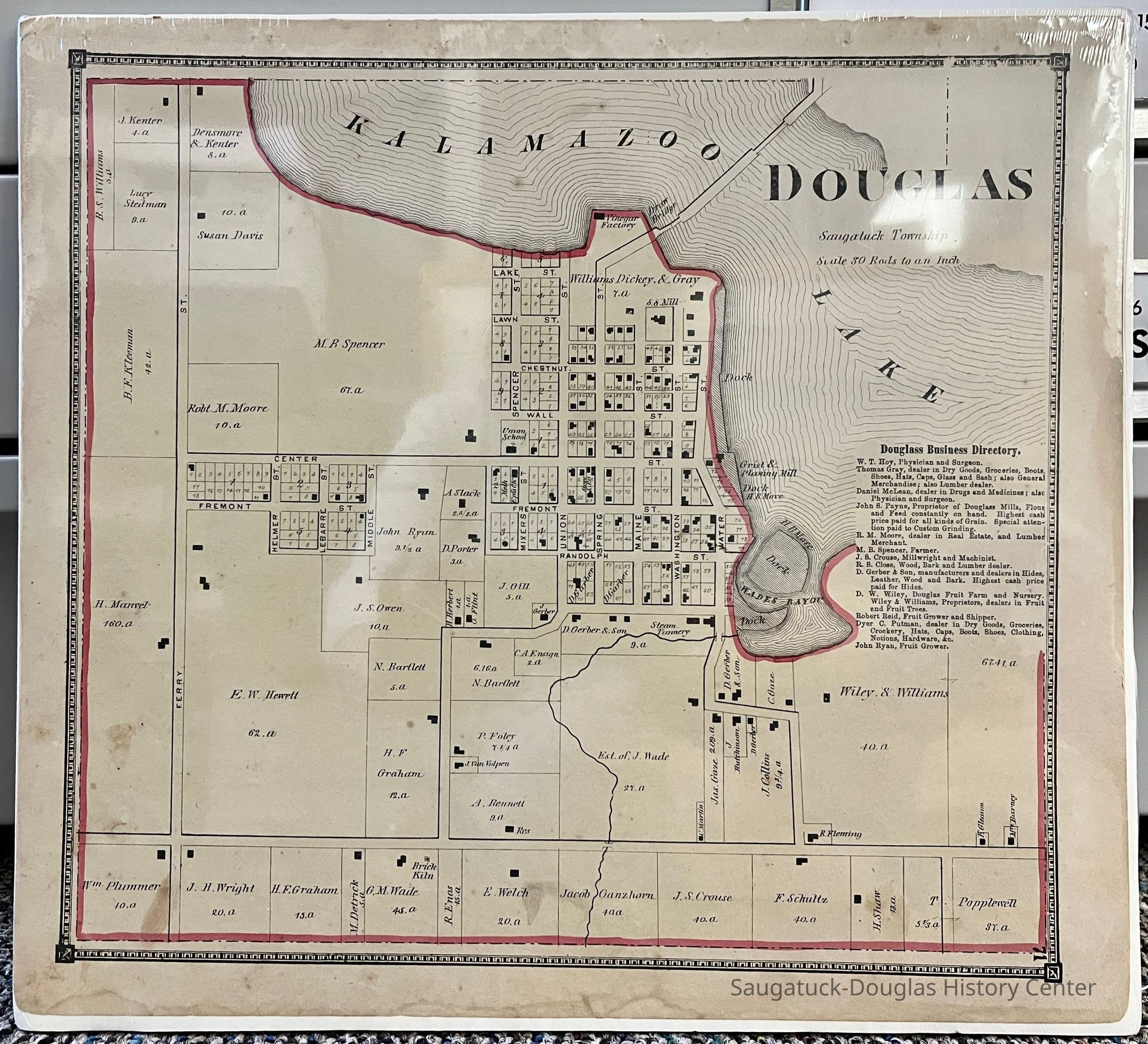
Page with of a map of the Douglas Business District taken from the 1873 "Atlas of Allegan County, Michigan" by C.O. Titus. The Douglas borders have been outlined in red marker. The map is shrink wrapped on white foam core.Collection
Maps, 1830 Settlement, pioneer eraCataloged By
Voss, MaryAcquisition
Accession
2020.01Source or Donor
Kutzel/McGlone partnershipAcquisition Method
DonationLexicon
Search Terms
Business Map of Douglas 1873Location
Drawer
Flat Files drawer 16 plat and property mapsGeneral Notes
Note
Status: OK
Status By: Mary Voss
Status Date: 2020-02-03Create Date
February 3, 2020Update Date
September 12, 2023