Name/Title
Map of Allegan CountyEntry/Object ID
2024.04.27Description
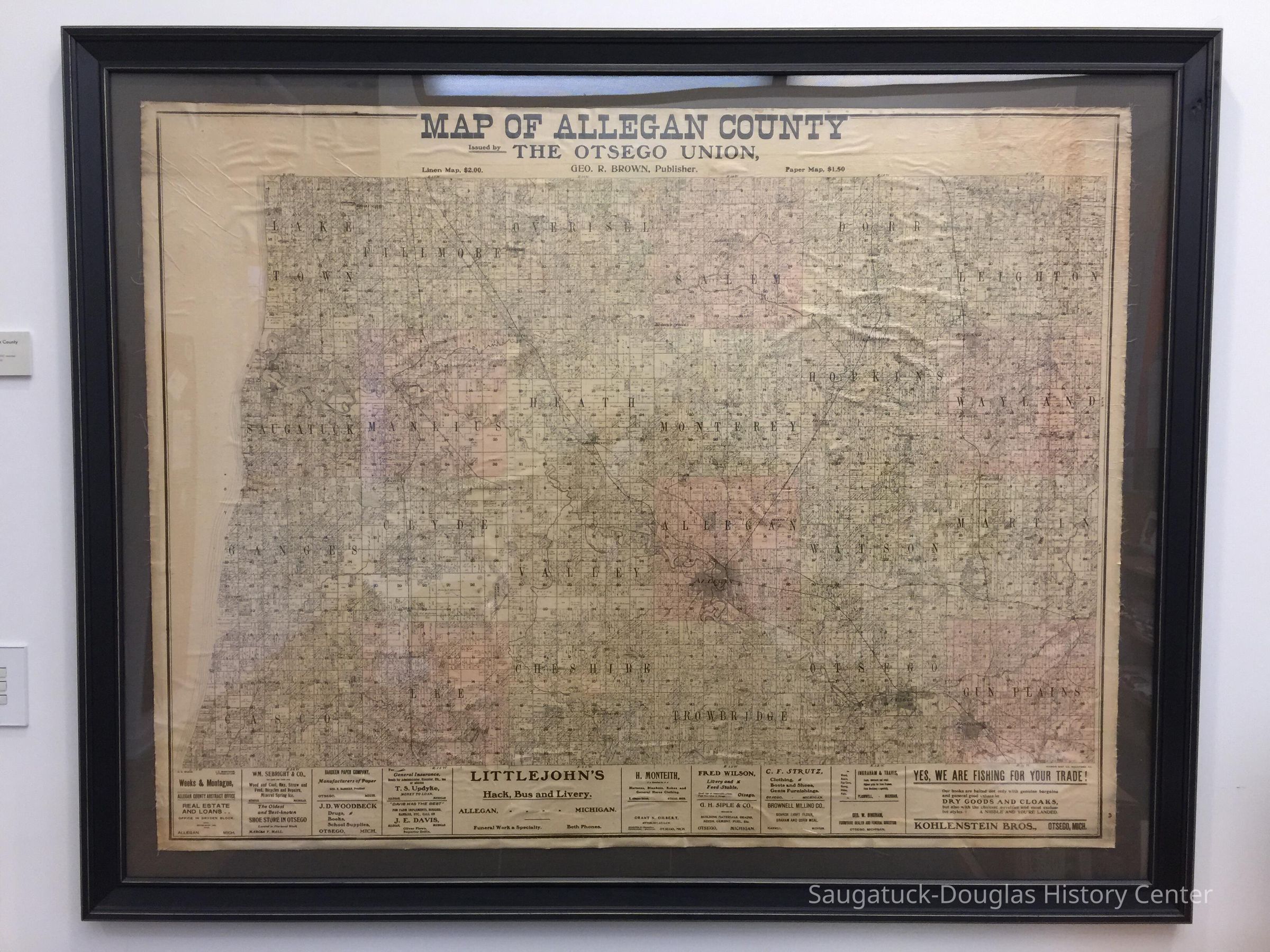
Large map of Allegan County, framed.
Issued by the Otsego Union, Geo. R. Brown, Publisher.
At top, "Linen Map, $2.00 Paper Map, $1.50"
The map uses pale tints of color to help distinguish the various townships. The bottom edge of the map has a strip of advertisements including
Weeks & Montague, Allegan Co. Abstracts Office
WM. Sebright & Co. (wood, coal, hay, straw and feed, bicylces and repairs, mineral spring ice)
The oldest and best-known shoe store in Otsego
Hardeen Paper Company
J.D. Woodbeck (drugs, books, school supplies)
T.S. Updyke (general insurance, money to loan)
J.E. Davis (farm implements, buggies)
Littlejohn's Hack, Bus and Livery (funeral work a specialty)
H. Monteith (harnesses and general horse clothing)
Grant N Olbert, Attorney at Law
Fred Wilson Livery and Feed stable
G.H. Siple & Co. building materials
C.F. Strutz (clothing, boot and shoes, gents furnishings)
Brownell Milling Co.
Ingraham & Travis
Geo. W.
Kohlenstein Bros (Dry goods and cloaks, a nibble and you're landed)Collection
MapsCataloged By
Winthers, SallyAcquisition
Accession
2024.04Acquisition Method
Found in CollectionNotes
Item donated to the SDHC by Steve TeichDimensions
Dimension Description
not including 4 inch mat and frameHeight
43 inWidth
55 inInterpretative Labels
Label
Map of Allegan County
circa 1860
Donated by longtime SDHC member and volunteer Steve TeichGeneral Notes
Note
Two more copies of this map are rolled up and stored on the top of the archive shelves.Create Date
November 30, 2021Update Date
July 6, 2024