Name/Title
A more or less accurate map of Saugatuck DouglasEntry/Object ID
2000.03.1Description
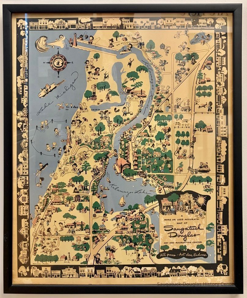
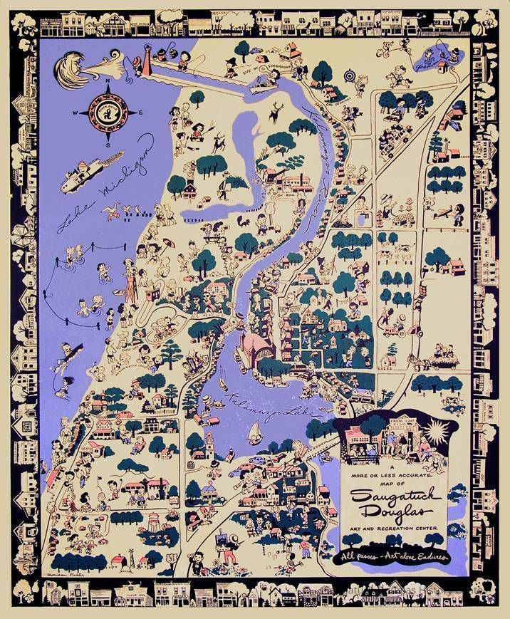
1941 illustrated area map by Maridan Richter for the River Guild (see logo inside compass rose). The map is behind glass with a .5" black frame and is printed in black, green, blue and red ink.Context
The map illustrates 1940s tourist attractions like horseback riding, observing the commercial fishermen or fruit farmers, swimming, painting, hayrides and croquet.
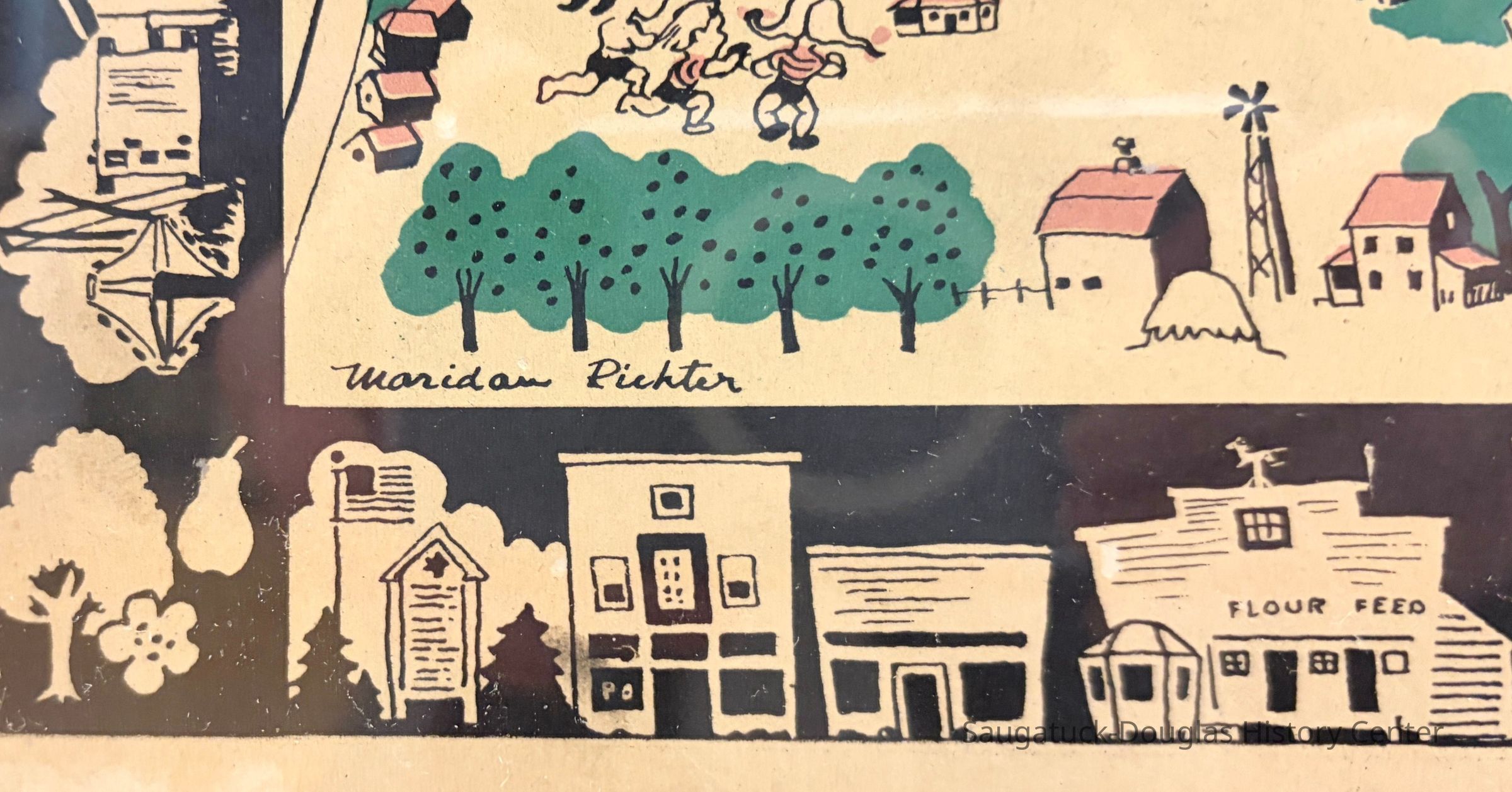
The map's border is illustrated with recognizable local buildings including the Saugatuck Boat Livery, Ox-Bow Studio, RRP Boat Livery, Maplewood, Casablanca, a shaggy information building, a fish market, the Douglas veterans memorial, the Douglas Flour and Feed store, Nortons drug store, Van Syckels grocery, Ross Phelps hardware, Saugatuck Post Office, Saugatuck Village Hall and Snug Harbor gas station.
Sites named include Singapore, Oak Openings, Goshorn Lake, Ox-Bow, U.S. 31, Camp Gray, Westminster Lodge, Oval, Tara, the Greason School and fresh lake fish.
Landmarks illustrated include the Douglas beach house, Douglas water tower, Westshore and Clearbrook golf courses, Force's greenhouse, the Kirby House, the Terrace Park eyeful tower, Mt. Baldhead, Lakeshore Chapel, West Fruit Farms/Sorensen house, Beachway, the old lighthouse, the Saugatuck airport property and the Big Pool.Collection
1930+ Tourism, brochures, guides and mapsCataloged By
Winthers, SallyAcquisition
Accession
2000.03Acquisition Method
Donation, unconditionalDimensions
Height
23-1/2 inWidth
19-1/2 inLocation
Flat Files drawer 12 tourism maps
Relationships
Related Person or Organization
Person or Organization
J.Petter/Joyce Petter Gallery/161 BSHwy/Gray Gables/River Guild, Greason School of Painting/Art school, Harbor Court Condos/Terrace Park View Resort/Eyeful Tower ?-1964, 550 Campbell, Sorensen, Murmuring Pines, Saugatuck Wilds/Airport property, Saugatuck, Force's Florists, 340-360 Water/Dockside Marketplace/Boatyard Village/Hiestand's Edge Water Boat Livery/Heath Grist MillGeneral Notes
Note
Whimsical map of Saugatuck ca 1948
One of the recent donations to the Saugatuck-Douglas Historical Society archives is a framed colored map of Saugatuck Douglas from the 1940s.
If you have ever been in the Auction House restaurant in Douglas there is one like it by the door as your leave. It is very nicely done with little drawings all over it depicting buildings and activities. It shows the old Big Pool north of town, and on a site near there where a home stands now it shows Chinese money plants growing. They still bloom in that spot every year.
The poster is signed by Maridan Richter and has the insignia of River Guild, an association of artists and craftspeople that opened a workshop and gallery in an old lumber company building in Douglas, later Gray Gables, now Joyce Petter Gallery. The map was found in the basement of the residence of Rev. Joe Hills at Presbyterian Camps.
This map and several others: a 1928 version by Fred Steams, a 1966 edition by Henry Niles, two different illustrated maps published in 1969 and 1973 by Deb Hoffman, a 1982 colored map done by Bob Carey and a 1984 map by Martha Severt will be included in this summer's exhibit on Saugatuck art. There will also be a wood block map of Western Michigan done by Hollyhock House proprietor Emily Lamb and several other specialty maps in the exhibit.
source: "Archivist's Corner" by Bill Kemperman, SDHS newsletter inserts, pg. 17Create Date
October 25, 2023Update Date
October 7, 2026