Name/Title
Shorewood Subdivision and Sewage PlanEntry/Object ID
2022.58.23Description
Blue print map of Shorewood subdivision with additional sewage disposal plan. The large, folded blueprint shows the Lake Michigan shoreline (the Beach Park), streets, lots with locations of cottages indicated, garden courts, an athletic field, orchards, the location of Forward Movement Park and inset maps of distances from Chicago and the Saugatuck Harbor.
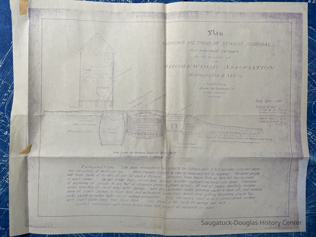
The smaller (14x18") supplement has a diagram and explanation of how the cottages will dispose of sewage.Context
Shorewood may be Saugatuck's first subdivision, built just when midwesterners (especially from Oak Park) were discovering Saugatuck as a resort destination.Collection
1902 Shorewood AssociationCataloged By
Winthers, SallyAcquisition
Accession
2022.58Acquisition Method
Found in CollectionLexicon
Search Terms
Sanitation, Public Works, InfrastructureMap Details
Maker or Creator
Alvord, John Watson 1861-1943Date Published
1900 - 1912Dimensions
Dimension Description
blueprint mapHeight
42 inWidth
36-1/2 inLocation
Drawer
Flat Files drawer 16 plat and property mapsCondition
Overall Condition
GoodNotes
Although deeply creased from folding and a few tears, the blueprint is holding up well. The accessory sewage plan has faded to a purple tone but is still readable.Create Date
September 13, 2022Update Date
September 18, 2023