Name/Title
Aerial US-196 c1976Entry/Object ID
2026.01.01Description
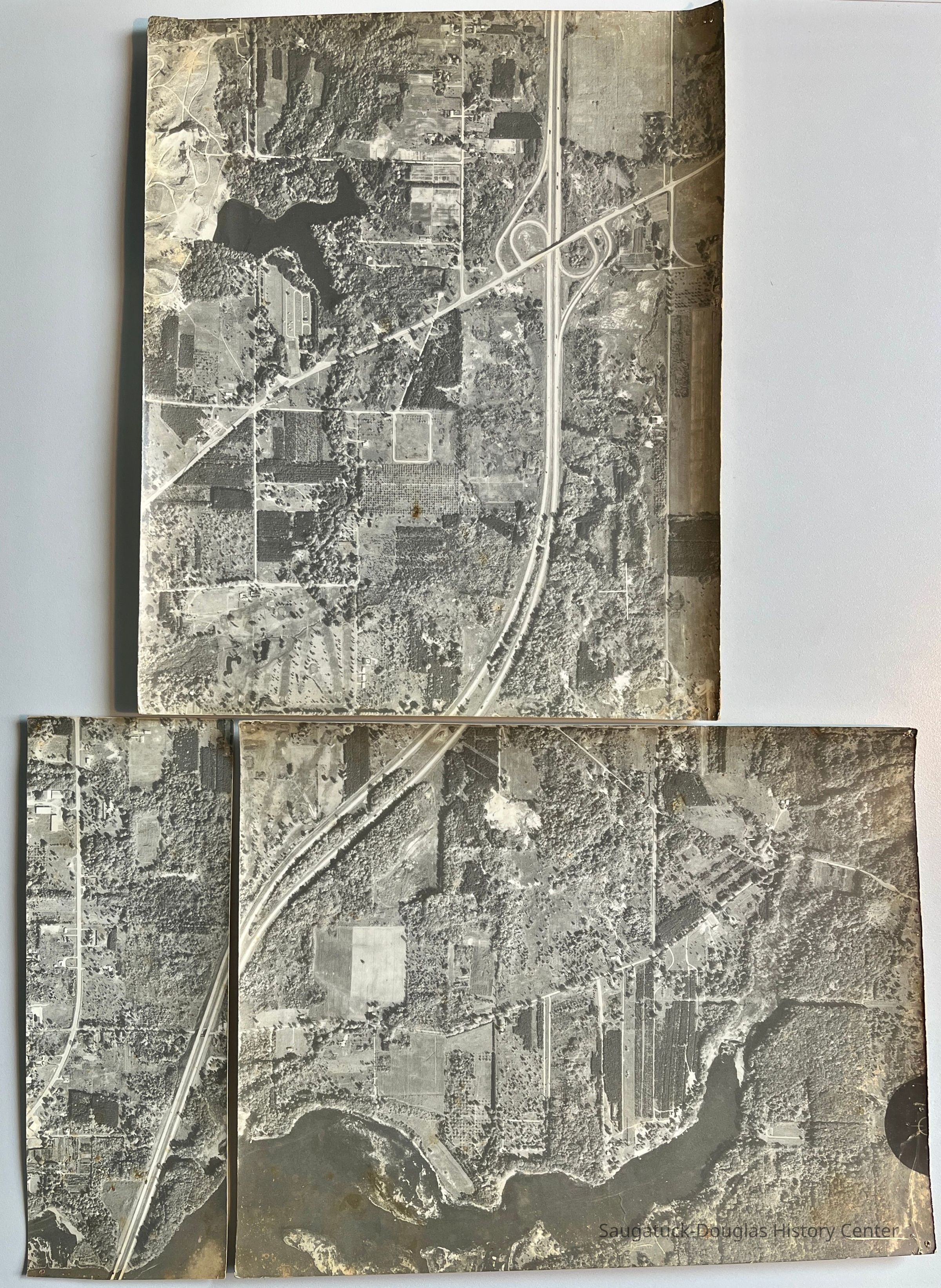
Aerial view of Saugatuck township taken from the air about 1976.
The photo is in three pieces and shows the US-196 highway from Goshorn Lake and exit 41 south to Old Allegan Road and Silver Lake.Photograph Details
Type of Photograph
Print, photographSubject Person or Organization
Interstate Highway I-196 c1963-presentSubject Place
* Untyped Subject Place
Goshorn LakeCollection
Development, land, Transportation: highway and road infrastructureCataloged By
Winthers, SallyDimensions
Dimension Description
medium-sized printHeight
12 inWidth
6 inLocation
Drawer
Flat Files drawer 15 photosCreate Date
February 10, 2026Update Date
February 12, 2026