Name/Title
Mt. Baldhead Threatens TownEntry/Object ID
2023.50.24Scope and Content
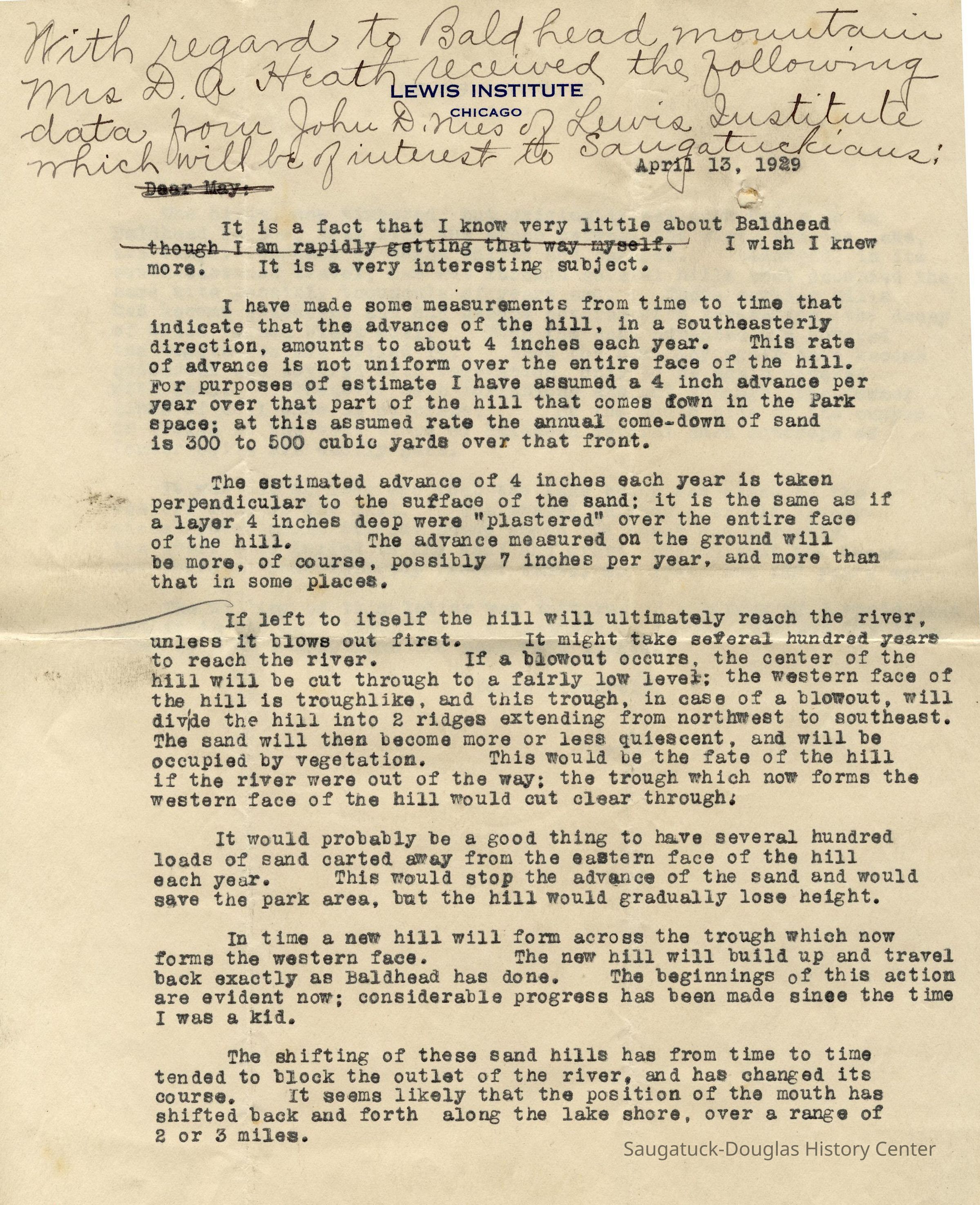
In 1929 residents of Saugatuck became concerned that Mt. Baldhead, then truly bald, would one day close off the river leaving the town without water access to Lake Michigan. May Francis Heath, who was writing a book about the area, led the group of concerned citizens. She wrote John D. Nies, identified on his stationary as of Lewis Institute, to seek his opinion as a scientist as well as a former resident (his father was one of the founders of Koning's Hardware Store). This is his reply:
Dear Mrs. Heath:
It is a fact that I know very little about Baldhead. I wish I knew more. It is a very interesting subject.
I have made some measurements from time to time that indicate that the advance of the hill, in a southeasterly direction, amounts to about 4 inches each year. This rate of advance is not uniform over the entire face of the hill. For purposes of estimate I have assumed a 4-inch advance per year over that part of the hill that comes down in Park space; at this assumed rate the annual come-dome of sand is 340 to 500 cubic yards over that front.
The estimated advance of 4 inches each year is taken perpendicular to the surface of the sand; it is the same as if a layer 4 inches deep were "plastered" over the entire face of the hill. The advance measured on the ground will be more, of course, possibly 7 inches per year, and more than that in some places.
If left to itself the hill will ultimately reach the river, unless it blows out first. It might take several hundred years to reach the river. If a blowout occurs, the center of the hill will be cut through to a fairly low level; the western face of the hill is troughlike, and this trough, in case of a blowout, will divide the hill into two ridges extending from northwest to southeast. The sand will then become more or less quiescent, and will be occupied by vegetation. This would be the fate of the hill if the river were out of the way; the trough which now forms the western face of the hill would cut clear through. It would probably be a good thing to have several hundred loads of sand carried away from the eastern face of the hill each year. This would stop the advance of the sand and would save the park area, but the hill would gradually lose height.
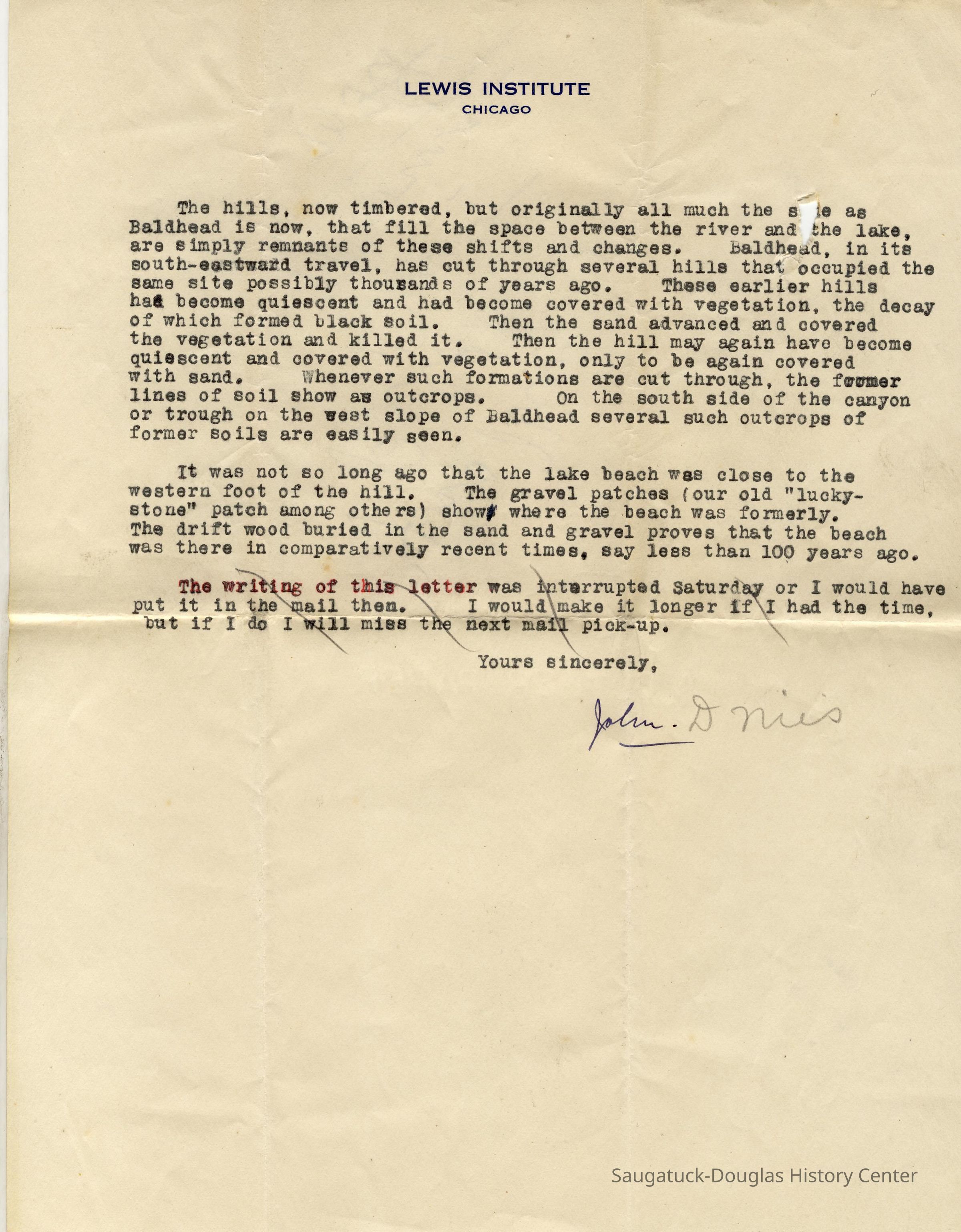
In time a new hill will form across the trough which now forms the western face. The new hill will build up and travel back exactly as Baldhead has done. The beginnings of this action are evident now; considerable progress has been made since the time I was a kid. The shifting of these sand hills has from time to time tended to block the outlet of the river, and has changed its course. It seems likely that the position of the mouth has shifted back and forth along the lake shore, over a range of two or three miles.
The hills, now timbered, but originally all much the same as Baldhead is now, that fill the space between the river and the lake, are simply remnants of these shifts and changes. Baldhead, in its south-eastward travel, has cut through several hills that occupied the same site possibly thousands of years ago. These earlier hills had become quiescent and had become covered with vegetation, the decay of which formed black soil. Then the sand advanced and covered the vegetation and killed it. Then the hill may again have become quiescent and covered with vegetation, only to be again covered with sand. Whenever such formations are cut through the former lines of soil show as outcrops. On the south side of the canyon or trough on the west slope of Baldhead several such outcrops of former soils are easily seen.
It was not so long ago that the lake beach was close to the western foot of the hill. The gravel patches (our old "lucky stone" patch among others) show where the beach was formerly. The driftwood buried in the sand and gravel proves that the beach was there in comparatively recent time, say less than 100 years ago.
Yours sincerely, John D. Nies
---
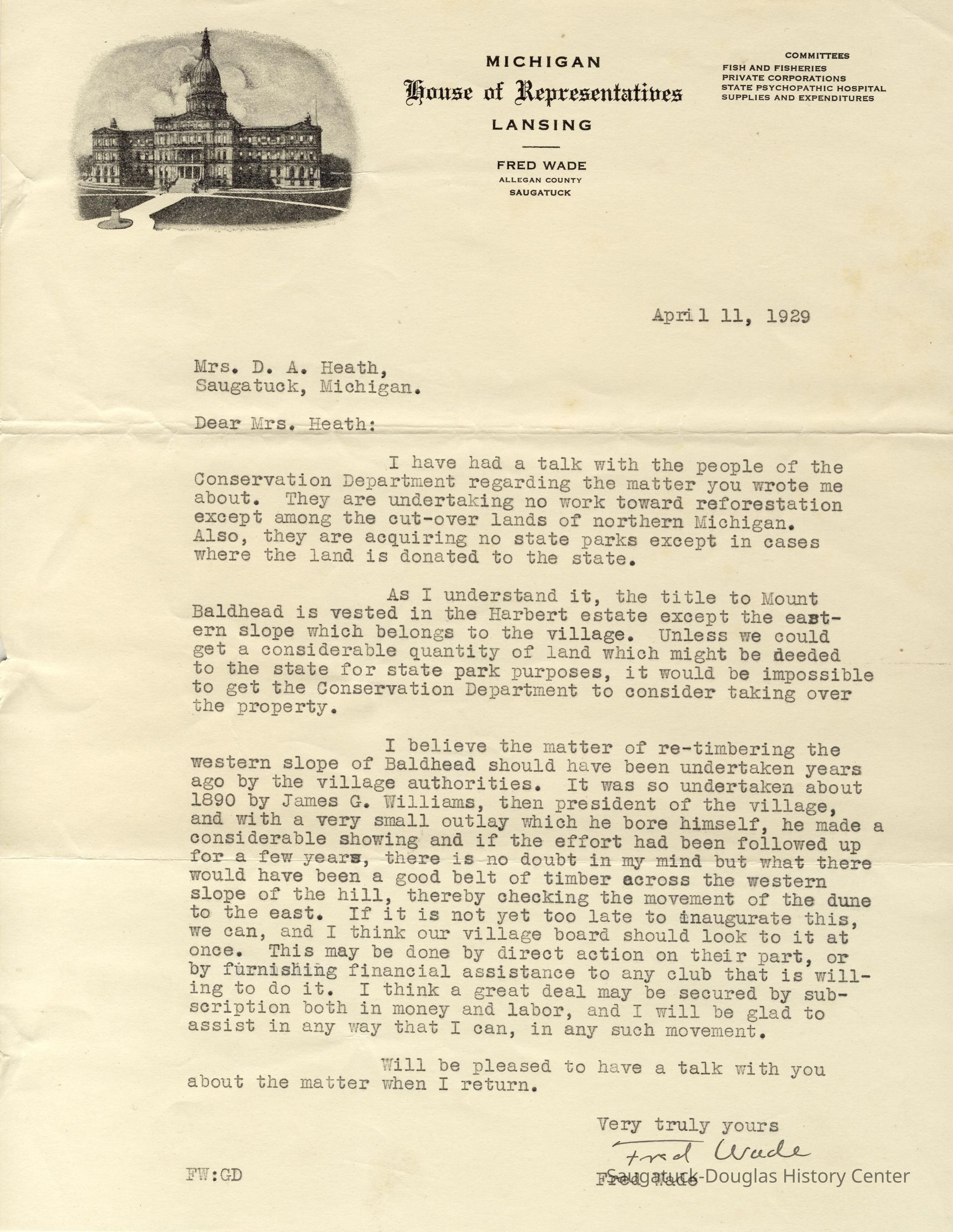
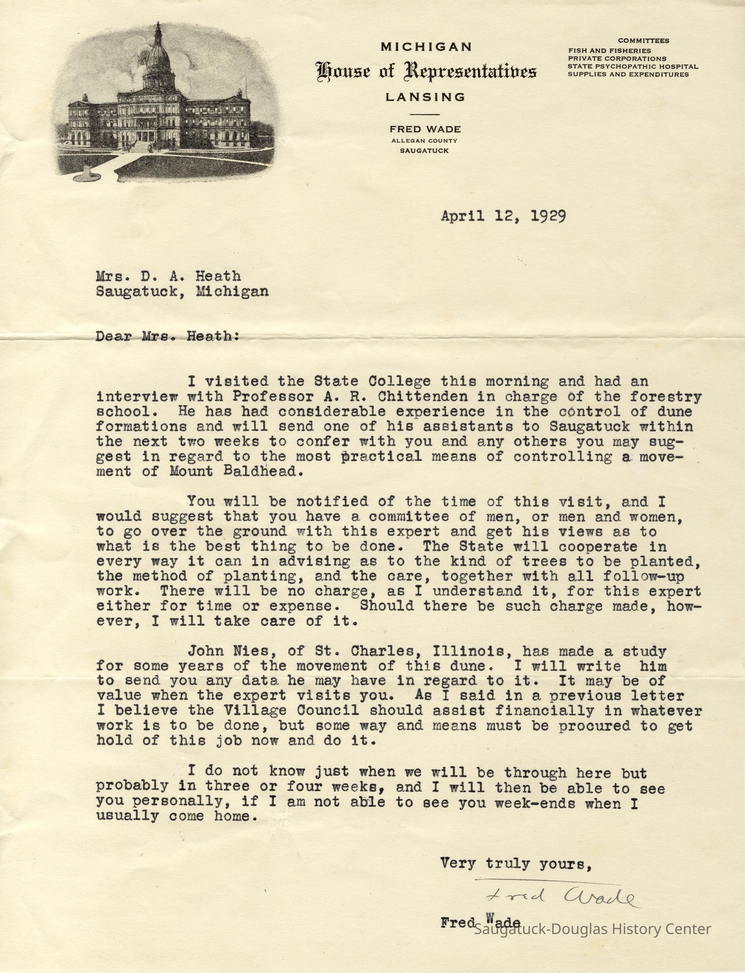
Included with this entry two letters from Michigan State Representative Fred Wade, dated April 11 and 12, about re-timbering Mt. Baldhead to stabilize the dune - if land owned by Harbert estate can be deeded to the state - and connect Mrs. Heath to John D. Nies.Context
A new staircase, with 367 steps, was built up the east side of the dune in 1931. In 1932 the forestry department of Michigan State College planted saplings and rye grass, and in 1939 the Saugatuck Park Commission planted 6,000 additional trees. This stabilized the sand. Following the Korean War a radar station was built stop Baldhead by the U. S. Air Force as part of the Distant Early Warning (DEW) line. In 1964 the apparatus was enclosed with a white fiberglass bubble. It was deactivated in 1968 and is now owned by the City of Saugatuck.
The Lewis Institute of Chicago (1896-1940), after struggling through the Great Depression, merged with Armour Institute of Technology in 1940. Today the school is known as Illinois Institute of Technology.Collection
SDHS NL Inserts, Nature, ecology, the landscapeCataloged By
Winthers, SallyAcquisition
Accession
2023.50Acquisition Method
Found in CollectionNotes
SDHS Newsletter insert page 54Location
* Untyped Location
Digital data in CatalogItRelationships
Related Person or Organization
Person or Organization
Mount Baldhead Dune/ParkGeneral Notes
Note
This information was OCR text scanned from SDHS newsletter supplements. A binder of original paper copies is catalog item 2023.50.01Create Date
November 8, 2023Update Date
March 31, 2024