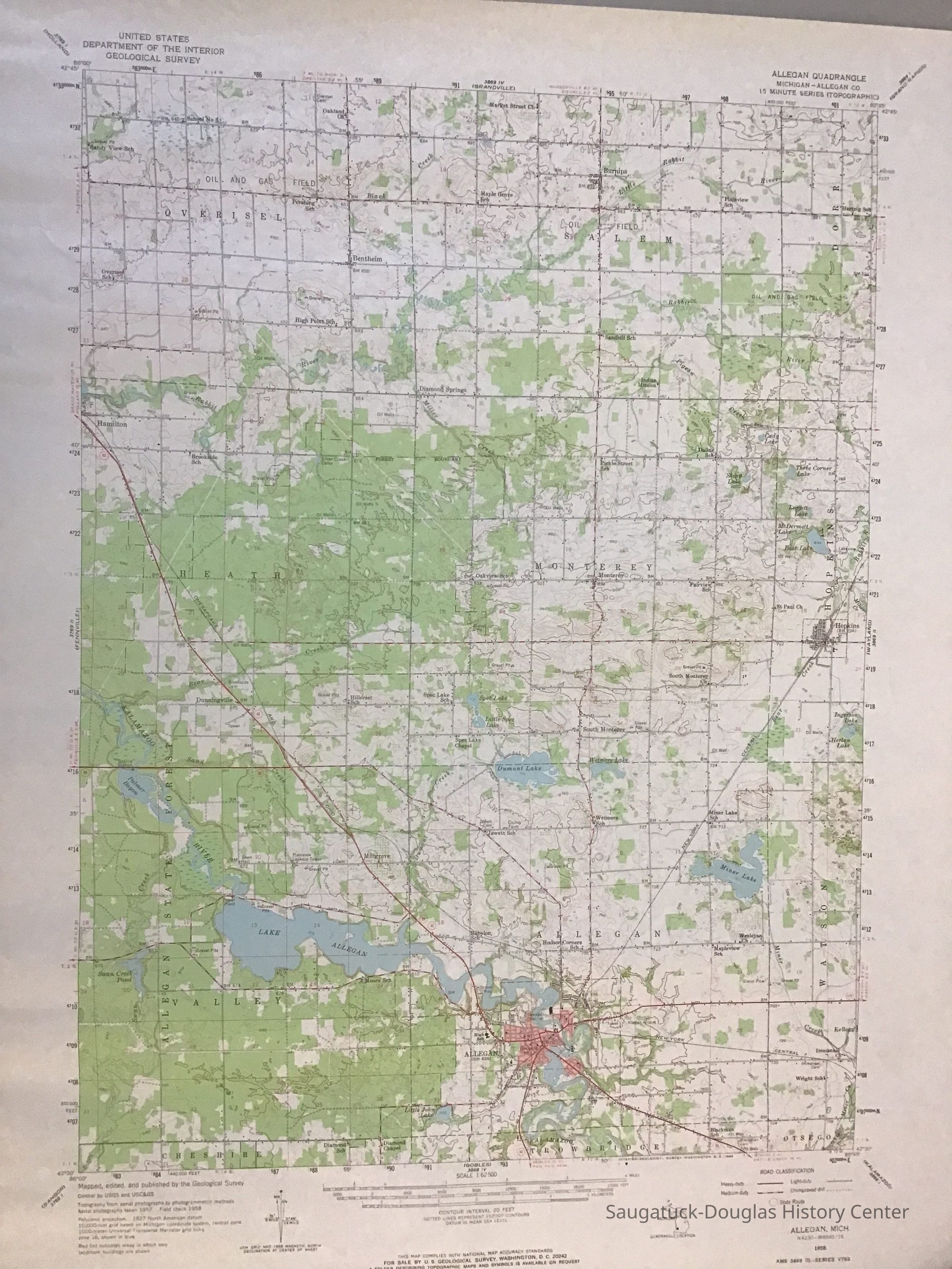
Name/Title
Allegan Quadrangle MapEntry/Object ID
2022.88.37Description
USGS quadrangle map of Allegan covering Overisel, Salem, Heath, Monterey, Valley, and Allegan townships.Collection
MapsAcquisition
Accession
2022.88Acquisition Method
Found in CollectionMap Details
Maker or Creator
United States Geological SurveyScale
1:62500Area or Region
County
Allegan CountyState/Province
MichiganCountry
United States of AmericaContinent
North AmericaProjection
ConicPublisher
United States Geological SurveyDate Published
1958Location
Drawer
Flat Files drawer 11 Local mapsCreate Date
April 20, 2023Update Date
July 23, 2023