Name/Title
Aerial 1955Entry/Object ID
2016.17.01Description
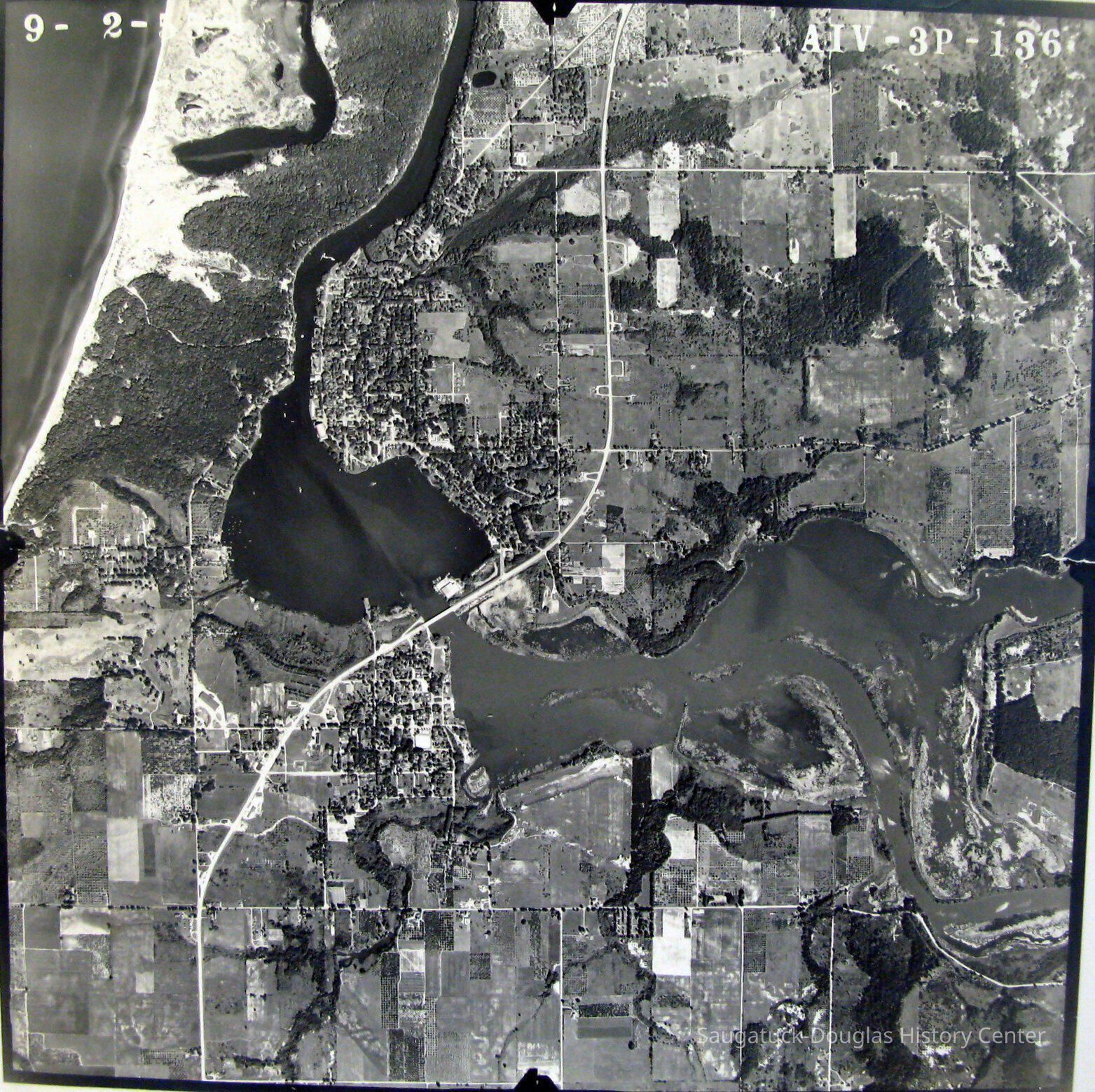
24"x24" black and white aerial photograph of the Saugatuck Harbor taken on September 2, 1955. According to James T. Fassen this was taken as a stereoscopic image to capture additional elevation information. A code in the upper right corner is AIV-3P-136.
Douglas is still dotted with orchards and large swaths of land are undeveloped.Photograph Details
Type of Photograph
Print, photographSubject Person or Organization
Tara Restaurant/Spencer House/200 Center, River Queen Boatworks/81. N Ferry/Harbor Club/Harding Hotel, 2nd, Pier Marina/Saugatuck Marine 1947-1970s, Saugatuck Fruit Exchange 1917-1956, Big Pavilion 1909-1960Context
This map is significant for all it does not show: no I-196, Tower Marina or 2024 High School.Collection
1870 Fruit growing, farming, agriculture, Development, landCataloged By
Voss, MaryAcquisition
Accession
2016.17Source or Donor
Bella, Victor "Vic"Acquisition Method
DonationLocation
Drawer
Flat Files drawer 15 photosGeneral Notes
Note
Status: OK
Status By: Mary Voss
Status Date: 2016-05-04Create Date
May 4, 2016Update Date
October 31, 2024