Name/Title
Plat map of SaugatuckEntry/Object ID
2024.08.01Description
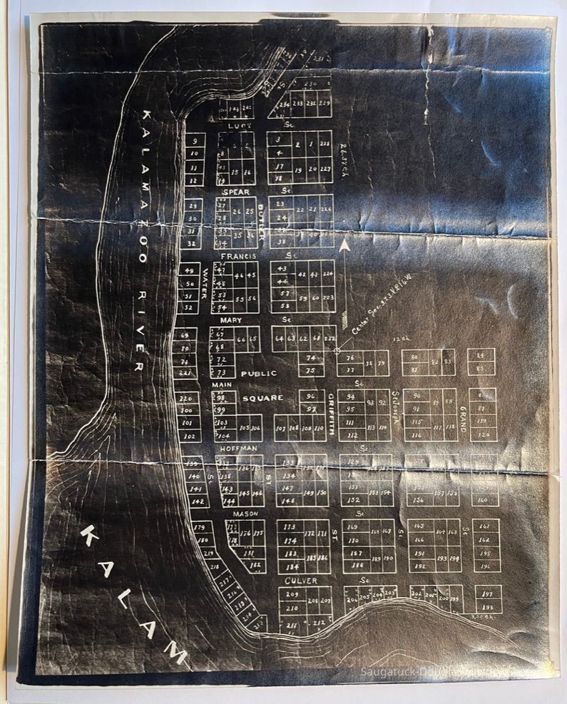
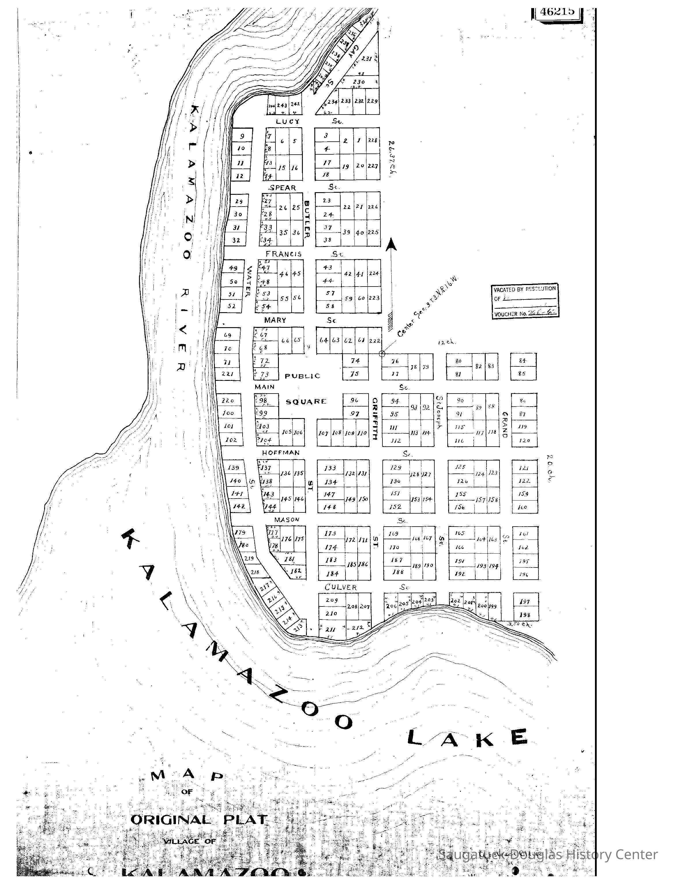
Photographic copy of a plat map that spans from Lucy St. to Culver and from the river on the west to Grand St. on the south. The center of the map is marked Center Sec. 9.T.3.N.R.16.W. Another code 26.37.Ch [Chain*] appears on the left side between Lucy and Spear St. The lots on the east side of Water Street include tiny additional markings.
Lots are numbered from 1 to at least 245. The maps shows Main and St. Joseph streets as longer than they are today.
The map has a black background and was reproduced using a photographic process. The paper is creased by three horizontal folds that are edged with a silvery sheen. The back is blank.Context
Context statement by James T. Faasen, 20 Nov 2024:
"Ch" is a survey reference meaning chain. A survey chain is 66 feet long that consists 100 links.
So in this case, 26.37 chains is 1,740.42 feet north of the center line of section 9, township 3 North, Range 16 west. Same holds true for the term 12 Ch which in this case means the eastern border of the village is 792 feet from that center line. From another “map of original Plat of the Village of Kalamazoo,” from that eastern point it is 20 ch (chains) or 1,320 feet south to the southwest corner of lot 198. From there it is either 2.99 or 3.5 chains or about 231 feet west to the river depending on which map you are looking at.
It is interesting to note that both these maps are labeled “Map of Original Plat of the Village of Kalamazoo.” Both undated maps are not the actual Plat and the subtle difference in the two between the distance from the southwest corner of lot 189 west to the river means someone was fooling around with the measurements.
With the original records in Book B, page 502 missing from the Kalamazoo County register of deeds, this poses many question with 200 pages of that book of deeds as well as the filed Plat map. The removal of these pages seem kind of deliberate. A hand written 4 can look like a 6 in this case, but not like a 5. Some one at some time removed pages 481 to 680 out of this book, but due to the 480 and 681 written similarly, no one noticed and no one noticed 3 plat maps filed at the end of this book were cut out as well.
Another disturbing thing is on this other copy of “Map of Original Plat of the Village of Kalamazoo.” there is a labeled or stamped reading 46215. In this one, there is an odd stamp that reads “Vacated by Resolution.” I have no idea what that means, but also in the lower right corner it has written “Abstract Office.”
From recorded deeds at Allegan, Butler was of the Village of Kalamazoo in Allegan County on 17 June 1834 when he sold his first lot in the village to R. R. Crosby
Deeds of his sale of lots to Mason, Griffith, and Hoffman are filed in Allegan, but are not available on-line to access.
On 7 July 1837 Butler is of Kalamazoo in Allegan County, but why that deed would not state “of the Village of Kalamazoo” is a question as yet resolved.
In 1838 when Butler sells property in the village to Morrison, he is of Newark Township, but the deed states it was signed at Newark.Collection
Maps, 1830 Settlement, pioneer era, Development, landCataloged By
Winthers, SallyAcquisition
Accession
2024.08Source or Donor
Historical Association of South HavenAcquisition Method
Donation, unconditionalLocation
Drawer
Flat Files drawer 16 plat and property mapsCreate Date
March 9, 2024Update Date
November 20, 2024