Name/Title
Mouth of Kalamazoo River MapEntry/Object ID
2022.88.38Description
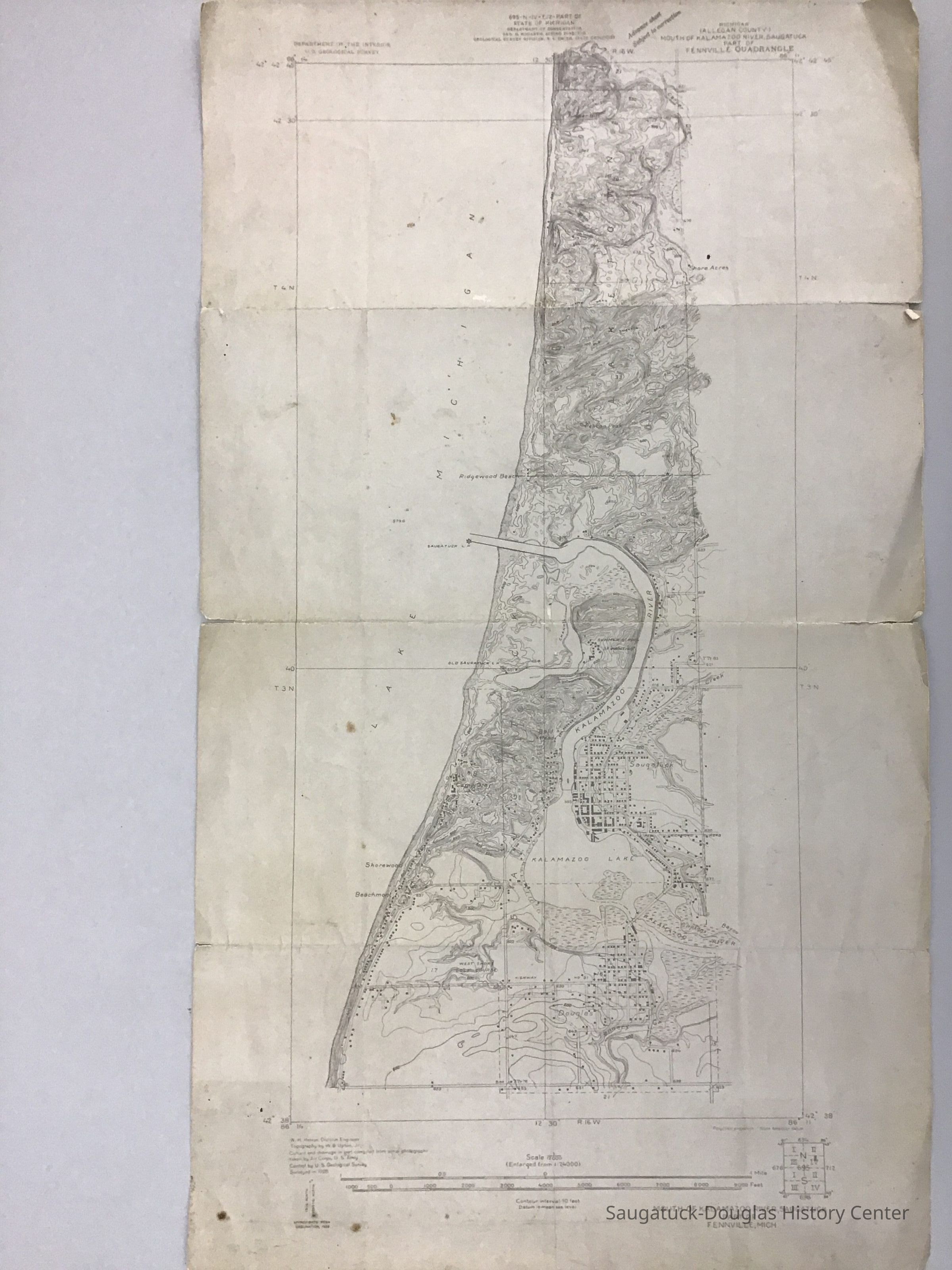
USGS quadrangle map of Douglas, Saugatuck, and Laketown township centered on the Kalamazoo River. Features on map include roads, buildings, elevation contours, and bodies of water. Place names on the map include Juniper Hill, Carver Drain, Shore Acres, Pelican Beach, Ridgewood Beach, Goshorn Creek, Shorewood, Beachmont, Clipson's Bayou, and the Tannery.Acquisition
Accession
2022.88Acquisition Method
Found in CollectionMap Details
Maker or Creator
United States Geological SurveyScale
1:24000Area or Region
* Untyped Area or Region
Kalamazoo RiverProjection
ConicPublisher
United States Geological SurveyDate Published
1928Dimensions
Height
21-1/2 inWidth
12-1/2 inLocation
Drawer
Flat Files drawer 11 Local mapsRelationships
Related Person or Organization
Person or Organization
West Shore Golf Course 1920-Create Date
April 20, 2023Update Date
July 23, 2023