Name/Title
Saugatuck Harbor 2025 MapEntry/Object ID
2025.27.01Description
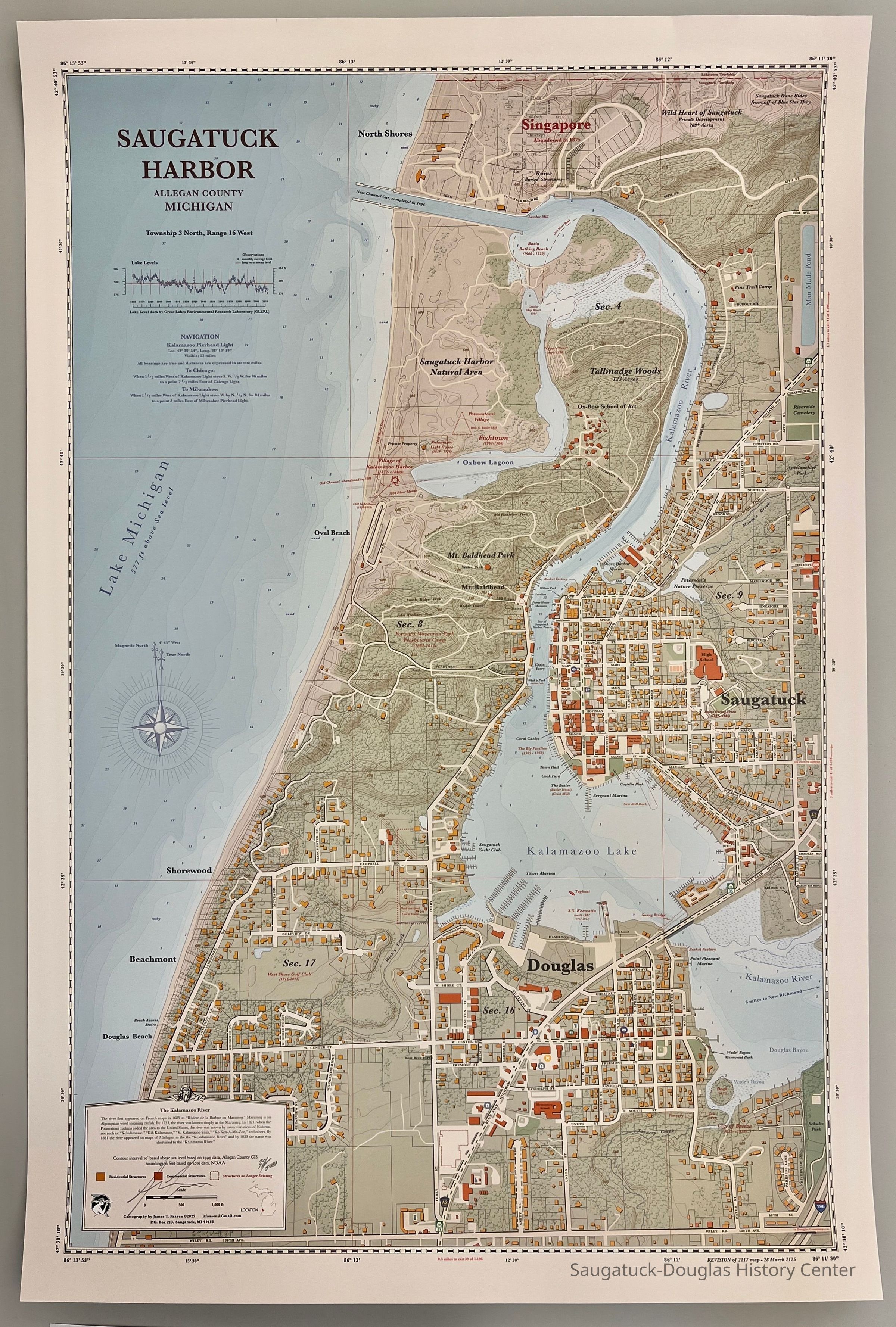
Highly detailed map that shows Saugatuck, Douglas and surroundings in 2025 from the northern boundary of Saugatuck Township to Wiley Road and from Lake Michigan to the Blue Star Highway. A new feature on the 2025 map is large, strangely-rectangular man-made lake along the upper right edge.
Numbered 38/300 and signed by the cartographer James FaasenContext
This is the third map of the harbor area created by James T. Faassen. The previous maps documented the harbor as it was in 1875 and 2017.Collection
MapsCataloged By
Winthers, SallyAcquisition
Accession
2025.27Source or Donor
Faasen, James T.Acquisition Method
Donation, unconditionalMap Details
Maker or Creator
Faasen, James T.Date Published
2025Location
Drawer
Flat Files drawer 11 Local mapsCreate Date
July 15, 2025Update Date
July 15, 2025