Shorewood Association map

ShorewoodMap20x27tu.jpg 8.2MB

ShorewoodMap20x27tu.jpg 8.2MB

Name/Title

Shorewood Association map

Entry/Object ID

2009.27

Description

Blue print map of Shorewood Association and the proposed golf course. A paper copy of survey is also in box 58 Shorewood

Collection

1902 Shorewood Association, Sports: golf, 1870 Fruit growing, farming, agriculture

Cataloged By

Voss, Mary

Acquisition

Accession

2009.27

Source or Donor

Sorensen, Cynthia A.

Acquisition Method

Donation

Lexicon

Search Terms

Shorewood

Map Details

Maker or Creator

Alvord, John Watson 1861-1943

Scale

1 inch = 100 feet, contour interval 5 feet

Date Published

1900 - 1912

Map Notes

Date(s) Created: ca. pre 1912

Dimensions

Height

34 in

Width

45 in

Location

Drawer

Flat Files drawer 14 fire maps building surveys

Condition

Overall Condition

Poor

Relationships

Related Person or Organization

Person or Organization

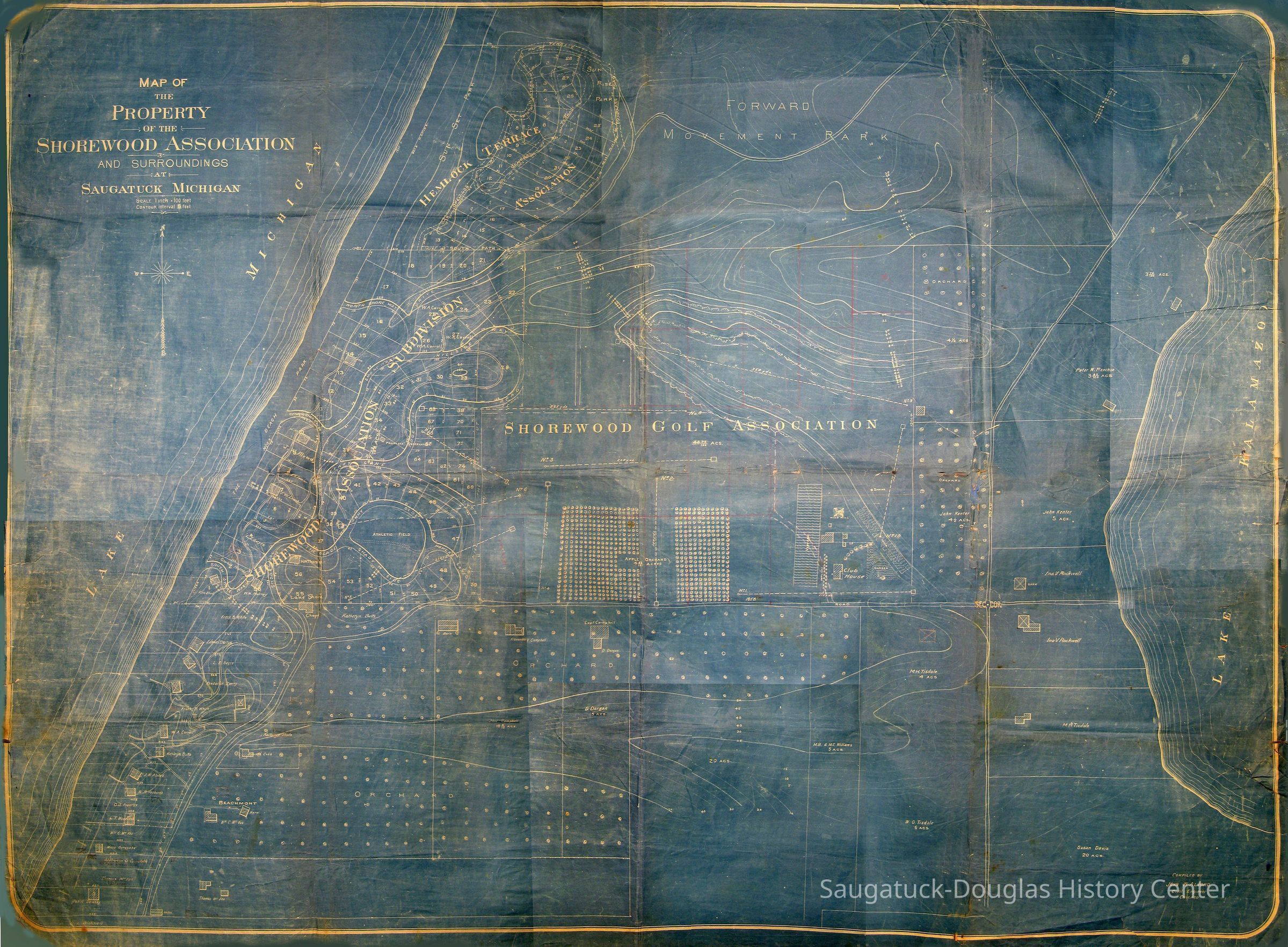
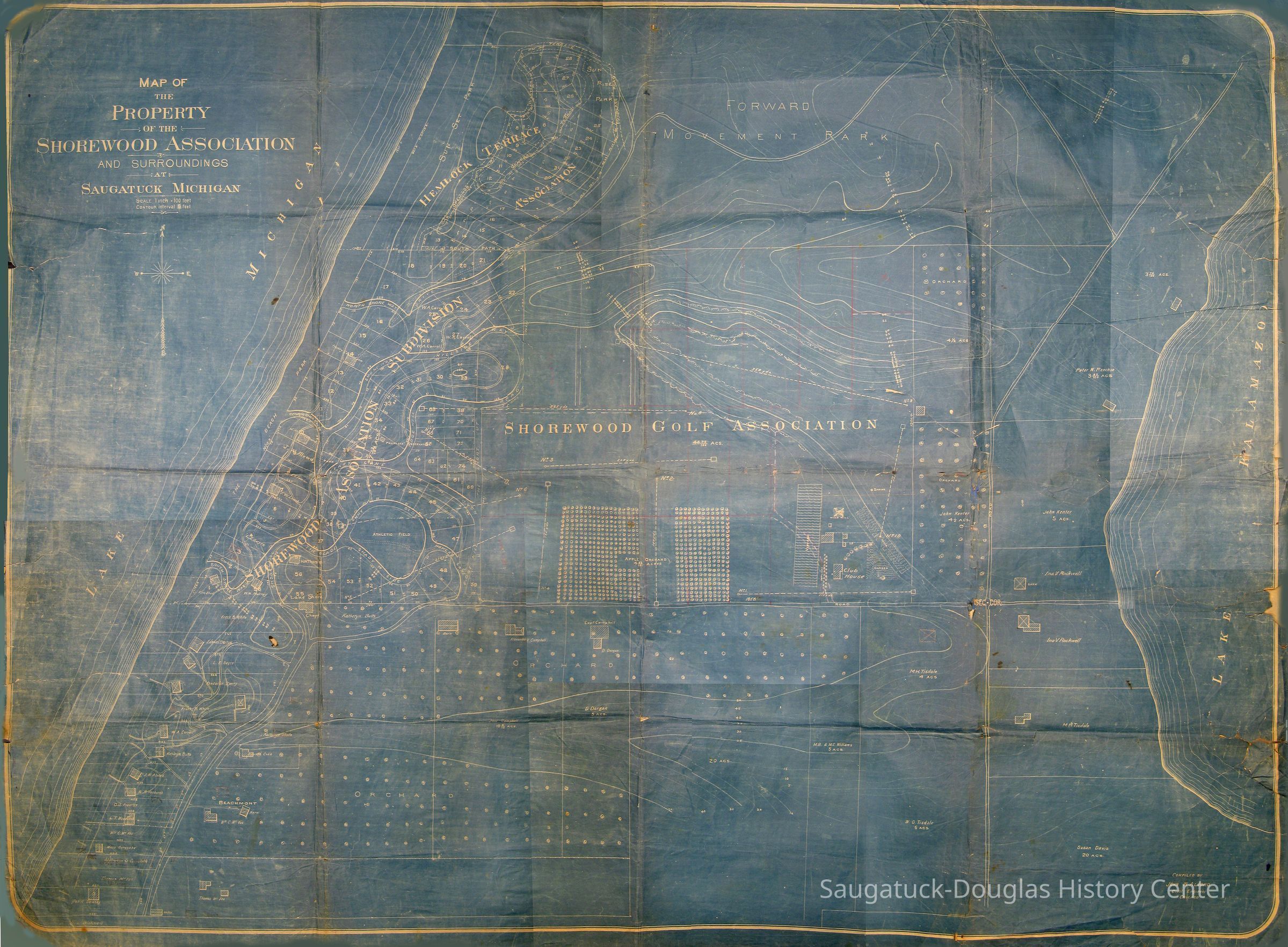
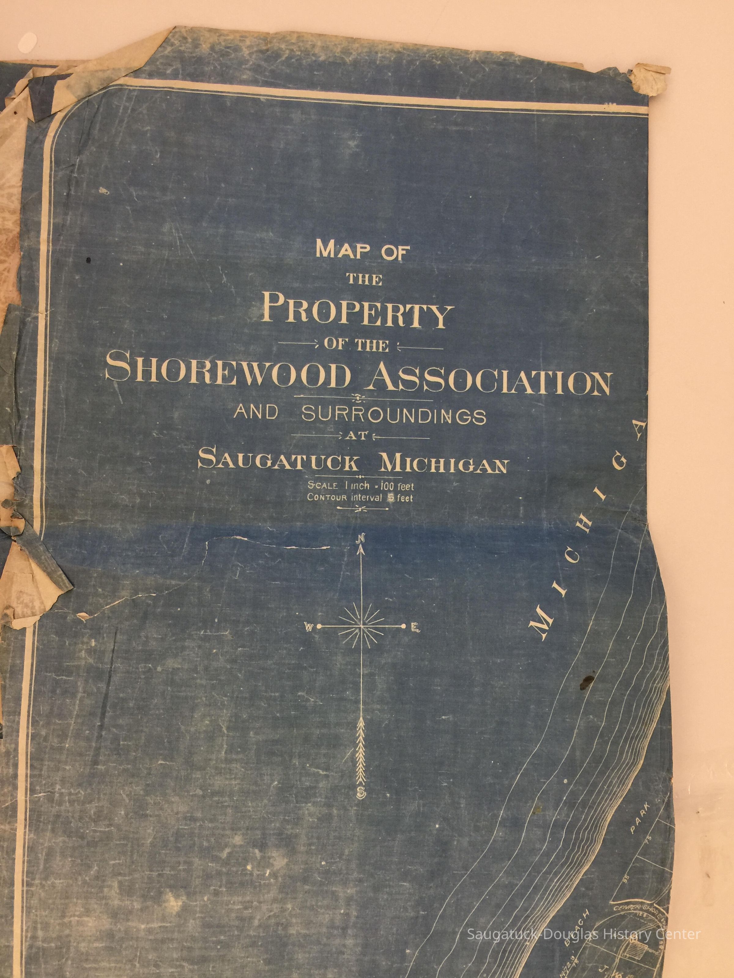
Shorewood/Hemlock Terrace, Beachmont Resort, Alvord, John Watson 1861-1943, Fowler, Ernest S., Leach, Ferry W., Sayre, Professor Lucius E. 1846-1925, Murray, Wilbur H., White, Frank B., Bartow, Dr. Edward L., Sperry, Frederick Alfred 1863-1931, Carroll, W. A., Butts, Katharyn, Vosburgh, William Richardson 1854-1924, McVea, William C. I 1860-1923, Garesche, Marie, McVea, Thomas 1823-1904, Delany, Elizabeth (Sloan), Tisdale, William Graham Sr. 1838-1907, Davis, Susan (Tisdale) 1836-1905, Rockwell, Ina Viola (Kenter) 1870-1951, Kenter, John 1825-1901, Presbyterian Camp/Camp Gray/Forward Movement Park 1899-2014, West Shore Golf Course 1920-, Williams, M. B.

General Notes

Note

The Sorrensens bought property at 550 Campbell Road - Originally a 40 acre orchard and vineyard called, "West Fruit Farm" founded by B.S. Williams and sons later known as Howard Farm. Status: OK Status By: Mary Voss Status Date: 2009-06-15

Create Date

June 15, 2009

Update Date

September 19, 2024