Name/Title
Supermap projectEntry/Object ID
2021.41.89Scope and Content
PDF proof of the Supermap image and newspaper clipping promoting the project.Context
From https://mysdhistory.org/history/projects/supermap/
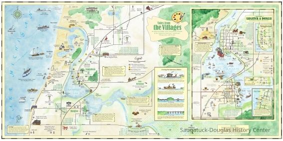
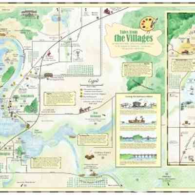
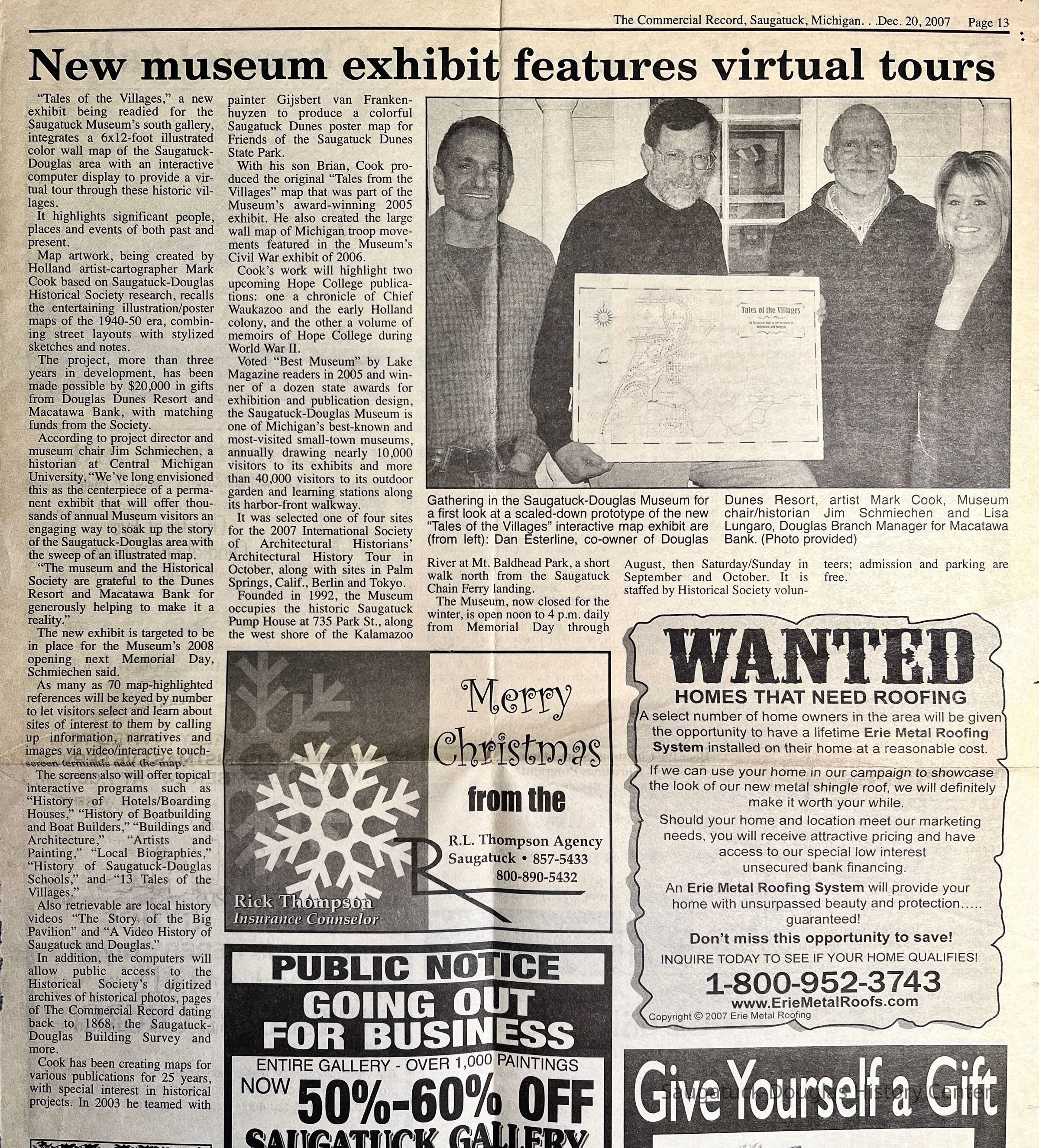
“SuperMap” is a 6-foot high, 12-foot wide illustrated color wall map of the Saugatuck-Douglas area integrated with a computer display to provide a virtual tour through the historic villages, highlighting significant people and places, past and present.
Map artwork, created by Holland artist-cartographer Mark Cook based on History Center research, recalls the entertaining illustration/poster maps of the 1940-50 era, combining street layouts with stylized sketches and notes. More than three years in development, this project was made possible by gifts from Douglas Dunes Resort and Macatawa Bank totaling $20,000, with matching funds raised by History Center members and friends.
Over 100 map-highlighted references are keyed by number to let visitors select and learn about sites of interest to them by calling up information, narratives, and historical photographs on an interactive computer terminal near the map.
The original map is in the South Gallery at the History Museum. There is a copy in the Map Room at the History Center.
Project credits
Concept and text: James Schmiechen, with Kit Lane
Data Input and Research: Dick Haight and Jack Sheridan
Map Design & Illustration: Mark Cook, with Brian Cook
Digital Production: John Capatosto for Agio Imaging, Inc.
Corporate Underwriters: Dunes Resort and Macatawa BankCollection
SDHC ExhibitsCataloged By
Winthers, SallyAcquisition
Accession
2021.41Source or Donor
Schmiechen, James A.Acquisition Method
DonationLocation
* Untyped Location
Digital data in CatalogItRelationships
Related Person or Organization
Person or Organization
Schmiechen, James A., Cook, Mark, Esterline, Danny, Cook, Brian, Lungaro, LisaGeneral Notes
Note
The original "Tales of the Village" exhibit was from 2004.Create Date
December 27, 2025Update Date
December 27, 2025