Name/Title
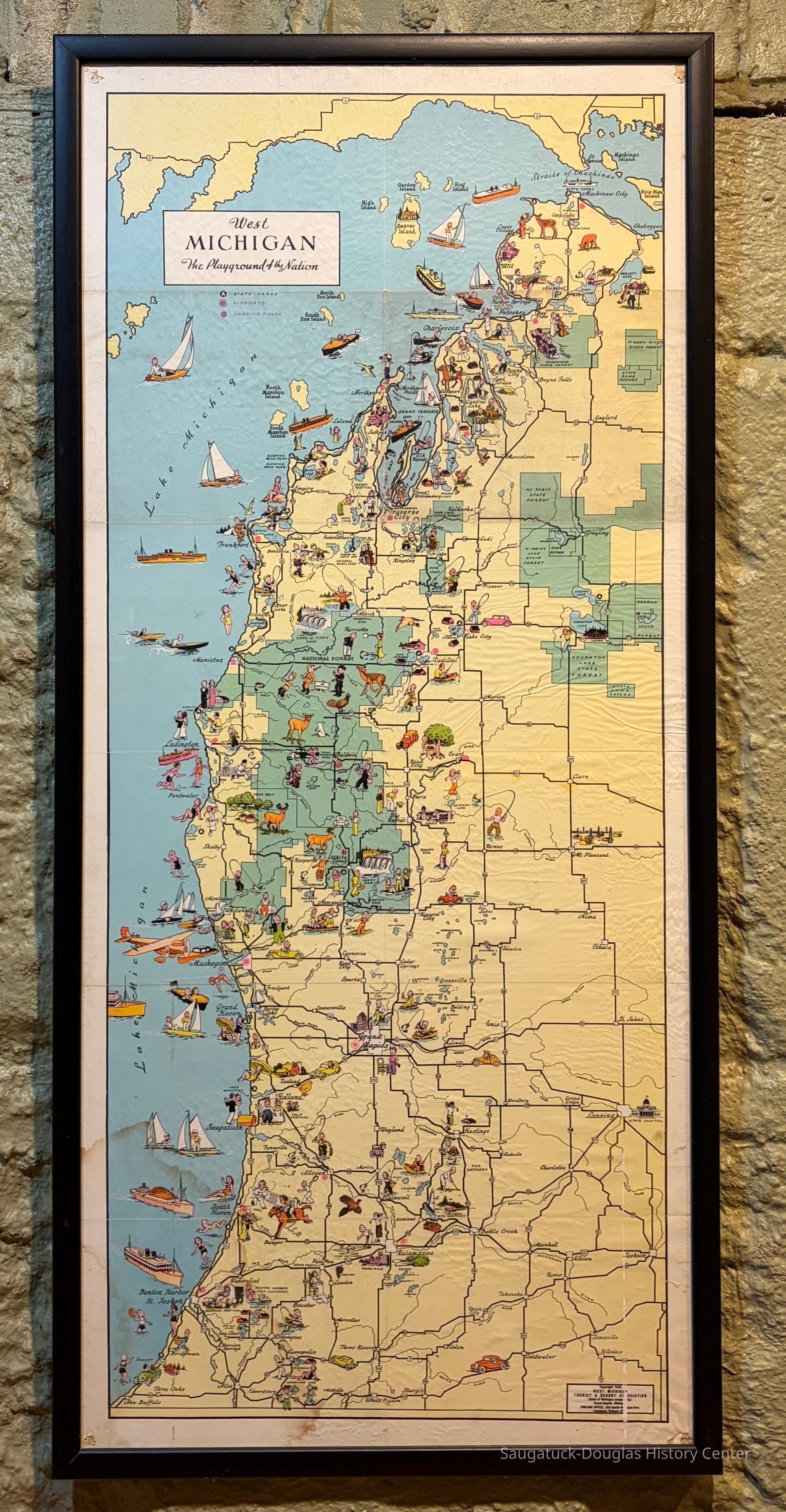
West Michigan, the Playground of the Nation, 1935Entry/Object ID
2000.03.03Description
Tourism map titled "West Michigan, The Playground of the Nation," published by the West Michigan Tourist and Resort Association in 1935. The map is behind glass with a 1-inch black frame. The map shows the western side of Michigan's lower peninsula from the Straights of Mackinac to New Buffalo. Saugatuck is symbolized by a dancing couple and the Big Pavilion. Fennville and Holland is also indicated.Context
As the Michigan Pike highway was completed, Michigan sought to promote itself as a tourist destination.Collection
Maps, 1930+ Tourism, brochures, guides and mapsCataloged By
Winthers, SallyAcquisition
Accession
2000.03Acquisition Method
Donation, unconditionalMap Details
Maker or Creator
West Michigan Tourist and Resort Association 1917-Date Published
1935Location
Building
History Museum at Mt. Baldhead Park/Pump House MuseumCondition
Overall Condition
FairNotes
The map is covered in fine wrinkles with tack hole damage in the corners.Create Date
October 8, 2026Update Date
October 8, 2026