Shaker Heights, 1932
Name/Title
Shaker Heights, 1932Entry/Object ID
5.1.1Tags
1930s, 20th Century, Shaker Heights, Shaker Square, Van SweringensDescription
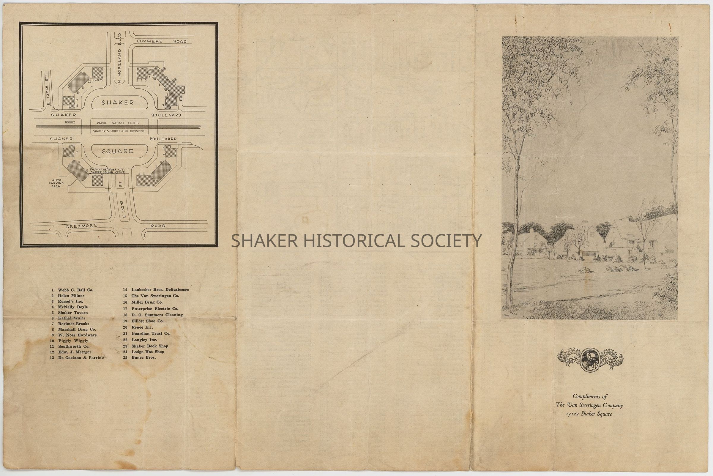
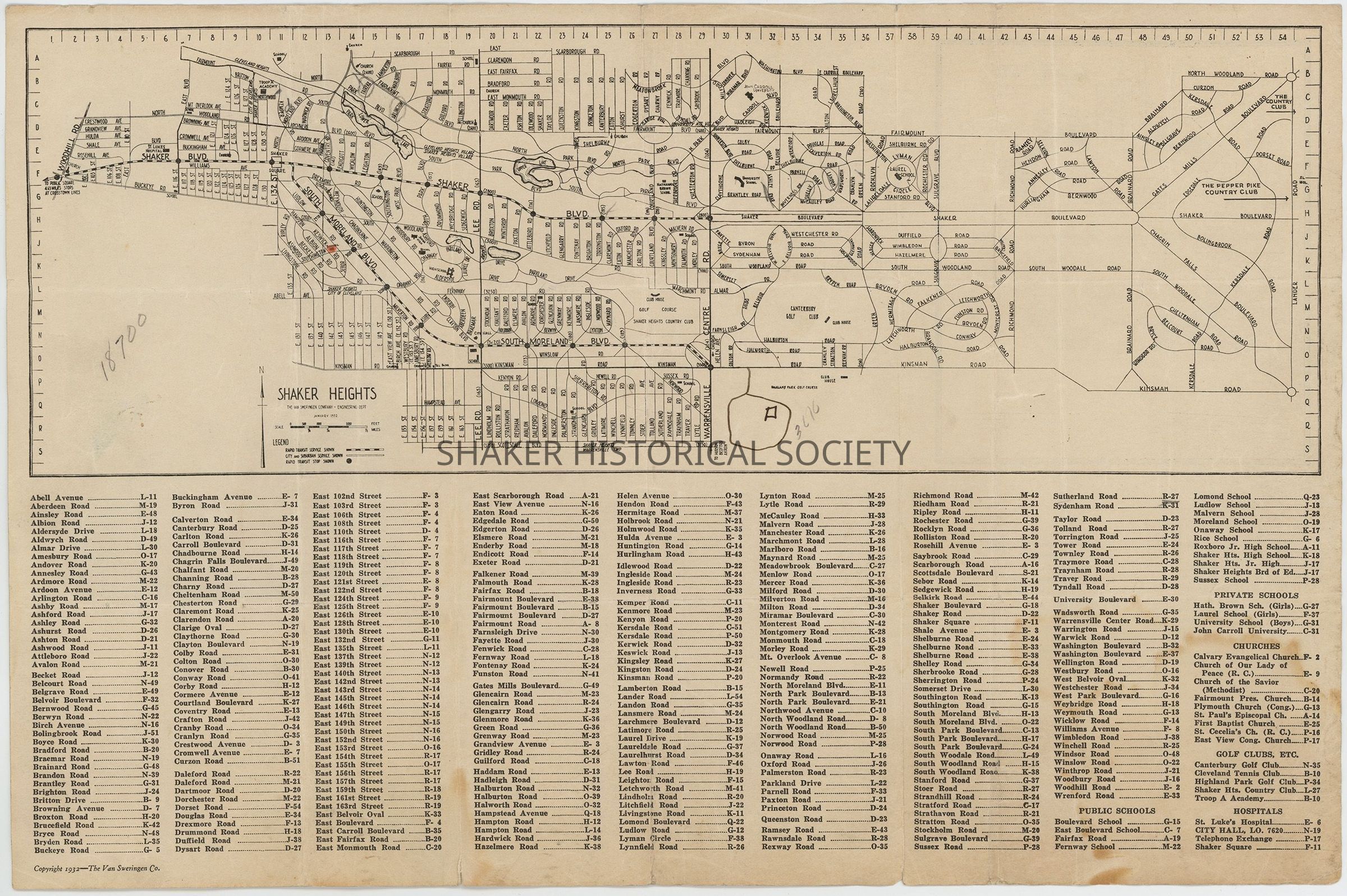
1932 map brochure of Shaker Heights showing an illustration of houses on the front, a map of Shaker Square on the tuck panel, and a map of Shaker Heights inside. The map features an alphanumeric grid system with numbers along the horizontal axis and letters along the vertical axis. An index below the map lists streets, schools, and churches and their corresponding grid coordinates.Collection
Map CollectionCategory
Maps
Archives