Name/Title
The Champlain Water District Map 1970Entry/Object ID
2023.00.186Description
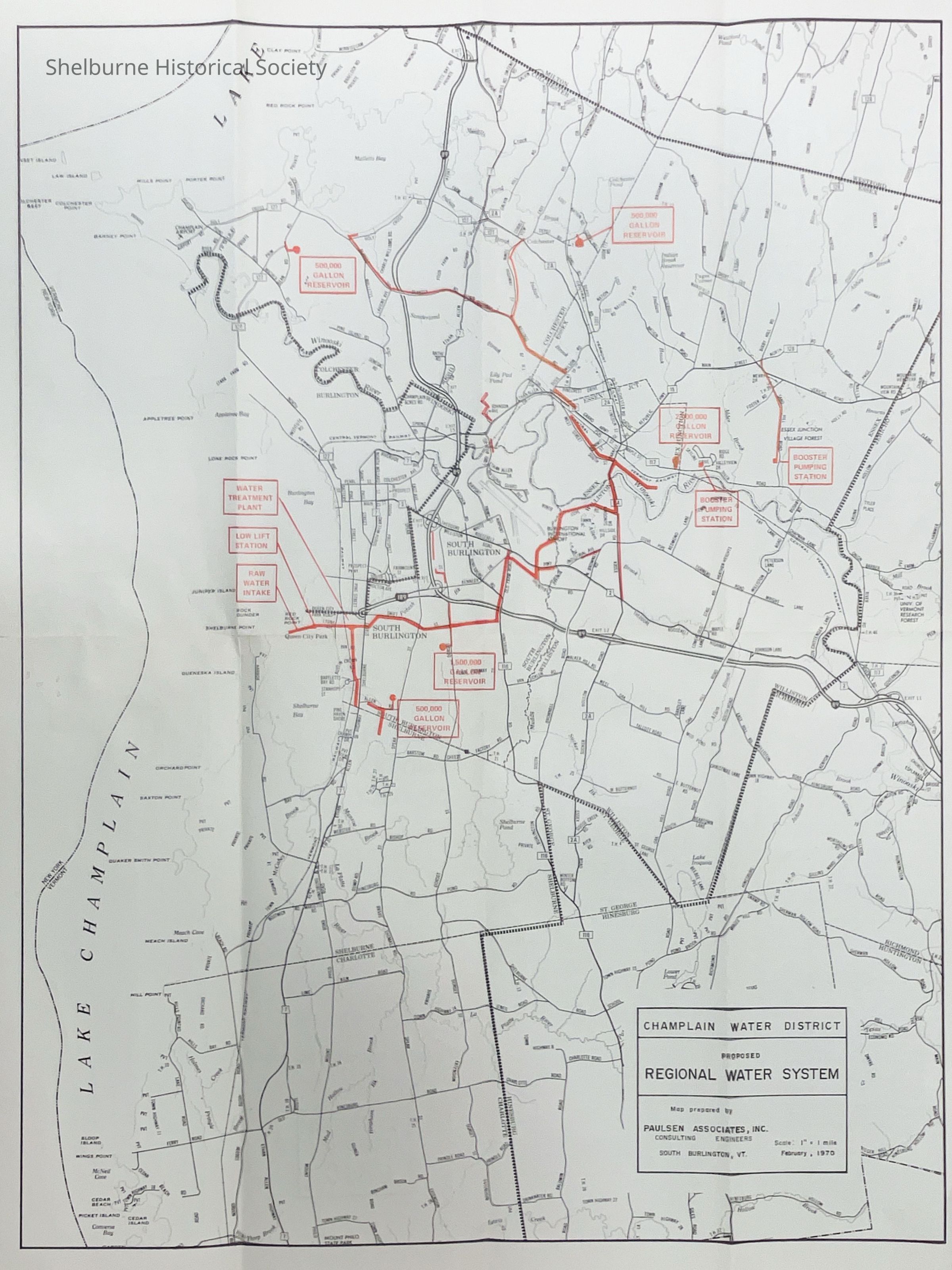
This map/brochure/mailer was createdin 1970 to explain what the "Champlain Water District is, how it came to being, what it is planning, how member communities will benefit, what costs are involved, and how it is to be financed." [" " taken from brochure] The map shows the member towns, roads and in red shows location of the water intake, treatment plant, pipelines, pumping stations and reservoirs.Context
This 1970 map is useful to show how the water system in Shelburne Vermont has expanded over the years. As of this map printing, Shelburne was not on this distribution system.Lexicon
Nomenclature 4.0
Nomenclature Secondary Object Term
MapNomenclature Primary Object Term
CartographNomenclature Primary Object Term
BrochureNomenclature Sub-Class
Graphic DocumentsNomenclature Class
Documentary ObjectsNomenclature Class
Advertising MediaNomenclature Category
Category 08: Communication ObjectsMap Details
Maker or Creator
Champlain Water DistrictScale
1" = 1 mileArea or Region
County
Chittenden CountyState/Province
Vermont* Untyped Area or Region
United StatesContinent
North AmericaIllustrator
Paulsen AssociatesDate Published
Feb 1970Dimensions
Height
22-1/2 inWidth
17-1/2 inDimension Notes
Folded: 11 1/4" H x 4 3/8" WCopyright
Type of License
Copright Statement - In CopyrightCopyright Holder
Champlain Water DistrictCopyright Date
1970Created By
Boucher, DavidCreate Date
May 19, 2025Updated By
Boucher, DavidUpdate Date
May 19, 2025