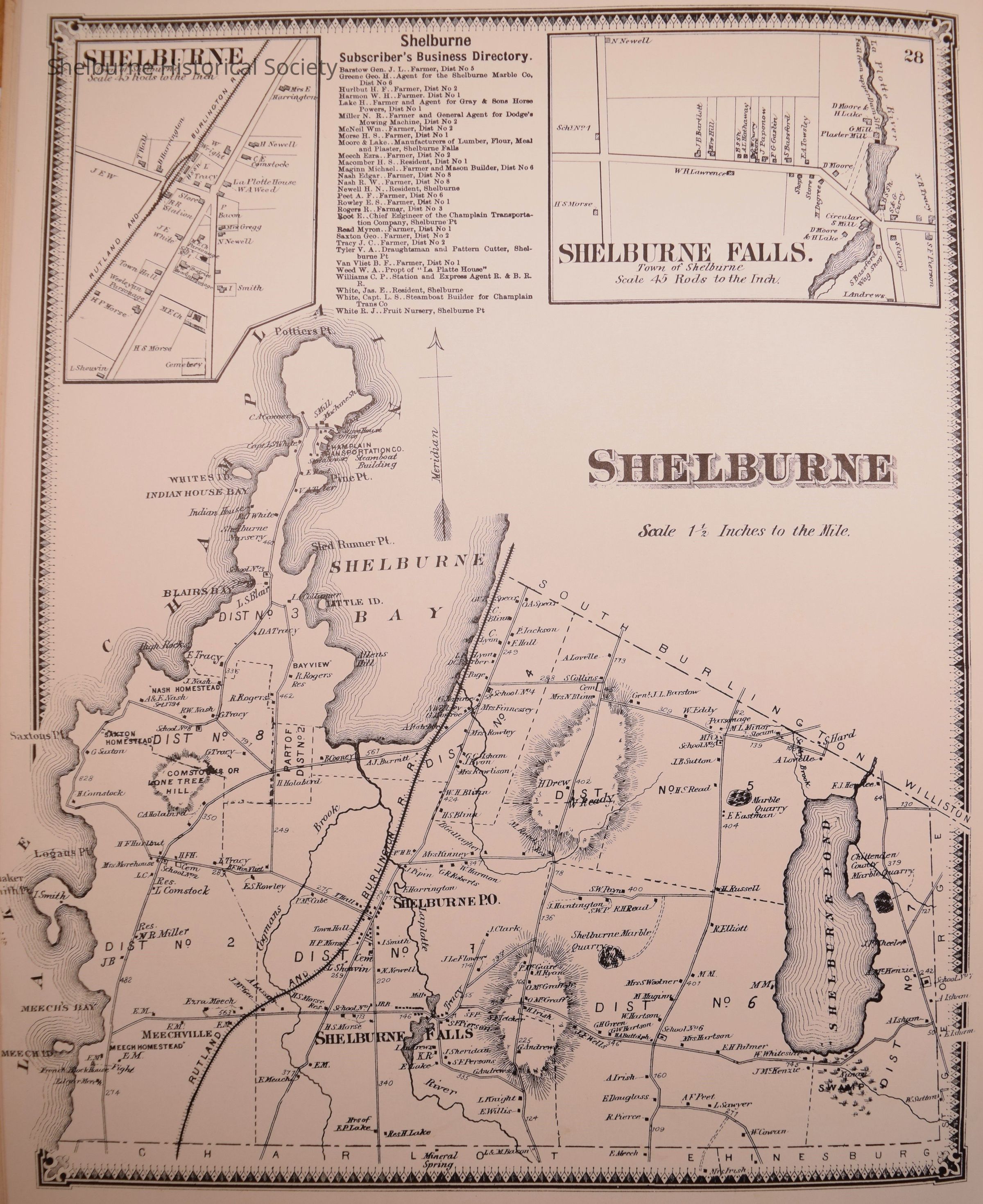
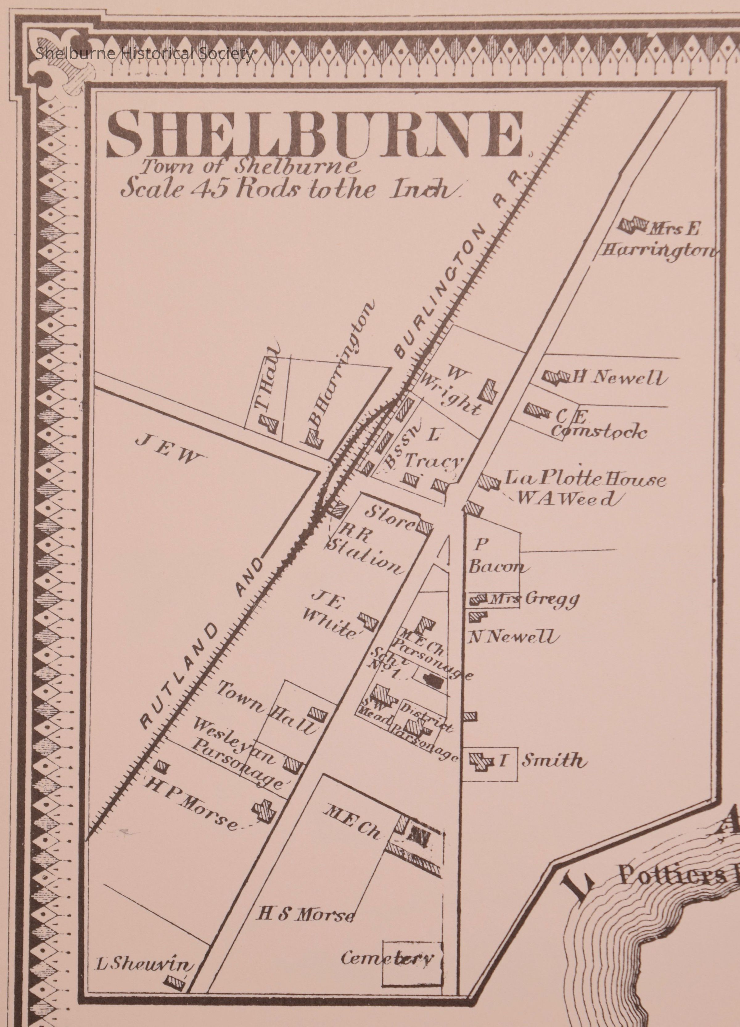
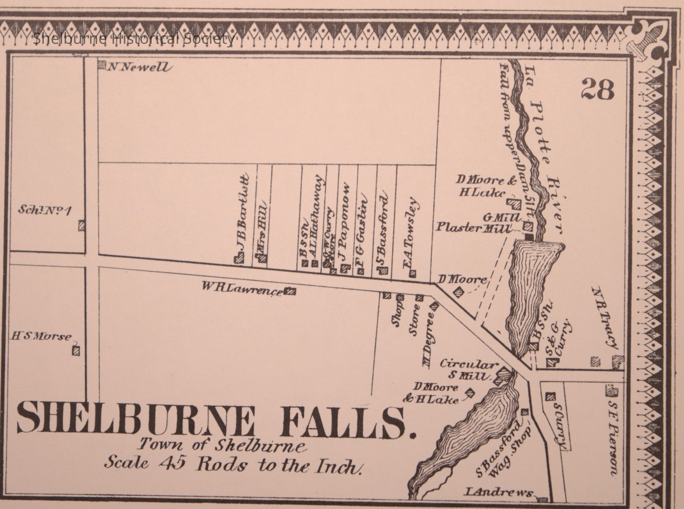
Atlas of Chittenden County Vermont - Shelburne

Atlas of Chittenden County Vermont - Shelburne - Full Page

Atlas of Chittenden County Vermont - Shelburne - Full Page

Name/Title

Atlas of Chittenden County Vermont - Shelburne

Entry/Object ID

2023.8.1

Description

The Atlas of Chittenden County Vermont was created from actual Surveys by and under the direction of F.W. Beers. These images have been taken from Page 28 of this Atlas. The actual book was reprinted by Harold E. Osmer of West Topsham, VT.

Lexicon

Nomenclature 4.0

Nomenclature Secondary Object Term

Atlas

Nomenclature Primary Object Term

Cartograph

Nomenclature Sub-Class

Graphic Documents

Nomenclature Class

Documentary Objects

Nomenclature Category

Category 08: Communication Objects

Publication Details

Publication Type

Book

Author

Beers, F.W., Sanford, Geo. P.

Publisher

Beers, F.W., Ellis, A.D., Soule, G.G.

Place Published

State

New York

Date Published

1869

Printer

James Mc Guigan

Place Printed

City

Philadelphia

State

Pennsylvania

* Untyped Place Printed

United States

Continent

North America

Notes

This publication information is about the original Atlas. These images were taken from a reprinted book published by Harold E. Osmer, West Topsham, VT.

Dimensions

Height

16 in

Width

12 in

Depth

1/4 in

Copyright

Type of License

Copyright Statement - No Known Copyright

Created By

Boucher, David

Create Date

April 3, 2023

Updated By

Boucher, David

Update Date

April 3, 2023