Name/Title
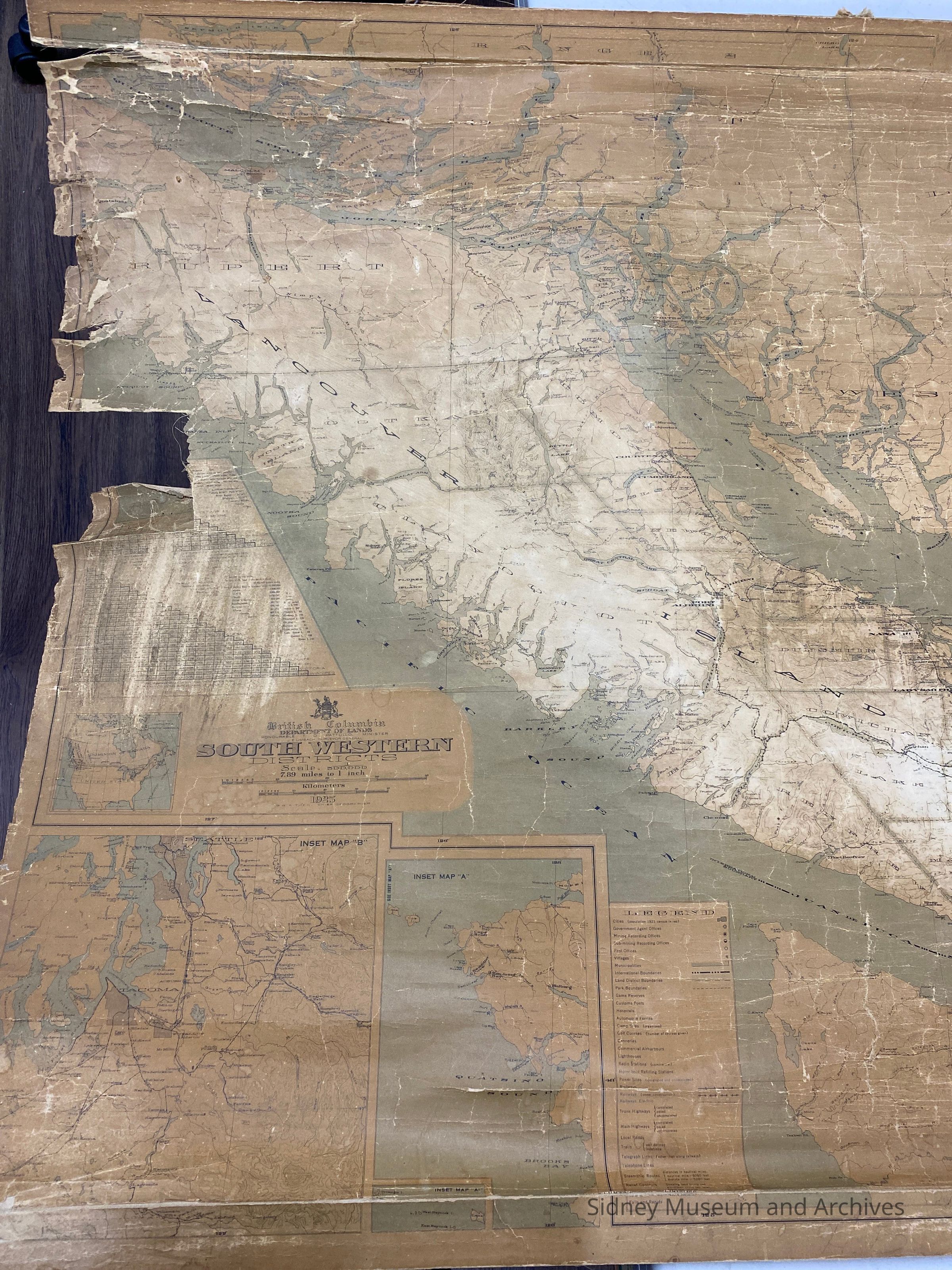
South Western DistrictsEntry/Object ID
1985.039.001Description
Wall map of Southwestern British Columbia dated 1925. Shows railway from Victoria to Sidney (C.N.R.) Wooden rod at top and bottom of map.British Columbia Department of Lands. South Western Districts. Honourable T D Pattullo, minister. J E Umbach, Surveyor General. Scale 7.89 miles to 1 inch. 1925. G G Aitken, Chief Geographer. Inset: Tacoma, Mileage, North Tip Vancouver Island, Legend- Cities, Government Agent Offices, Mining Redording Offices, Sub-mining Recording Offices, Post Offices, Villages, Municipalities, International Boundaries, Land District Boundaries. Game Reserves, Custom Posts, Hospitals, Automobile Ferries, Camp Sites (organized), gold Courses, Canneries, Commercial Airharbours, Lighthouses, Radio Stations (commercial), Motor Boat Refilling Stations, Power Sites (developed and undeveloped) Railways, Railways (under construction), Railways, Electric, Trunk Highways (completed, paved, uncompleted), Main Highways (completed, paved, uncompleted) Local Roads, trails (well defined, indefinate), Telegraph Lines, Telephone Lines, Steamship Routes, relief Contours, Falls and rapids.Acquisition
Source (if not Accessioned)
Parsons, DennisNotes
Accession Date: 18-Sep-85
Mode of Acquisition: giftLexicon
Nomenclature 4.0
Nomenclature Secondary Object Term
MapNomenclature Primary Object Term
CartographNomenclature Sub-Class
Graphic DocumentsNomenclature Class
Documentary ObjectsNomenclature Category
Category 08: Communication ObjectsLegacy Lexicon
Object Name
s.w. british columbia mapCreated By
Fischer, LoriCreate Date
September 3, 1995Update Date
August 7, 2025