Name/Title
Map of WashingtonEntry/Object ID
2008.037.001Description
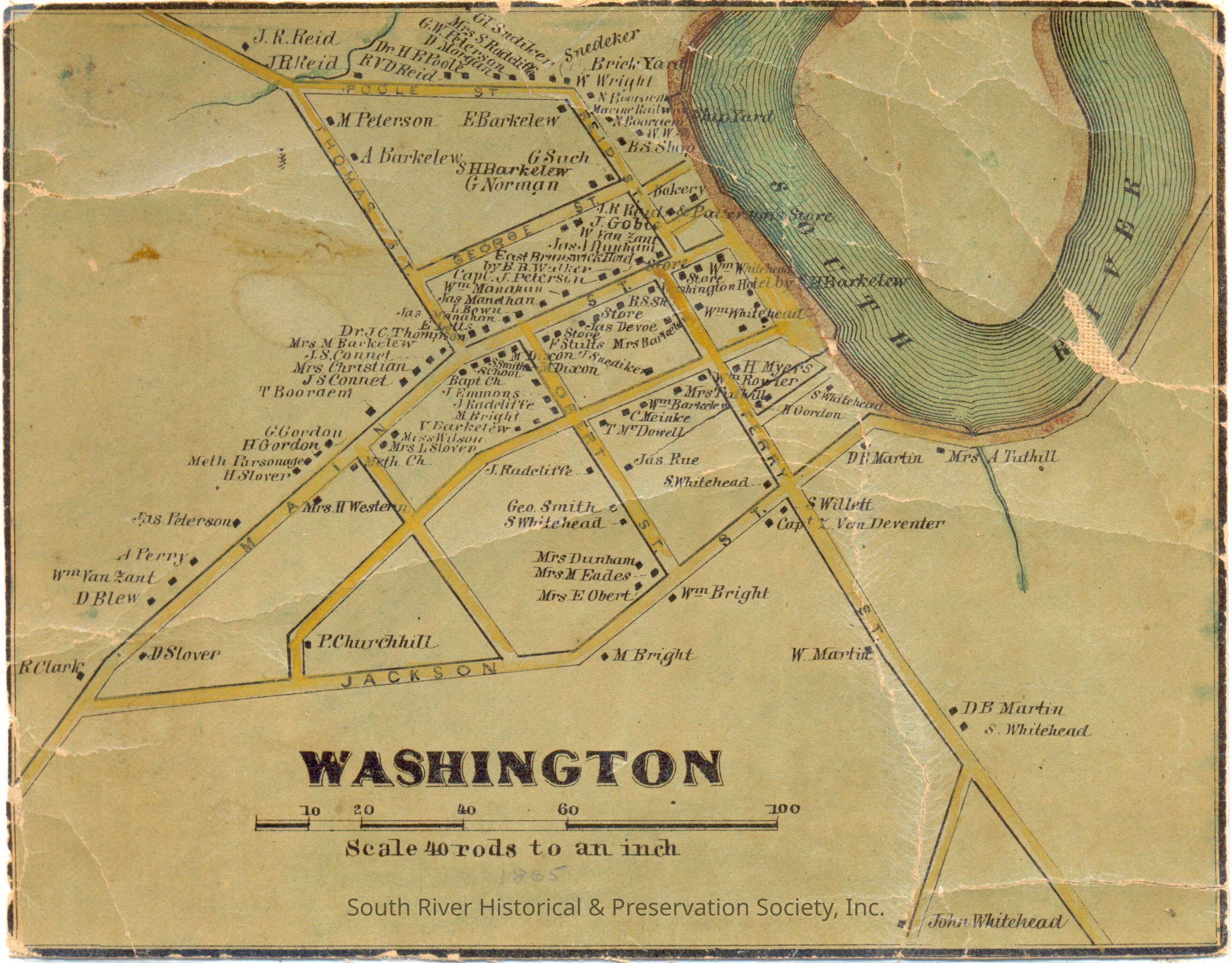
Color map of Washington, now South River, listing names of property owners, circa 1861. Ferry Street is shown as extending to include what is now Whitehead Avenue. Reid Street, from the bend to Thomas Street, is identified as Poole Street. George Street runs only from Reid Street to Thomas Street.
Printed on cloth backed paper and measures 4 1/2" x 5 1/2" in a 6" x 8" frame. No date.Acquisition
Accession
2008.037Source or Donor
Garbowsky, M.J.Acquisition Method
DonationLexicon
Nomenclature 4.0
Nomenclature Secondary Object Term
MapNomenclature Primary Object Term
CartographNomenclature Sub-Class
Graphic DocumentsNomenclature Class
Documentary ObjectsNomenclature Category
Category 08: Communication ObjectsOther Names and Numbers
Other Numbers
Number Type
Hub SortingOther Number
032.museum25.001Research Notes
Research Type
CuratorPerson
Bartz, StephanieDate
Sep 2023Notes
Similar to the inset of Washington (South River) at the top of Walling's 1861 "Map of the county of Middlesex, New Jersey: from actual surveys."
There are five differences between 2008.037.001 and the Walling map the Library of Congress has online at http://hdl.loc.gov/loc.gmd/g3813m.la000457. The LOC version from 1861 includes the cemetery and three other notations that are missing from the South River Museum version. In the block bordered by Main, Ferry, and an unnamed street, the LOC version lists Bissett and S. Whitehead. Near the corner of Ferry and Jackson Streets, it also shows a Pottery.
One notation on the South River version is missing from the LOC version. Along Obert Street, just above S. Whitehead, we have Geo. Smith.