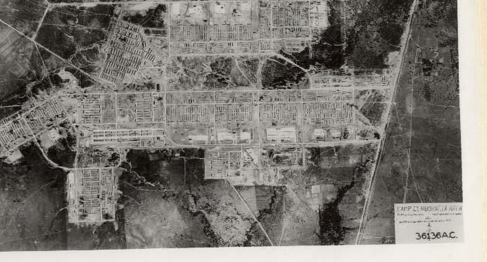
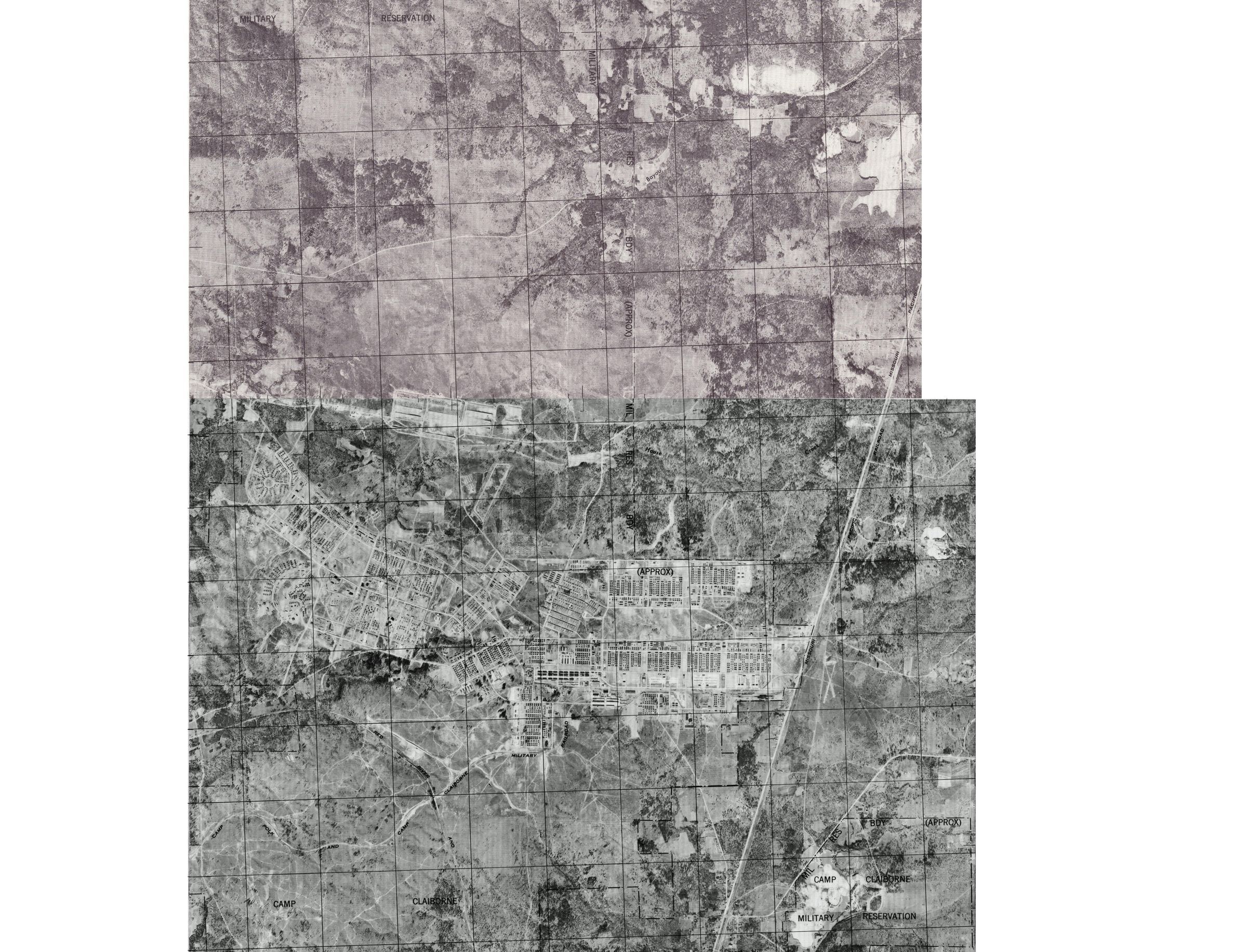
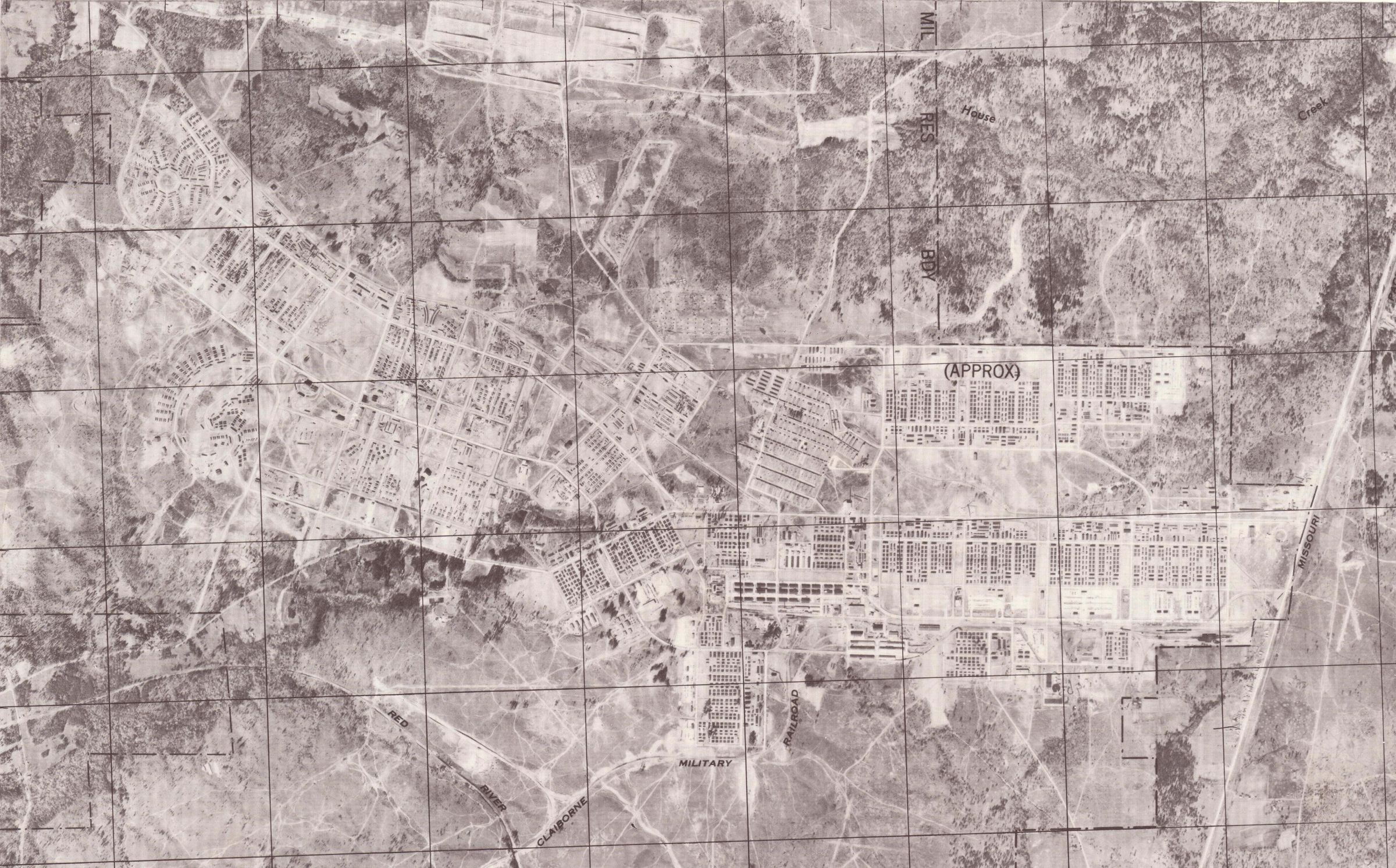
Aerial Maps of Camp Claiborne
Page 1
Name/Title
Aerial Maps of Camp ClaiborneEntry/Object ID
2020.4.068Tags
Camp Claiborne, Public, Archive, WWII, World War II, MapDescription
3 aerial maps of Camp Claiborne; a zoomed in copyCollection
Rhodes Brothers CollectionsAcquisition
Accession
2020.4Source or Donor
Douglas J. RhodesCredit Line
*title of entry*, Rhodes Brothers Collection, *Accession Number*, *Exhibit Title (if it's being displayed)*, Southern Forest Heritage Museum, Long Leaf, LA.Map Details
Date Published
1943 - 1944Publication Language
EnglishOther Names and Numbers
Other Names
Aerial%20of%20Camp%20Claiborne
combined photo
Camp Claiborne Air Photo 1944 400 dpi