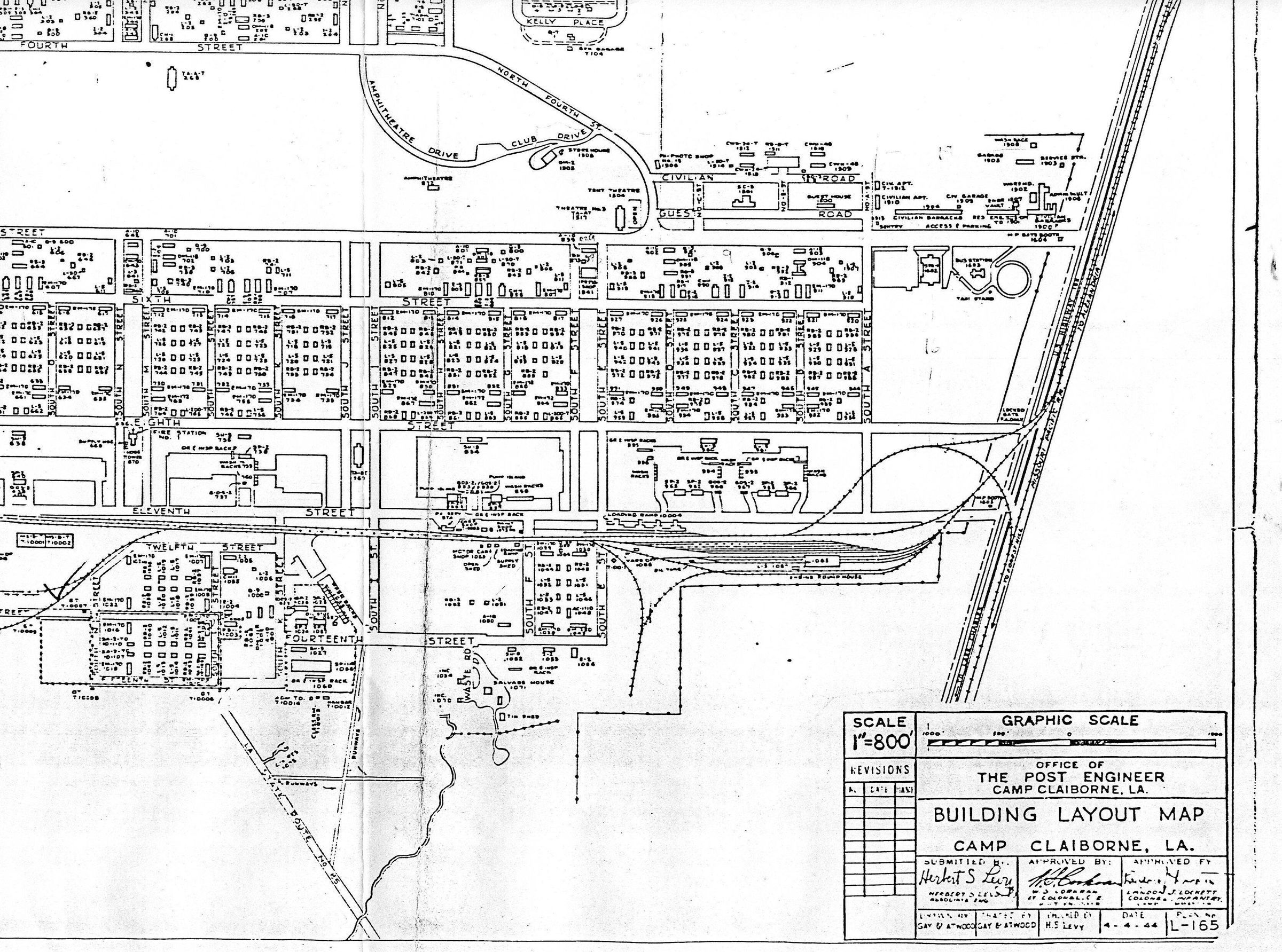
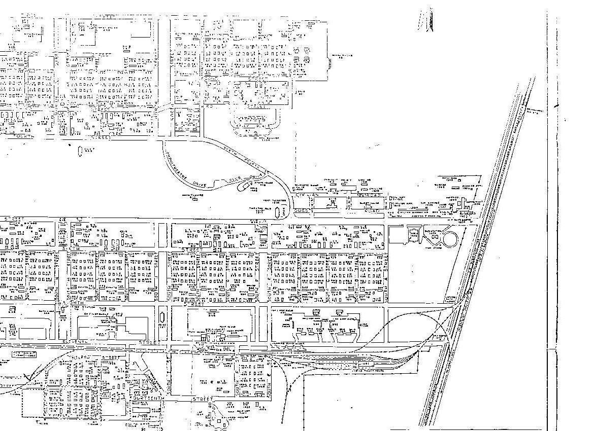
Camp Claiborne Building and Street Layout Maps
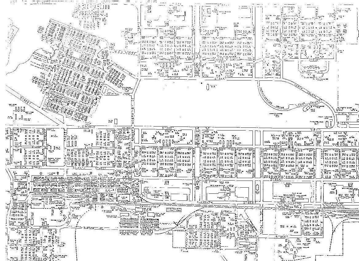
central map of the camp
Page 1
Name/Title
Camp Claiborne Building and Street Layout MapsEntry/Object ID
2020.4.069Tags
Archive, Camp Claiborne, Public, WWII, World War II, MapDescription
maps of Camp Claiborne building and street layouts; sectioned by central, east and north; post of engineer of Camp ClaiborneCollection
Rhodes Brothers CollectionsAcquisition
Accession
2020.4Source or Donor
Douglas J. RhodesCredit Line
*title of entry*, Rhodes Brothers Collection, *Accession Number*, *Exhibit Title (if it's being displayed)*, Southern Forest Heritage Museum, Long Leaf, LA.Map Details
Maker or Creator
Carl C. Gay, Post of Engineer of Camp ClaibornePlace Published
Historic Site
Historic Camp ClaiborneCity
Forest HillState/Province
LouisianaContinent
North AmericaDate Published
Feb 4, 1944Date Printed
Feb 4, 1944Publication Language
EnglishOther Names and Numbers
Other Names
Camp Claiborne Central Map
Camp Claiborne East Map
Camp Claiborne North Map