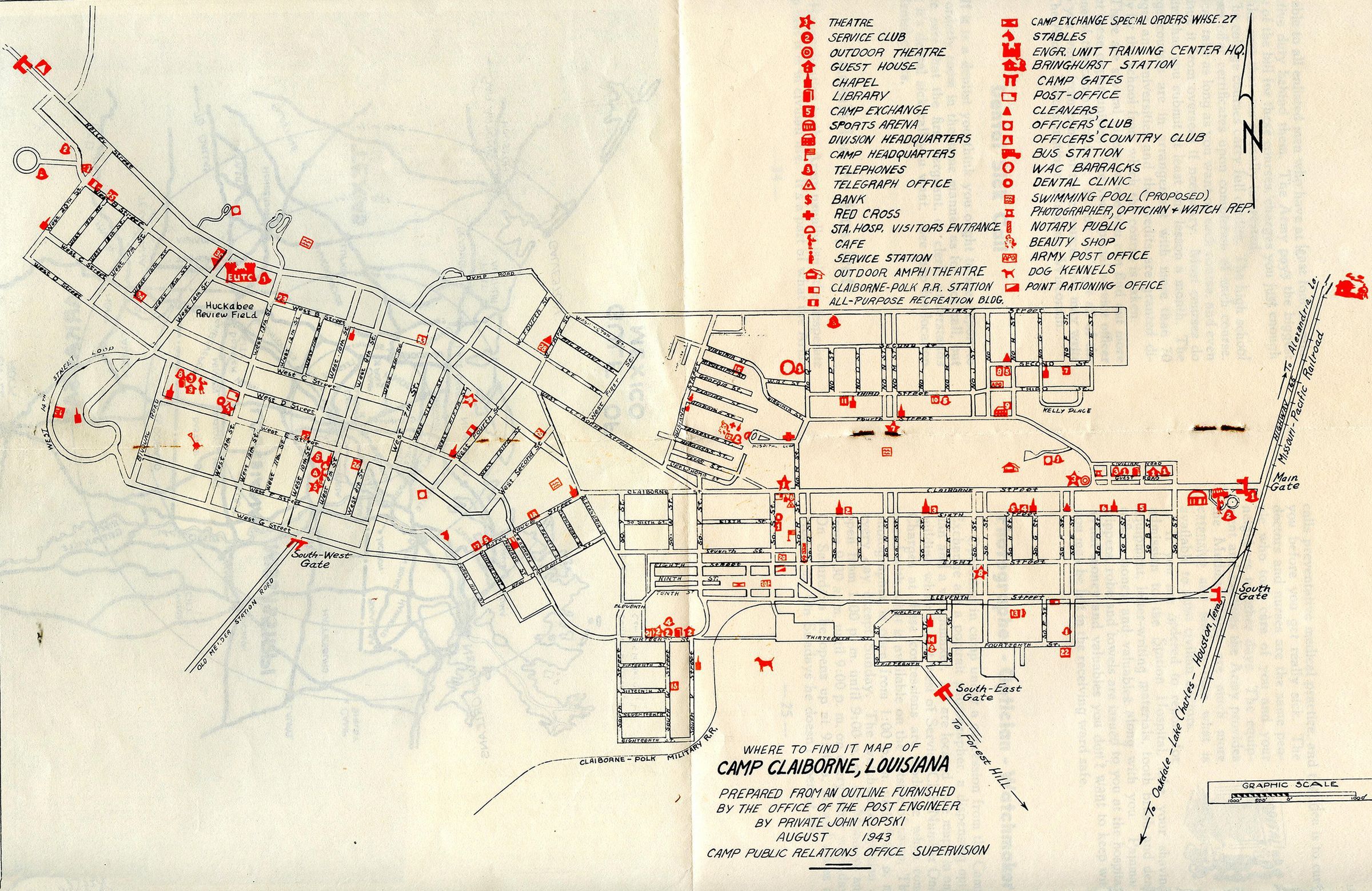
Name/Title
Map of Camp Claiborne (in The What and Where Book of Camp Claiborne Louisiana)Entry/Object ID
2020.4.067Tags
Camp Claiborne, Archive, Public, WWII, World War II, MapDescription
part of The What and Where Book of Camp Claiborne Louisiana; this map was included of the campCollection
Rhodes Brothers CollectionsAcquisition
Accession
2020.4Source or Donor
Douglas J. RhodesCredit Line
*title of entry*, Rhodes Brothers Collection, *Accession Number*, *Exhibit Title (if it's being displayed)*, Southern Forest Heritage Museum, Long Leaf, LA.Map Details
Maker or Creator
Private John KopskiDate Published
Aug 1943Place Printed
Historic Site
Historic Camp ClaiborneCity
Forest HillState/Province
LouisianaContinent
North AmericaDate Printed
Aug 1943Publication Language
EnglishOther Names and Numbers
Other Name
Untitled_Panorama1Other Numbers
Number Type
DriveOther Number
SFHM.Rhodes.2020.Drive.062bNotes
In folder CC Maps