Name/Title
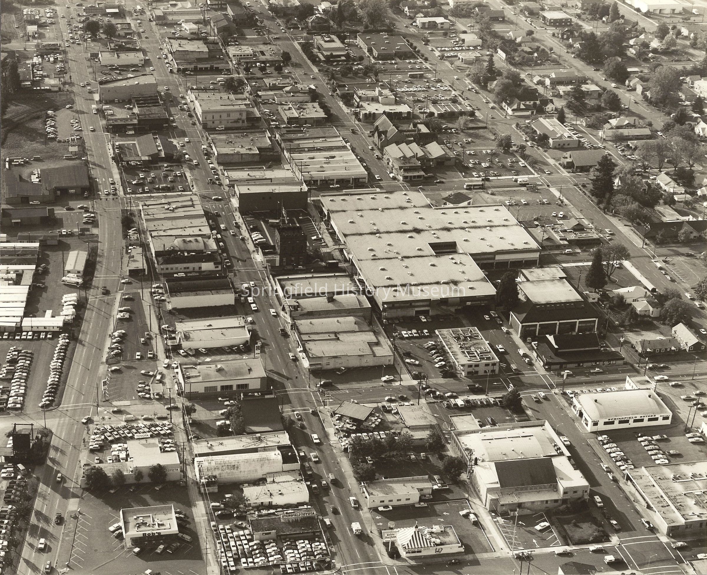
Aerial photograph of Downtown Springfield, Oregon, circa 1972Entry/Object ID
2003.043.001Description
Aerial view of downtown Springfield showing parts of South A to North D Street and Eighth through Mill Street. Photographer is Skyview Aerial Surveys of Springfield. Dated between 1972 and 1976.
Dated by features: Kentucky Fried Chicken on 8th; uncovered bus stop on 5th & B; empty lot middle of block on Main between 4th to 5thPhotograph Details
Subject Place
City
SpringfieldCounty
Lane CountyState/Province
OregonCountry
United States of AmericaContinent
North AmericaLocation
Main Street, SpringfieldCollection
Denning CollectionAcquisition
Accession
2003.043Source or Donor
Denning, BonnieAcquisition Method
GiftMade/Created
Artist
Skyview PhotographyDate made
1972 - 1976Place
City
SpringfieldCounty
Lane CountyState/Province
OregonCountry
United States of AmericaContinent
North AmericaCopyright
Type of License
Copyright Not Evaluated, http://rightsstatements.org/vocab/CNE/1.0/Copyright Details
Images on this website are provided by the Springfield History Museum for educational purposes. Researchers assume all responsibility for copyright questions. For inquiries, please contact springfieldmuseum@springfield-or.gov, or use the Image Request Link.