Name/Title
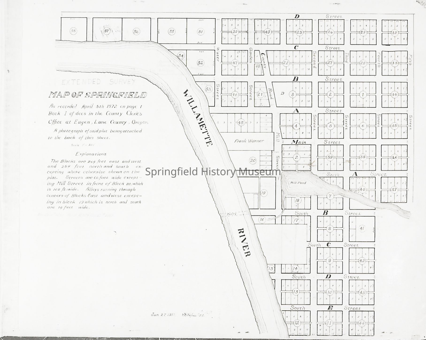
Photograph of Early Plat Map of Springfield, c. 1888Entry/Object ID
1996.009.004Tags
Review by supervisorDescription
Photograph of Early plat map of Springfield, circa 1888.Photograph Details
Subject Place
City
SpringfieldCounty
Lane CountyState/Province
OregonCountry
United States of AmericaContinent
North AmericaCollection
Unknown Donor Photo CollectionAcquisition
Accession
1996.009Source or Donor
UnknownAcquisition Method
GiftCopyright
Type of License
Copyright Not Evaluated, http://rightsstatements.org/vocab/CNE/1.0/Copyright Details
Images on this website are provided by the Springfield History Museum for educational purposes. Researchers assume all responsibility for copyright questions. For inquiries, please contact springfieldmuseum@springfield-or.gov, or use the Image Request Link.