Name/Title
Tourist Map of Springfield and Area, 1978Entry/Object ID
2021.005.924Scope and Content
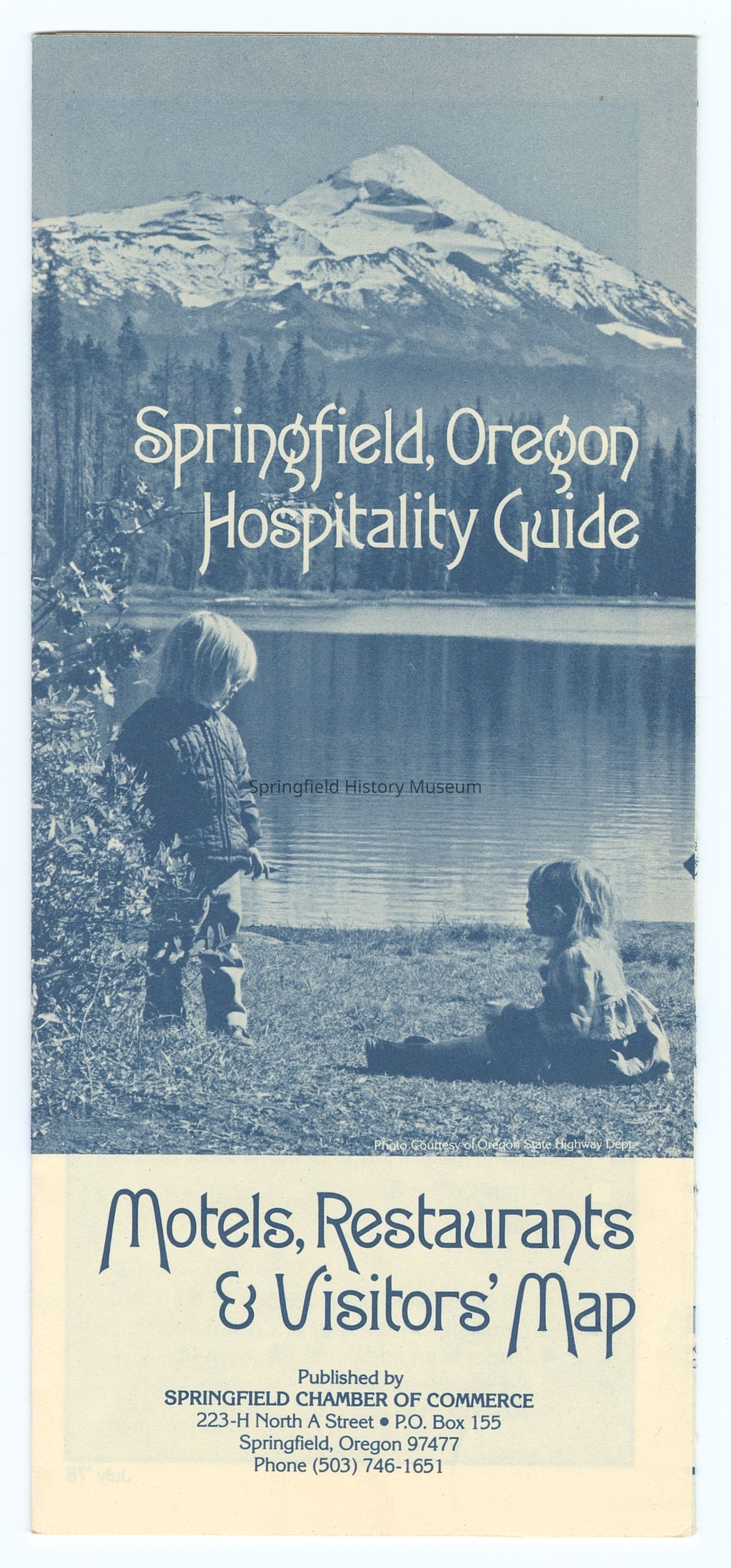
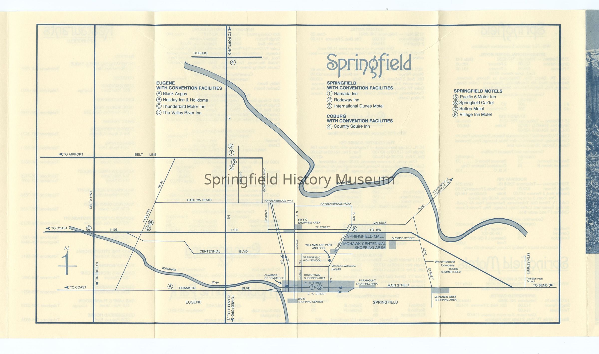
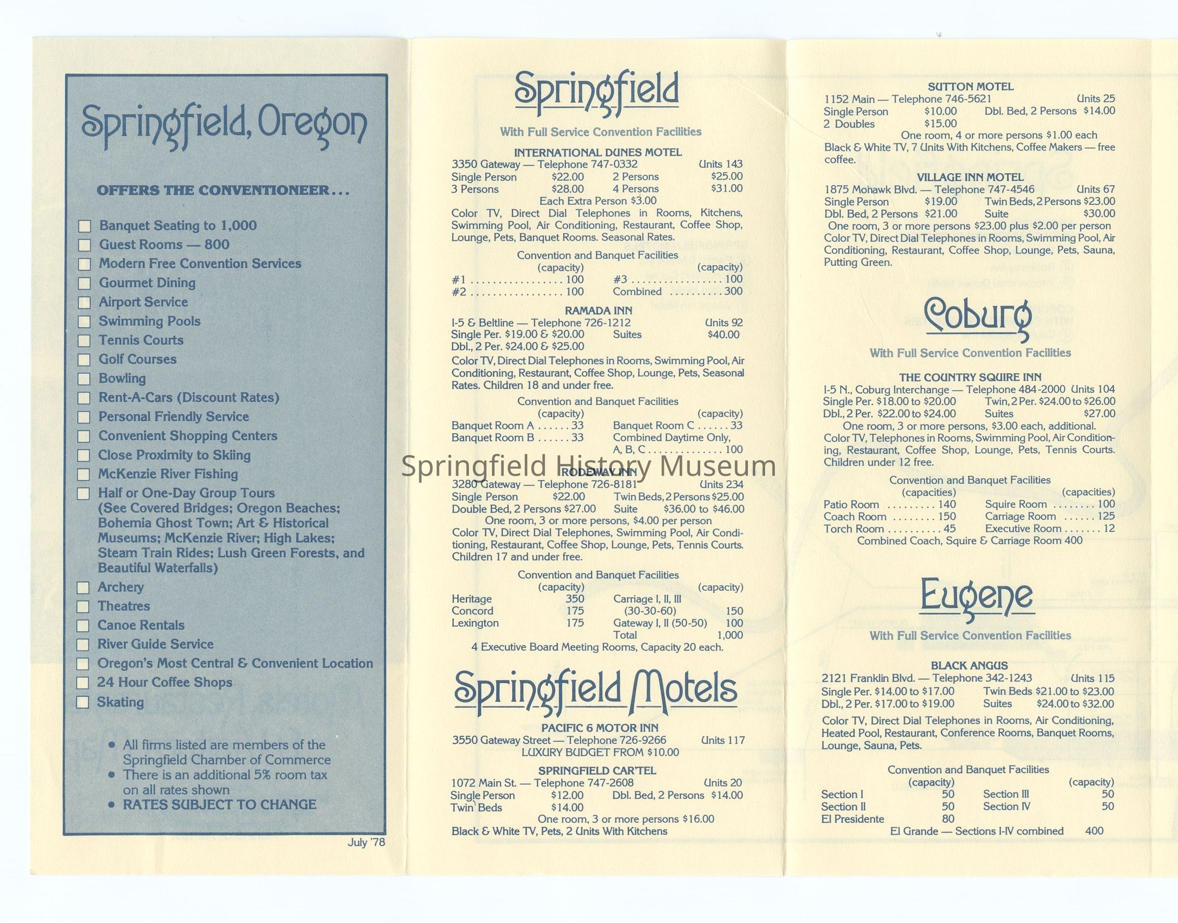
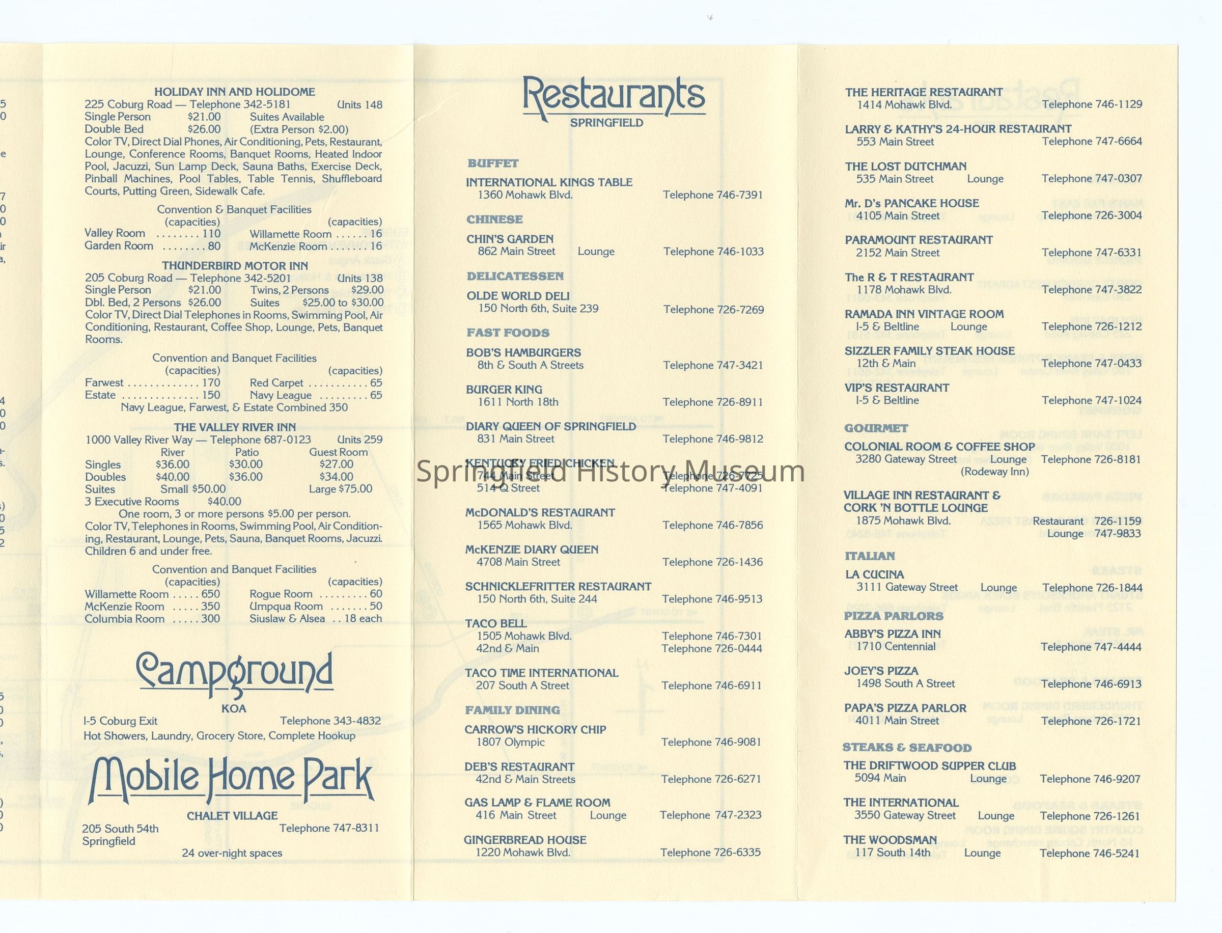
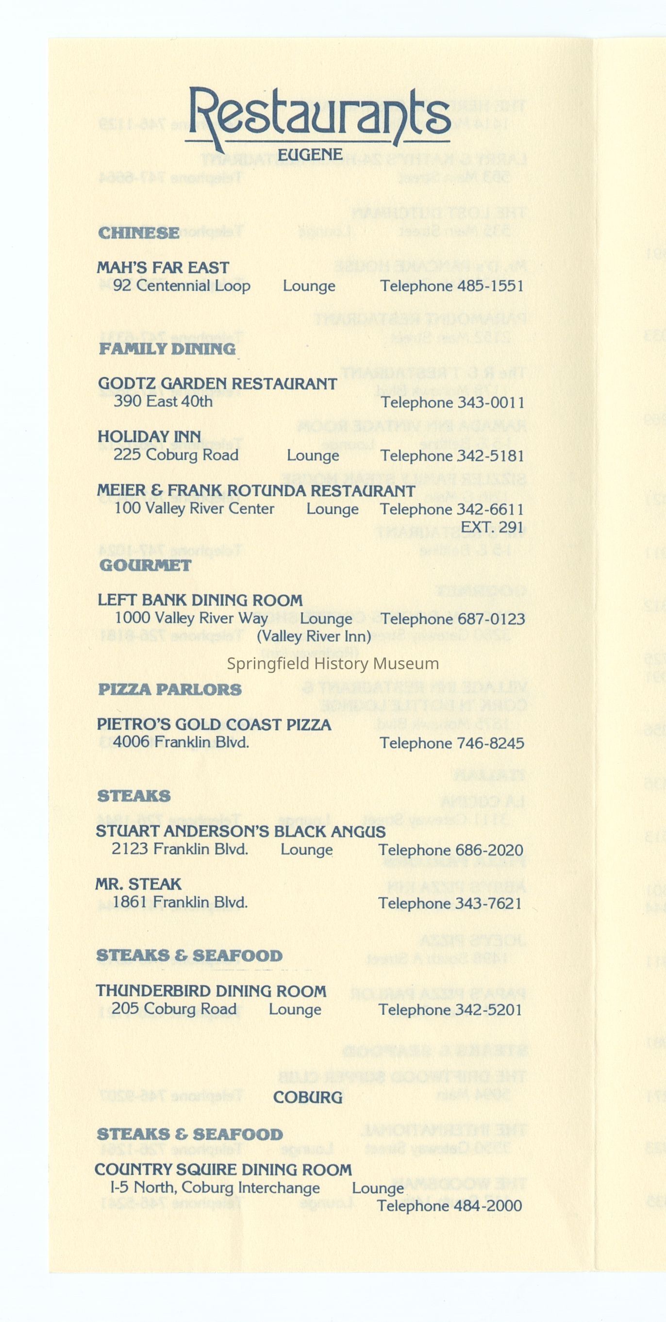
Hospitality Guide, Motel, Restaurants and Visitors Map of Springfield, 1978. Photograph 2021.005.213 on cover.Context
Part of B. Springfield MapsCollection
Springfield Area Chamber of Commerce CollectionAcquisition
Accession
2021.005Source or Donor
Springfield Chamber of CommerceAcquisition Method
DonationArchive Items Details
Creator
Springfield Area Chamber of CommerceDate(s) of Creation
1978Container
Springfield Area Chamber of Commerce Box 1Notes
Map has one duplicate copy.Dimensions
Height
8-1/2 inWidth
22-1/2 inRelationships
Related Places
Place
City
Springfield, Eugene, CoburgCounty
Lane CountyState/Province
OregonCountry
United States of AmericaContinent
North AmericaCopyright
Type of License
Copyright Not Evaluated, http://rightsstatements.org/vocab/CNE/1.0/Copyright Holder
Springfield Area Chamber of CommerceCopyright Details
Images on this website are provided by the Springfield History Museum for educational purposes. Researchers assume all responsibility for copyright questions. For inquiries, please contact springfieldmuseum@springfield-or.gov, or use the Image Request Link.