Name/Title
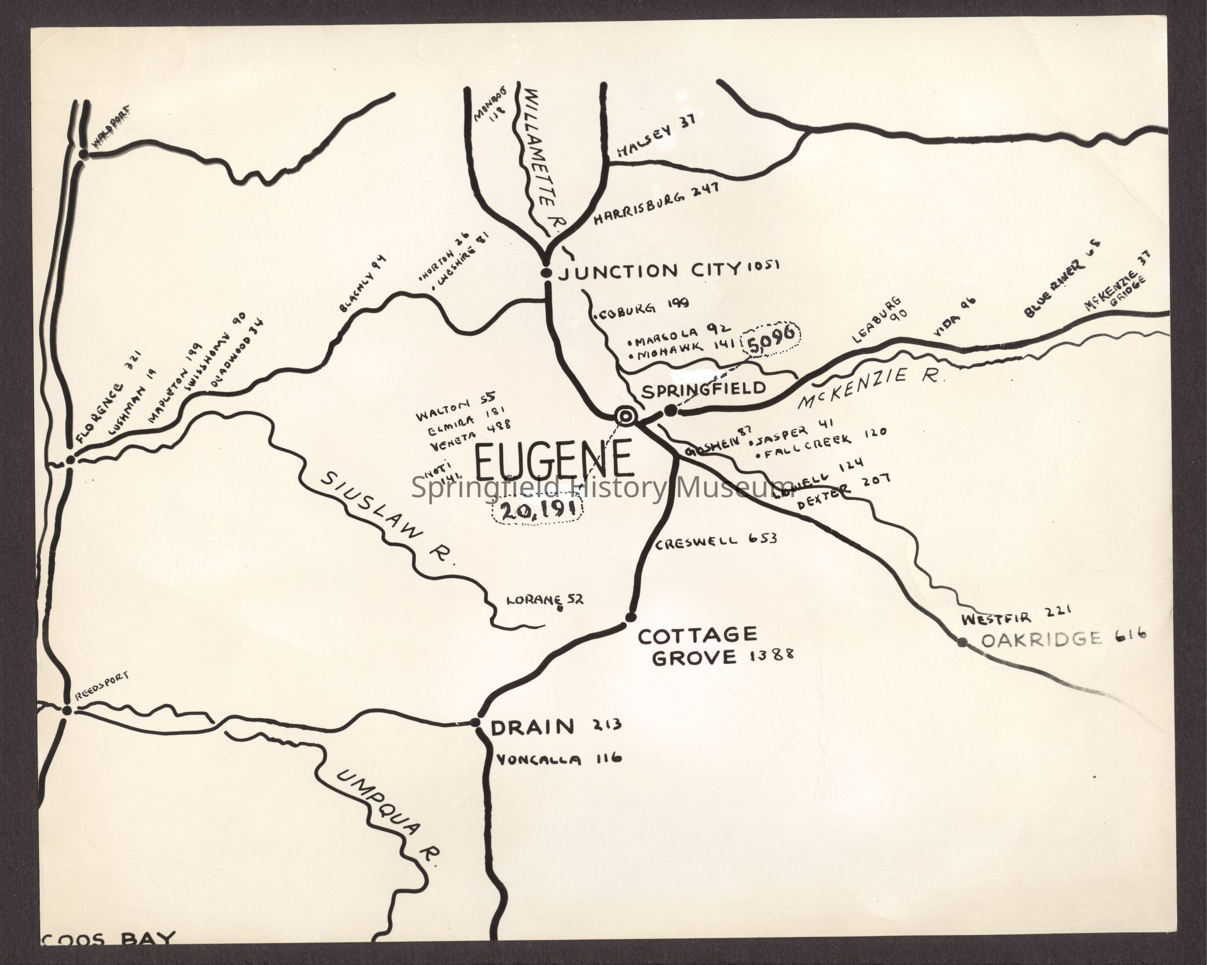
Photograph, Map of Eugene and surrounding area, date unknown.Entry/Object ID
2017.003.805Description
Photographic print of Springfield-Eugene area map with populations for local communities from McKenzie Bridge to Florence. The populations of Springfield and Eugene are written on by hand.Collection
Fogle Photo CollectionLexicon
Search Terms
Map, Springfield, Eugene, Marcola, McKenzie Bridge, OakridgeCopyright
Type of License
Copyright Not Evaluated, http://rightsstatements.org/vocab/CNE/1.0/Copyright Details
Images on this website are provided by the Springfield History Museum for educational purposes. Researchers assume all responsibility for copyright questions. For inquiries, please contact springfieldmuseum@springfield-or.gov, or use the Image Request Link.