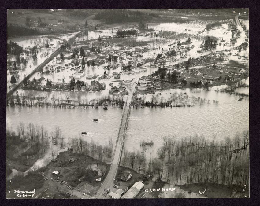
Photograph of aerial view of Glenwood Flooding, date unknown
Entry/Object ID
1989.001.665
Description
Photograph of aerial view of flooding in Glenwood looking west. In center is bridge with piers of old bridge [possibly streetcar bridge] beside it.
This is an enlarged duplicate of 1989.001.649.
Taken by Howard
Copyright Not Evaluated, http://rightsstatements.org/vocab/CNE/1.0/
Copyright Details
Images on this website are provided by the Springfield History Museum for educational purposes. Researchers assume all responsibility for copyright questions. For inquiries, please contact springfieldmuseum@springfield-or.gov, or use the Image Request Link.