Name/Title
City Map - 1808Entry/Object ID
Q2024.30.3ABScope and Content
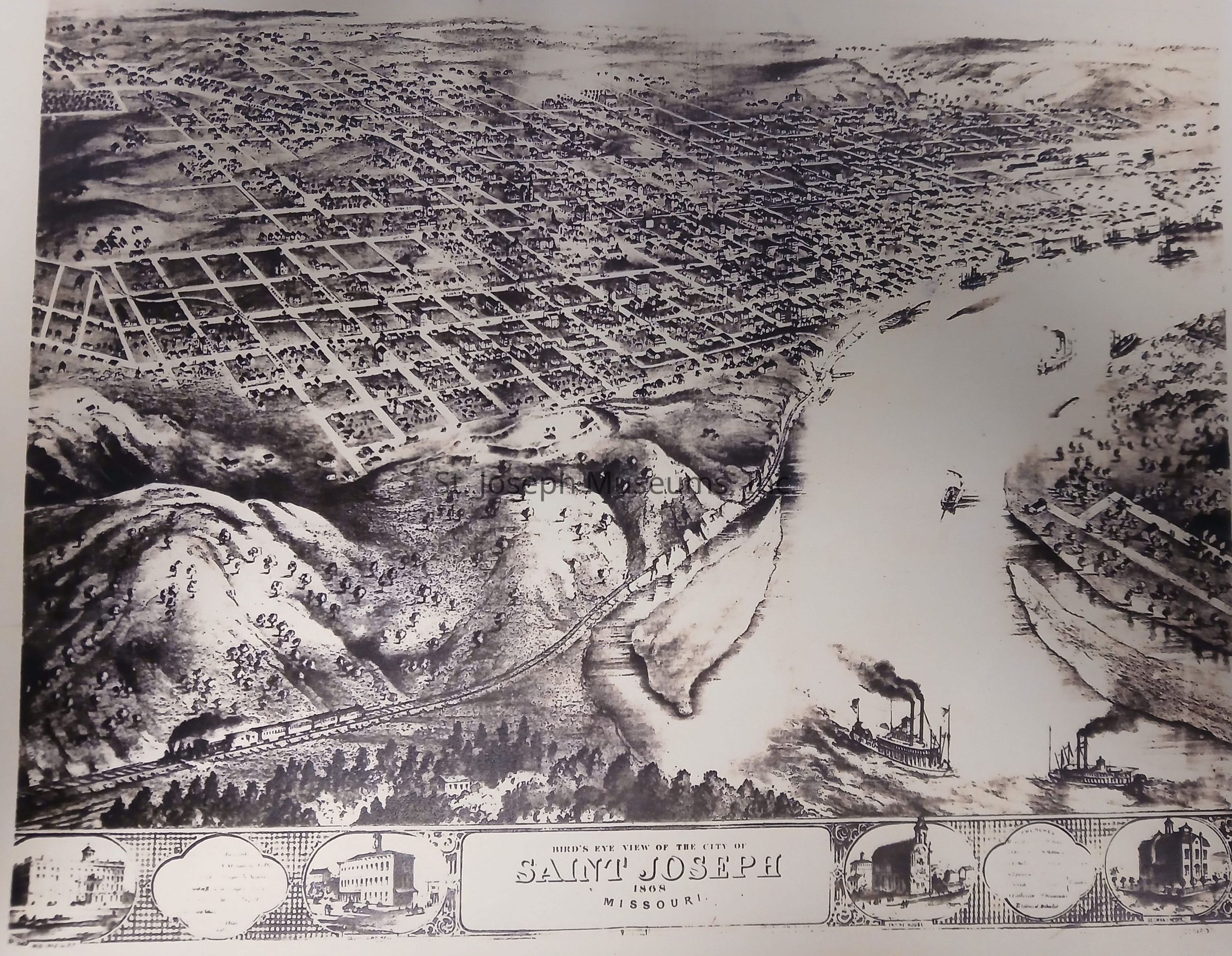
A copy of a "Bird's Eye View Of The City Of SAINT JOSEPH 1808 Missouri on yellow paperContext
The view of the city highlights the Missouri River and the blocked streets. In the lower border are small pictures of historic buildings and churches. Information in the two circles between the pictures are illegible.
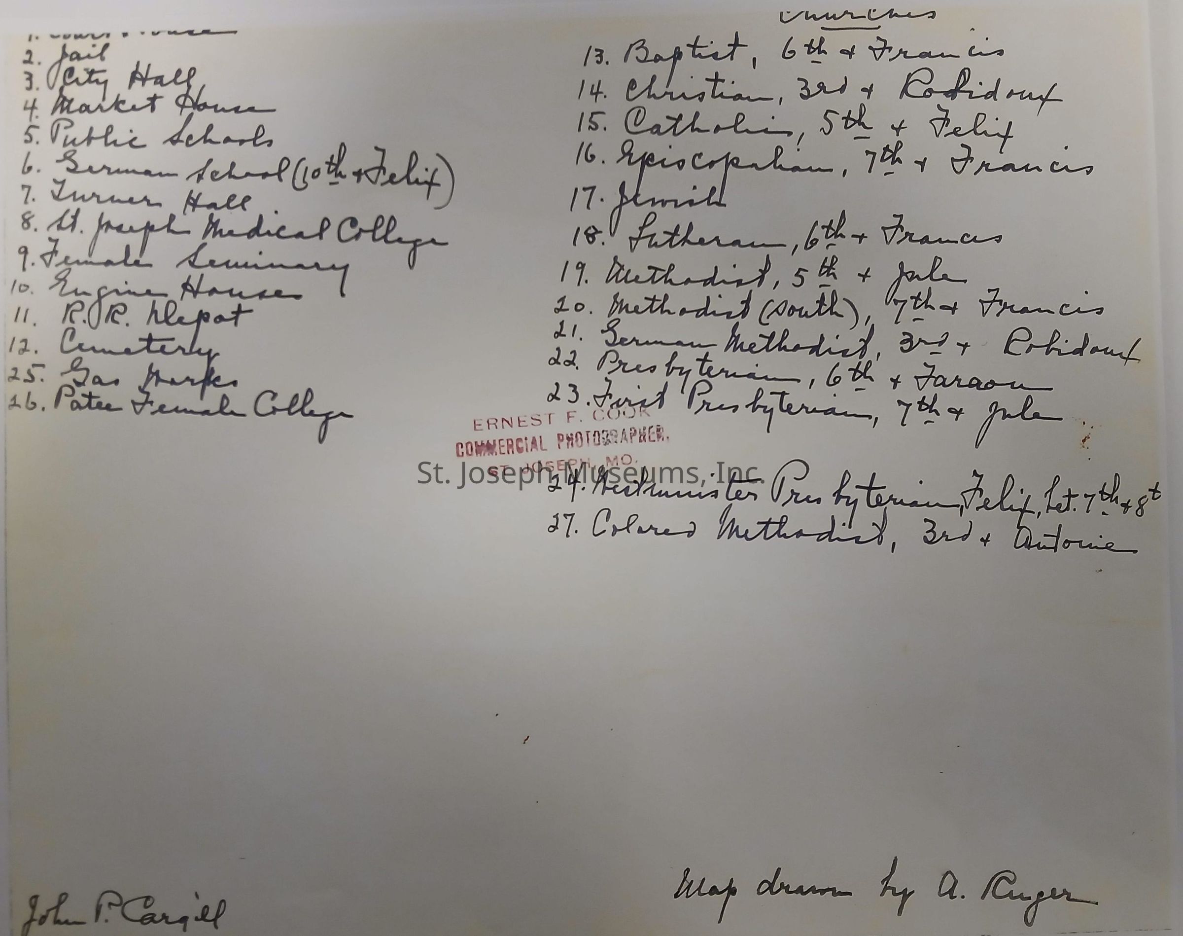
On the back of the map is a numbered list of the 27 structures. On the left, numbers 1-10 and 25 & 26 are businesses, on the right side numbered 13-24 and 27 are the names and locations of churches.
Al so on the back is stamped 'Ernest Cook, Commercial Photographer, St .Joseph, Mo. and handwritten 'The map was drawn by A. Ruger.Lexicon
Nomenclature 4.0
Nomenclature Tertiary Object Term
PlatNomenclature Secondary Object Term
MapNomenclature Primary Object Term
CartographNomenclature Sub-Class
Graphic DocumentsNomenclature Class
Documentary ObjectsNomenclature Category
Category 08: Communication ObjectsDimensions
Dimension Notes
8.5" X 11"