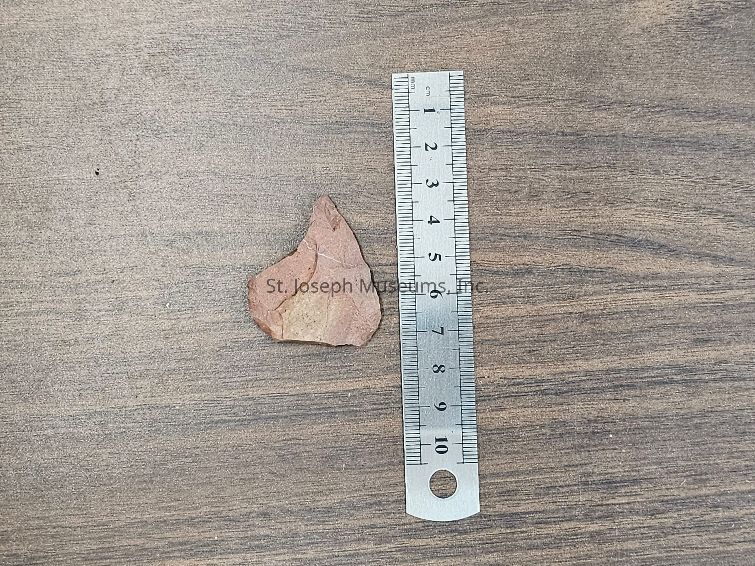
Name/Title
23CL23 Excavation Box #2Entry/Object ID
1999.27.2210Description
23CL23
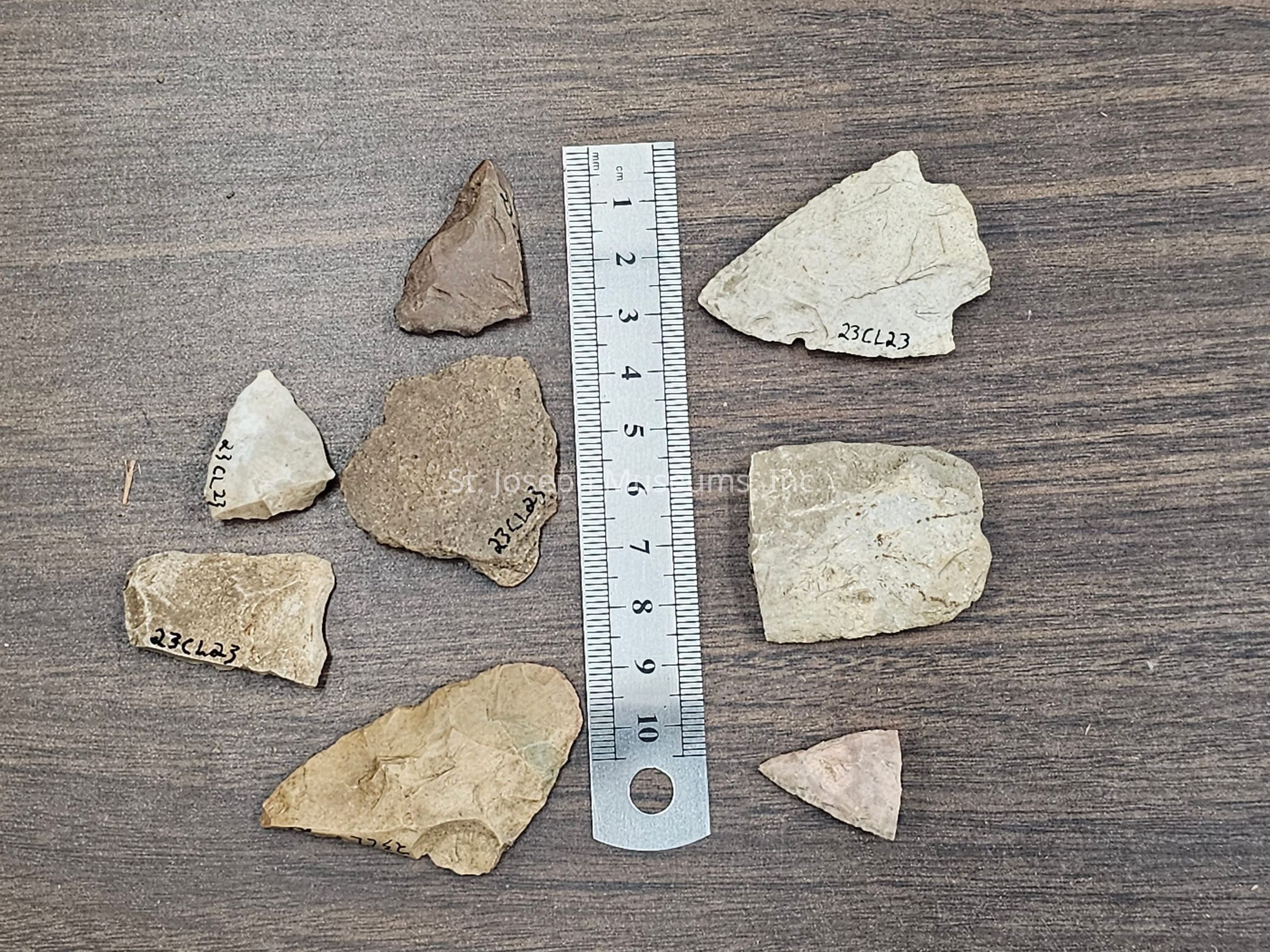
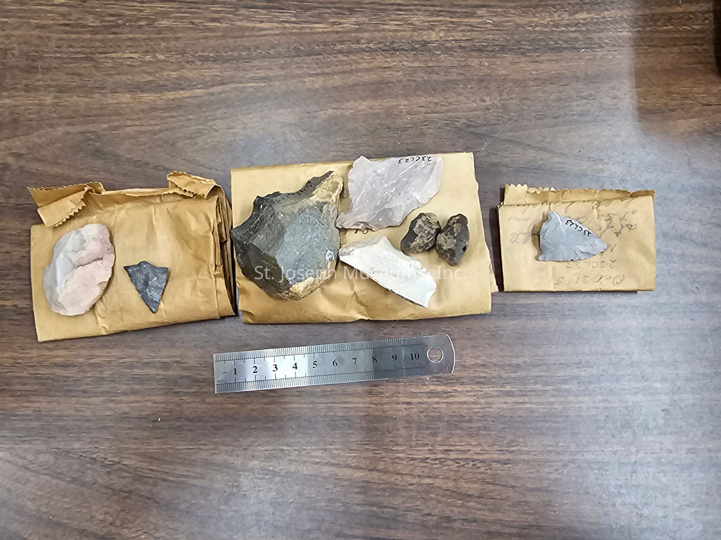
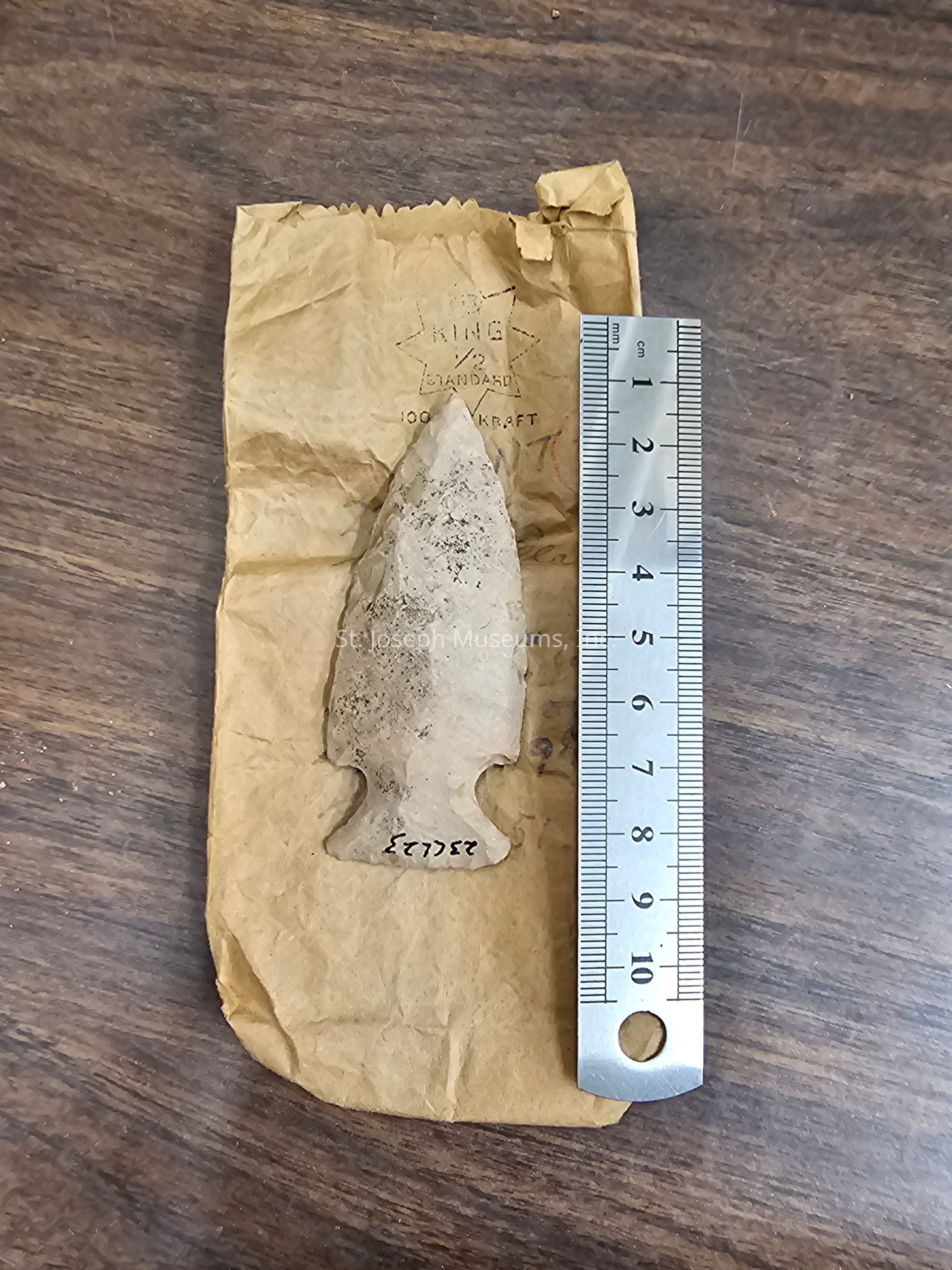
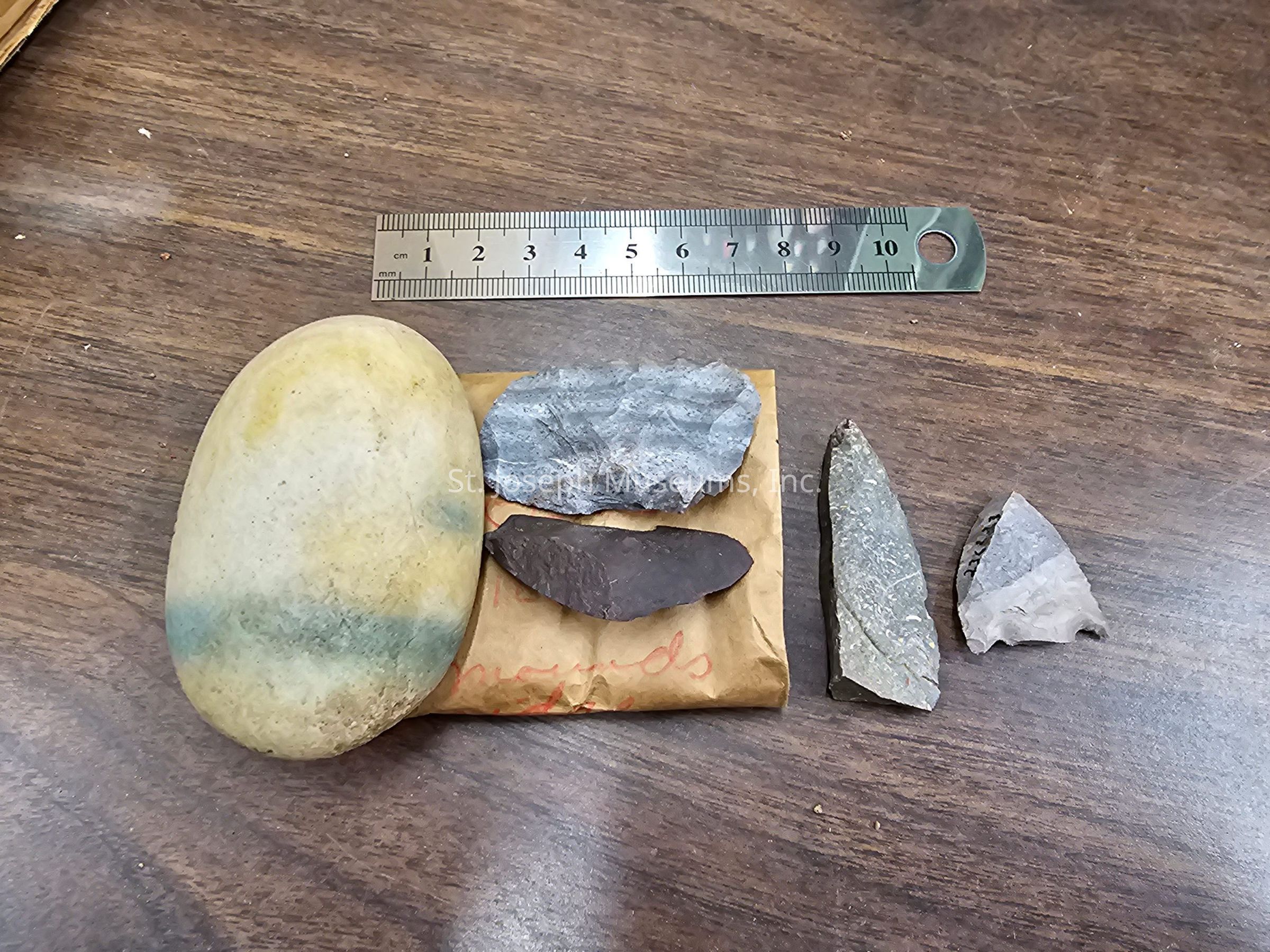
Excavation box.
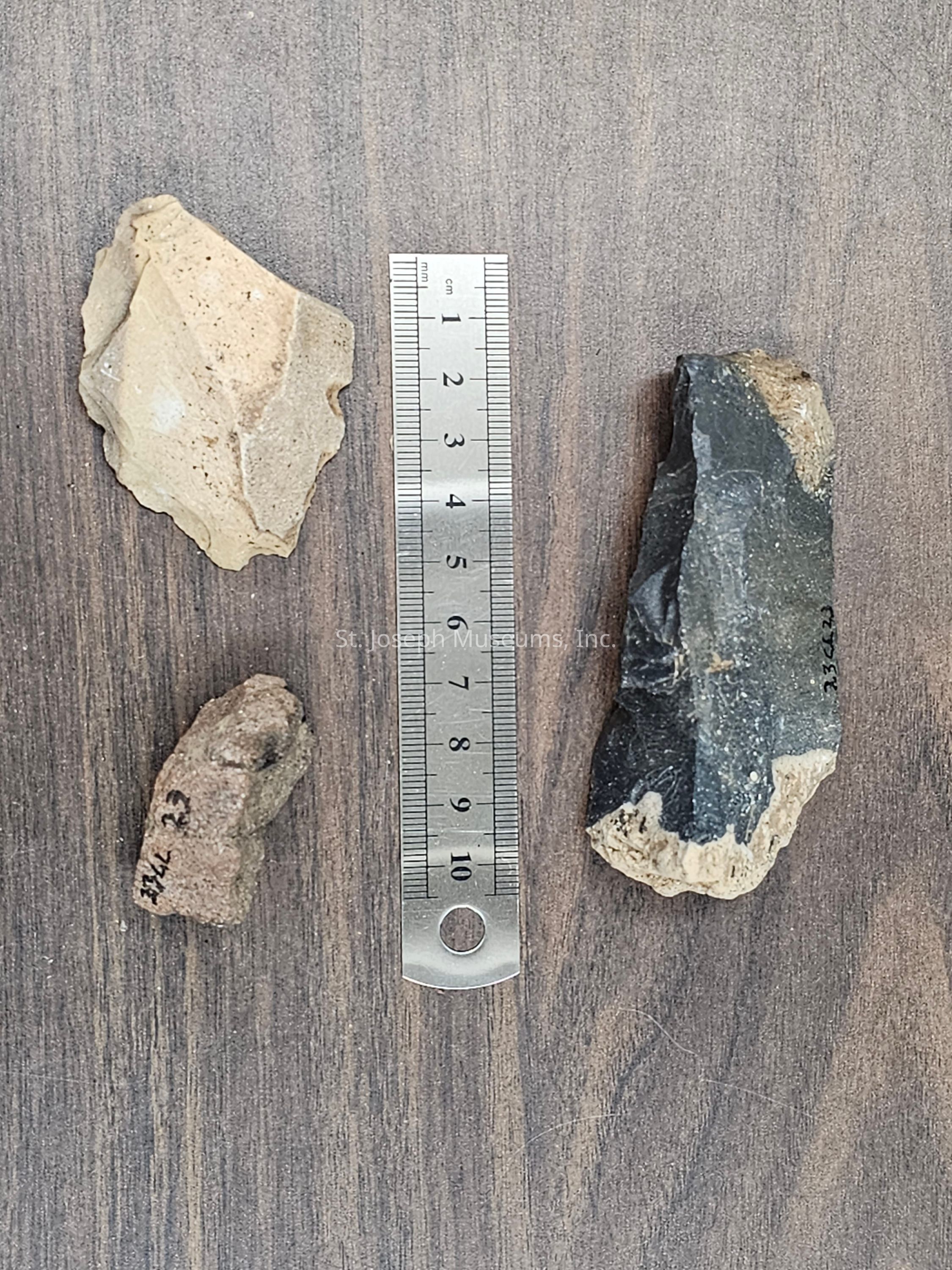
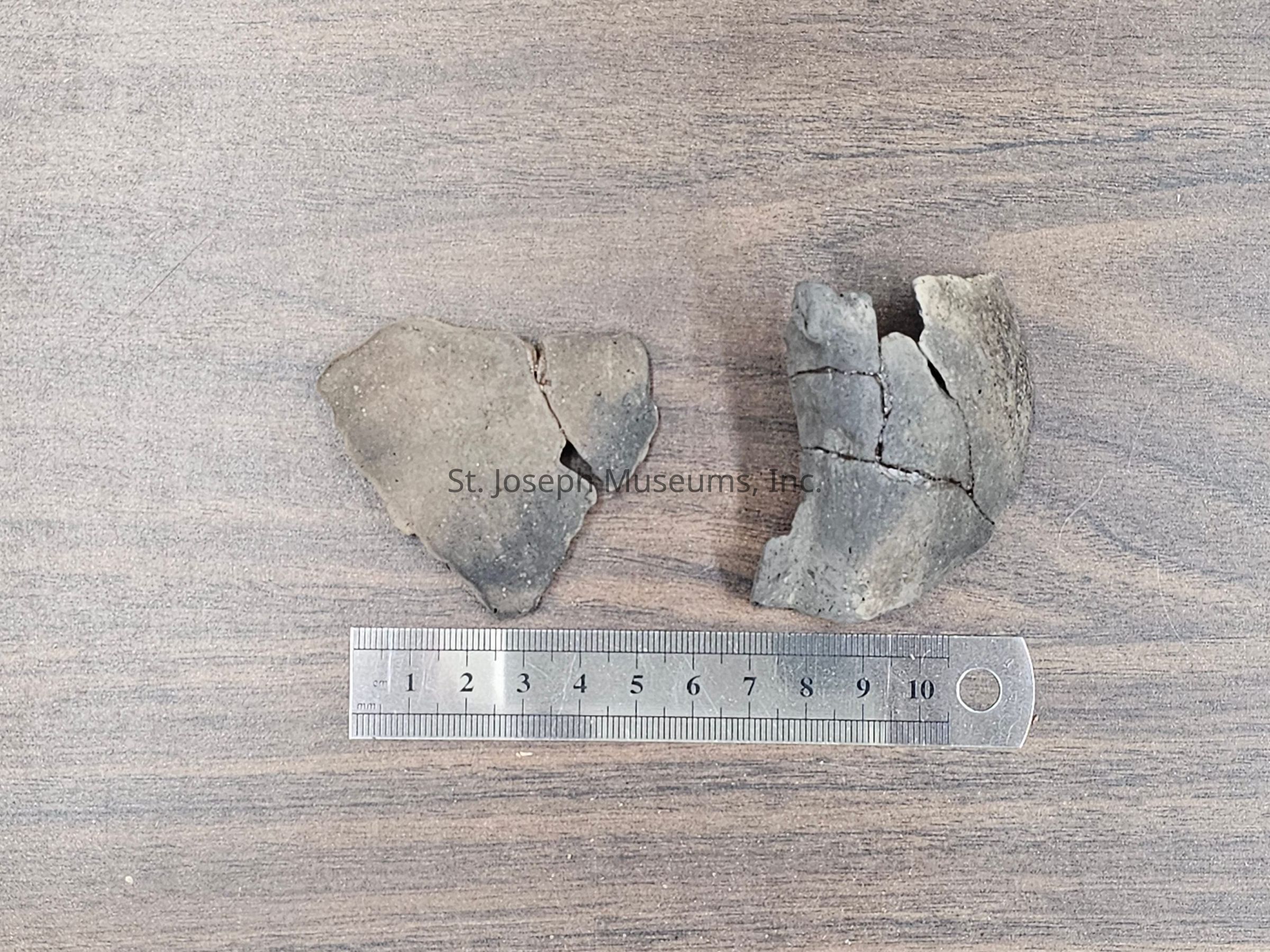
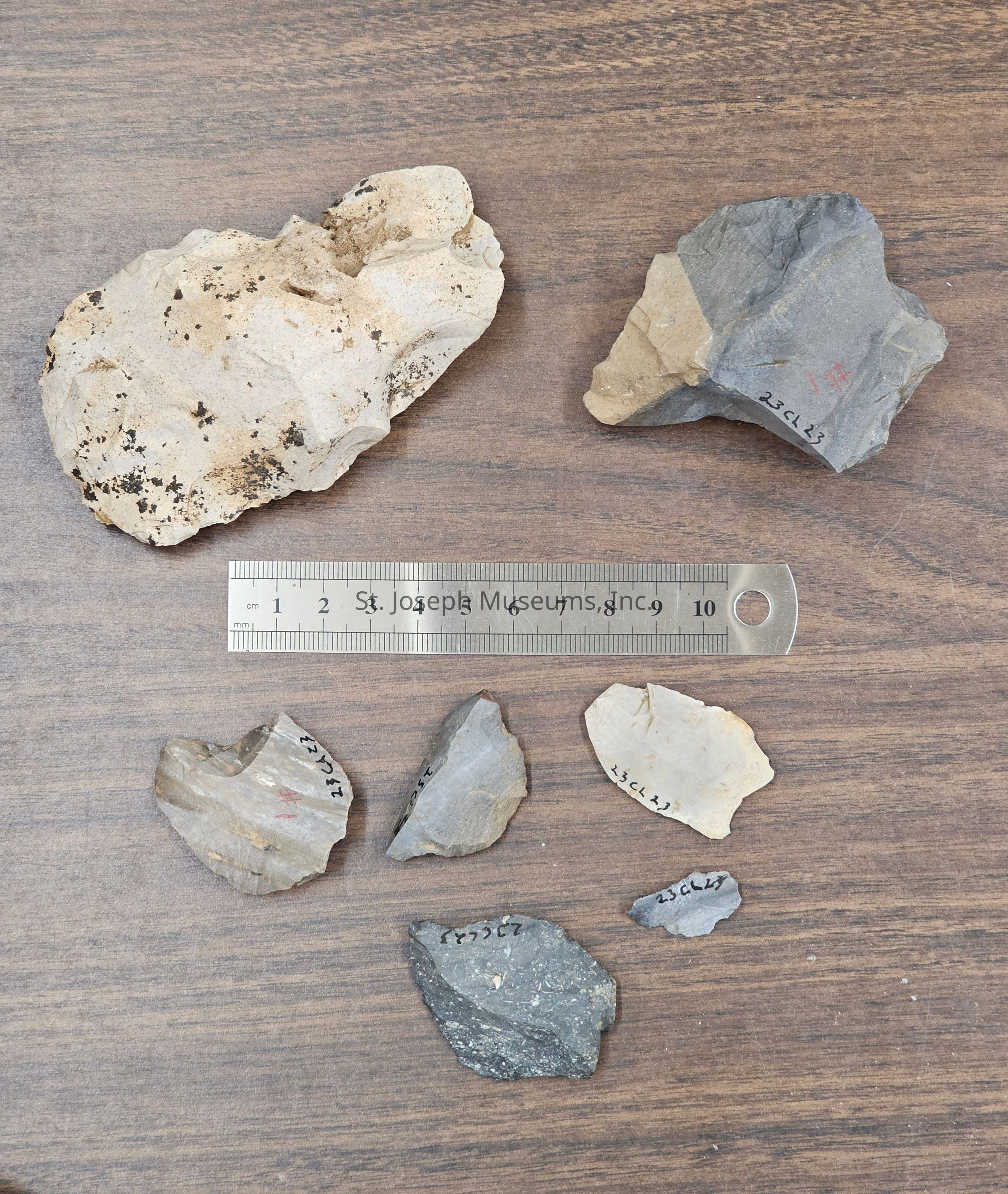
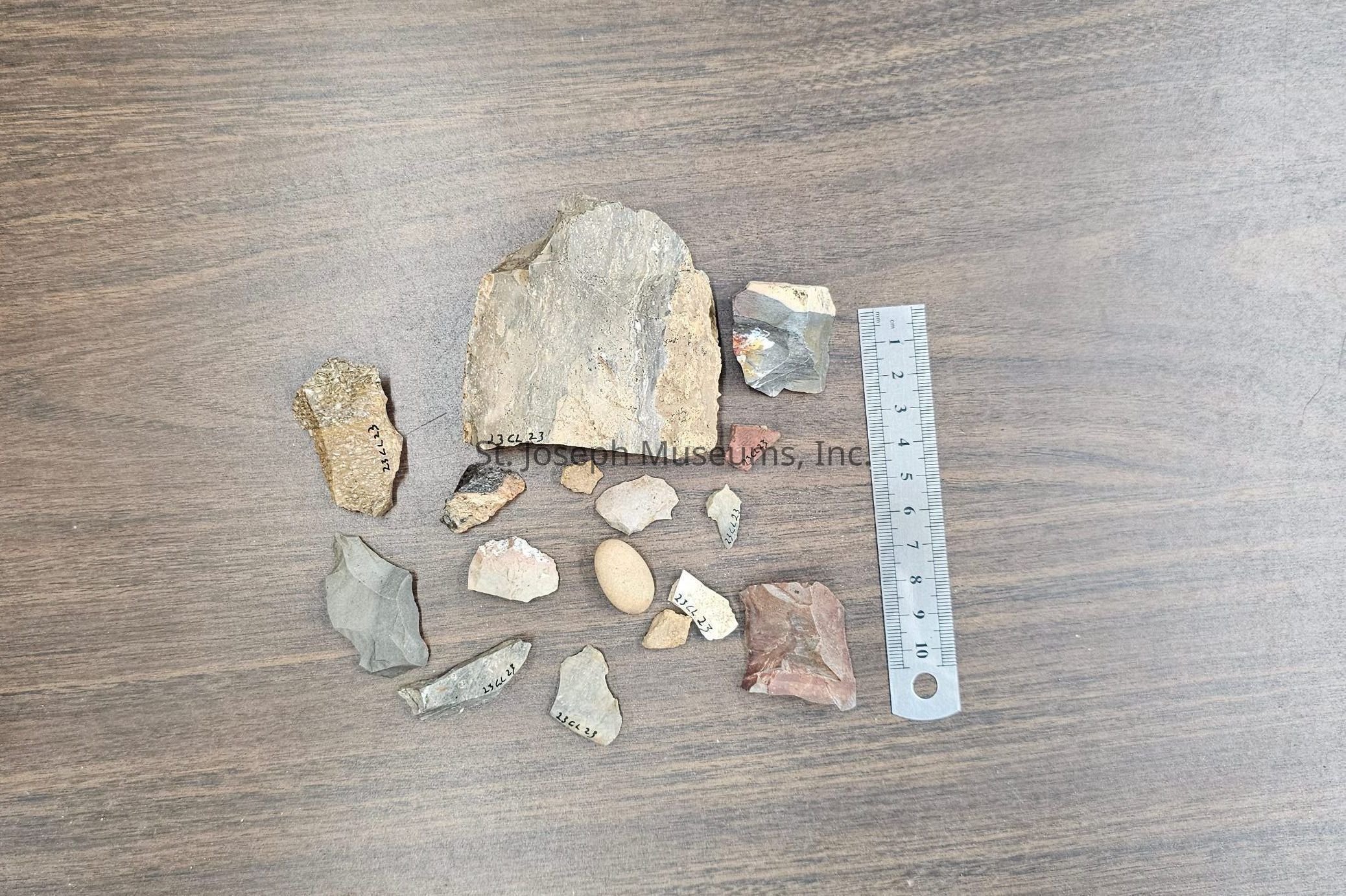
Contains multiple individual bags and packets of bags
Bag Packet #1
Bag a:
October 31, 1951
23CL23
N70 E90
at foot of profile at SW Corner of square. Fallen from about 24" deep
Bag b:
October 31, 1951
23CL23
N70 E90
Depth 19" in the center of the square. There is considerable evidence of a fill with such items scattered through it as red ochre? bits of charred coal chips, chunks, and a few human bones frags. Beneath the area (above) at 30" about 8 fragments of flint (chips) were found (unreadable) of area 8"
Bag c:
October 31, 1951
23CL23 N70 E90
14"-24"
Bag packet #2
N65 E80
Bag a:
Red earth above bone fragments in burial in N65 E80
21"-28"
Bag b:
Red limestone pebble
Bag packet #3
N65 E90
Bag a:
Red limestone
23CL23
April 21, 1951
N65 E90
o to 9"
4" of humus
Bag b:
Point
#7
23CL23
Depth 23" in NE corner of sq N65E90
Area of red burials
May 21, 1951
Bag c:
Sherds
23CL23
#6
May 5, 1951
Sq N65E90
Depth 19" in center of square
Area of red burials 6 small sherds, 4 pieces stone
Bag packet #4
Surface
Bag a:
23CL23 in loose dirt of dig. Lithic fragment
Bag b:
May 2, 1950
#26
Midway between mounds on Rundale Hill
Depth 18" to 2.4 ft
Approximately N145E60
Area of flexed burials
1 piece chert, 1 piece fragment, 1 blade fragment
Bag c:
#49
23CL23
Dec 1, 1950
1 sherd
Depth 24" from present surface
16" from old humus top in yellow subsoil
Approx N175E50
Area of flexed burials
Bag d:
June 3, 1951
Surface
Found by Leo Hamilton
Bag e:
23CL23
1951
Surface of disturbed area
Bag f:
Surface 23CL23
1/4-mile N of mounds on ridge
Bag g:
Surface of area 1/4mile north of mound. John Callison; Smithville, MO
R.F.D1
Bag h:
Sure, this is from bank cut by power shovel near a burial exposed when the dirt man got to the north mound in 1949. Includes a note in the bag that reads: "Sherd from near burial exposed by power shovel in cut bank Sept 1949. First work I did. Bag includes two rock sherds and a pottery rim sherd. The pottery sherd reads BY BURIAL 23CL23 North Mound Avondale
Bag packet #5
23CL23
N70E75
Bag a:
HAMMER
#15
SW corner
Sq N70E75
13" deep
Area of red burials
Bag b:
Small sherds
Depth 11" or the same as the first rocks of the square east. N70E80
May 29, 1951. Margaret
#19
4 sherds, 2 stone frag.
Area of red burial
Bag c:
POINT
#20
May 29, 1951
Depth 12" 1-foot north of N70E70 on west line of square. Margaret
Area of red burials
Waubesa point
Bag d:
ROUGH BLADE
#18
NE Corner of square at depth 25"
Other chips come out too
May 31, 1951
Area of red burial
Bag e:
SHERD
POINT
#17
Depth 17"
Center of square, first chips associated in level
Area of red burial
Bag #6
Bag a:
POINT
#25
Sq N70E80
Midway of burials
Depth 26" at 18" east of center of west side of square
Bag b:
CORD RFG POT SHERD
#24
Sq N70E80
Depth 20"
20" north 10 east of stake N70E75
Area of red burials
(note: bag and note only list 1 small sherd, but bag includes two rocks fragments and two ash deposits)
Bag packet #7
N70E85
Bag a:
CHIPPED FLAKE
#47
Chips were very infrequence
Depth 38"
May 29, 1951
SE Corner
Area of red burials
Bag b:
CRUDE SCRAPES
#45
Depth 31"
May 29, 1951
7 flakes, 3 firestones
Bag c:
May 5, 1951
#48
1.S - center depth 20" bone
2. West side - depth 24" galena
3. Center depth 23" point frag
edge of area of red burial
Bag d:
Depth 21
Under cluster of stones at edge in west center
May 1951
Bag e:
Tiny point and 2 sherds
#43
May 5, 1951
N TO E 85
2 sherds 16" from surface or 6" lower than the level on which the fired stones have accumulated or been laid
Point was 10 to14" deep
Area of red burials.
Point is 3 cm long
Bag f:
April 29, 1951
Depth 0 to 9" (just at top of brown soil
#46
Area of red burial
2 pieces worked flake, 1-piece small ochre
Bag g:
Body sherd
#44
May 4, 1951
N70 E 85
Depth 11"
Close to feature of a group of buried small lime stones (drain 8"x10")
Don Hartel
Area of red burial
Bag Packet #8
N60 E80
Bag a:
N60E80
Depth 10"
June 3
2 lithic cores and sandstone
Bag packet #9
Bag a: April 2, 1951
N165E50
Sherds from dark soil 8" below present surface and 10" above the top of the brown soil in in which the lanceolate point found (indecipherable)
Lanceolate point was at 34" from present surface
Pottery sherds
Bag packet #10
Bag a:
April 14, 1951
#40
Sq N155 E55
Depth 18" below the old humus.
Location 21/2 ft from south wall, 1 ft from west
Scraper like piece was at 22" below old humus.
Scrapers and flake, one piece of red ochre. Found in area of flexed burials
Bag packet #11
Bag a:
Chip scraper
#33
May 5, 1951
N60E75
NW Corner
Depth 16
Area of red burial
Bag b:
Long flake knife
#32
May 5, 1951
SQ N60 E75
Depth 19"
5" below bone frag level which are at 14" below surface
Area of red burial but 5" below burial
Bag Packet #12
Bag a:
25" deep in square N65 E75
Fenenga dug found October 1951 by Mett
Bag b:
Limestone
N65E75
depth 7" from surface
ocher stained limestone - three pieces
Depth 19" from surface
Chert flake scraper
Bag c:
Burial at 26"
October 25, 1951
Square N65 E75
Red Ochre mixture at slightly lower levels
also, burial above by F. Fenenga
Red ochre +rades, left humerus in place
27" from wall is teeth of both jaws in articulation
Bag contains red ochre and another bag of human teeth
Bag packet #13
Bag a: October 24, 1951
#29
Sherd from 32" ft deep in east profile of Sq N190 E65 or 6" above top of skull of the (indecipherable) this square
Area of flexed burials
Bag packet #14
Bag a:
Pot Sherd
#35
Depth 35" below present surface which has an approximate 12" fill at this point Depth below surface of original fill top would be appr. 24" at N189E65
Large chips occur at this depth
Area of flexed burials
Bag packet #15
Bag a:
#16
Bone frags, paint, dull chips, sherd, point end, RF Blade
N70 E75
Depth 9" to 12"
May 29, 1951, Margaret
Area of red burials
Bag packet #16
Bag a:
#28
N185E70
Depth 15" below original hilltop surface in center of square
October 20, 1951
Area of flexed burials
Bag b:
#27
Oct 21, 1951
N185E70
Depth 20"-24" below original surface at 27" the soil changes from brown to yellow loess but still contained chips and spalls and small stones
Area of flexed burials
Bag packet #17
N65 E85
Bag a:
#30
Depth 31"
10" South, 16" west of NE stake
1 stone drill
Area of red burials
Bag b:
Gorget fragment
Depth 20" to 21"
(Bag reads 1 point and 2 gorgets but inside the bag is one complete projectile point, one round stone, and 1 worked chert fragment)
Area of red burial
Bag packet #18
Bag a:
Chipped stone celt
#1
N65 E80
April 21, 1951
Depth 22" to 24" and 18" below black humas on top. Traces of charcoal and paint (hematite)
Question of a burial here, bone was not noticed.
Same areas as red burials
Bag packet #19
Bag a:
April 3, 1951
Sq N155 E50
Depth 40 from surface 21 from old human
These were in a fairly horizontal layer but were not really associated in any feature
Bag b:
#39
Depth 32" from surface now 13" old surface
Sq N155 E50
Humphrey gets these in the South Hills of Nebraska
Area of flexed burials
(this is a calf creek style projectile point fragment)
Bag packet #20
Bag a:
April 21, 1951
Sq N95 E70 By stump
Depth 15" below surface, 9" below bottom of humus
to depth 21" below present surface
Bag packet #21
Bag a:
Sq N185 E65
Depth 18"
Bag b:
Sq N185 E65
Depth 33" to surface 23" to bottom of fill
3ft S. of burial
June 17,
Area of flexed burials 1951
Bag packet #22
April 3, 1951
Sq N150 E55
Depth 21 from first surface, 19" from humus top
Bag packet #23
Scraper
April 21, 1951, from back fill of players dig or North mound at a present depth in fall of 10" on west profile of square N160 E60
Bag packet #24
Bag a:
April 2, 1951
Rim sherd from frozen black soil of sq N175, E55 which had rolled down the (indecipherable)
Bag b:
Small red sherd at 24" other sherd at 18"
March 19, 1951
Cold wind frost in ground, dug N175 E55. I level at 18" skull fair shape. Development Co put up sign DO NOT DIG HERE. That helps us a lot.Collection
Shippee Archaeological CollectionRelationships
Related Places
Place
Location
23 CL 23County
Clay CountyState/Province
Missouri