1966 23BN1 Excavation Forms
Click for PDF
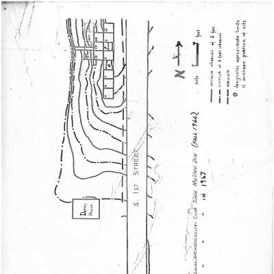
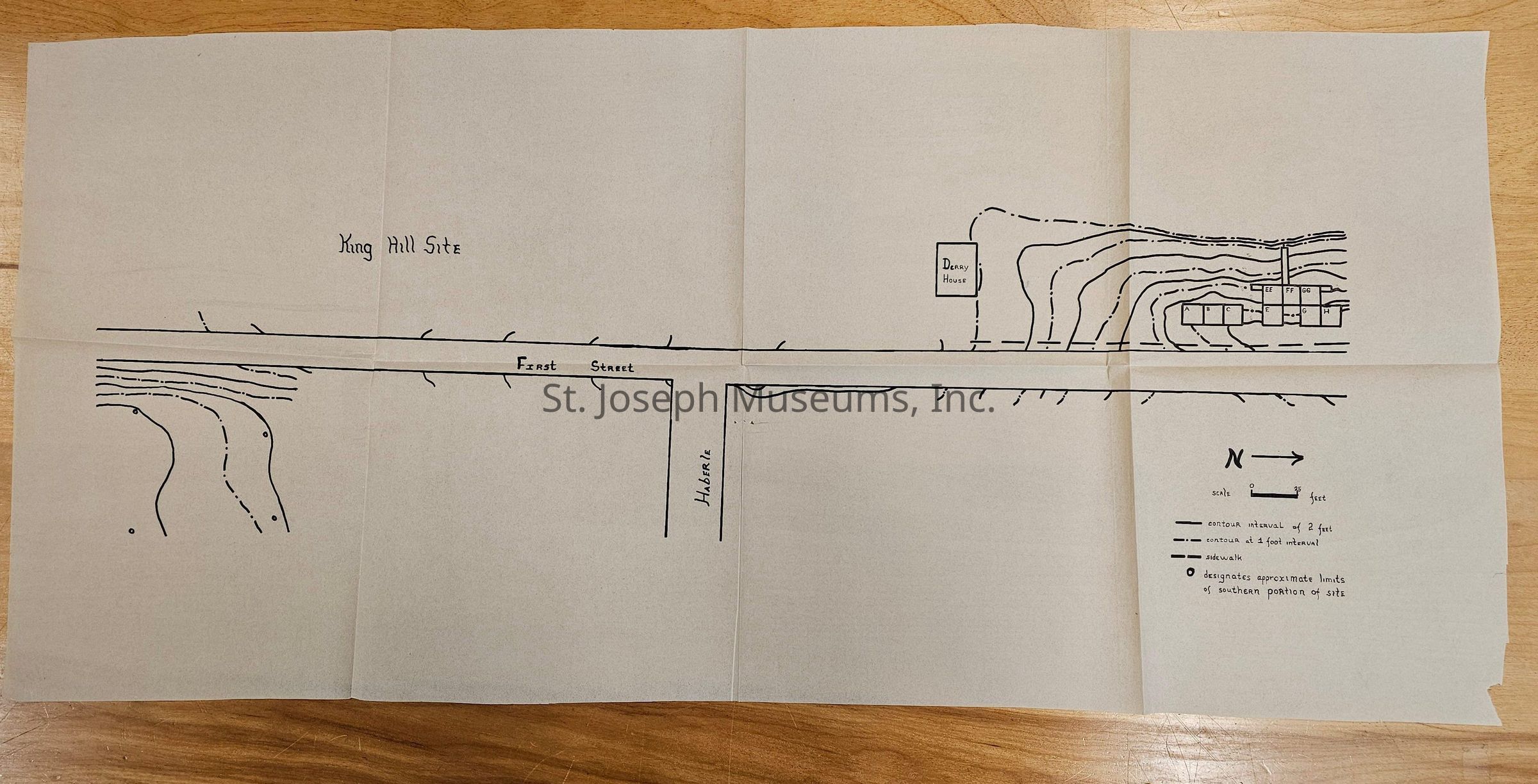
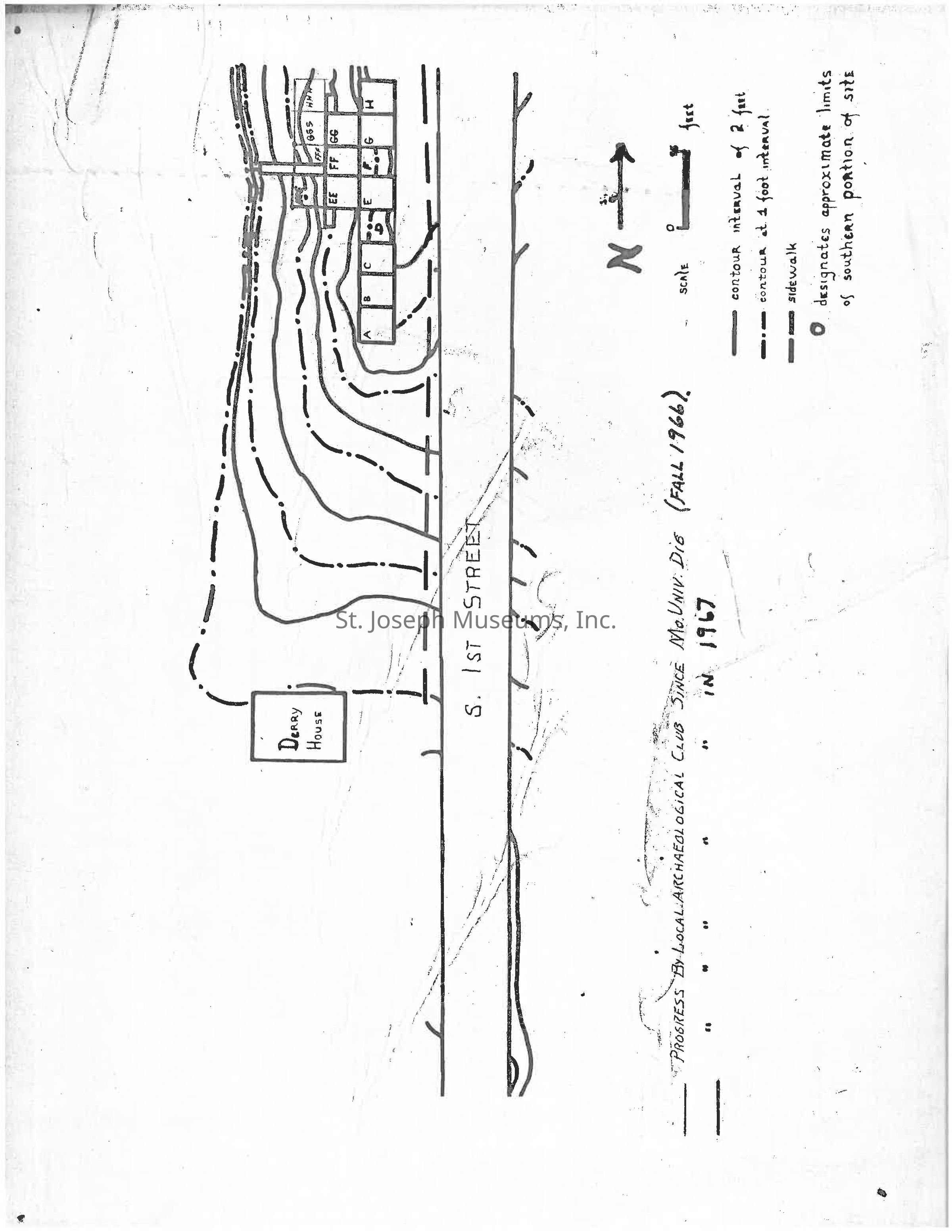
The image depicts a hand-drawn map labeled "Dairy House" situated alongside "S. 1st Street," illustrated with contour lines indicating elevation differences at 2-foot and 4-foot intervals. The map includes a section marked with approximate limits of the southern portion of the site, accompanied by a north directional arrow and a scale in feet. Several rectangular plots are outlined and labeled with letters or numbers, indicating specific areas within the site.