Name/Title
Road from Missouri to Oregon, Fremont's Topographical Map, 1946Entry/Object ID
AM2020.1.316Scope and Content
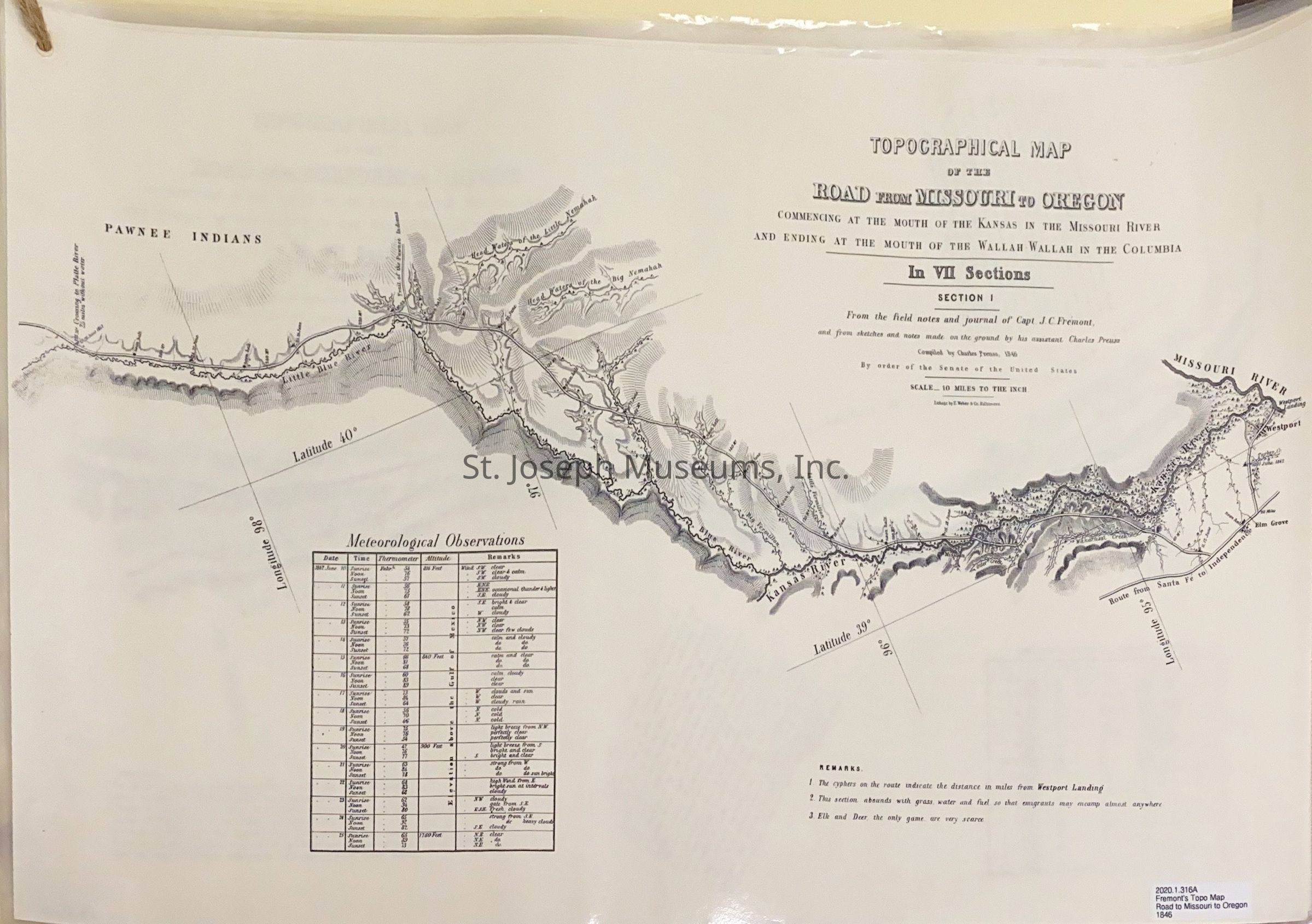
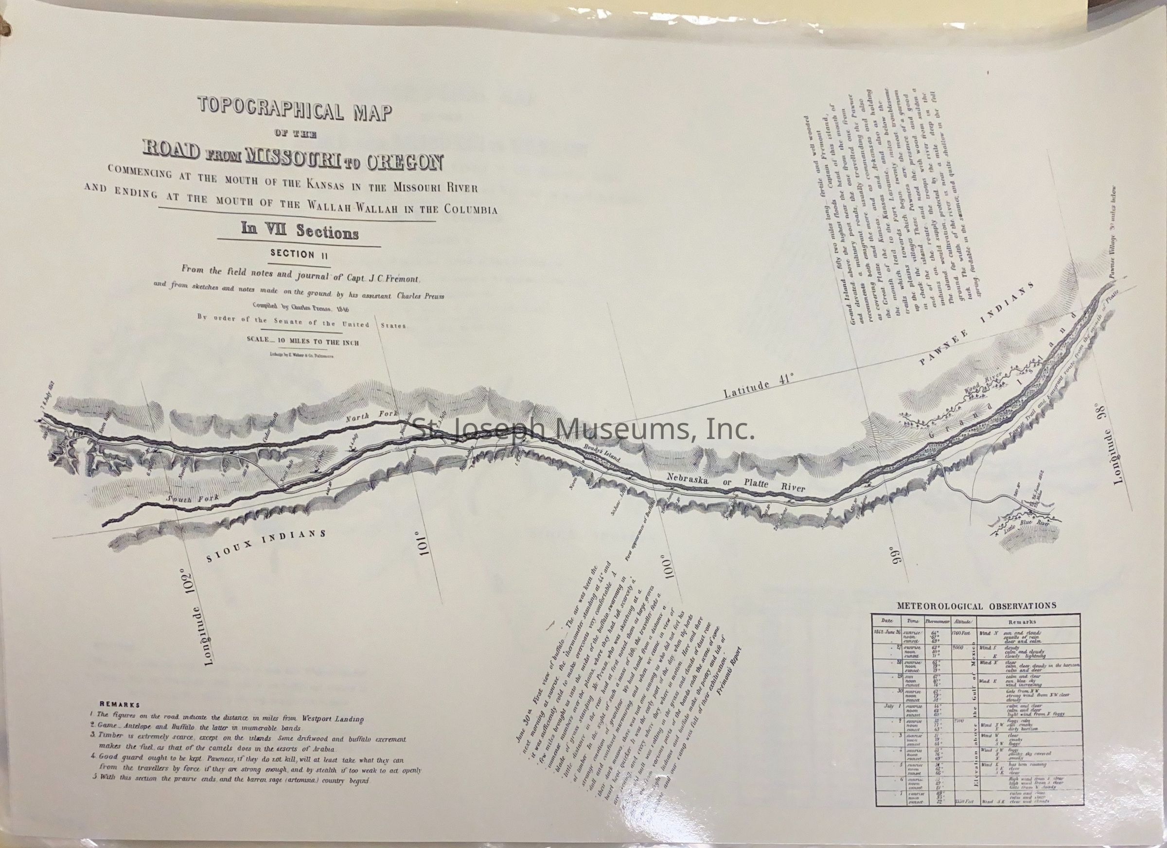
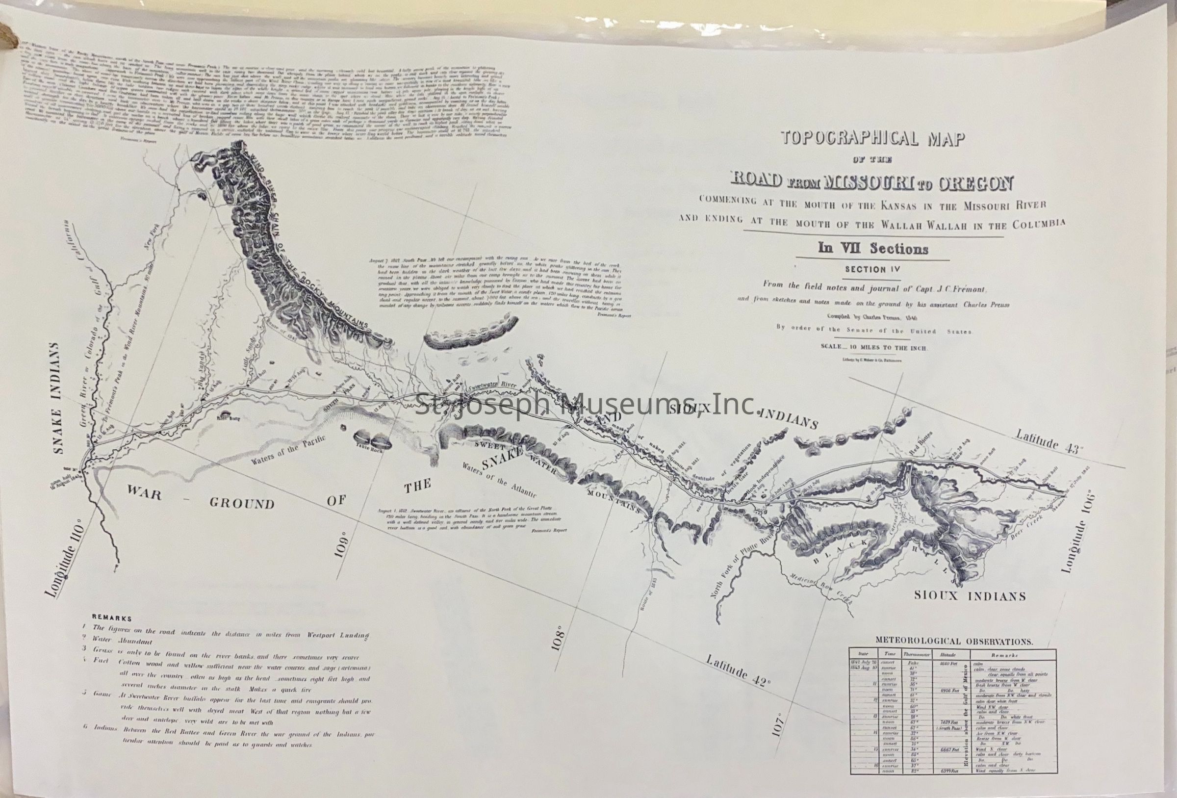
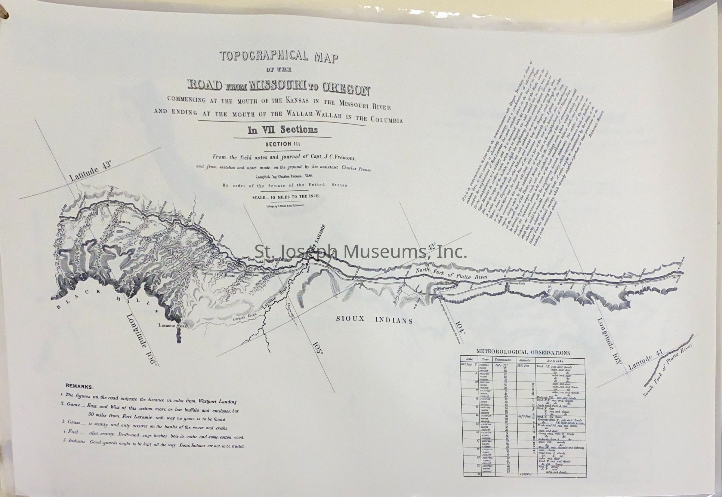
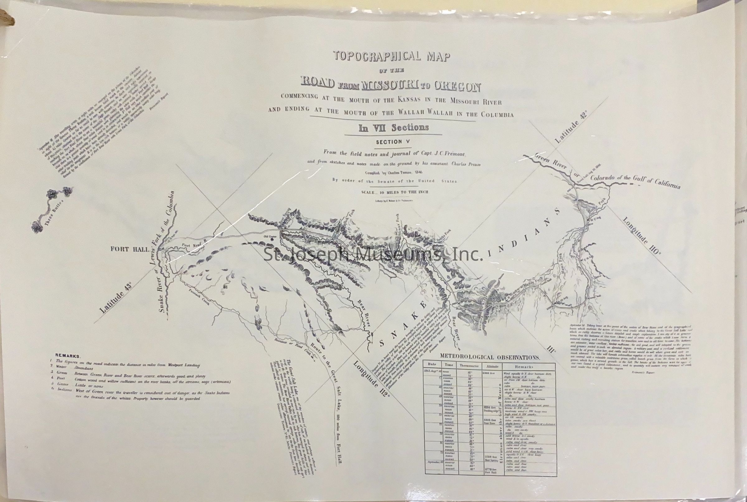
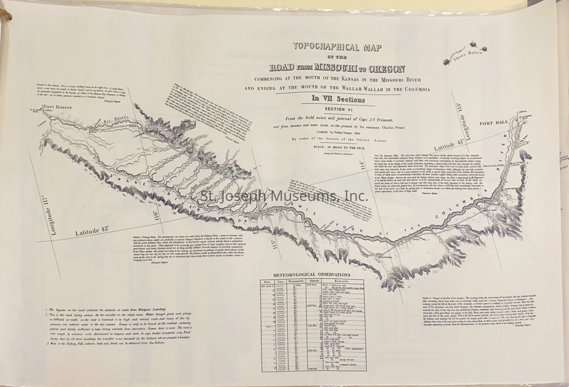
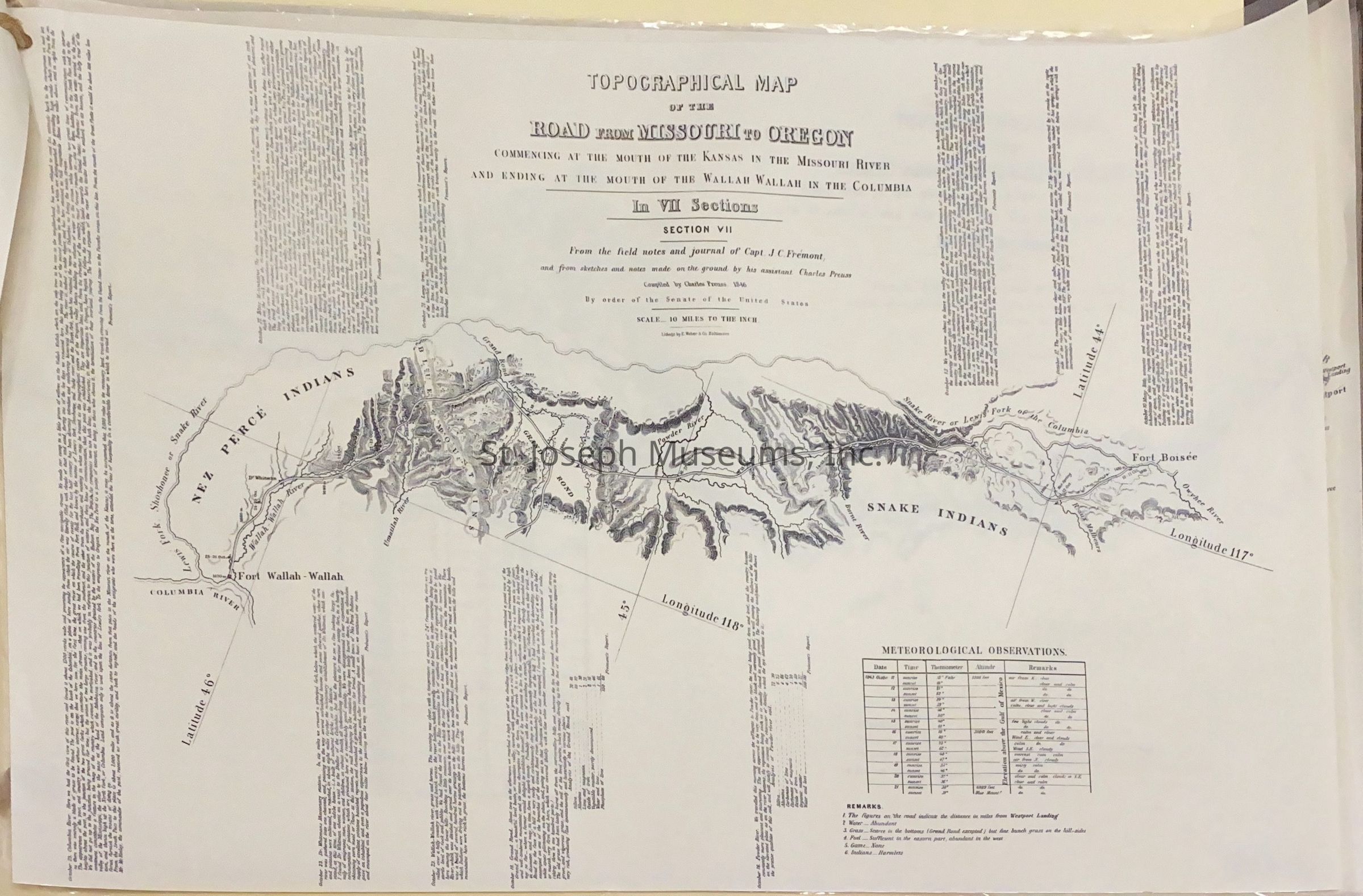
Road from Missouri to Oregon, Fremont's Topographical Map, 1946. "Topographical Map of the Road from Missouri to Oregon, commencing at the Mouth of the Kansas in the Missouri River and Ending at the Mouth of the Wallah Wallah in the Columbia. In VII Sections, From the field notes and journal of Capt. J.C. Fremont and from sketches and notes made on the ground by his assistant, Charles Preuss. compiled by Charles Preuss, 1846, by order of the Senate of the United States."
Seven maps that include names of tribes in their occupying areas. 2 sets laminated and bound in set by twine loop.Lexicon
Nomenclature 4.0
Nomenclature Secondary Object Term
MapNomenclature Primary Object Term
CartographNomenclature Sub-Class
Graphic DocumentsNomenclature Class
Documentary ObjectsNomenclature Category
Category 08: Communication ObjectsLOC Thesaurus for Graphic Materials
Pony expressSearch Terms
Pony Express Trail, Nevada Maps