Name/Title
Atlas of Buchanan County, MissouriEntry/Object ID
L2005.1.75Description
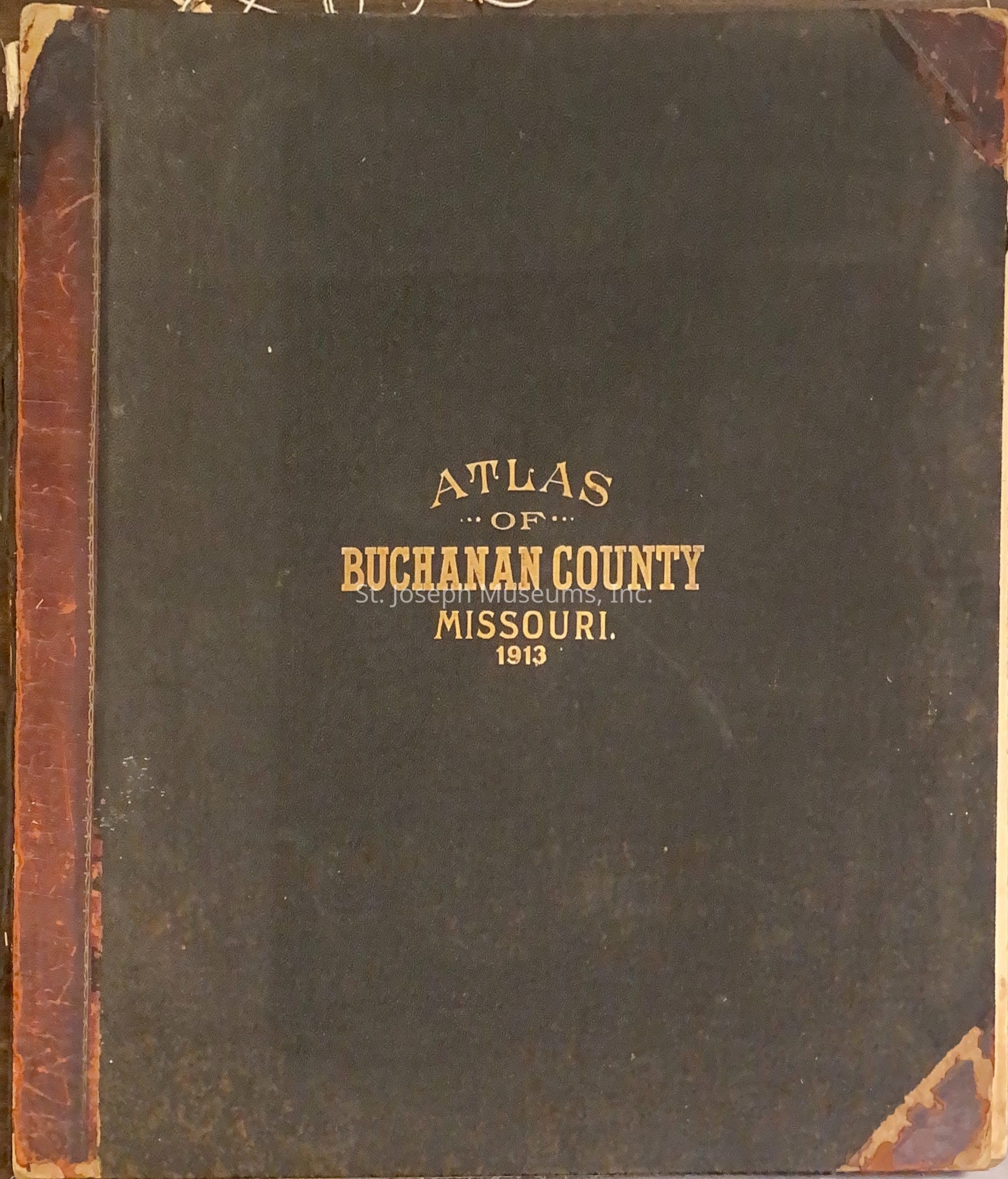
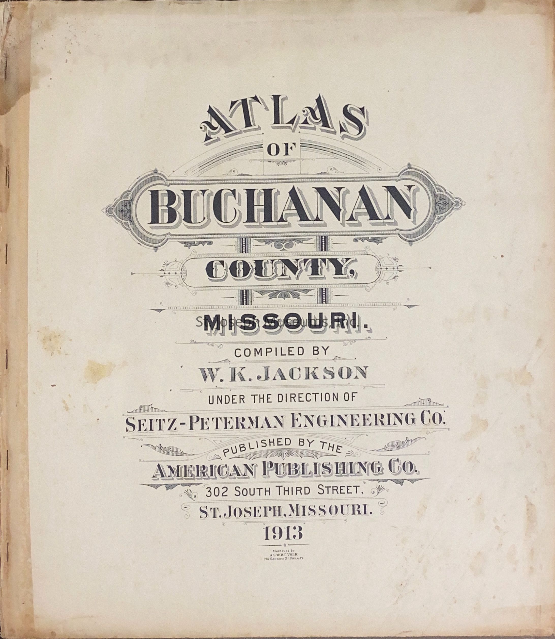
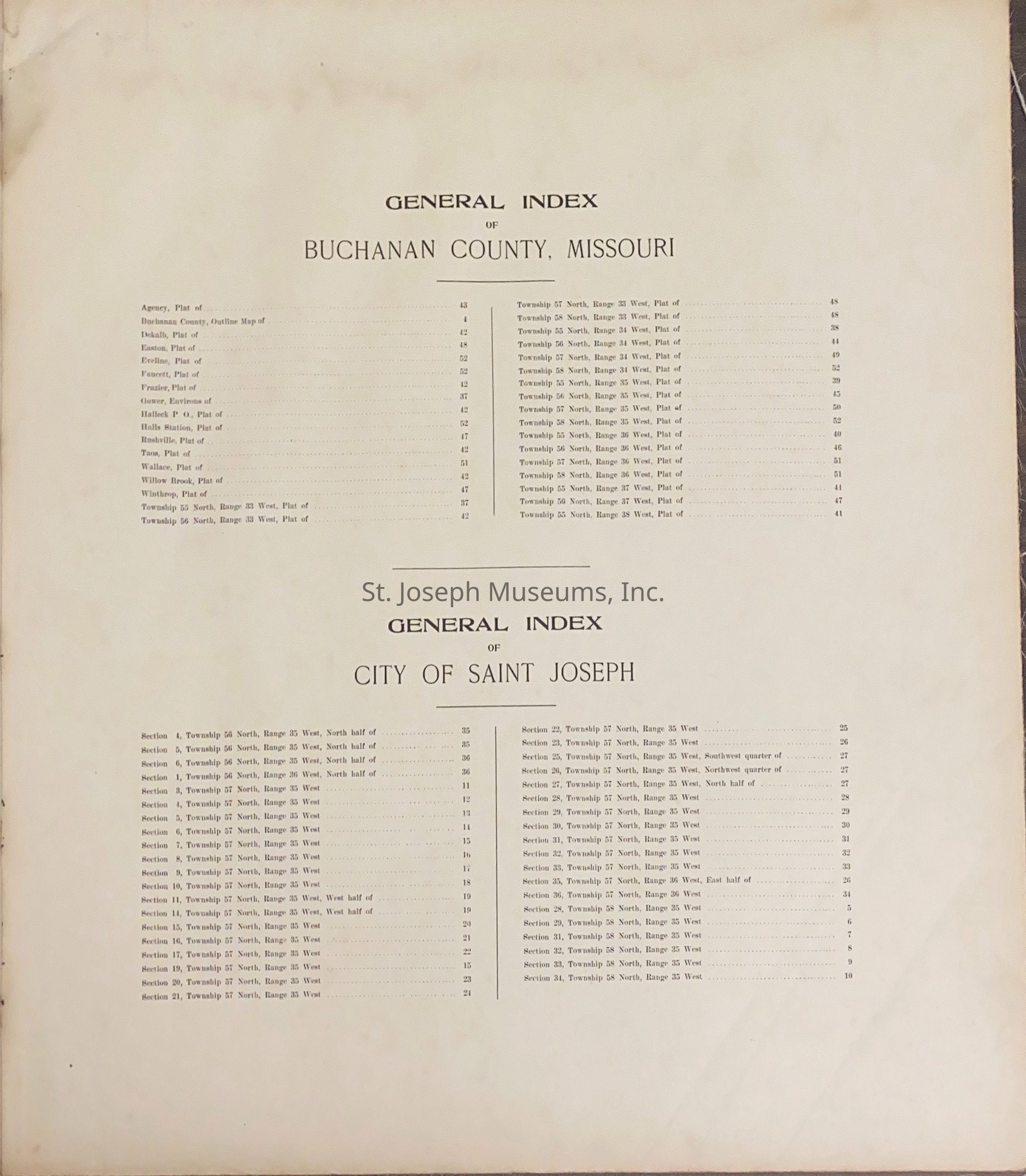
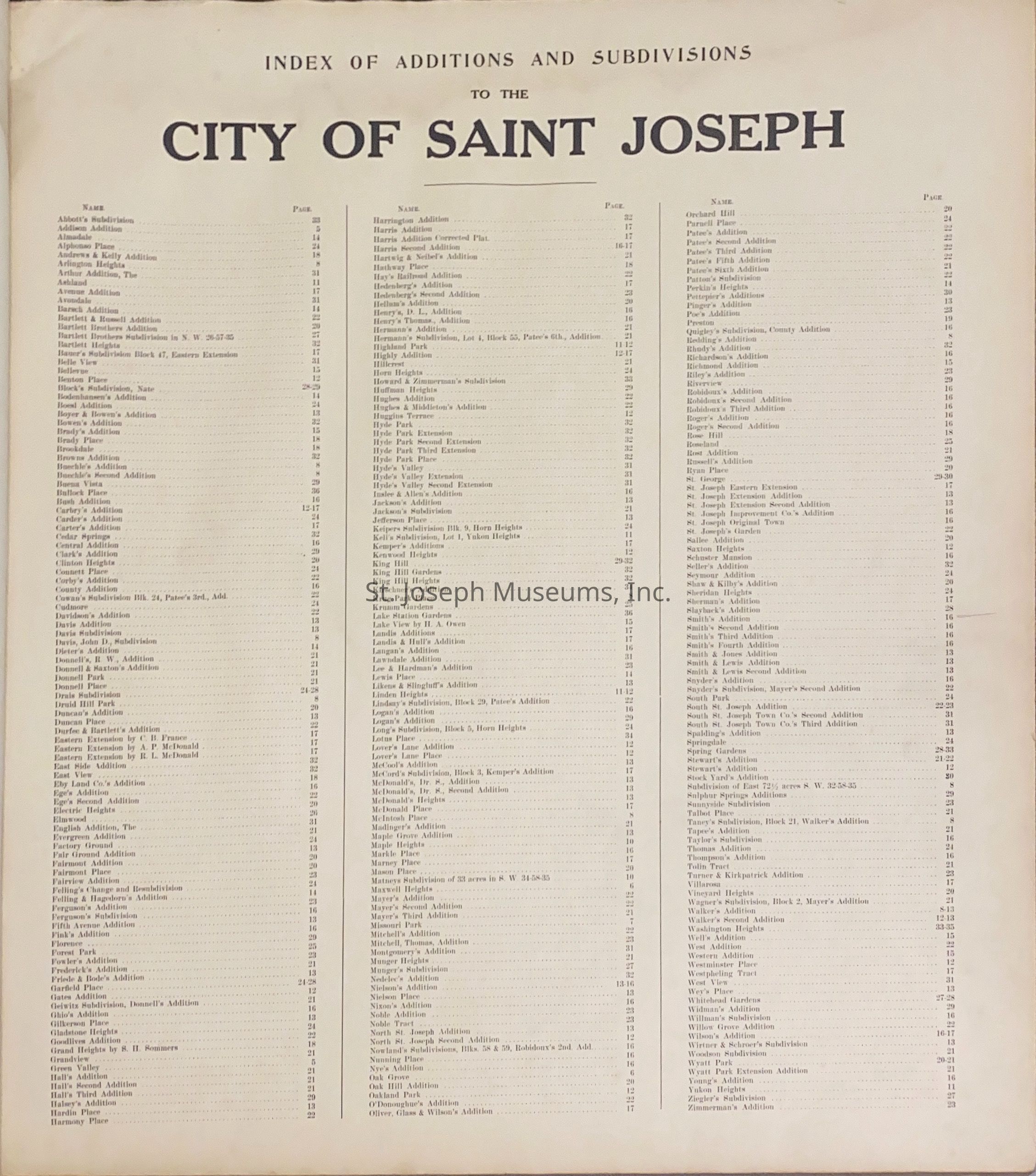
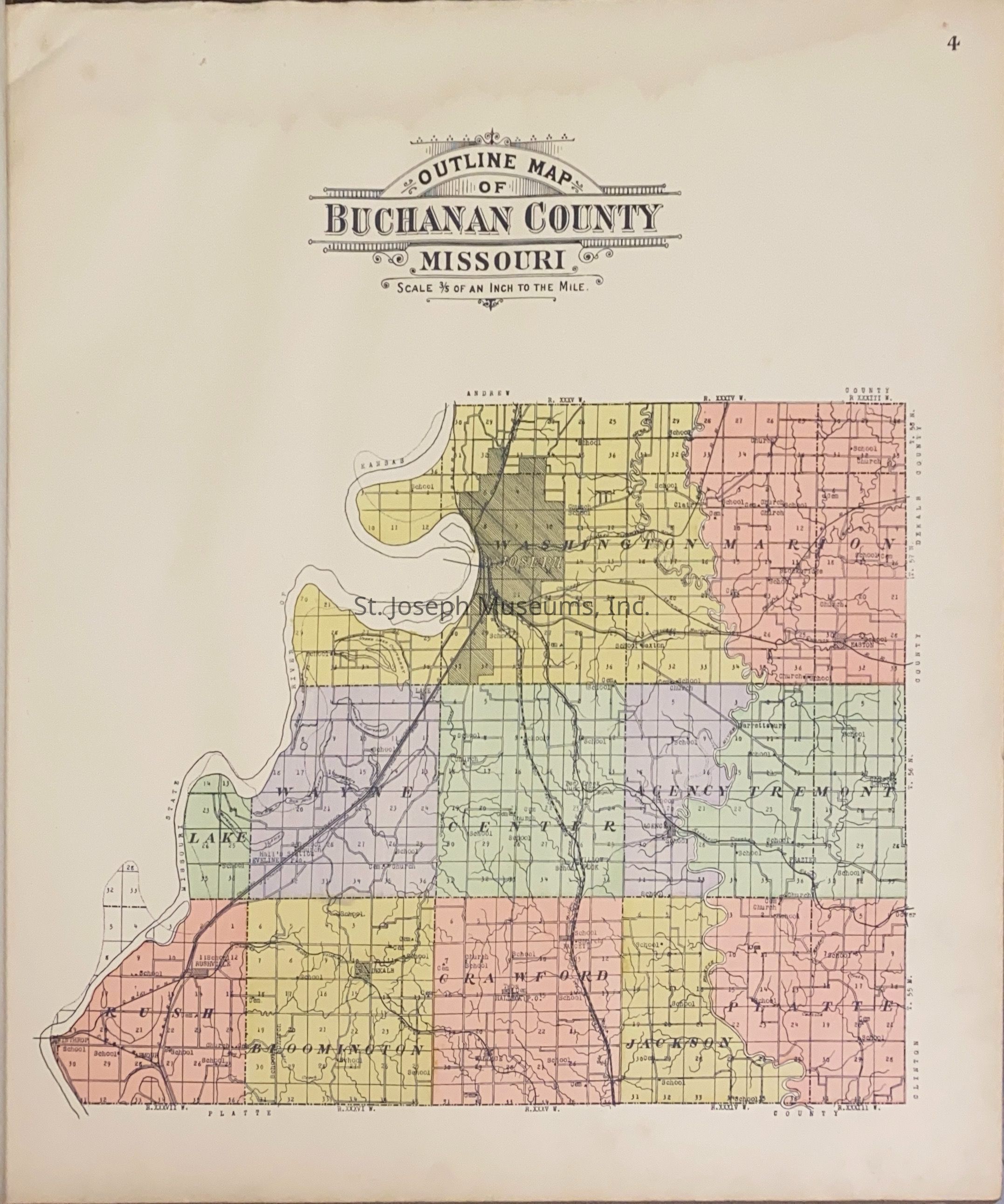
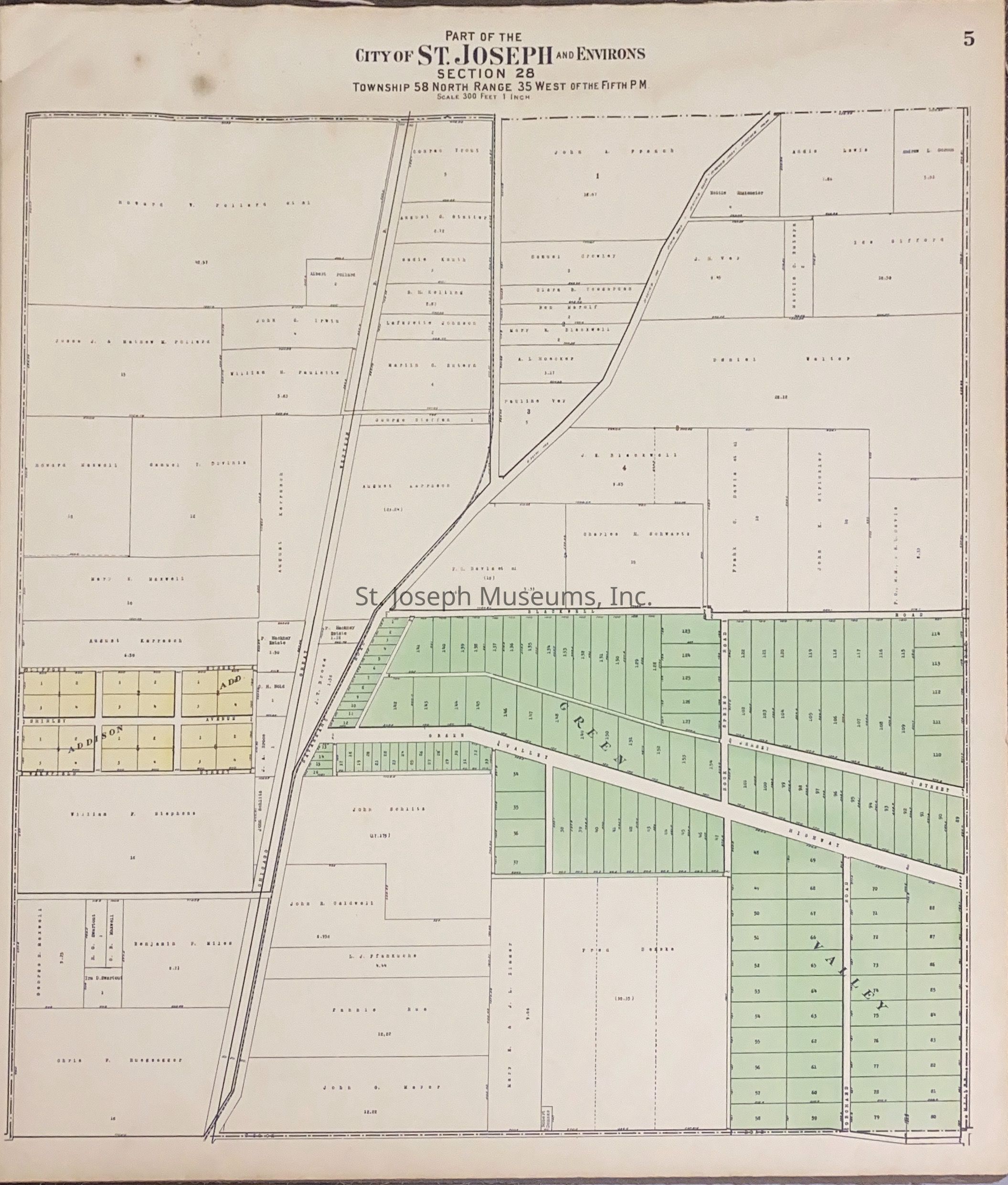
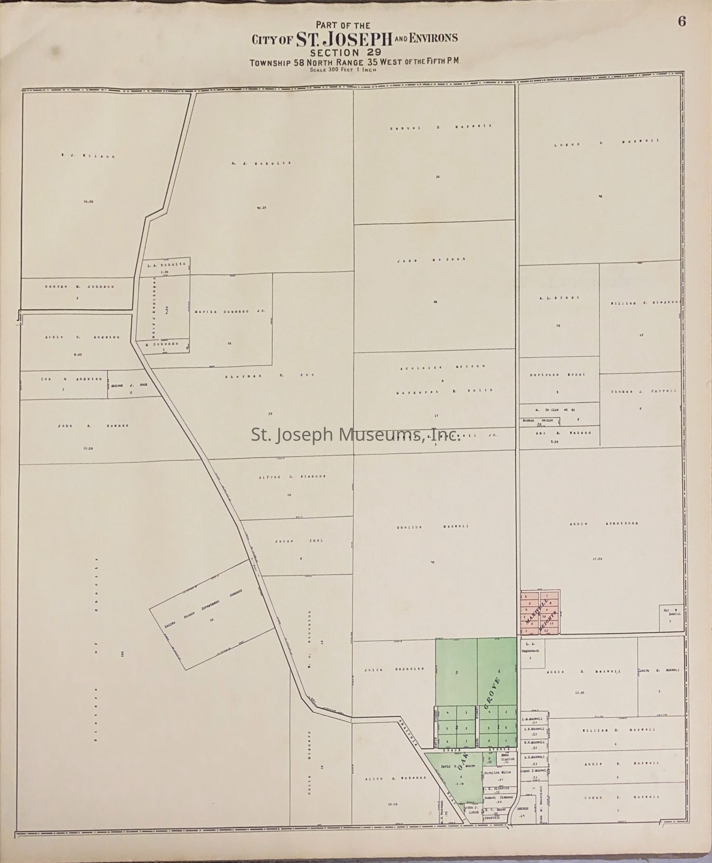
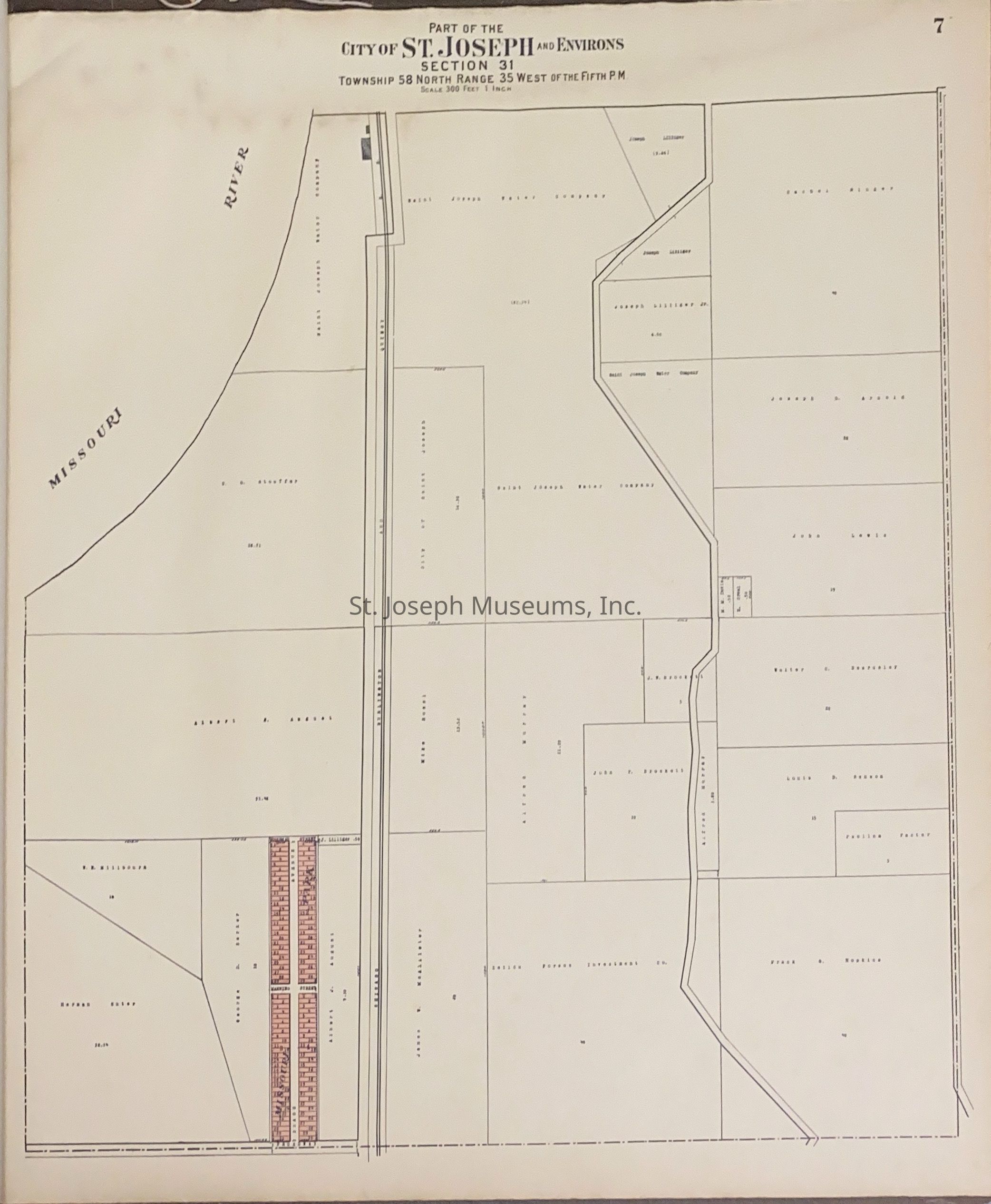
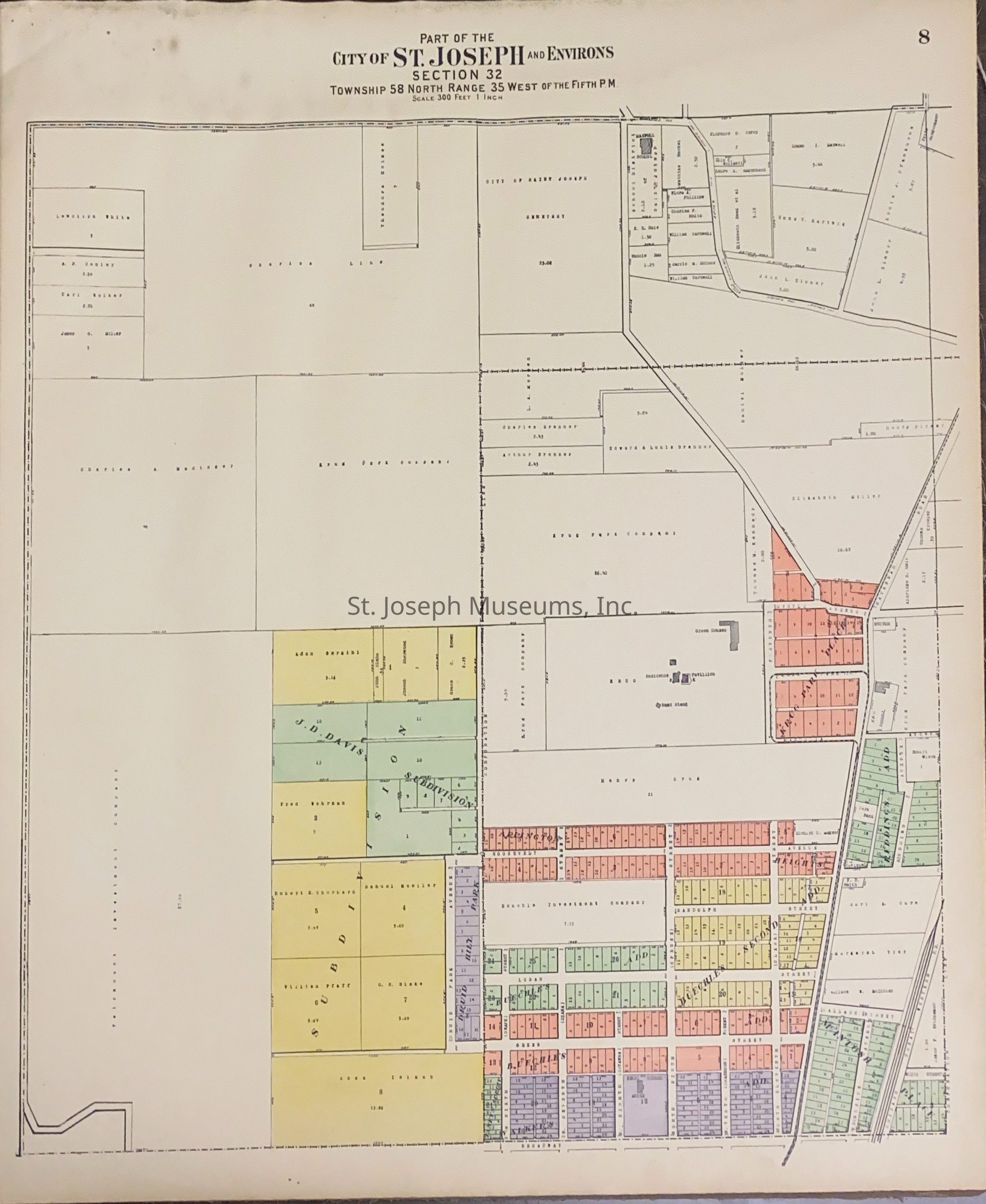
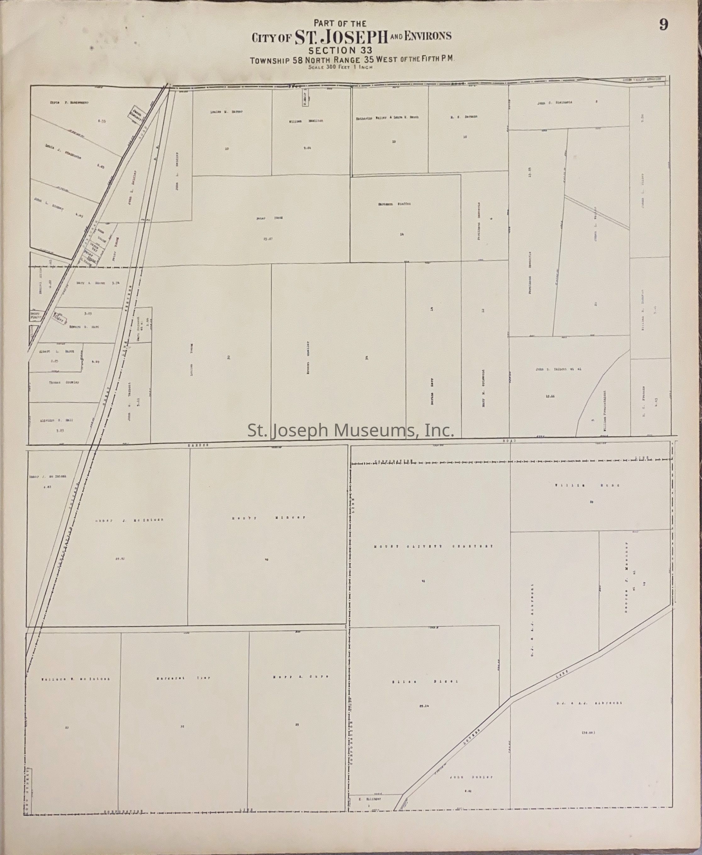
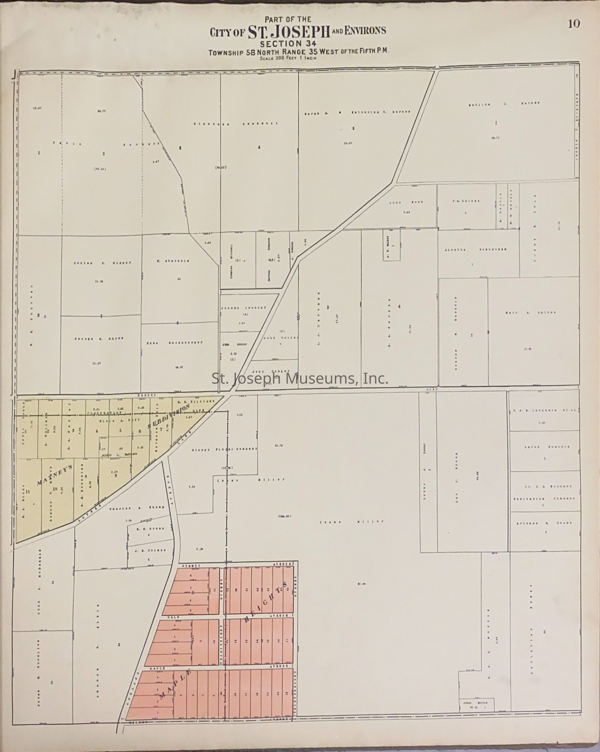
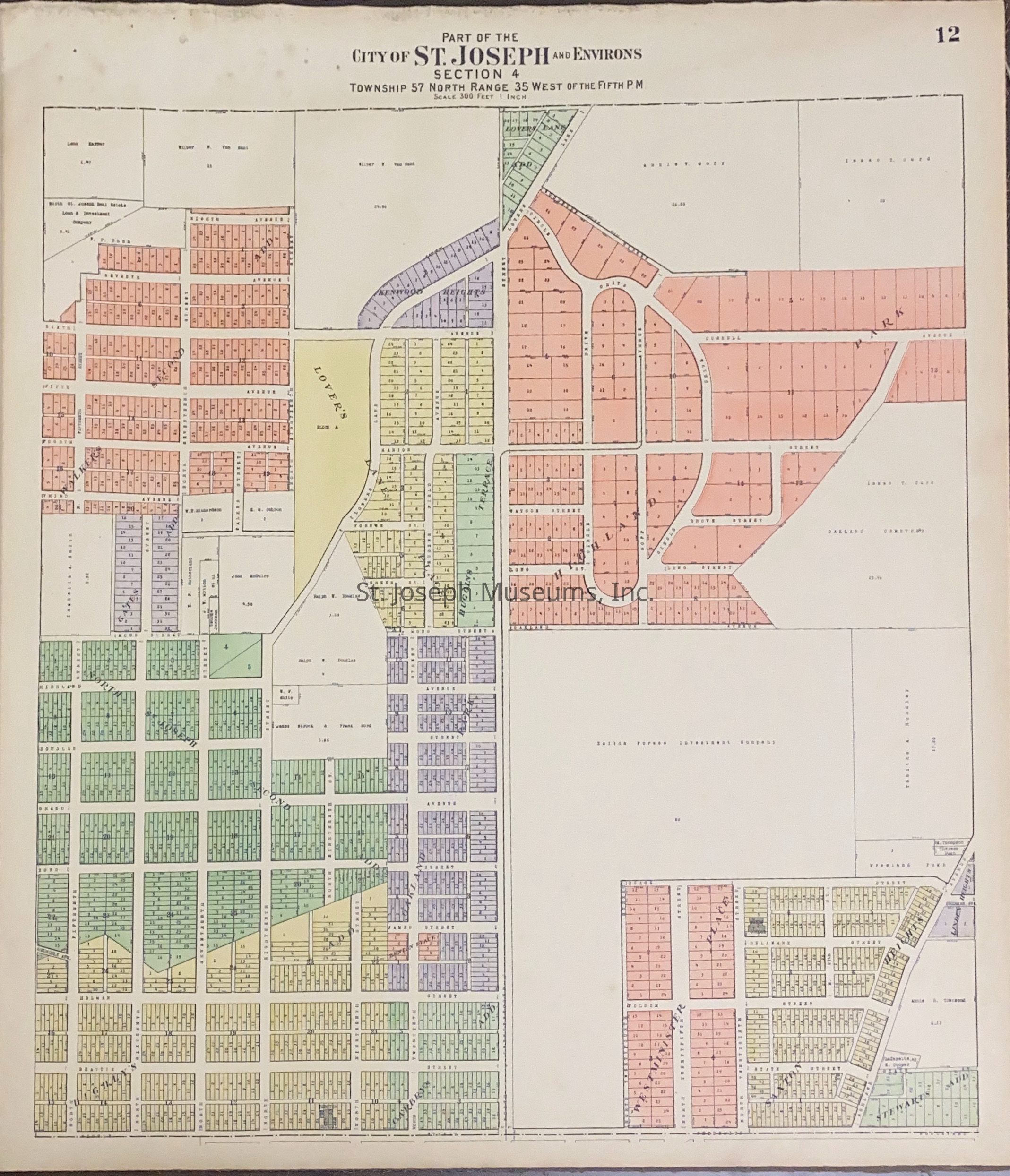
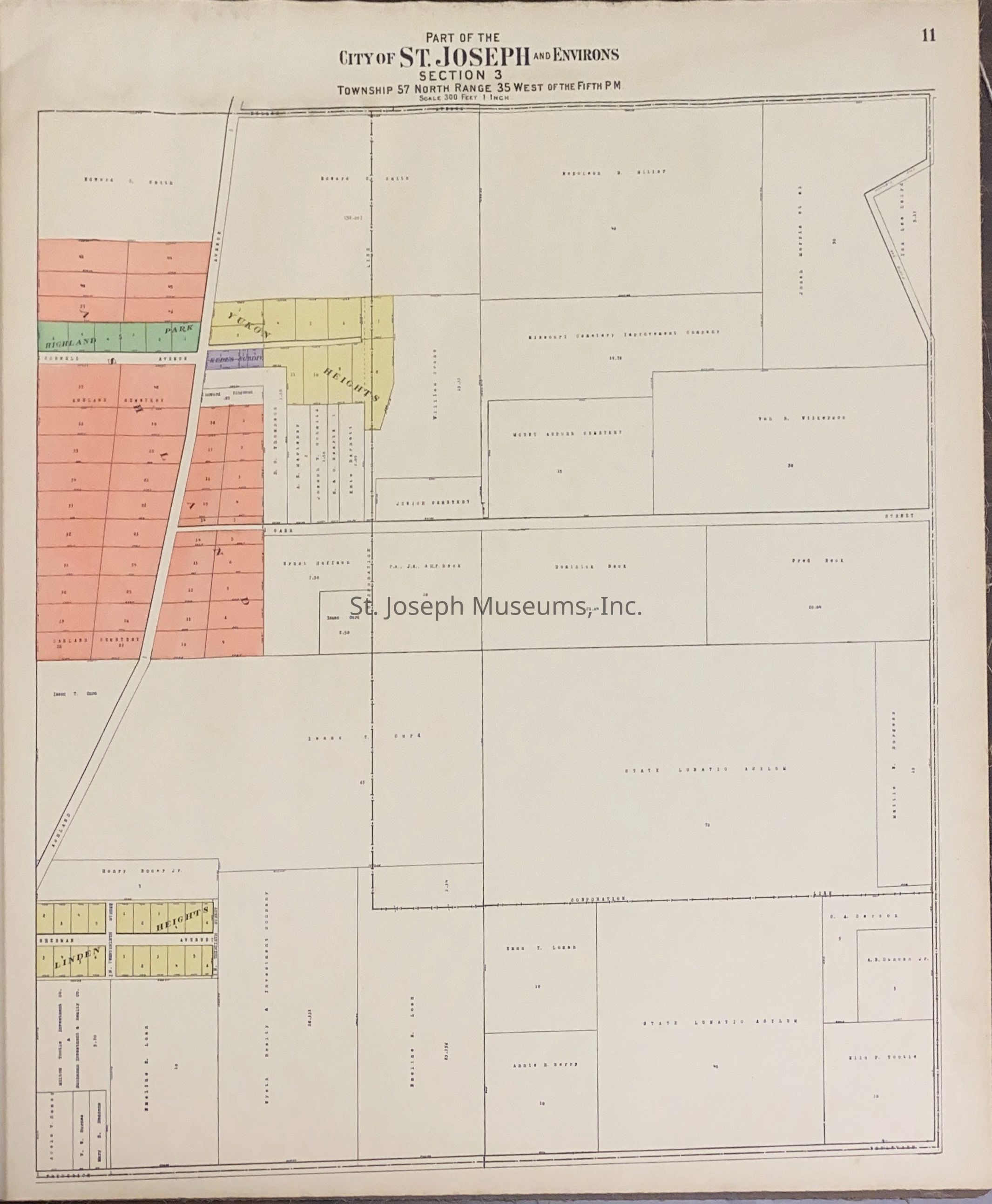
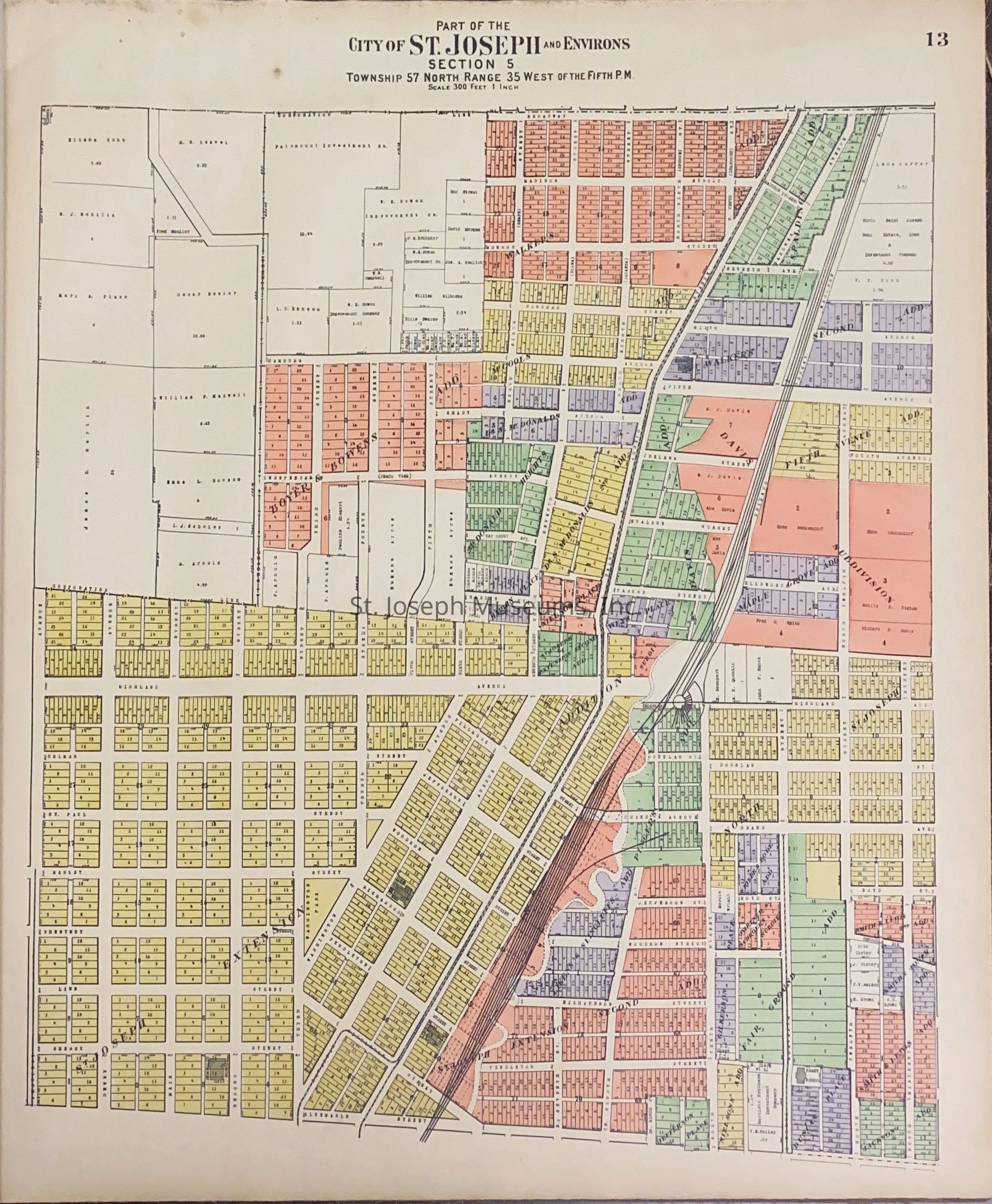
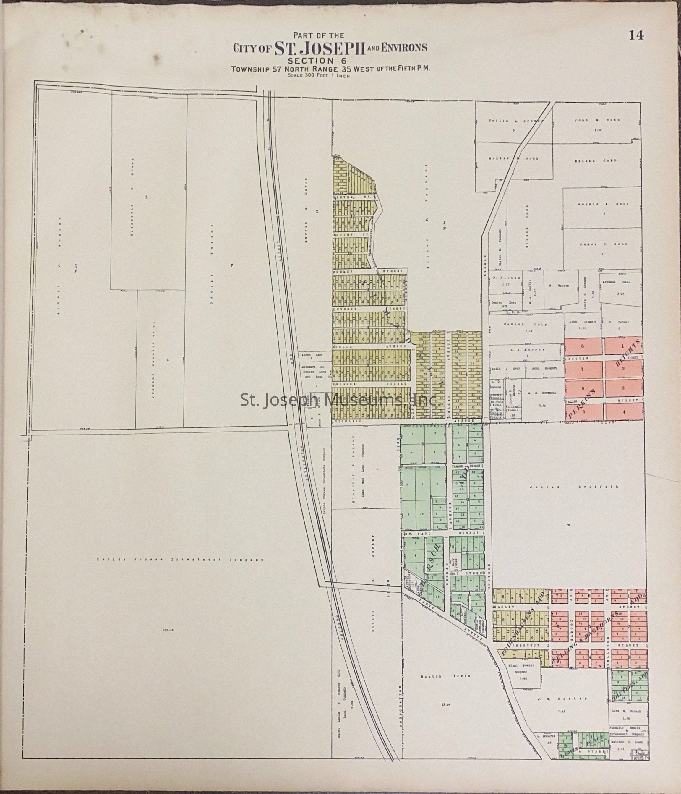
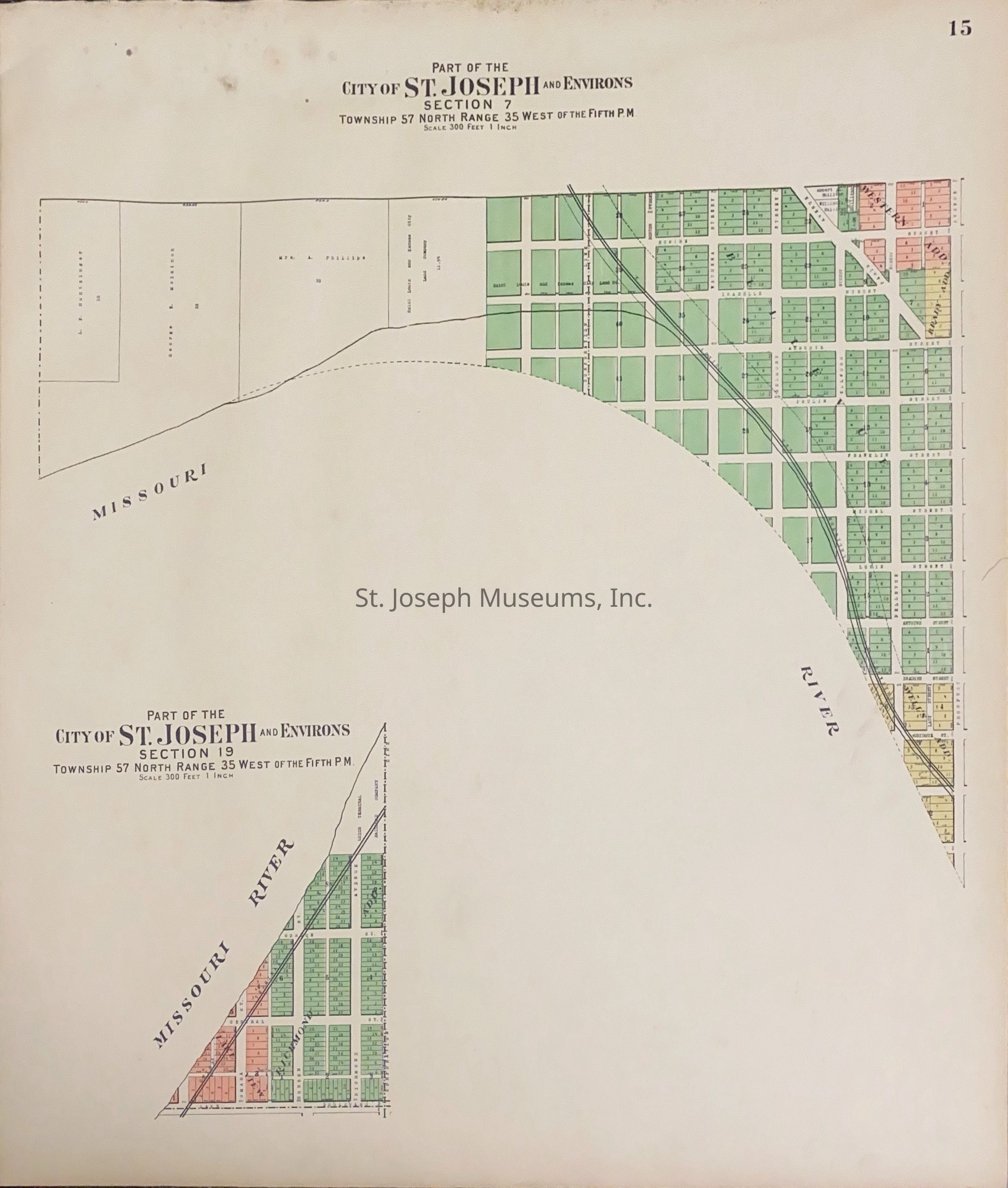
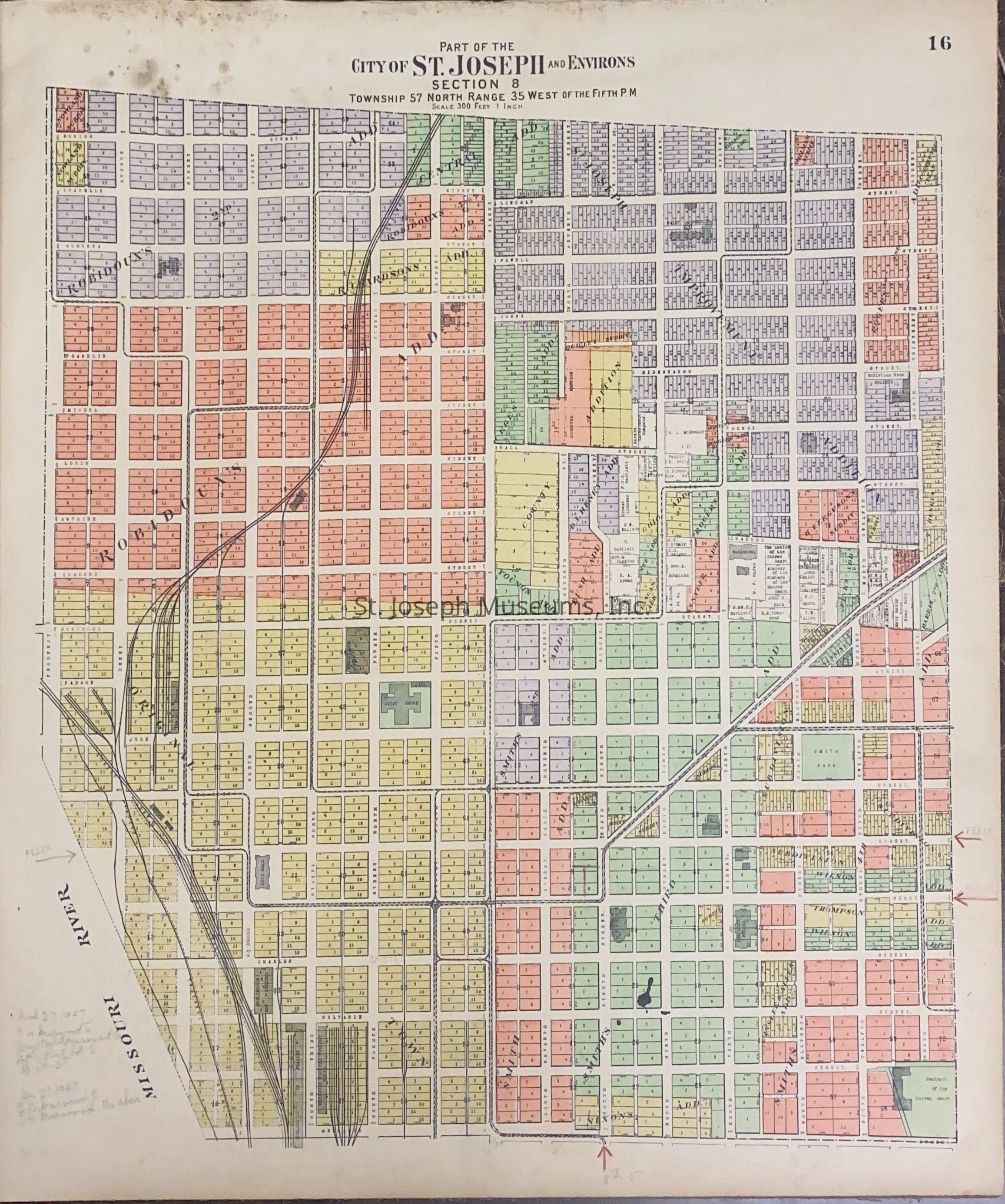
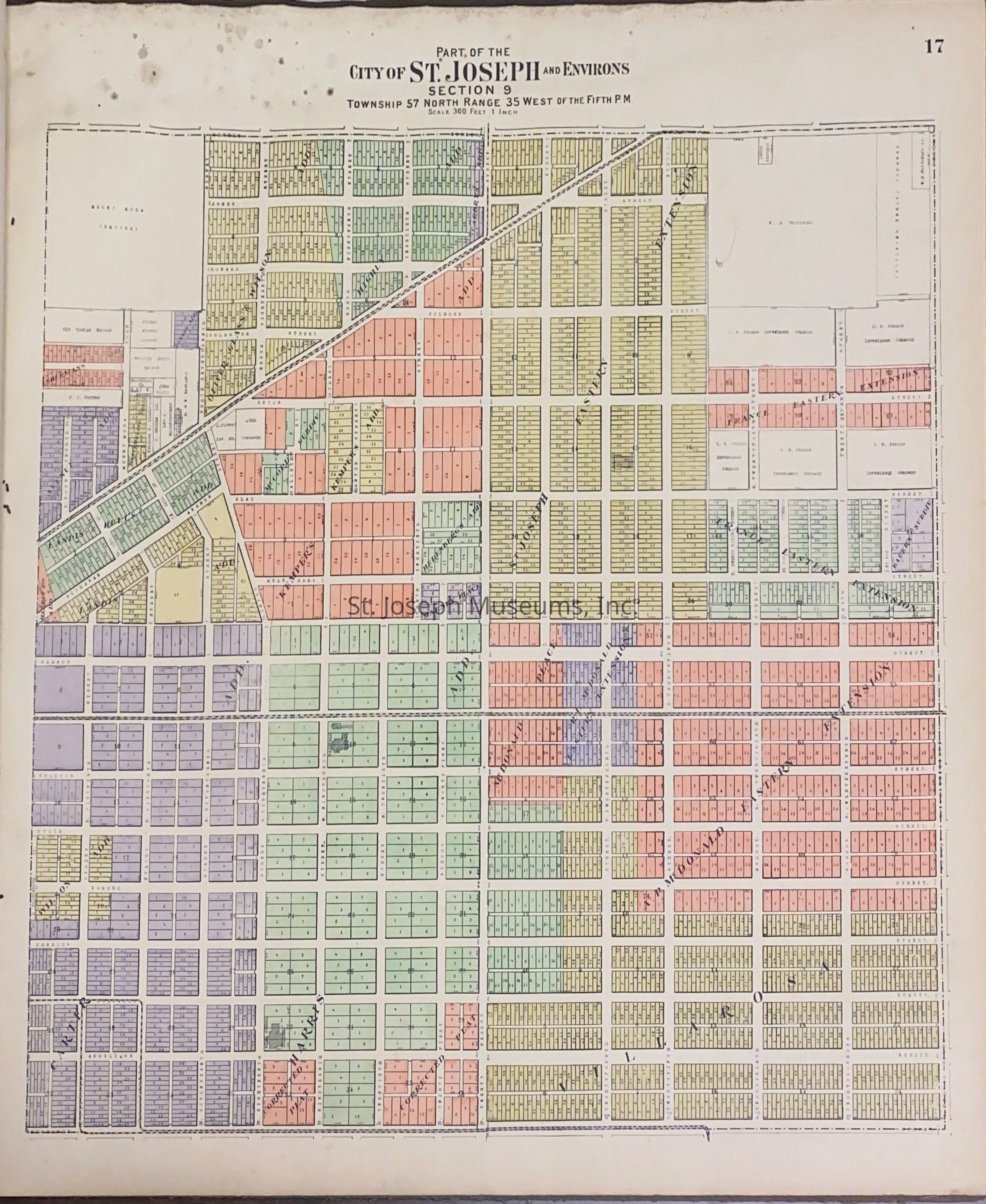
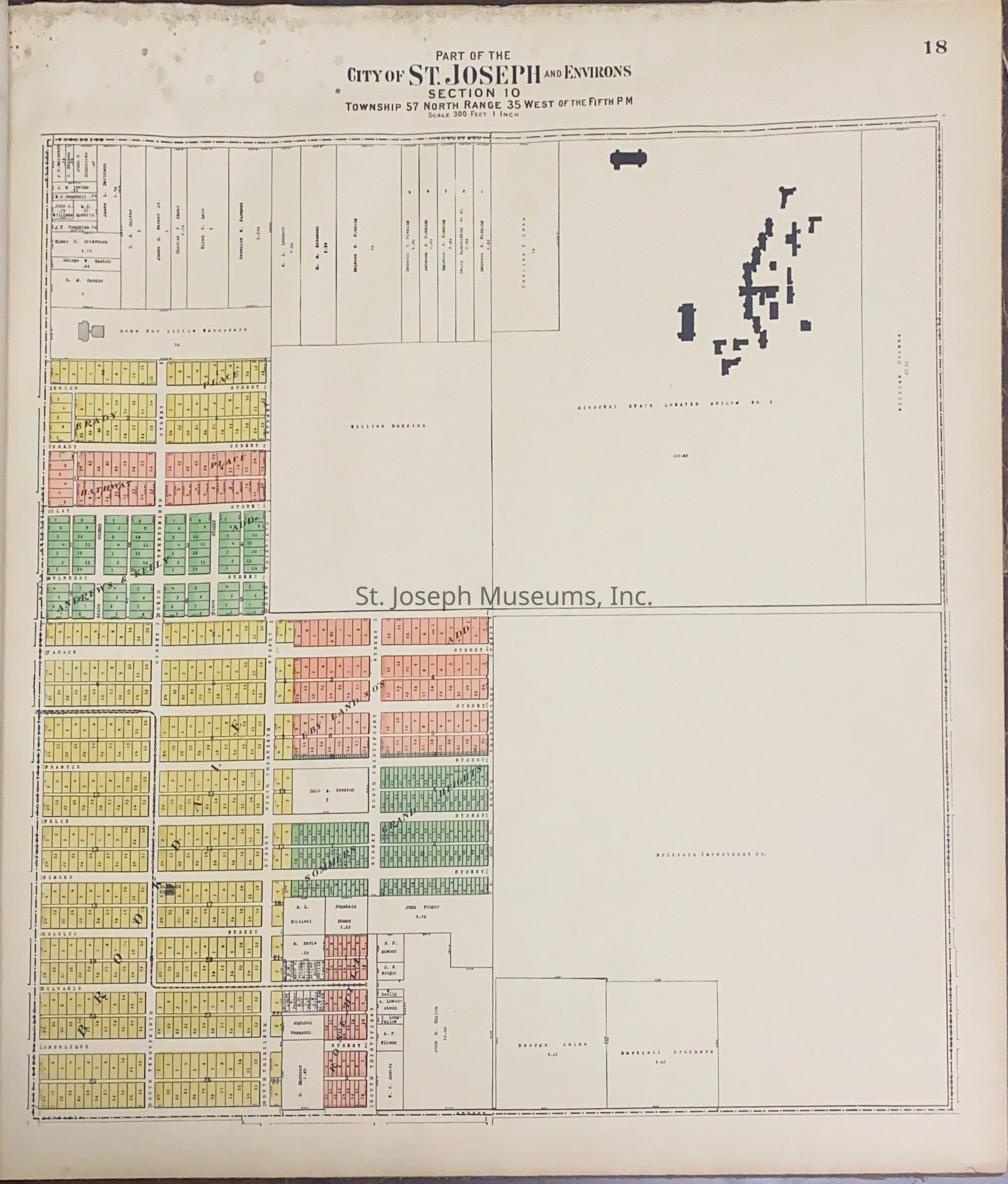
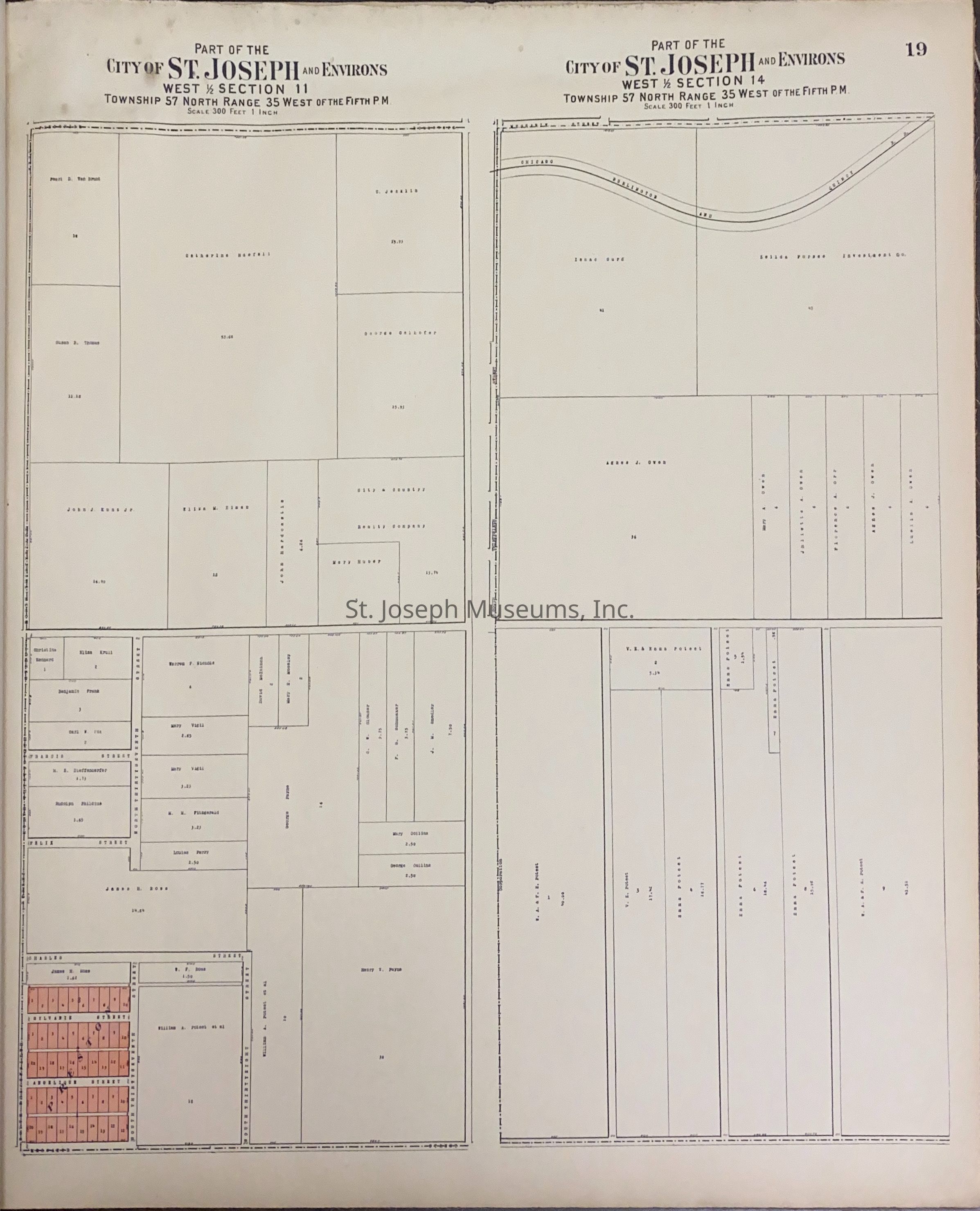
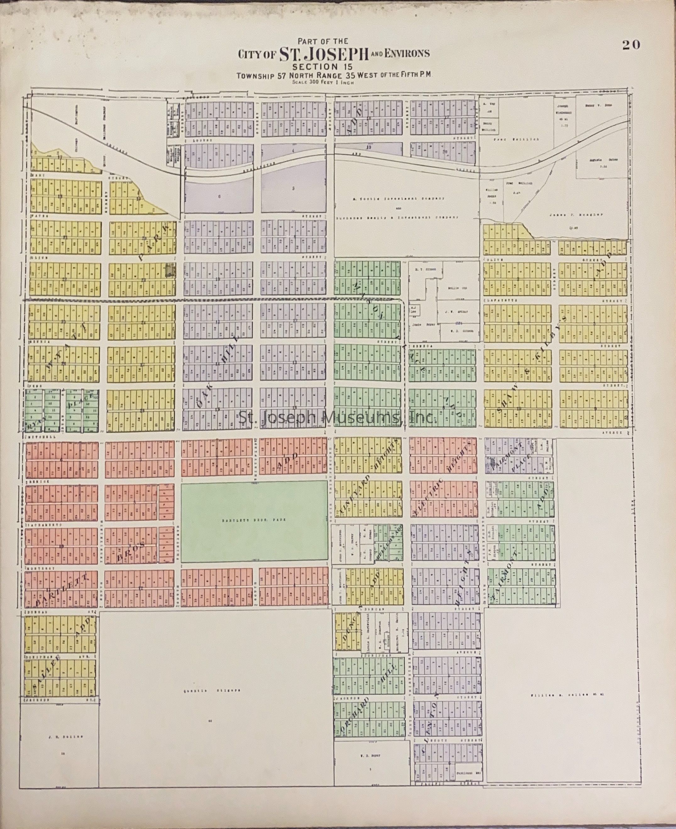
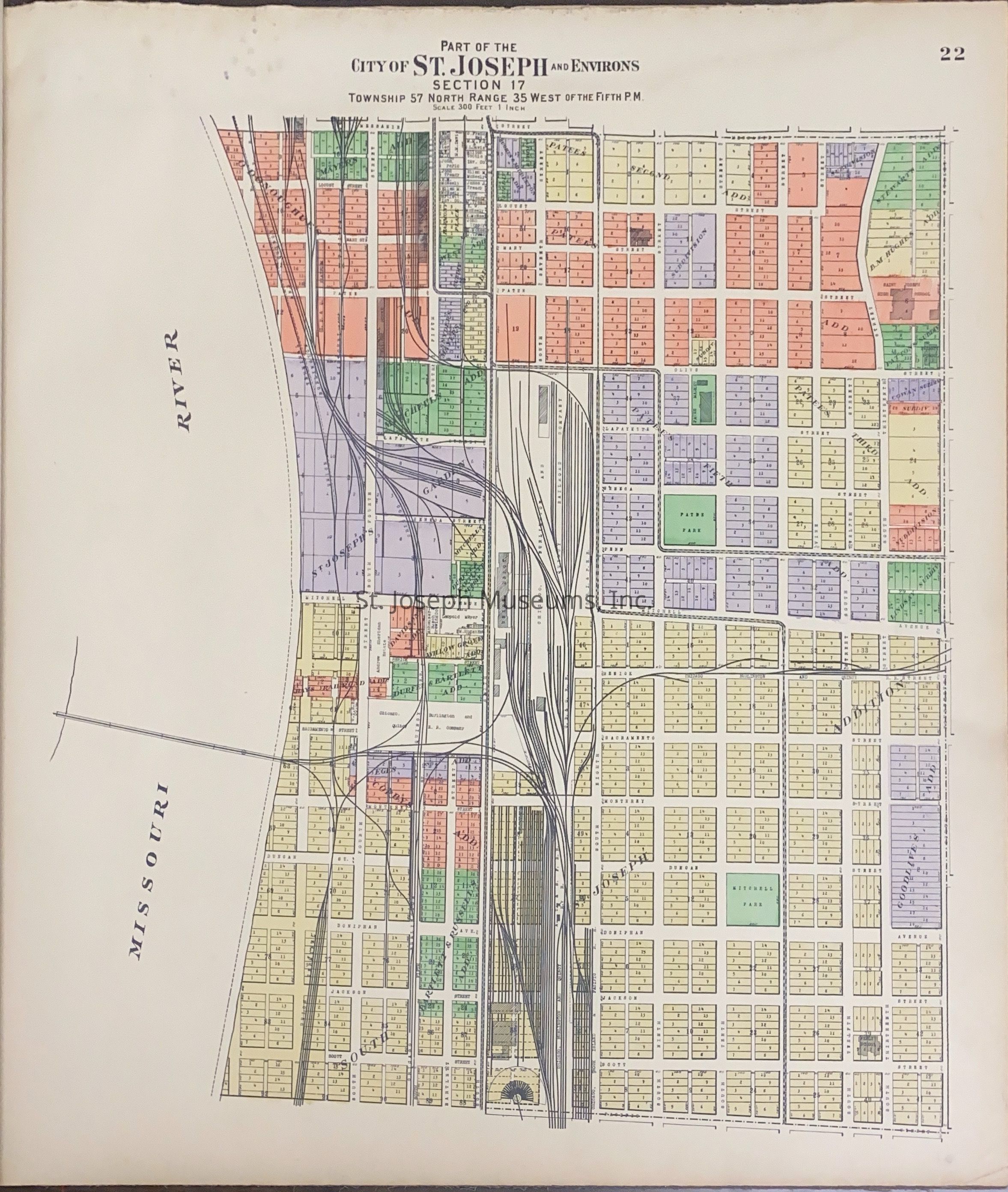
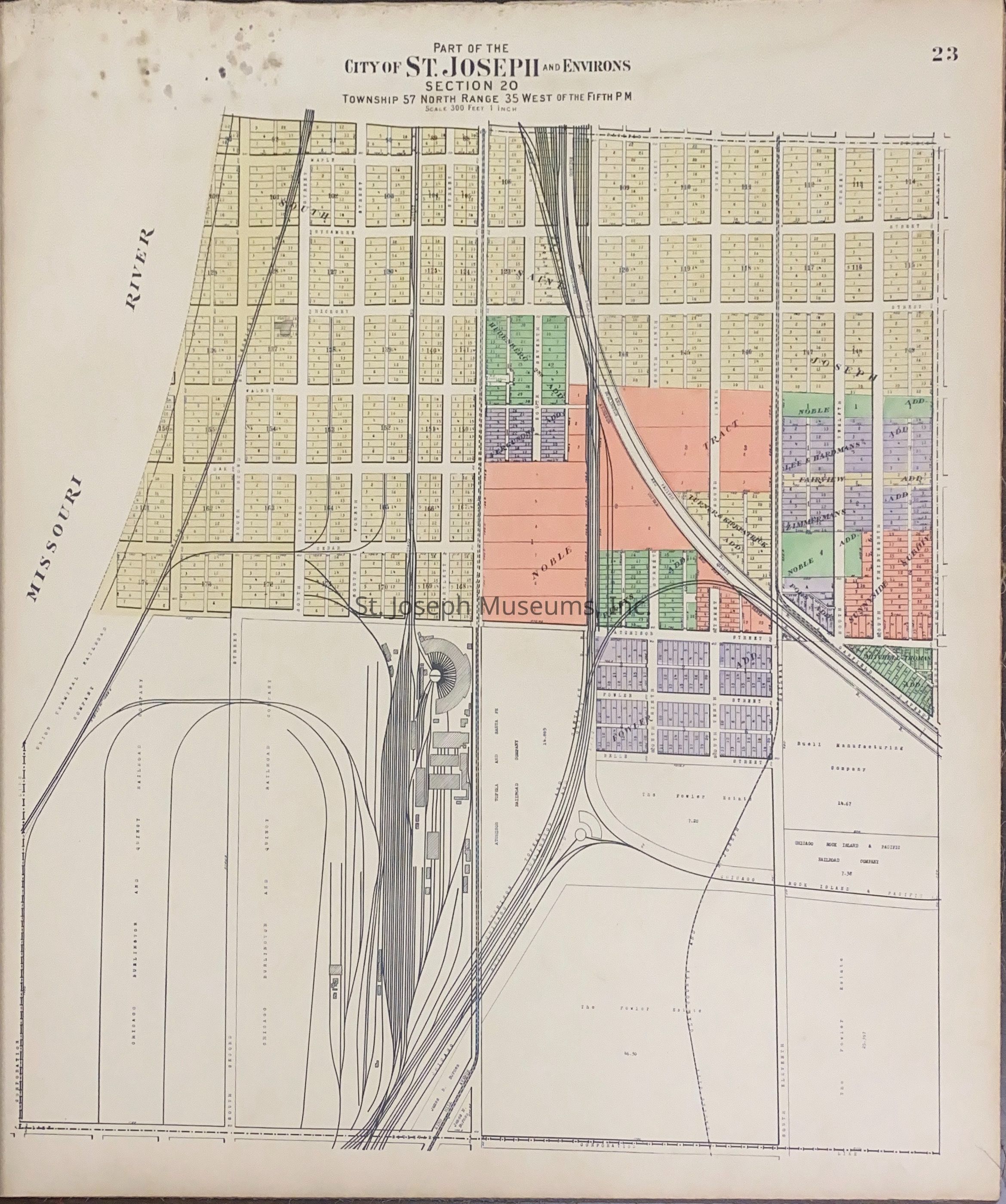
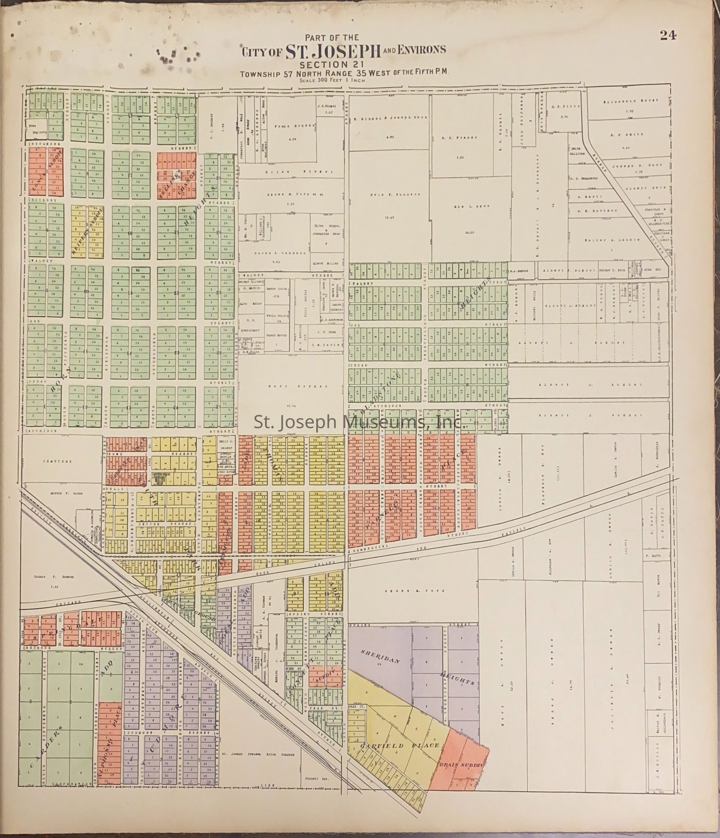
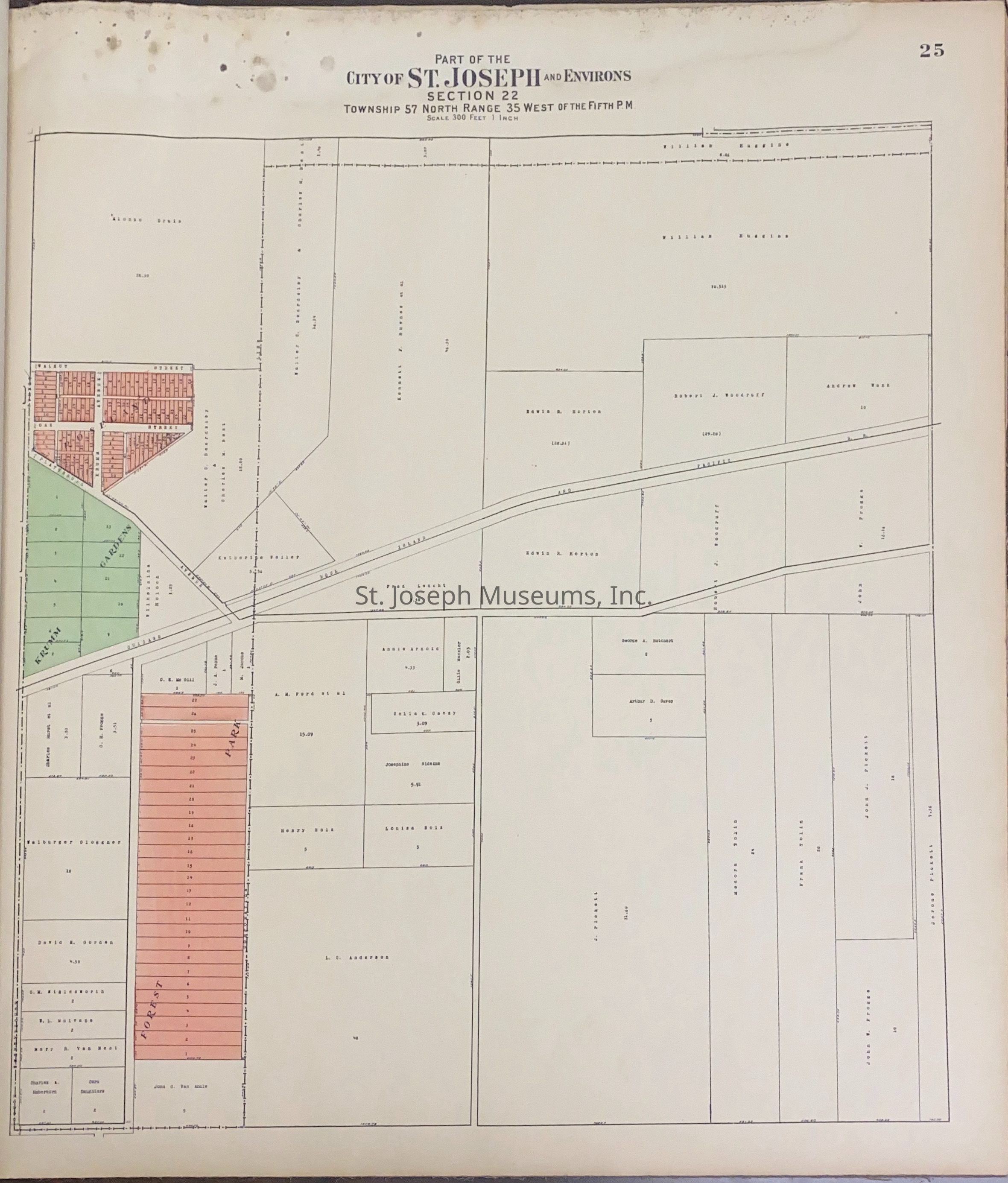
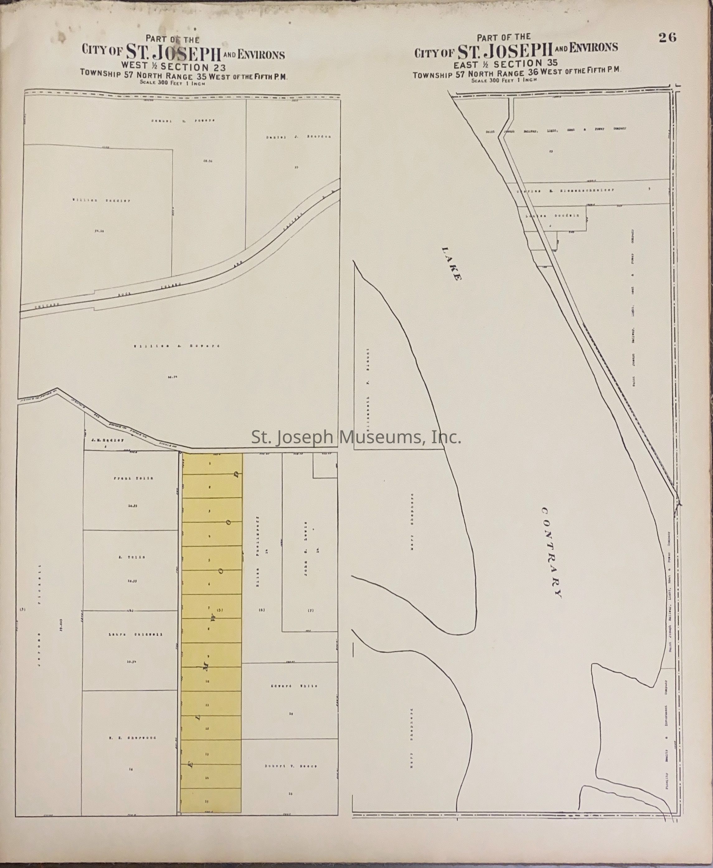
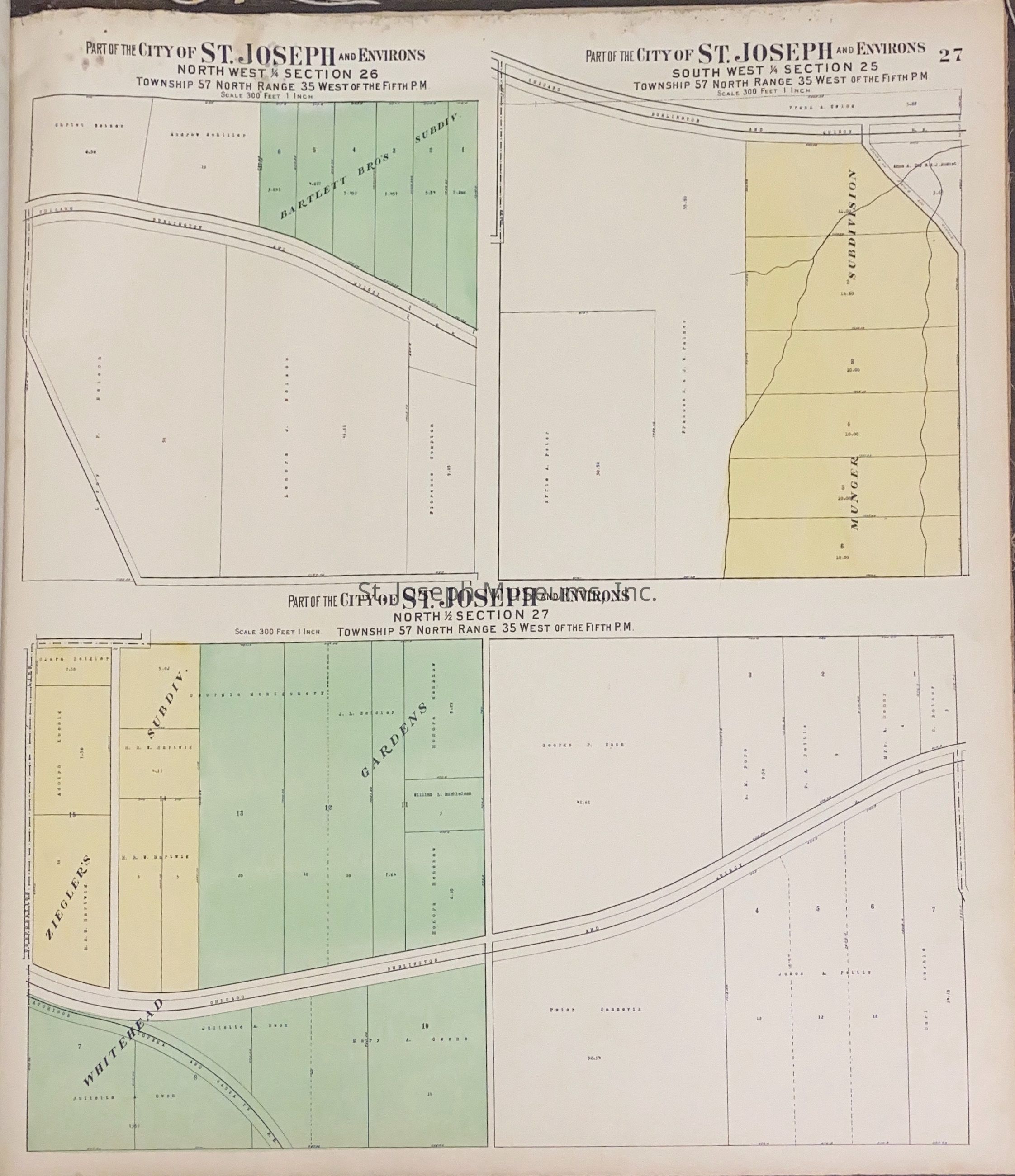
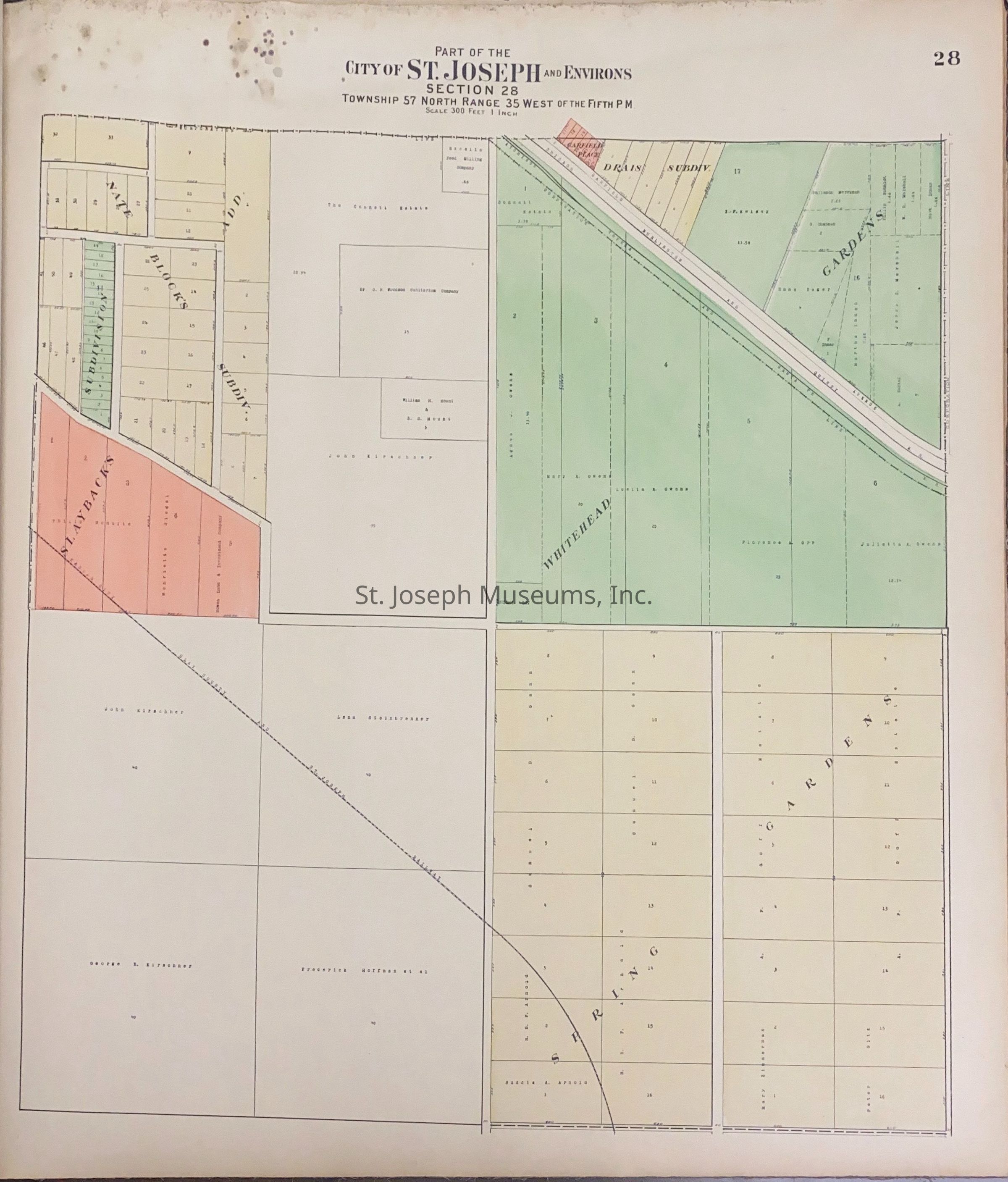
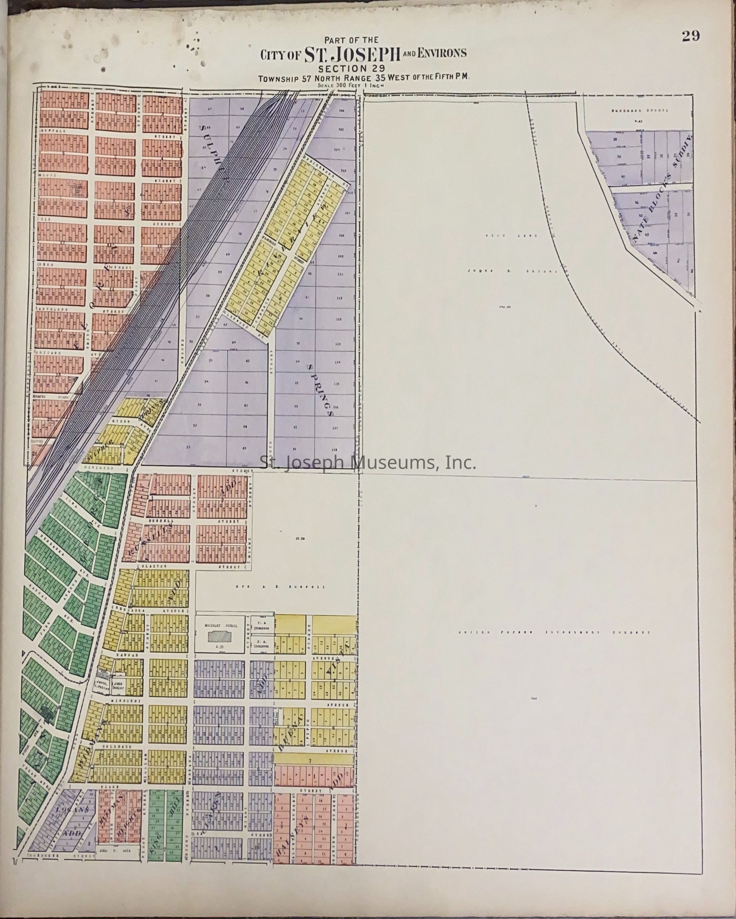
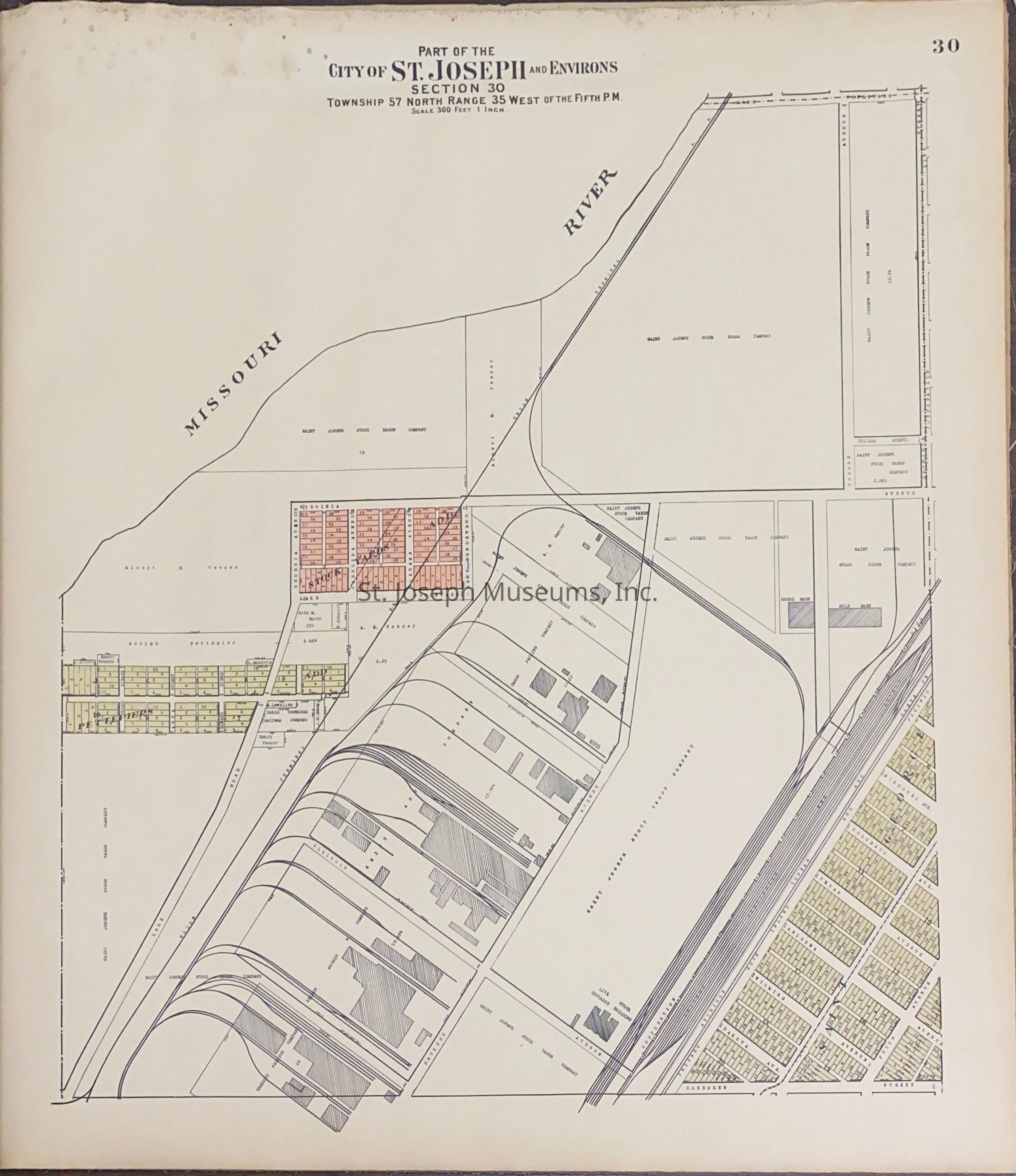
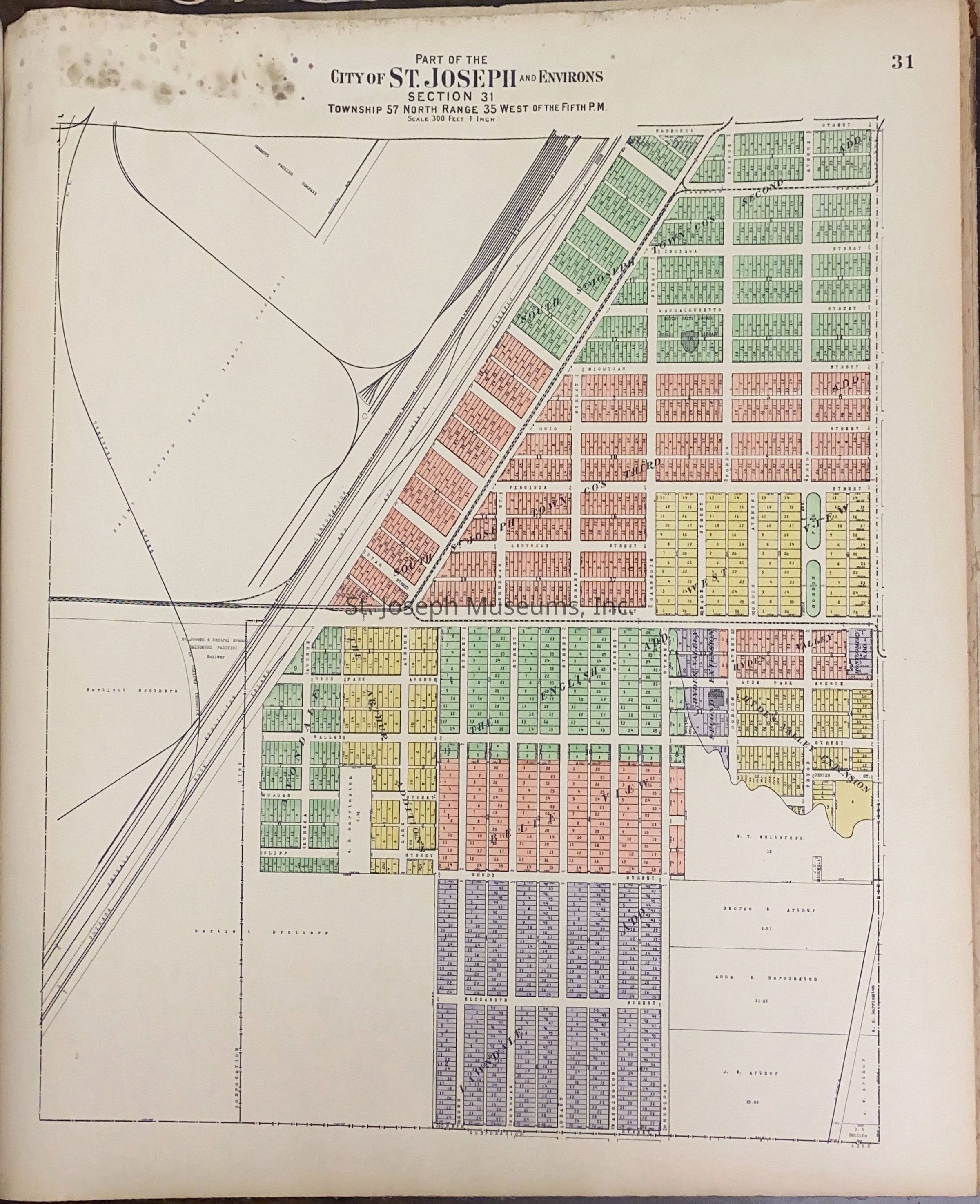
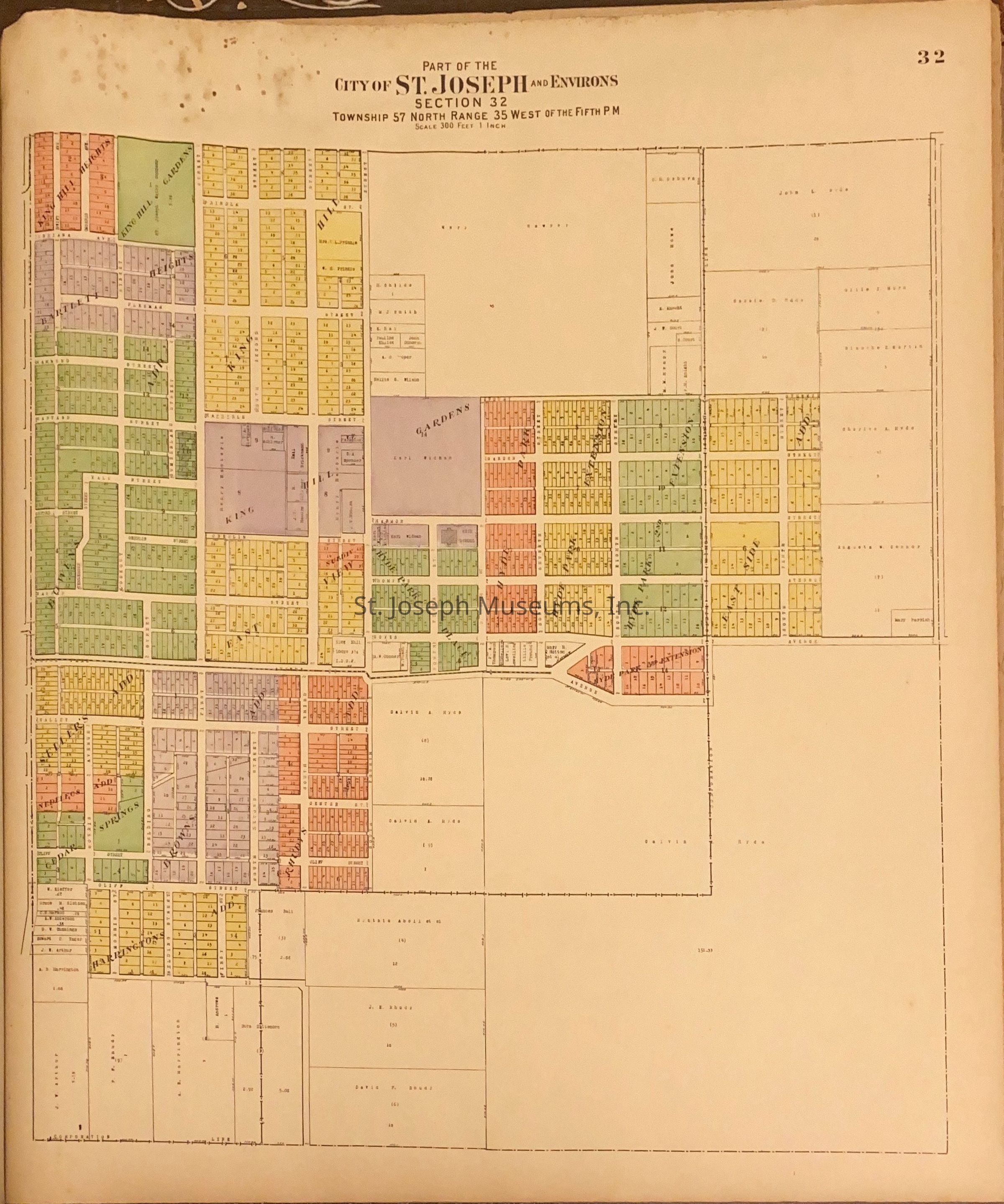
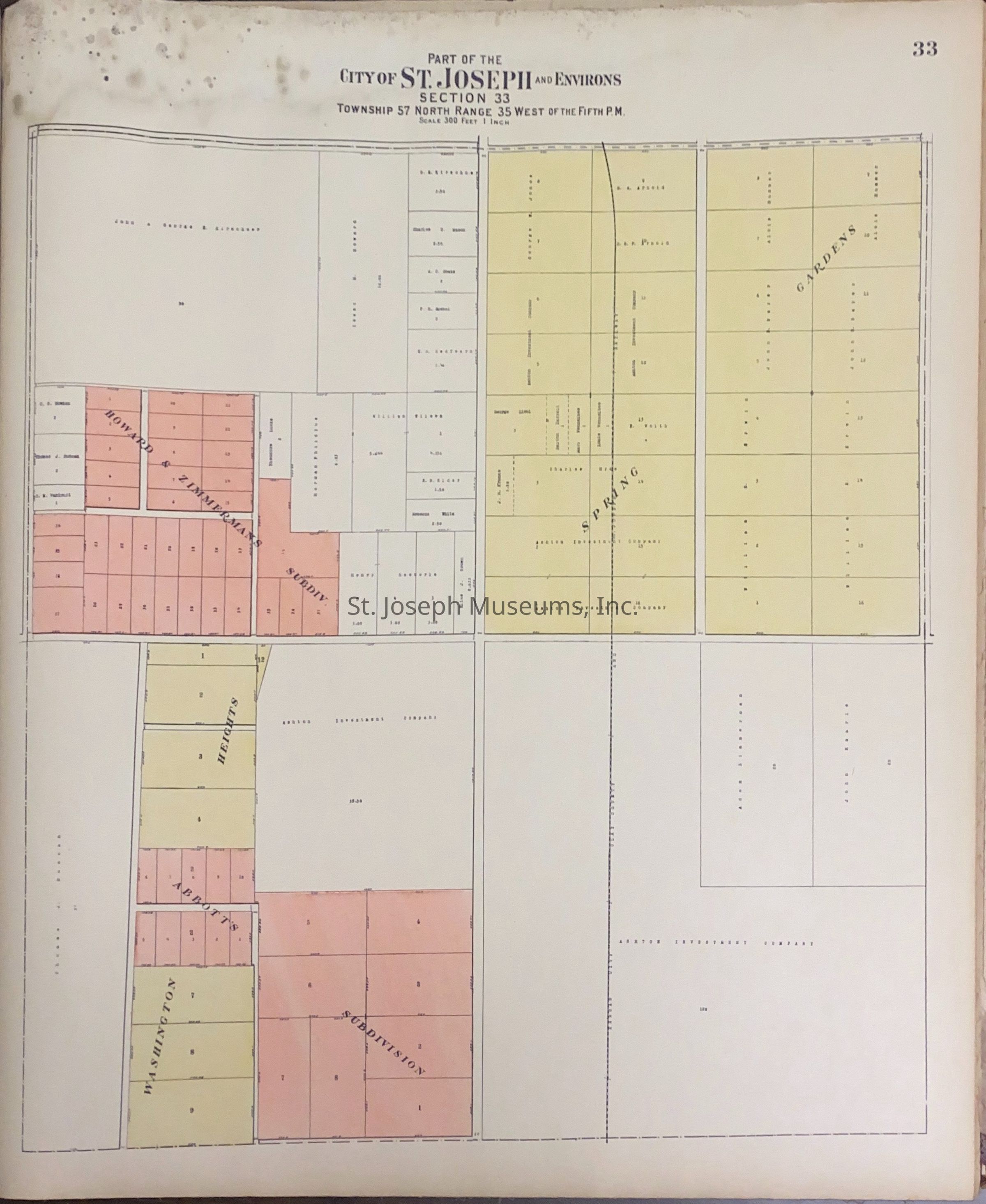
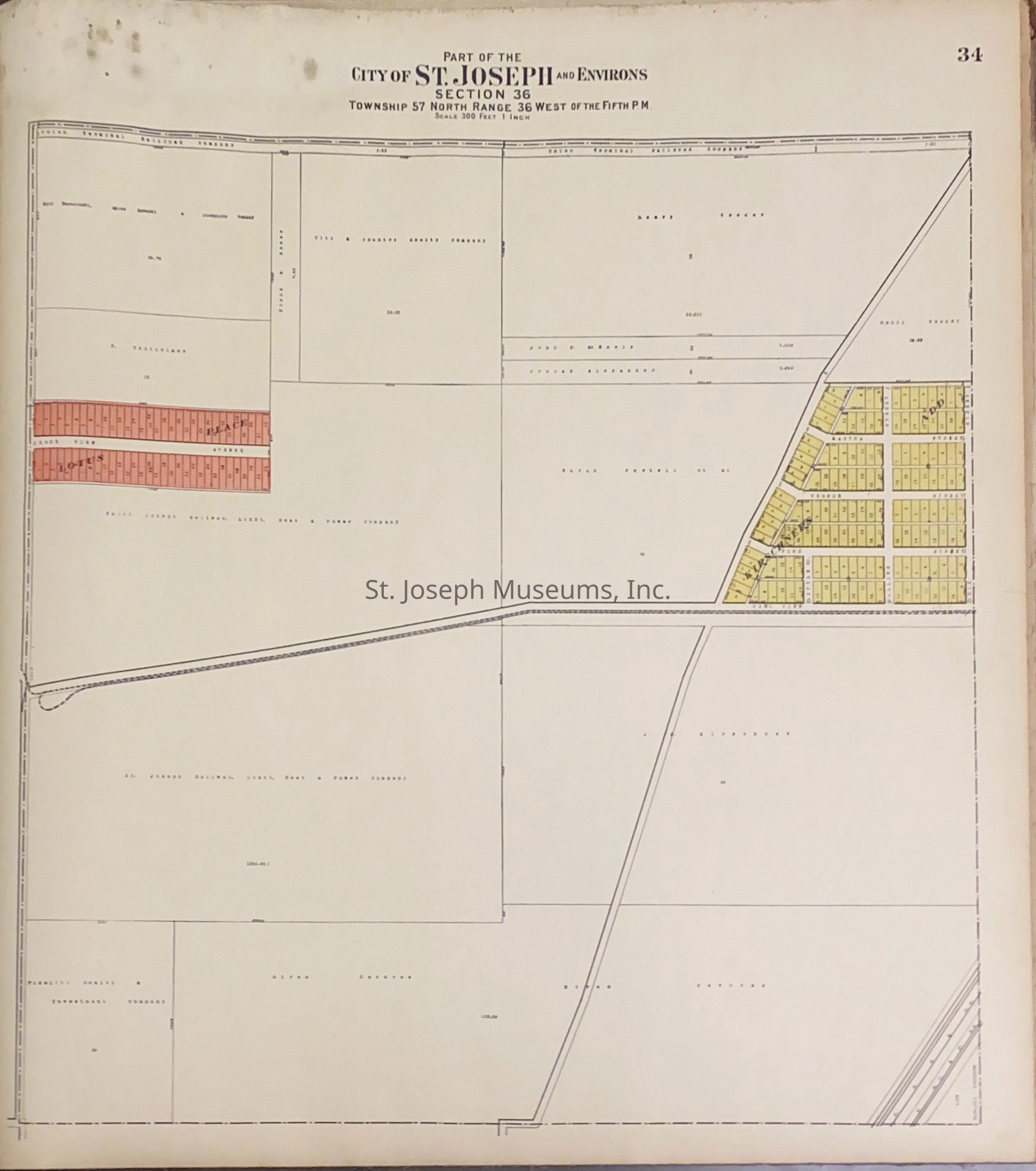
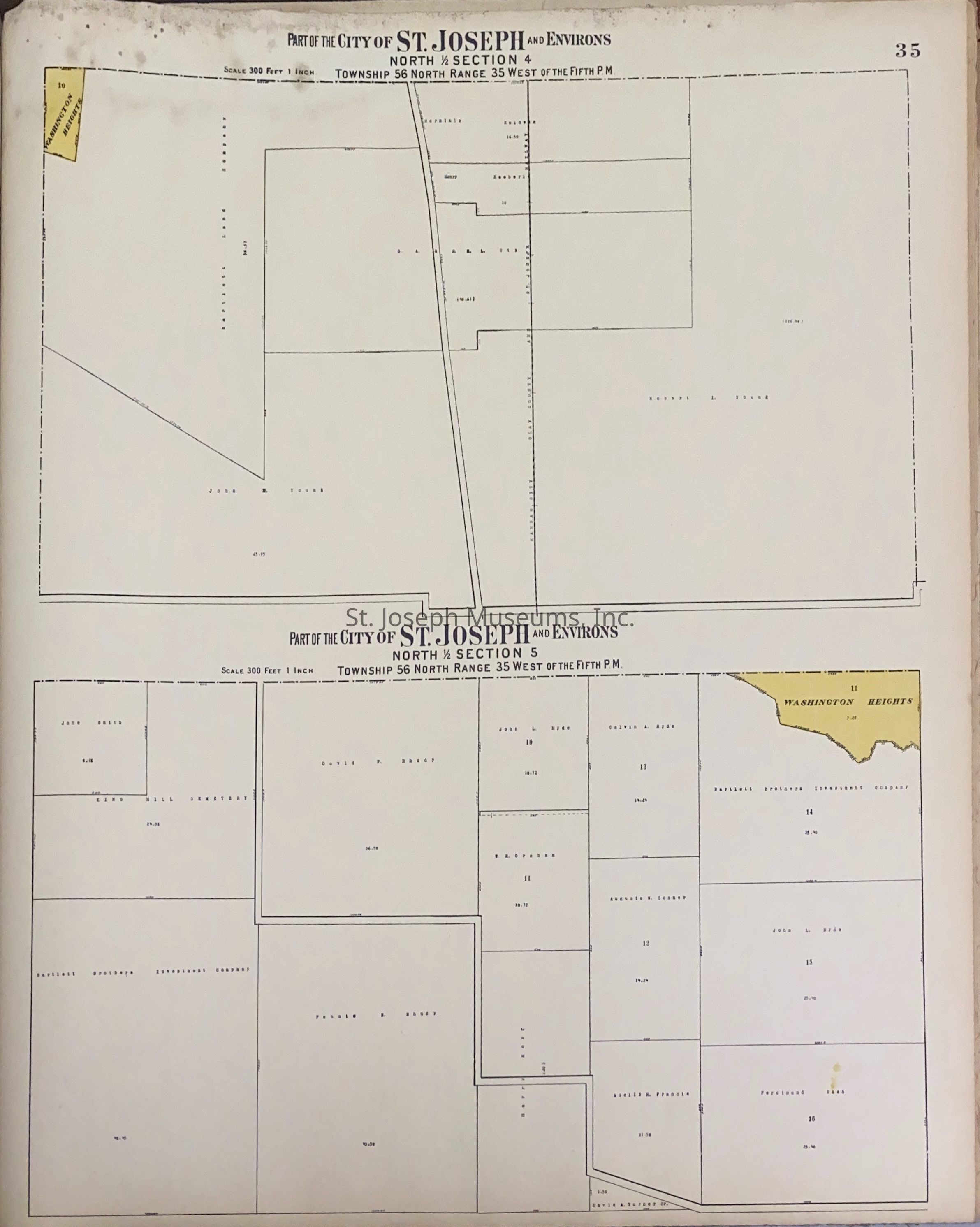
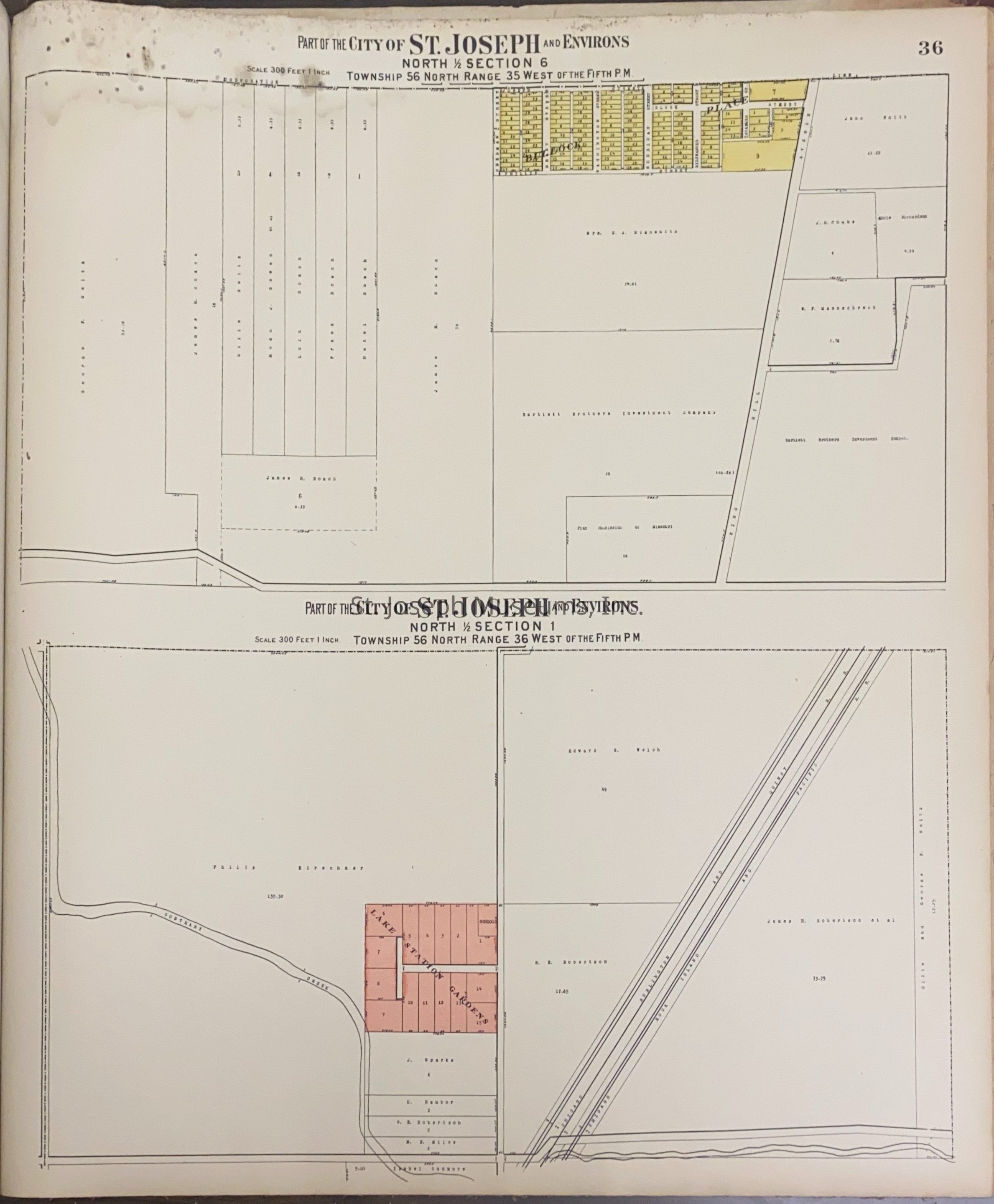
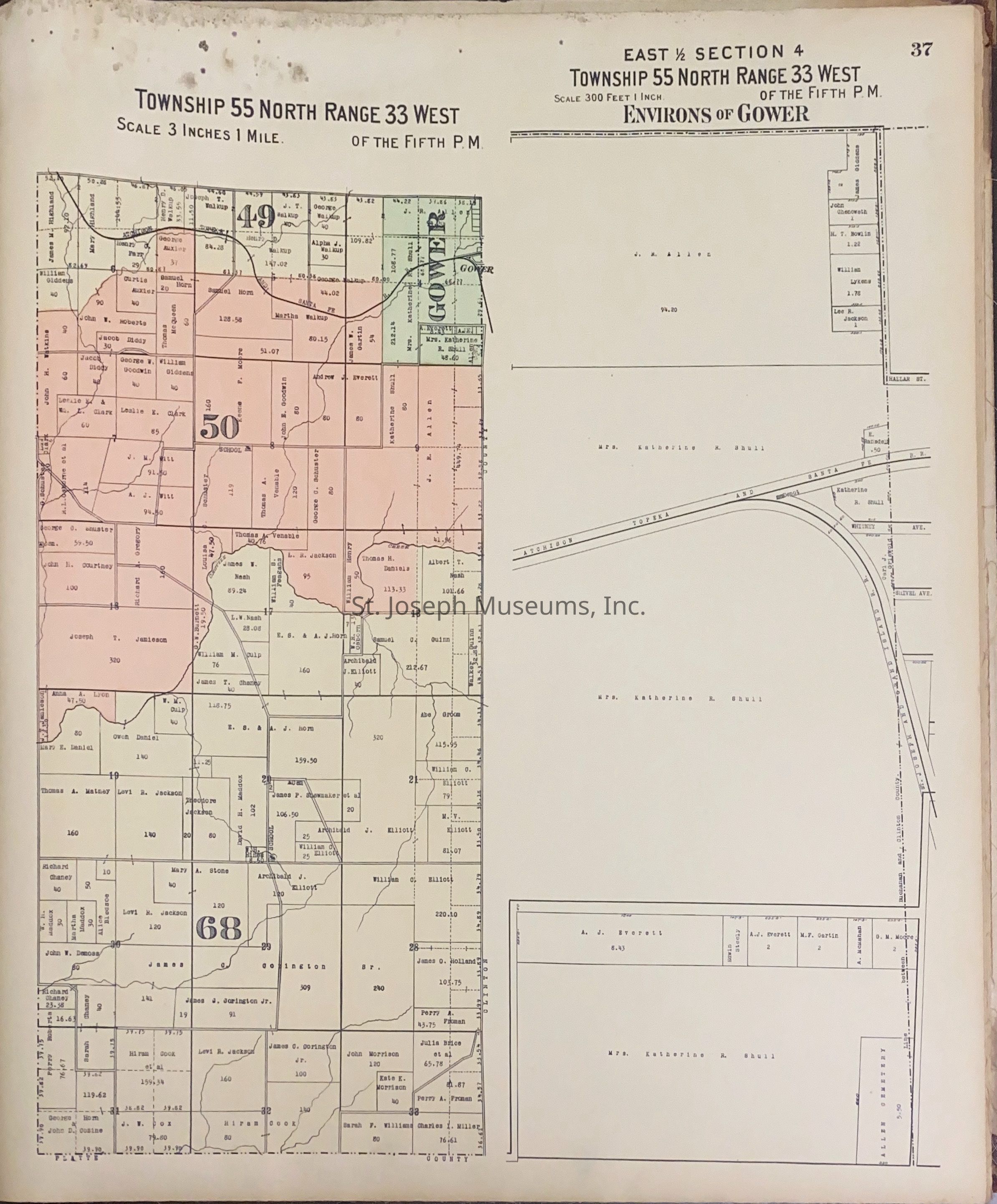
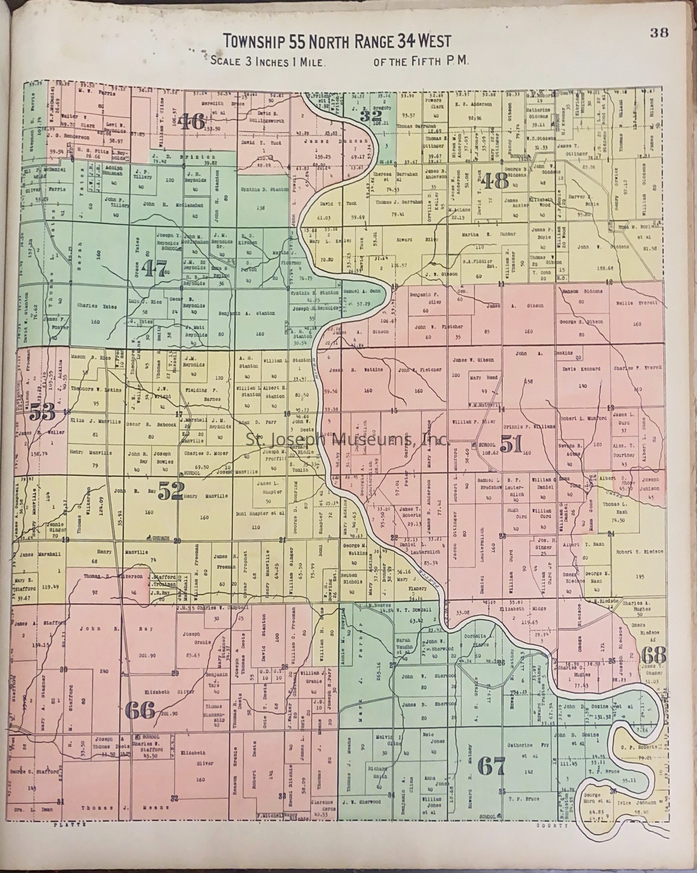
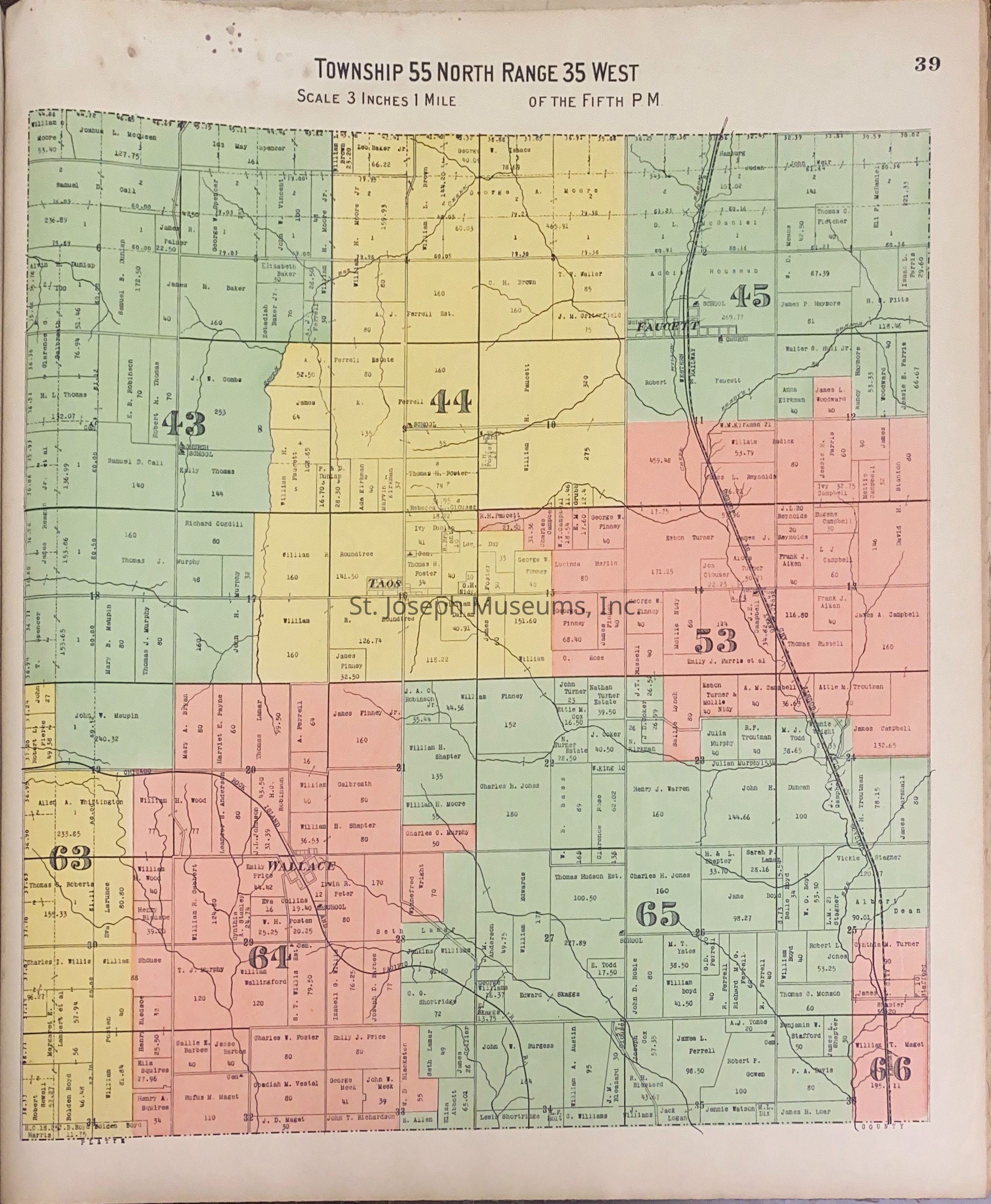
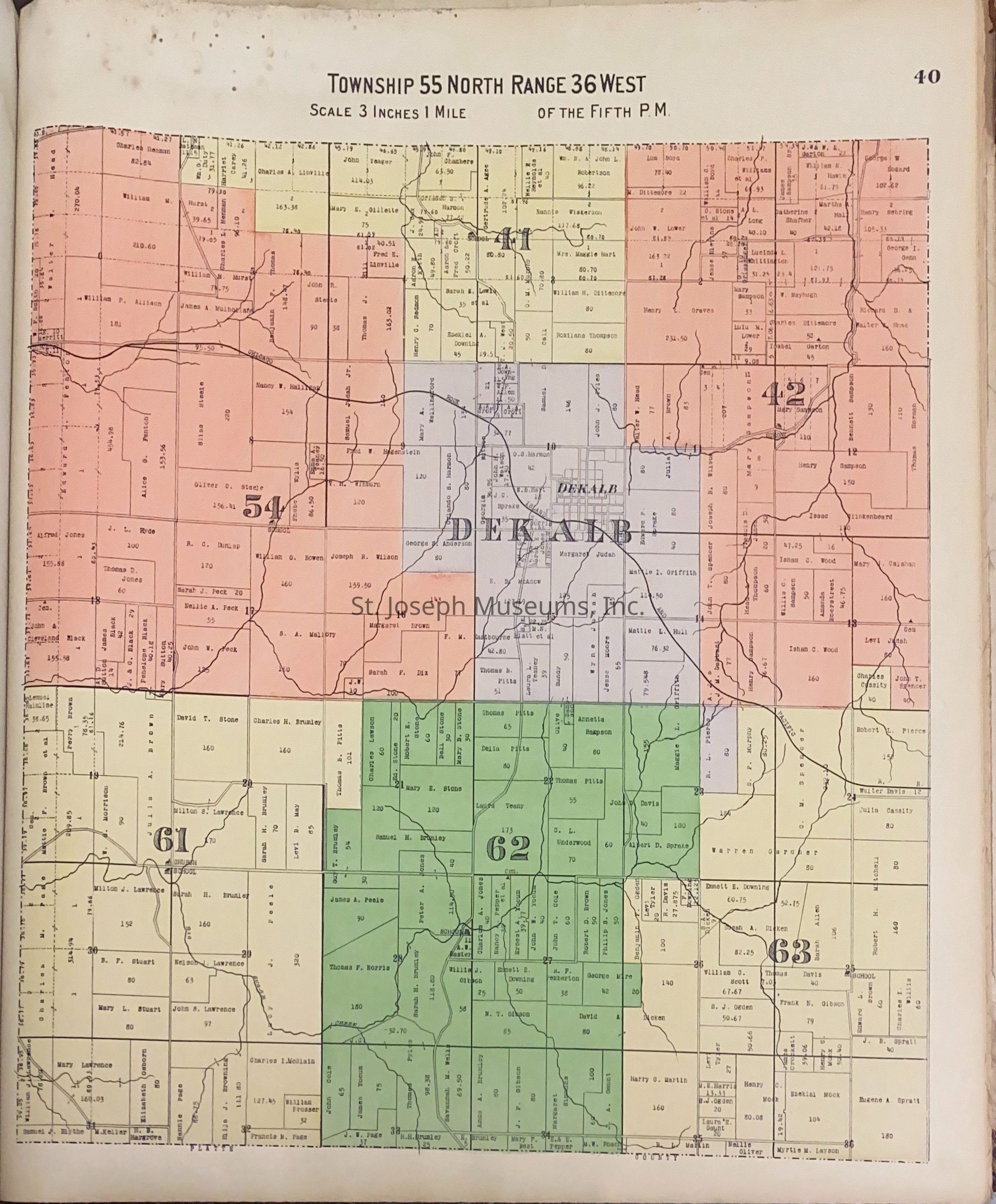
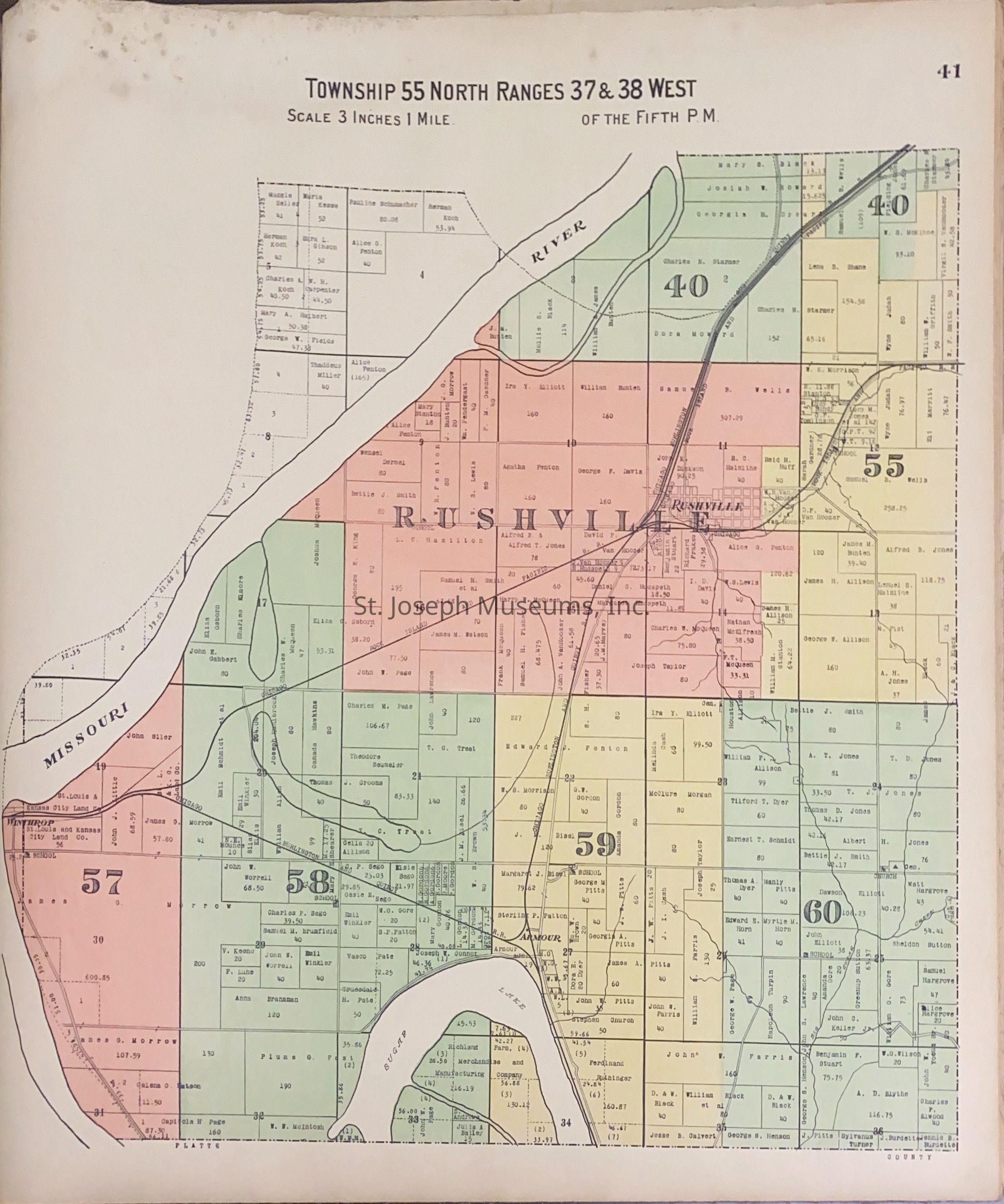
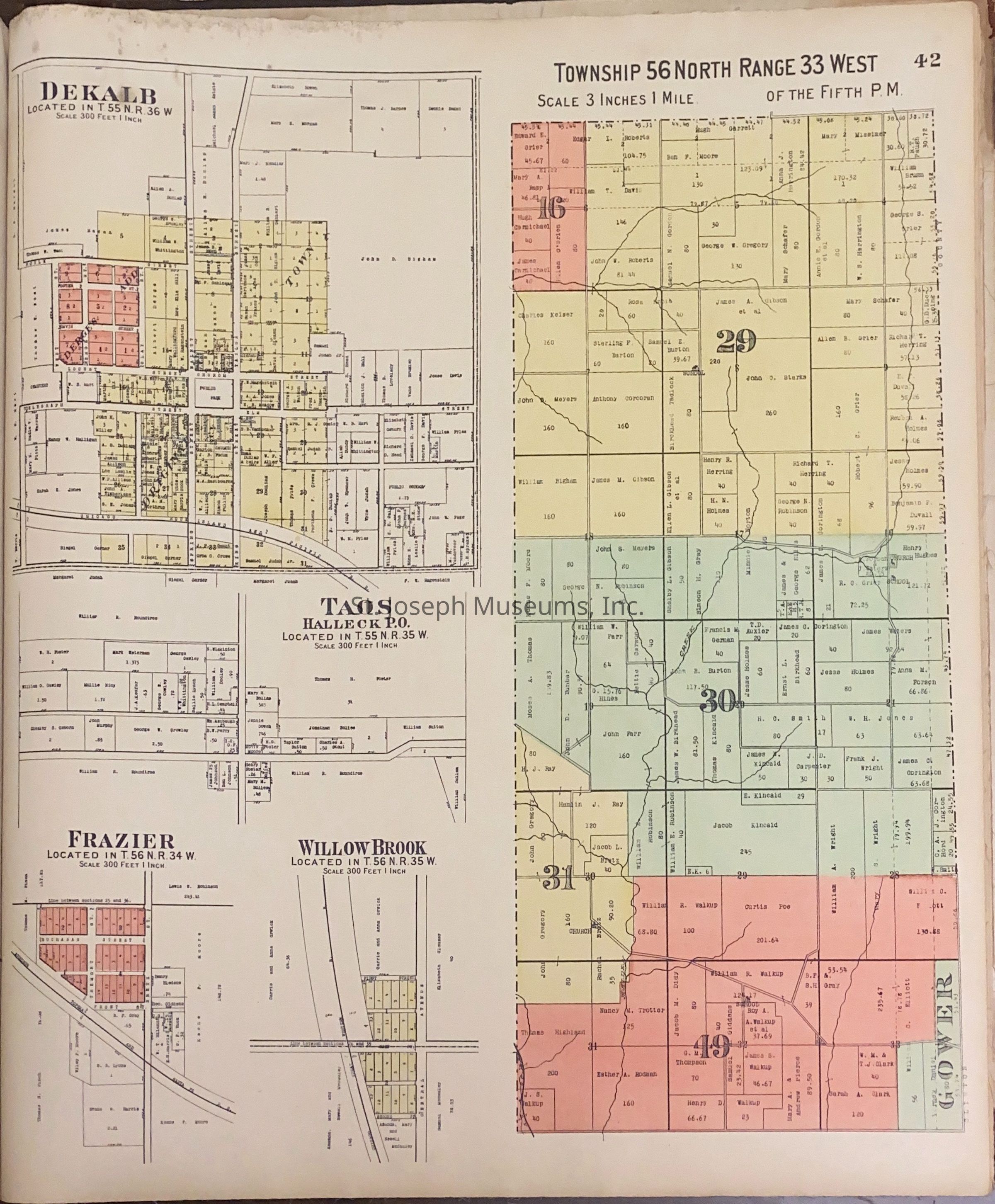
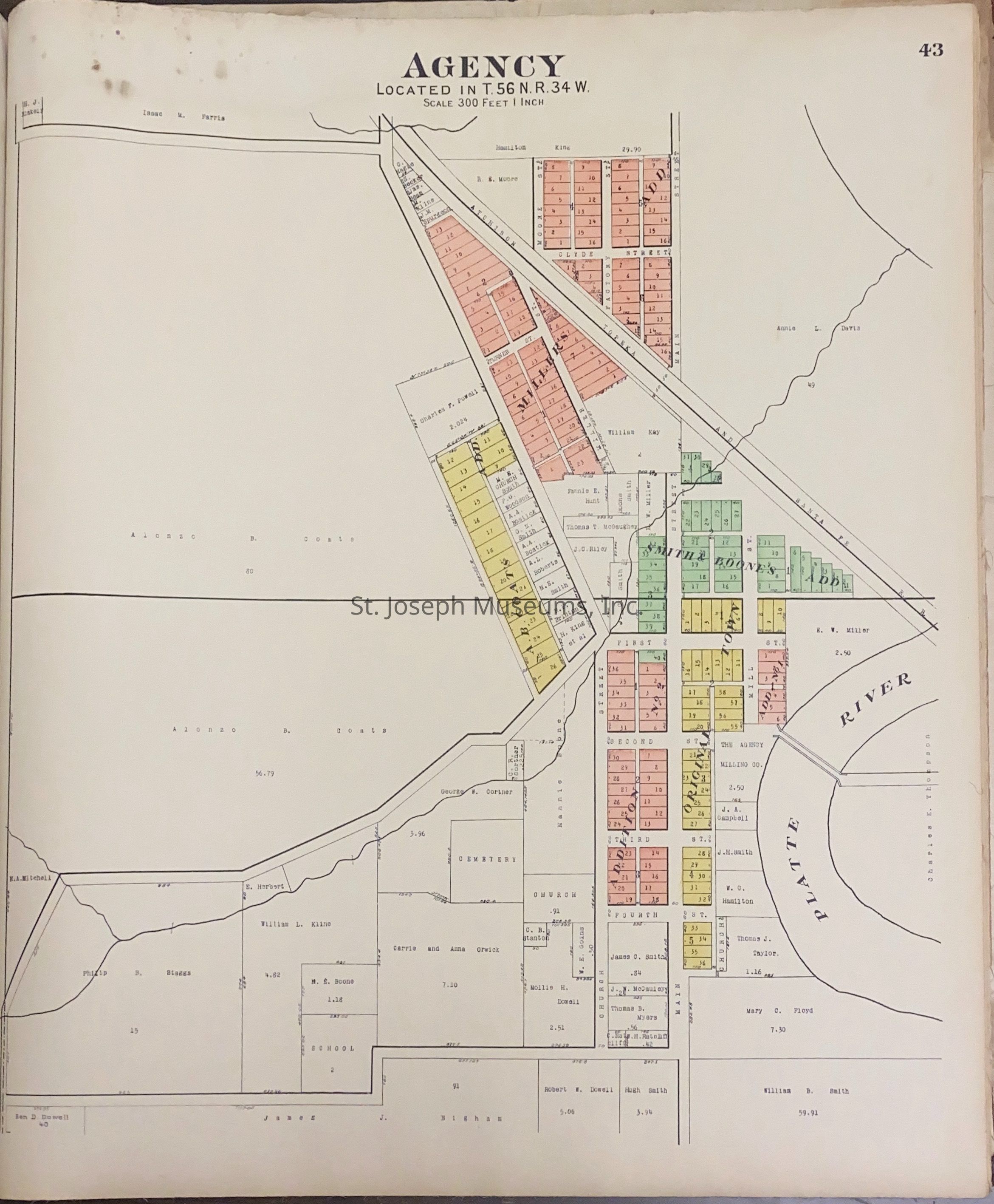
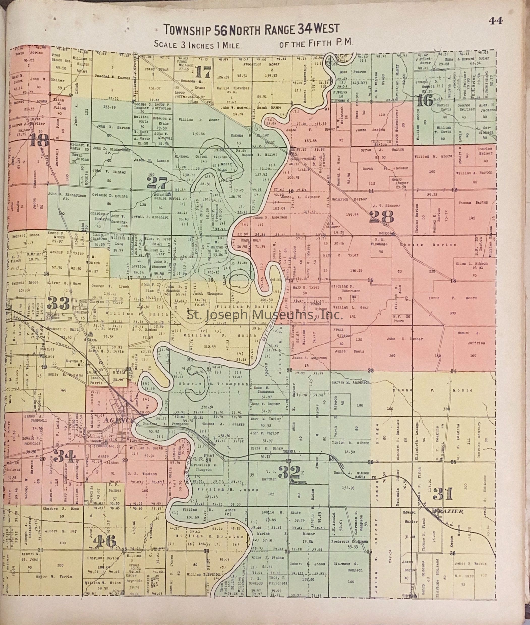
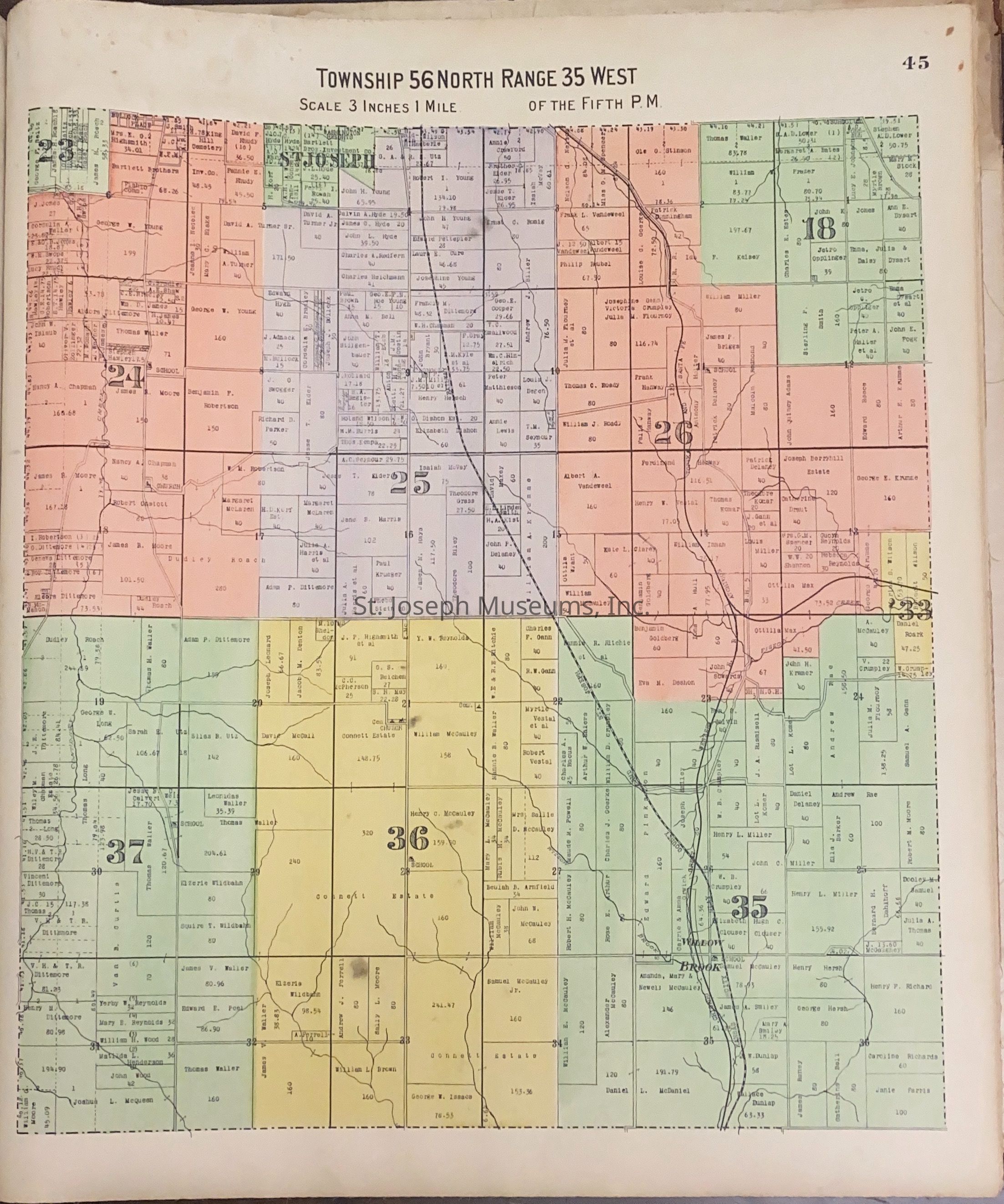
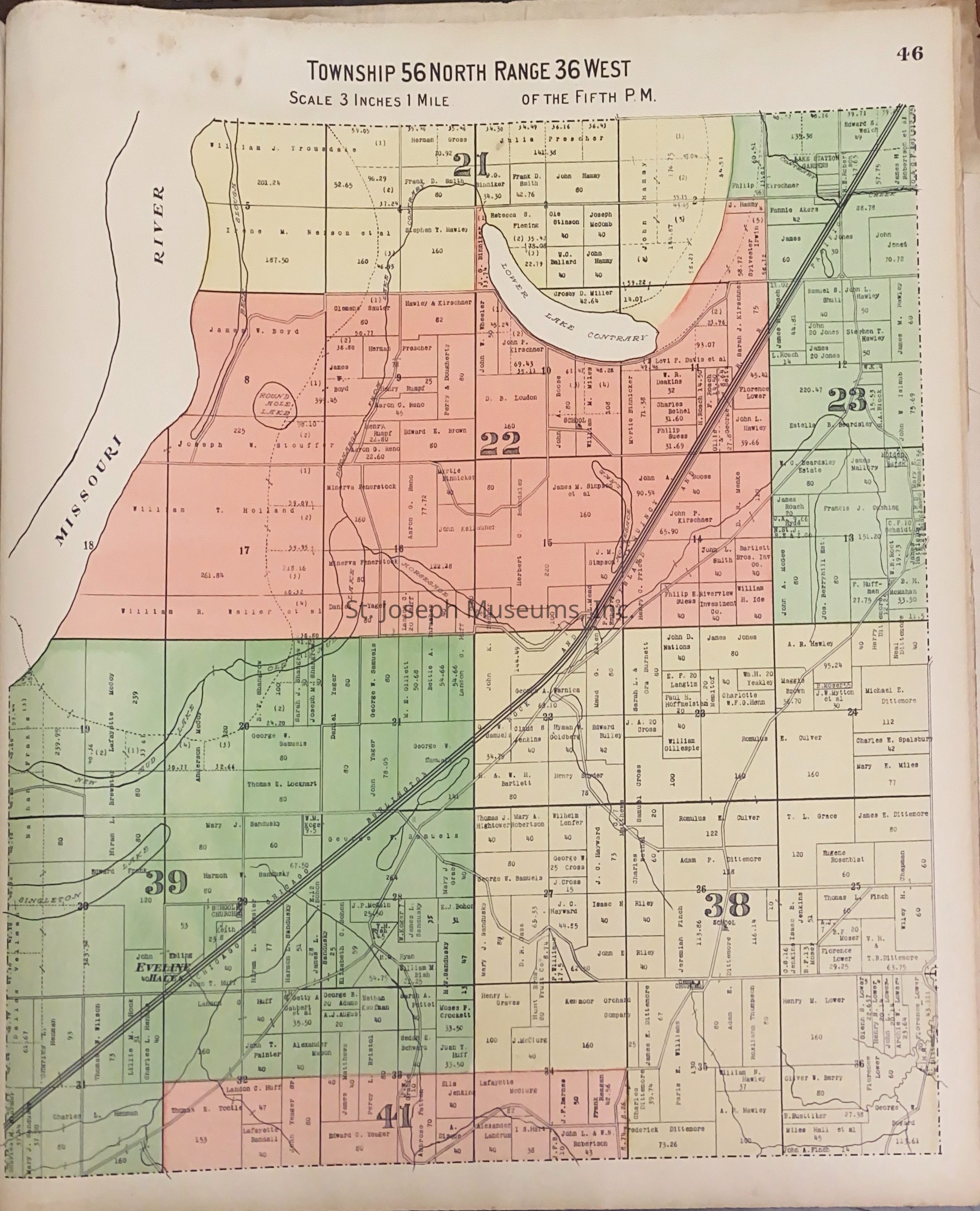
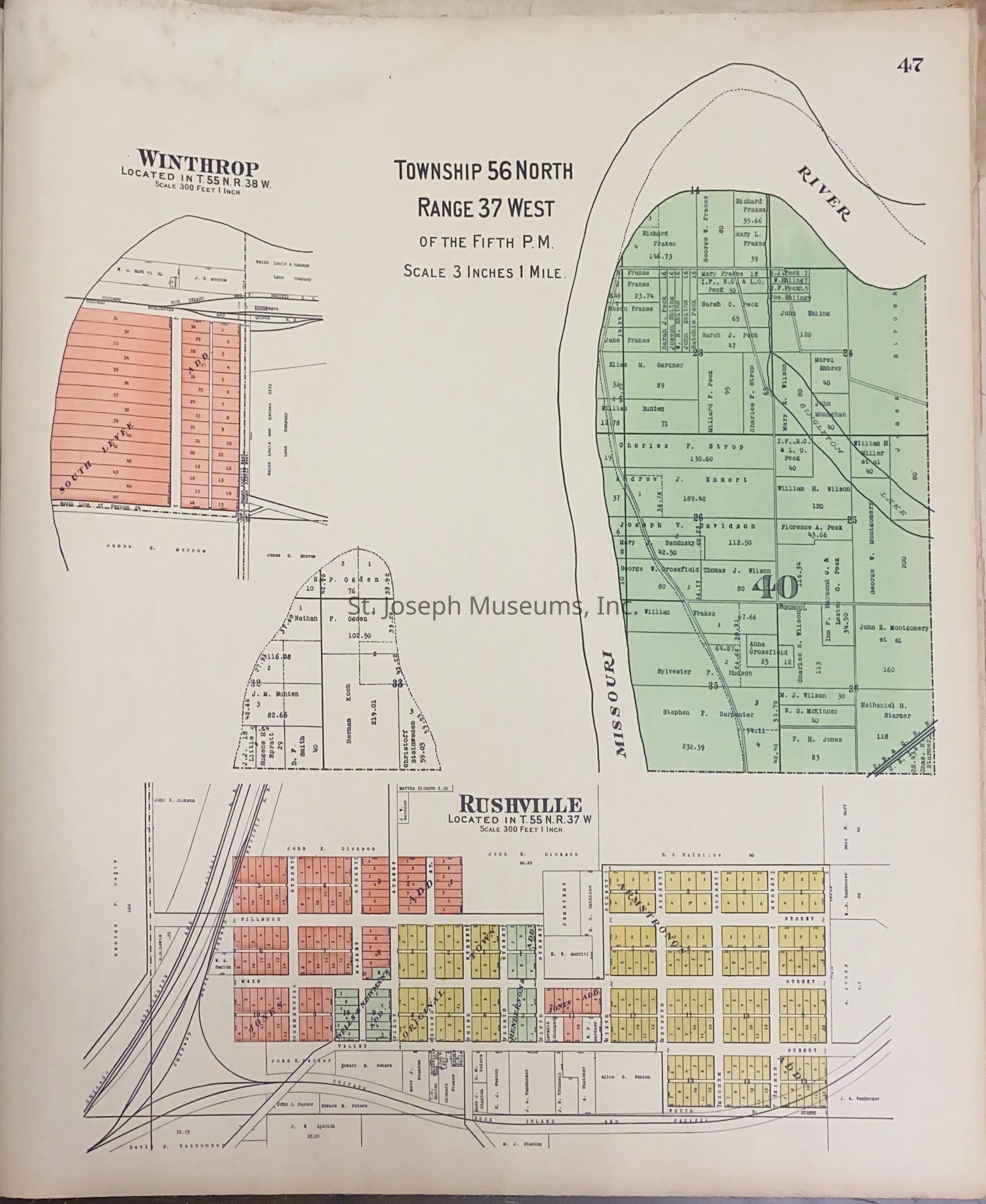
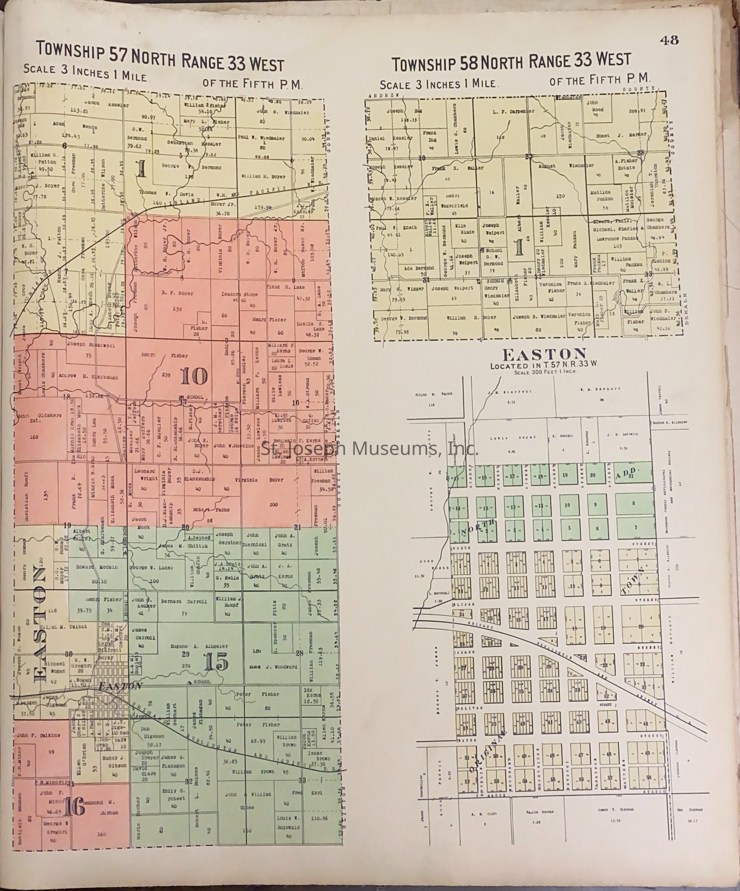
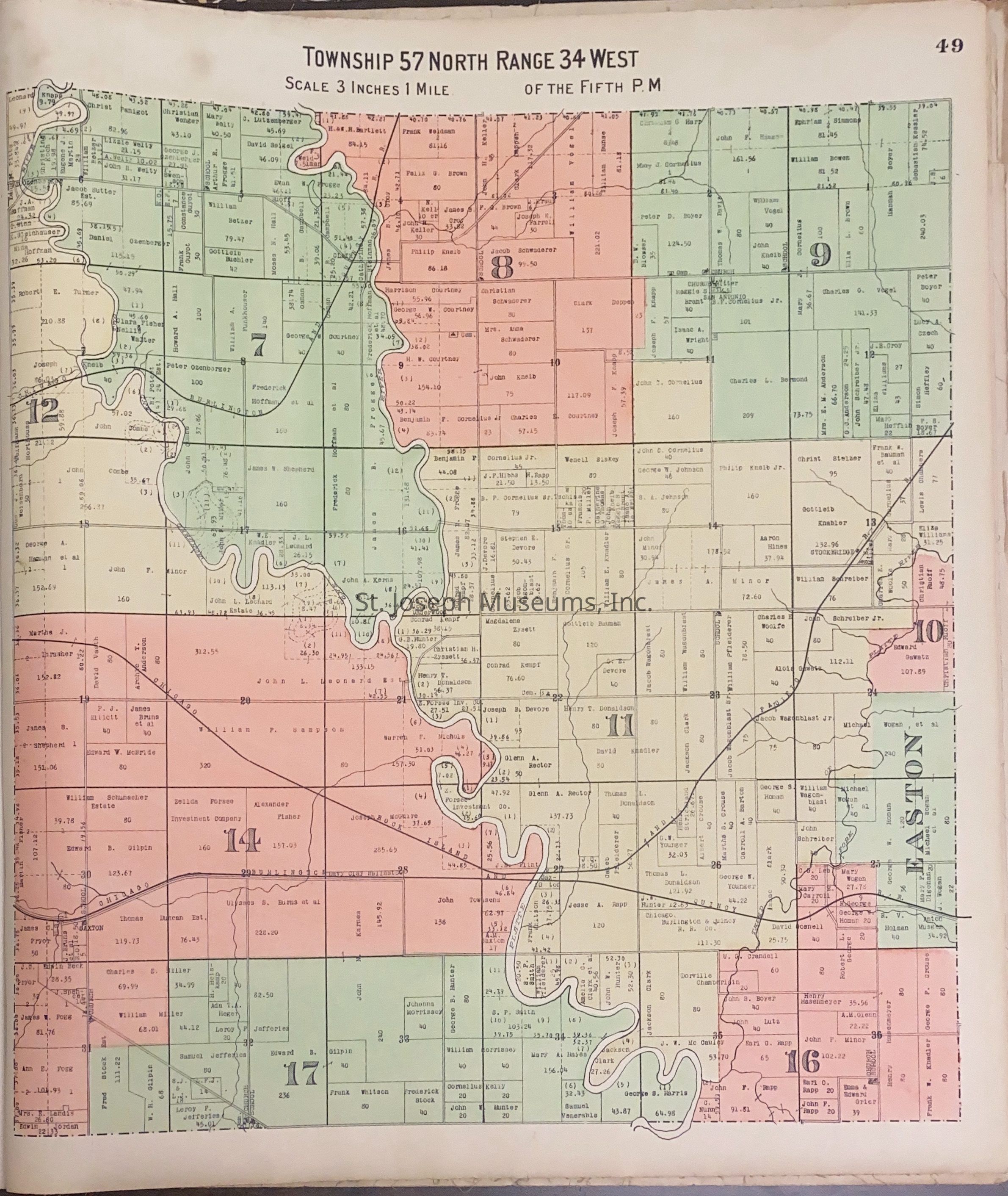
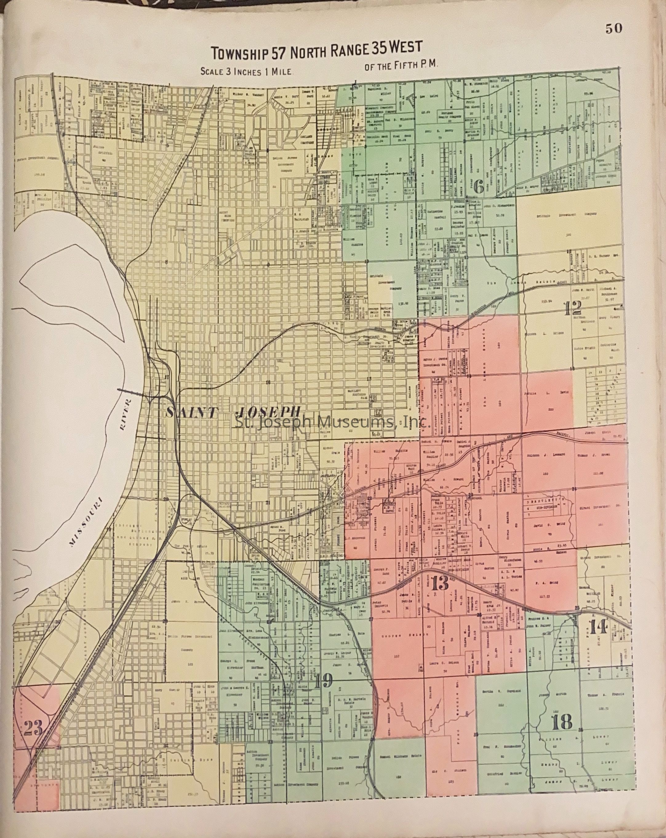
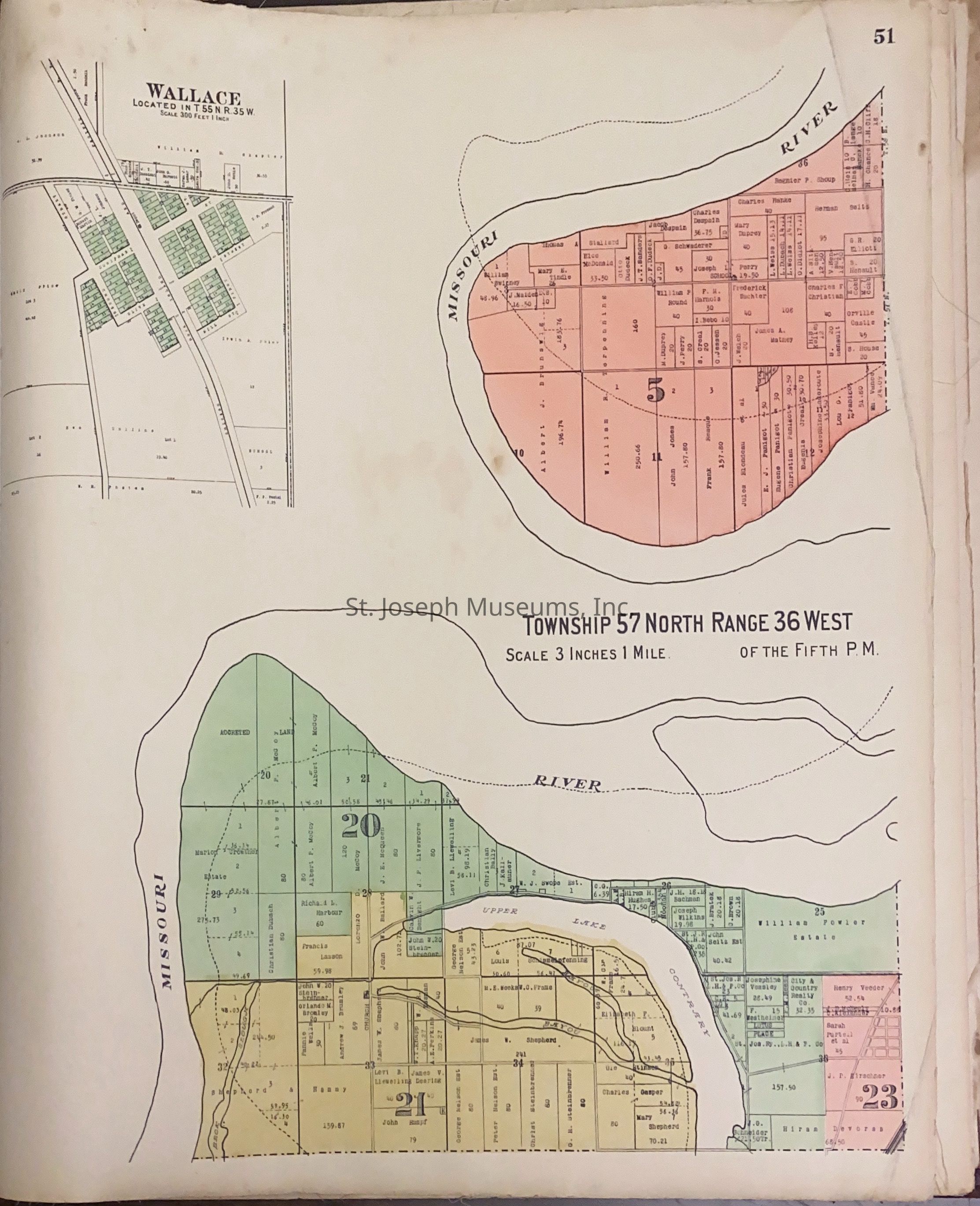
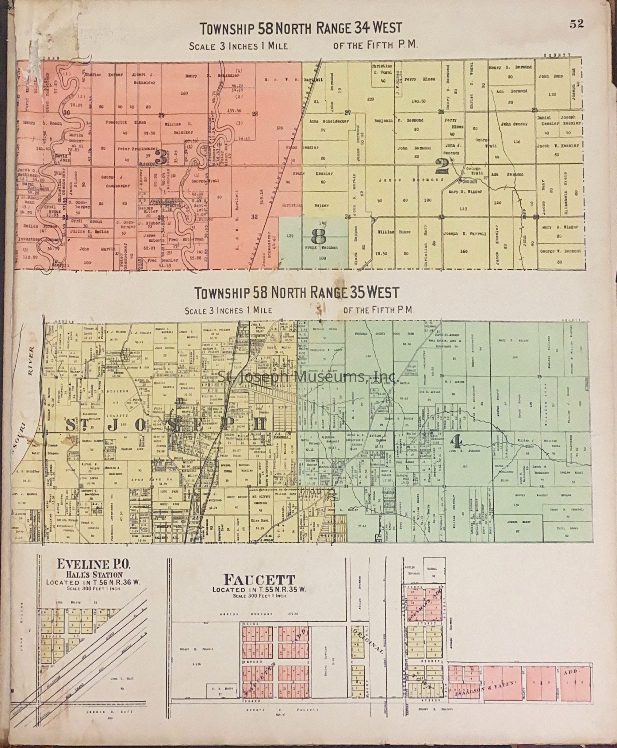
Atlas of Buchanan County, Missouri is an index of Buchanan County by township, section and range. Index of St. Joseph, Missouri by section, township and range and and index for additions and subdivisions of St. Joseph under the direction of Seitz-Peterman Engineering company.
J.A. Duncan Jr. stamped on inside front cover.
This was donated previously but no number assigned until 2005.
19 1/2 x 21
Poor condition - front and back cover are loose.
52/Hardbound/Maps.Lexicon
Nomenclature 4.0
Nomenclature Secondary Object Term
AtlasNomenclature Primary Object Term
CartographNomenclature Sub-Class
Graphic DocumentsNomenclature Class
Documentary ObjectsNomenclature Category
Category 08: Communication ObjectsLOC Thesaurus for Graphic Materials
MapsSearch Terms
St. Joseph atlas, Buchanan County atlas, St. Joseph, Missouri, Buchanan County, AtlasPublication Details
Author
Jackson, W.K.Place Published
City
St. JosephState/Province
MissouriDate Published
1913Call No.
StJoArea JANotes
Copy No.: 1