Name/Title
Booklet from The First National Bank, Santa FeEntry/Object ID
Q1430.634.459ADescription
A twenty-three page Booklet entitled "The City Different, Descriptive ___ Santa Fe and Vicinty" including information and maps about Santa Fe. Vol I pg. 459A
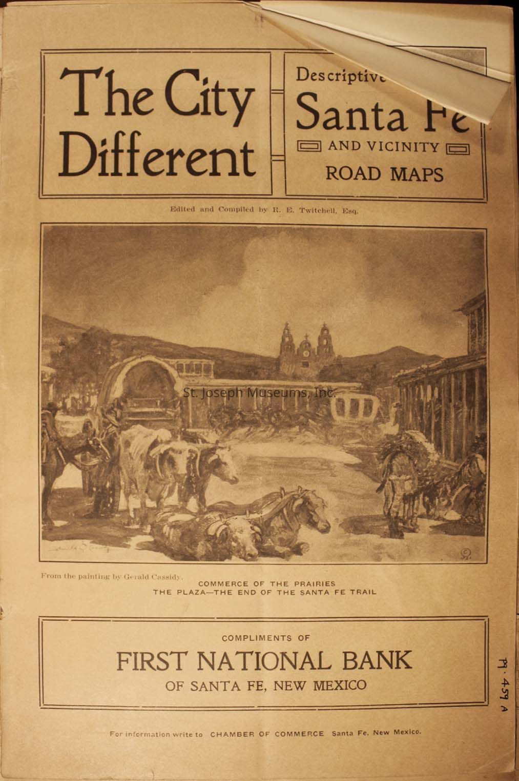
1.) The cover from "The City Different," focusing on Santa Fe and vicinity, including road maps, edited by R.E. Twitchell. It features an illustration by Gerald Cassidy, depicting the bustle of commerce with oxen and horses in a plaza at the end of the Santa Fe Trail. The bottom of the cover mentions "Compliments of First National Bank of Santa Fe, New Mexico," and it suggests writing to the Chamber of Commerce in Santa Fe for more information.
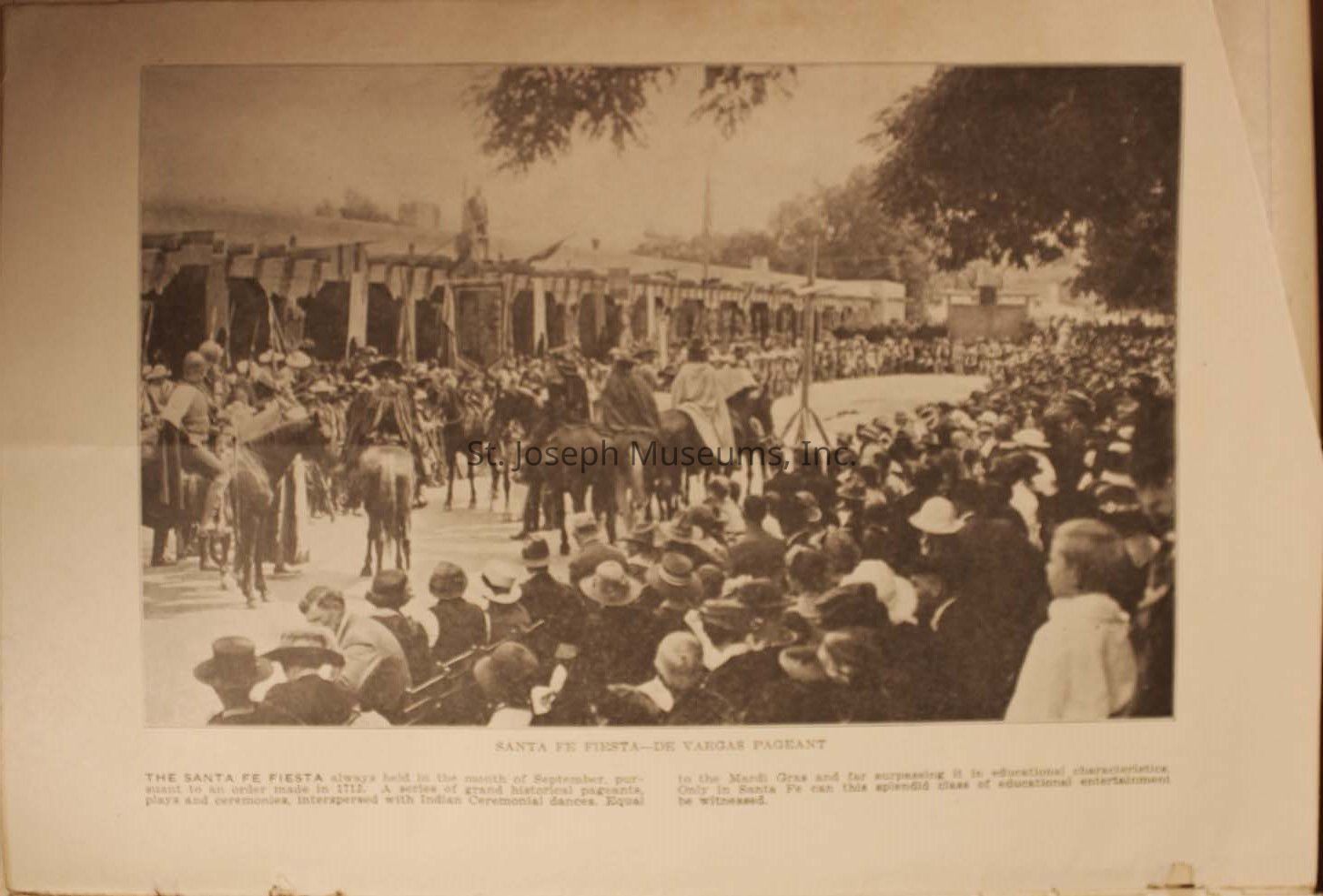
2.) The image depicts a historical scene from the Santa Fe Fiesta, showing a large crowd gathered to watch a pageant. People are lining the street, dressed in period attire, with many wearing hats. In the center, figures on horseback move through the street, possibly representing a parade. The background features buildings with traditional architecture, contributing to the historic atmosphere. The description at the bottom highlights the significance of the event, mentioning ceremonial dances and educational entertainment, suggesting that this festival was a significant cultural and community event.
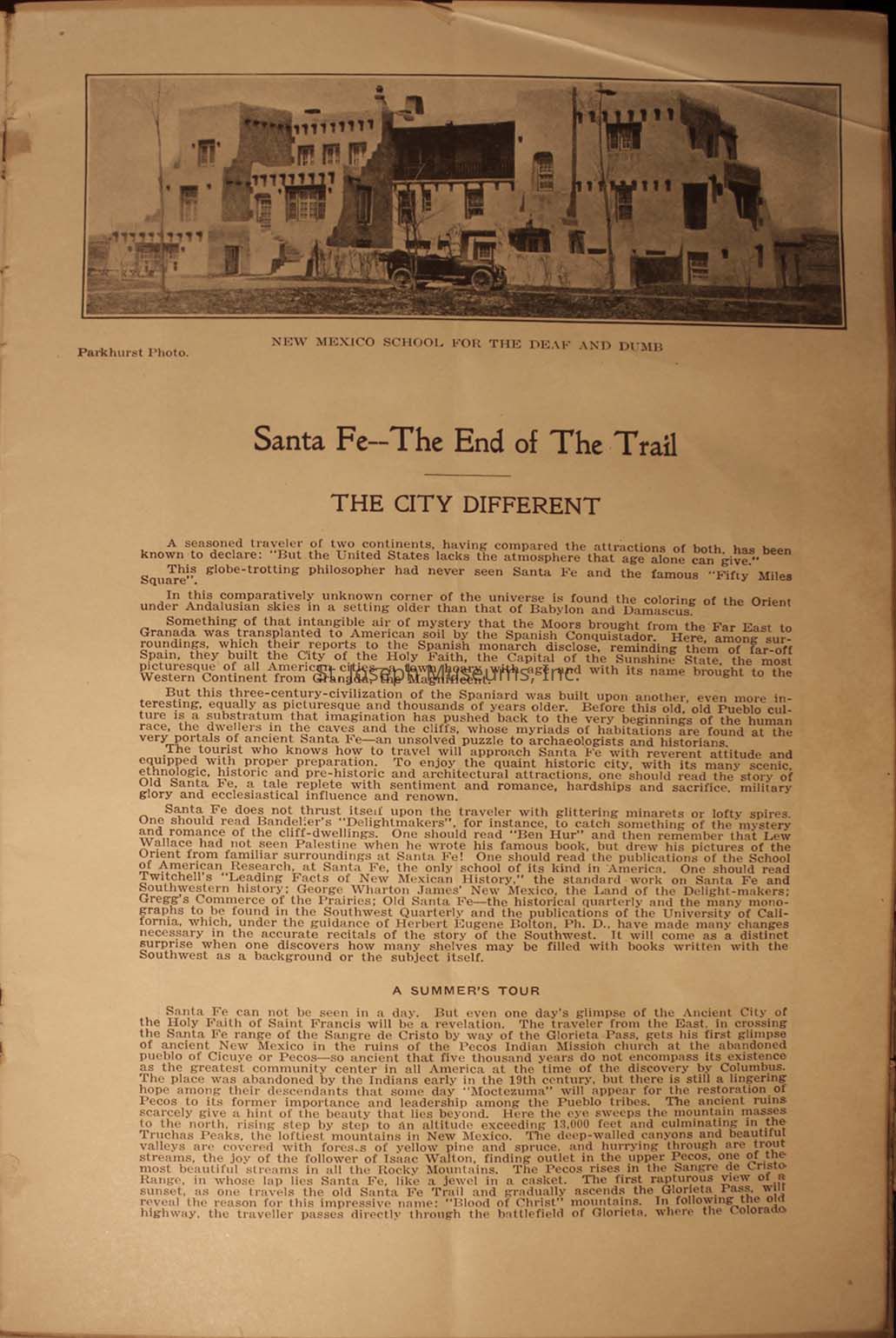
3.) The image showcases an article titled "Santa Fe—The End of The Trail: The City Different," featuring a black-and-white photograph of the New Mexico School for the Deaf and Dumb. The text highlights Santa Fe's unique blend of history, culture, and scenic beauty, praising its heritage and architecture. It encourages travelers to explore Santa Fe's distinctive offerings, referencing its historical ties and cultural landmarks. The description alludes to Santa Fe as a city rich in history and tradition, offering
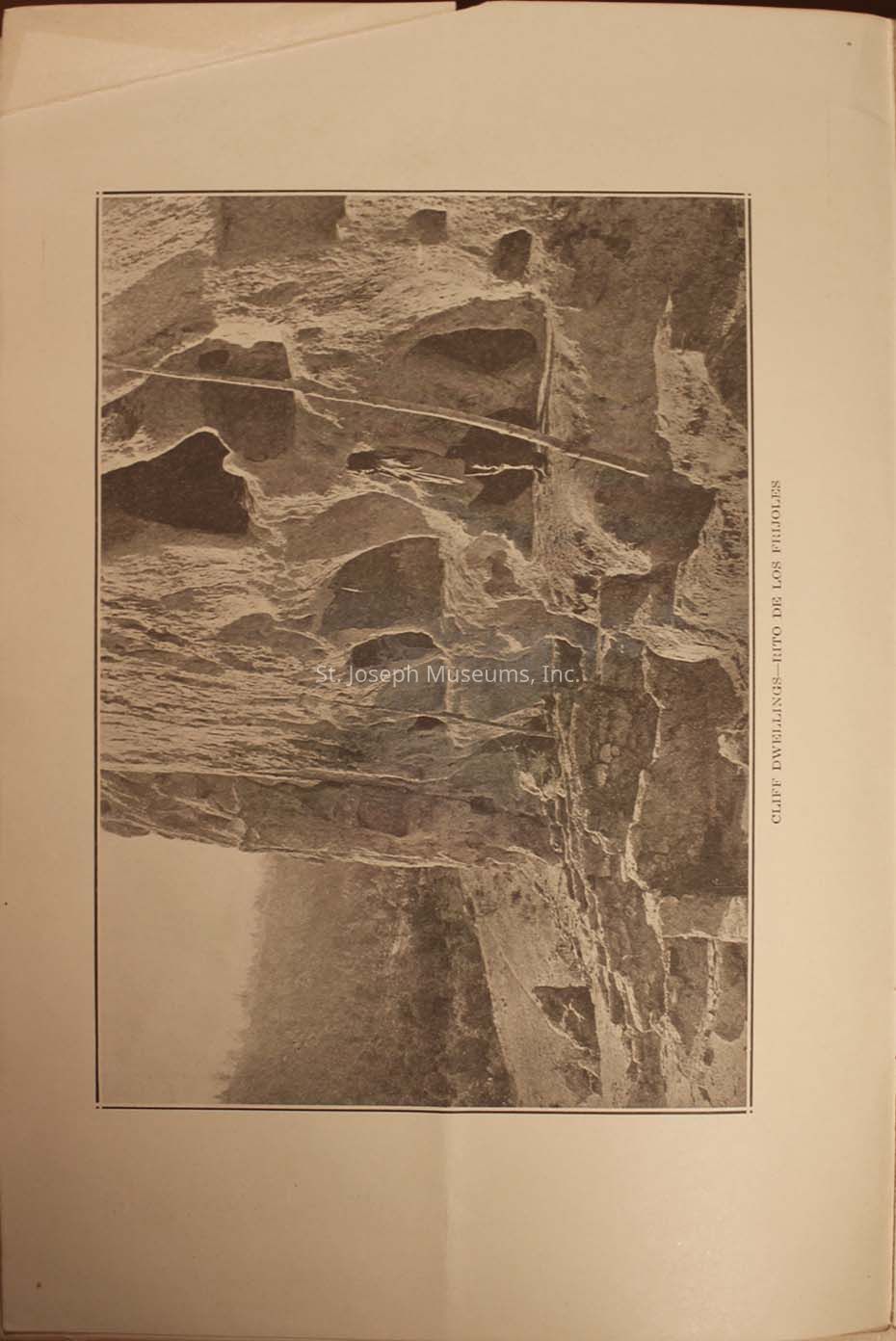
4.) The image depicts cliff dwellings located in Frijoles Canyon, with rugged rock formations creating natural shelters and intriguing structures hewn into the cliff face, all surrounded by an ancient, rugged landscape touched lightly by foliage, illustrating a historical human interaction with nature.
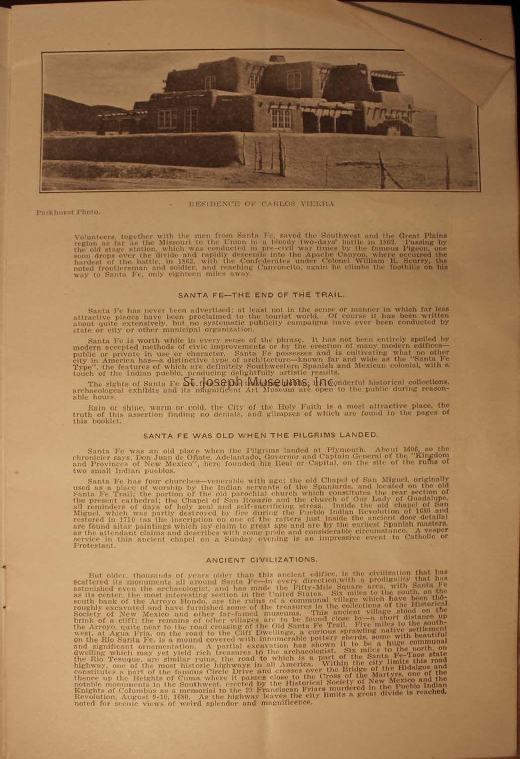
5.) The image is an old photograph titled "Residence of Carlos Vieira," showing a large adobe-style building. The text discusses historical aspects of Santa Fe, emphasizing its significance as a historical site with connections to both ancient and colonial history. It describes the city's unadvertised charm, historical architecture, and cultural importance, mentioning the battle of 1862 involving the Confederates and Santa Fe's status as a place of attraction for its ancient civilizations.
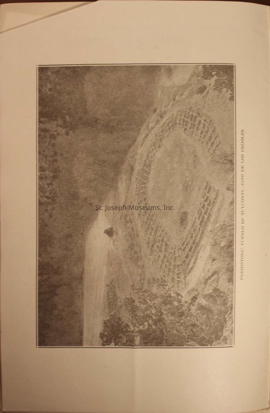
6.) The image depicts an archaeological site, likely a prehistoric amphitheater or terraced structure, set against a backdrop of natural vegetation, with concentric stone circles encompassing the area, suggesting it may have been used for gatherings or ceremonies. A label on the side indicates a reference to "Retro de los Frijoles" period.
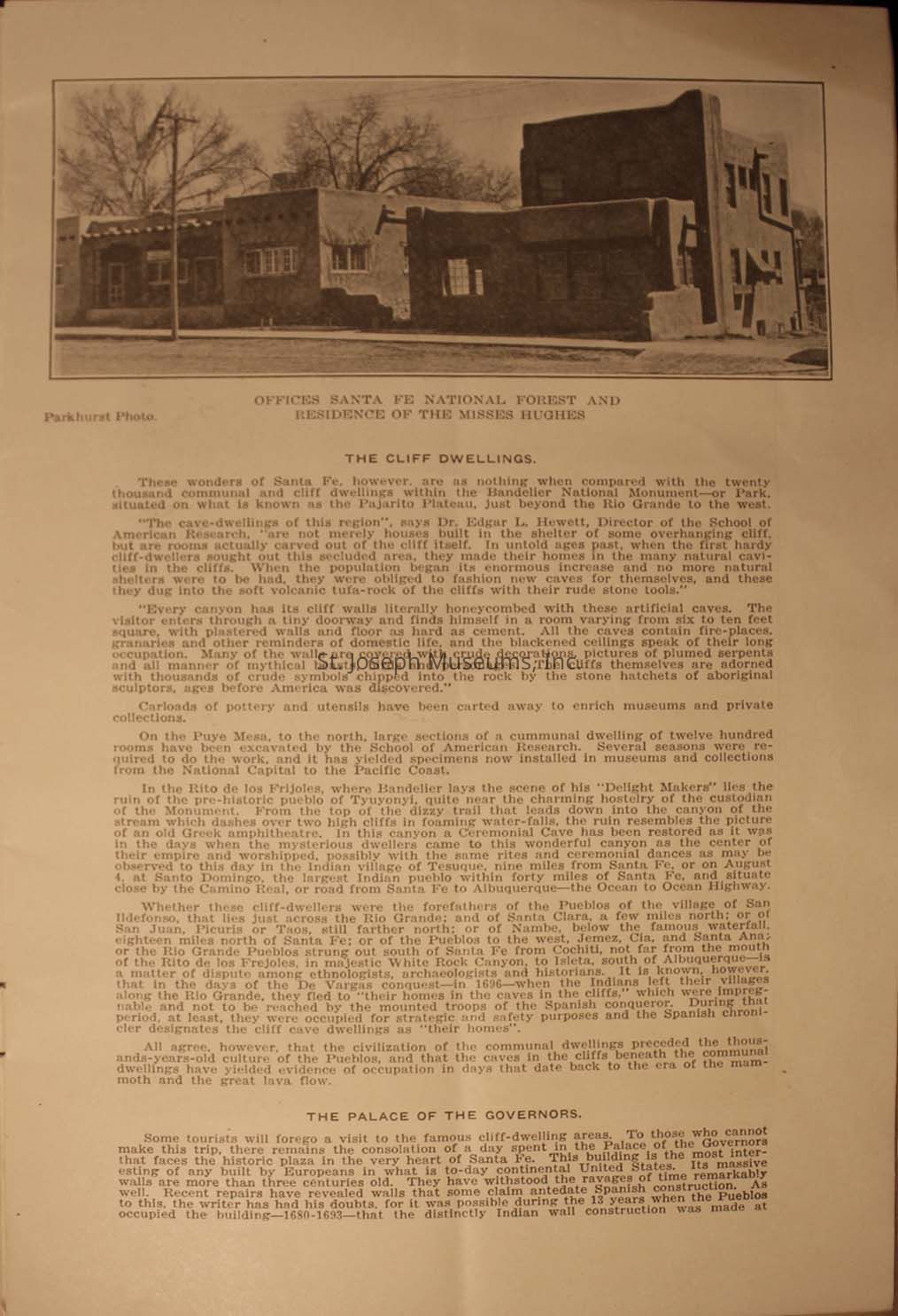
7.) A historical document and photograph depicting the "Offices Santa Fe National Forest and Residence of the Misses Hughes." Below the image is a detailed article titled "The Cliff Dwellings," discussing the ancient communal and cliff dwellings within the Bandelier National Monument, highlighting the rich cultural heritage and architectural ingenuity of the region.
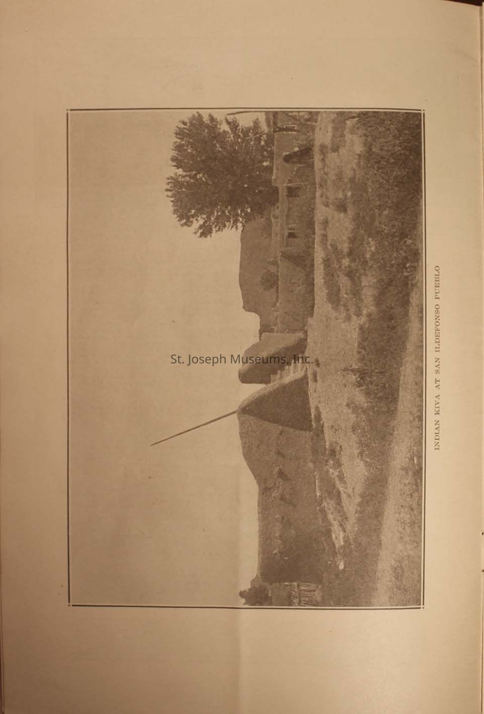
8.) The photograph depicts an early 20th-century scene at San Ildefonso Pueblo, showcasing a traditional kiva structure in the middle ground, surrounded by an arid landscape with sparse vegetation and distant hills under an expansive sky, while a large tree stands prominently on the left side, providing a contrast of shape and texture.
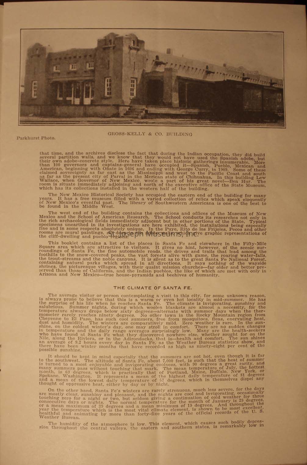
9.) A photograph of the "Gross-Kelly & Co. Building", a classic, adobe-style architecture with a flat roof and prominent rectangular shape. Below the photo is descriptive text discussing the history and significance of the building, and its role during the Indian occupation, as well as its later occupations by various governors and captains-general.
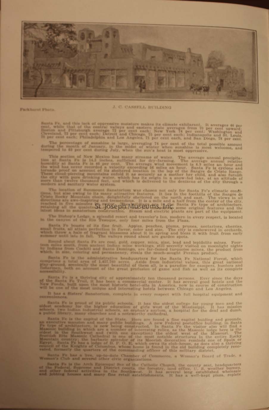
10.) The illustration labeled "J. C. Cassell Building," contains an adjacent caption "Parkhurst Photo." Beneath the image, the page contains detailed text describing the characteristics of Santa Fe, including its climate, precipitation, and attributes of the region's natural beauty. The text highlights the abundance of sunshine, suitability for dry farming, and describes the region’s scenic landscapes attributed to the Sangre de Cristo Range .
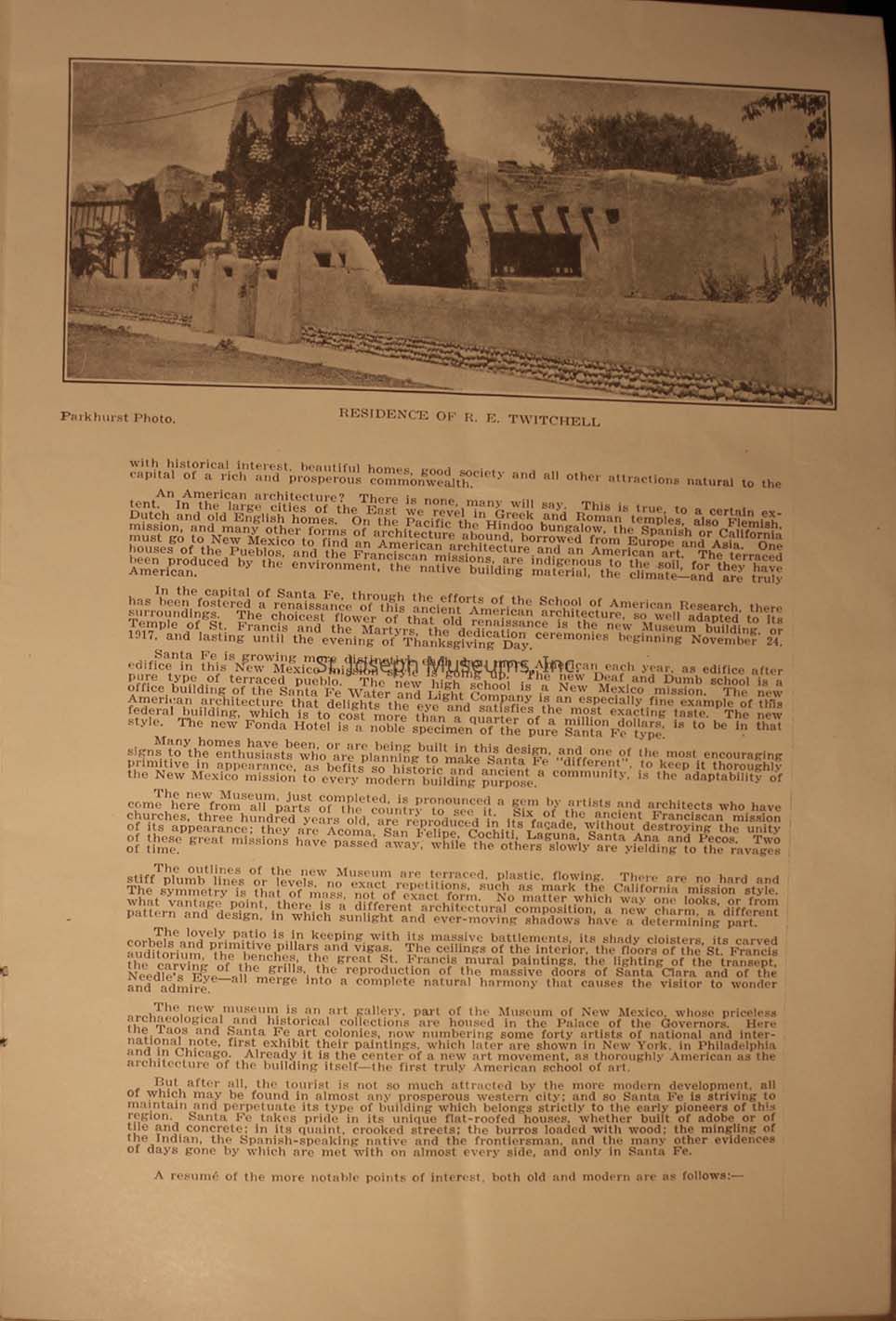
11.) A photograph from an old publication featuring the residence of R. E. Twitchell. The picture, credited to Parkhurst Photo, shows an adobe-style house characteristic of New Mexico architecture. Below the photograph, a detailed article discusses the distinctive elements of American architecture, particularly in regions like Santa Fe, emphasizing the contribution of native building materials and the adaptation to local climates and environments. The article highlights the historical and aesthetic significance of the New Mexico mission style.
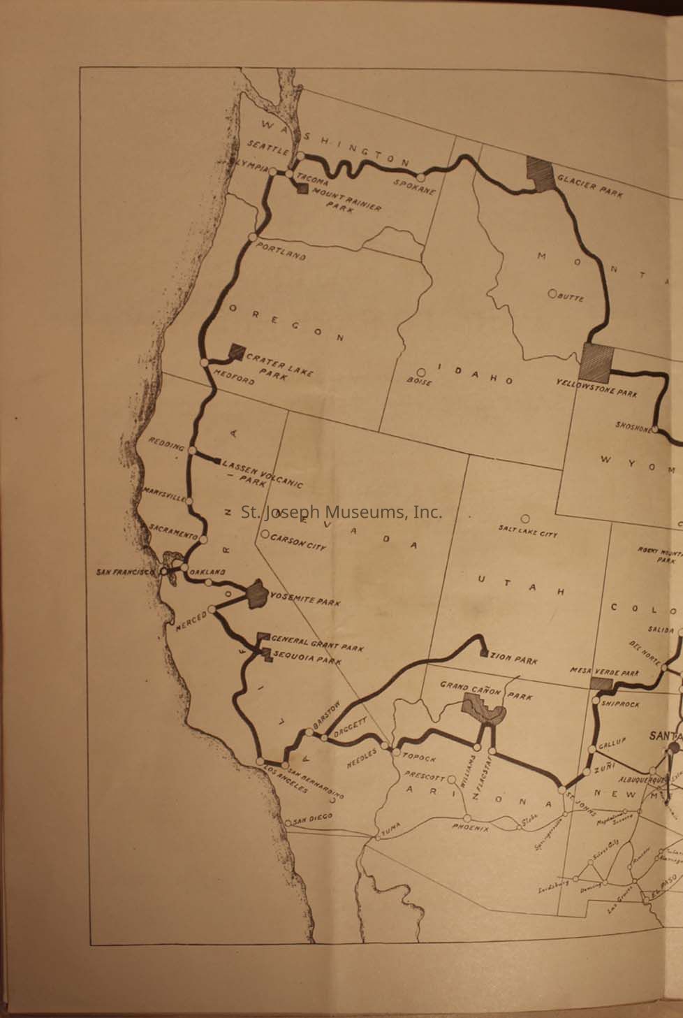
12.) The image is an old map depicting a route through national parks and major cities in the western United States, including locations such as San Francisco, Seattle, and Yellowstone Park, with notable parks like Grand Canyon, Zion, and Glacier marked along the travel path; it highlights a network of roads connecting these points of interest across states like California, Oregon, Washington, Idaho, Montana, Nevada, Wyoming, Utah, Colorado, Arizona, and New Mexico, emphasizing both the natural landmarks preserved as parks and the urban.
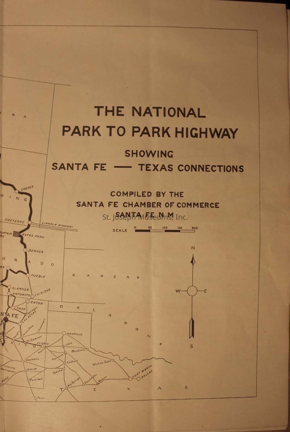
13.) A historical map titled "The National Park to Park Highway," which illustrates the connections between Santa Fe and Texas, compiled by the Santa Fe Chamber of Commerce in Santa Fe, NM. The map displays a network of highways with routes marked and labeled, crossing several states including Oklahoma and Texas.
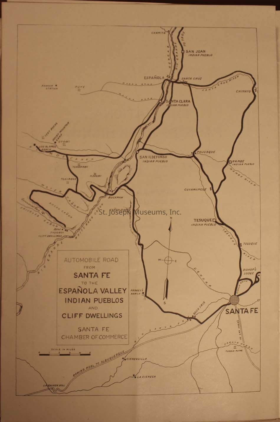
14.) A vintage map showcasing automobile routes from Santa Fe to the Española Valley, highlighting various Indian Pueblos and cliff dwellings. It includes routes passing through areas such as San Ildefonso, Pojoaque, Tesuque, and Chimayo, with clear delineation of major roads leading to cultural and historical sites. The map is labeled with directions like north, south, east, and west, using a compass rose for orientation, and features a scale in miles at the bottom.
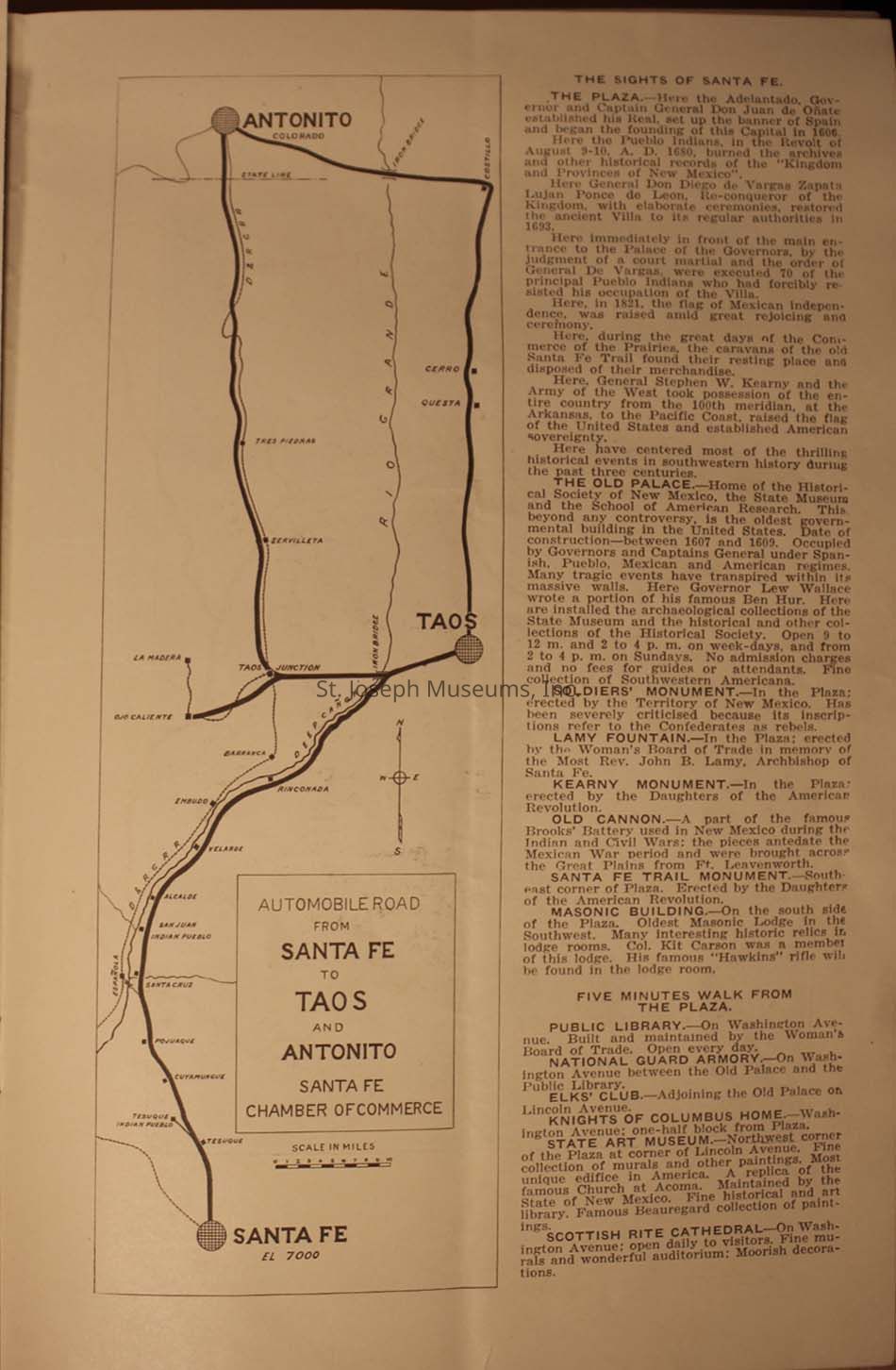
15.) A vintage document featuring a detailed map on the left side, illustrating the automobile road from Santa Fe to Taos and Antonito, along with surrounding areas marked, all produced by the Santa Fe Chamber of Commerce. To the right, the text titled "The Sights of Santa Fe" narrates significant historical sites and monuments, providing a deep dive into the cultural heritage and historical points of interest in Santa Fe.
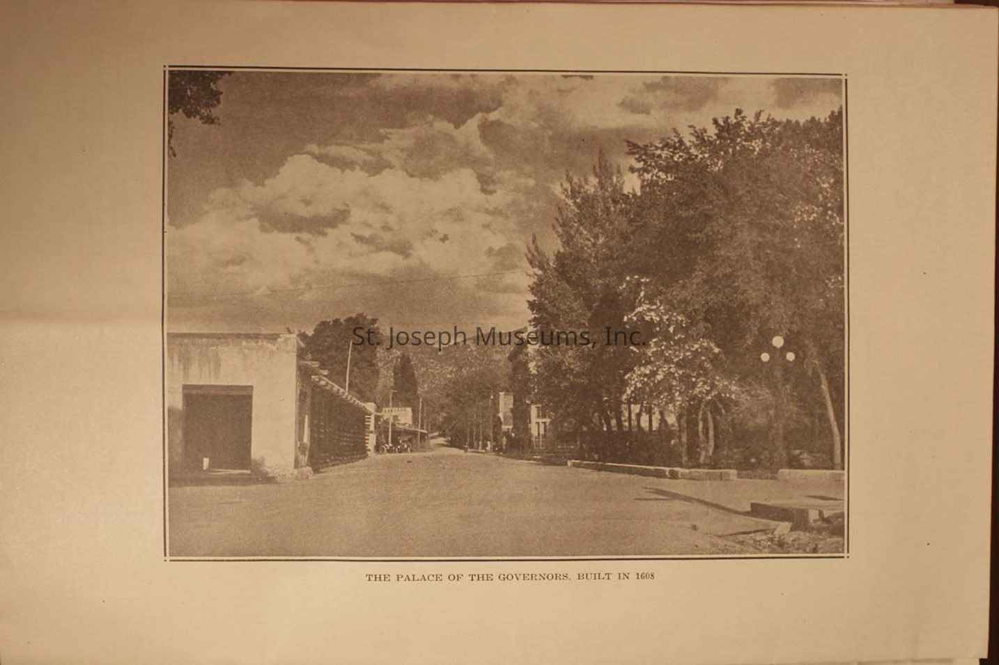
16.) The photograph of a street view featuring the historic Palace of the Governors, constructed in 1608, with a clear sky adorned by fluffy, scattered clouds creating a picturesque backdrop against the distant, rolling hills; on the left, you can see the simple, stucco-style architecture typical of the period, while lush, leafy trees line the right side of the street, casting gentle shadows on the ground, evoking a sense of timeless tranquility and rich historical ambiance.
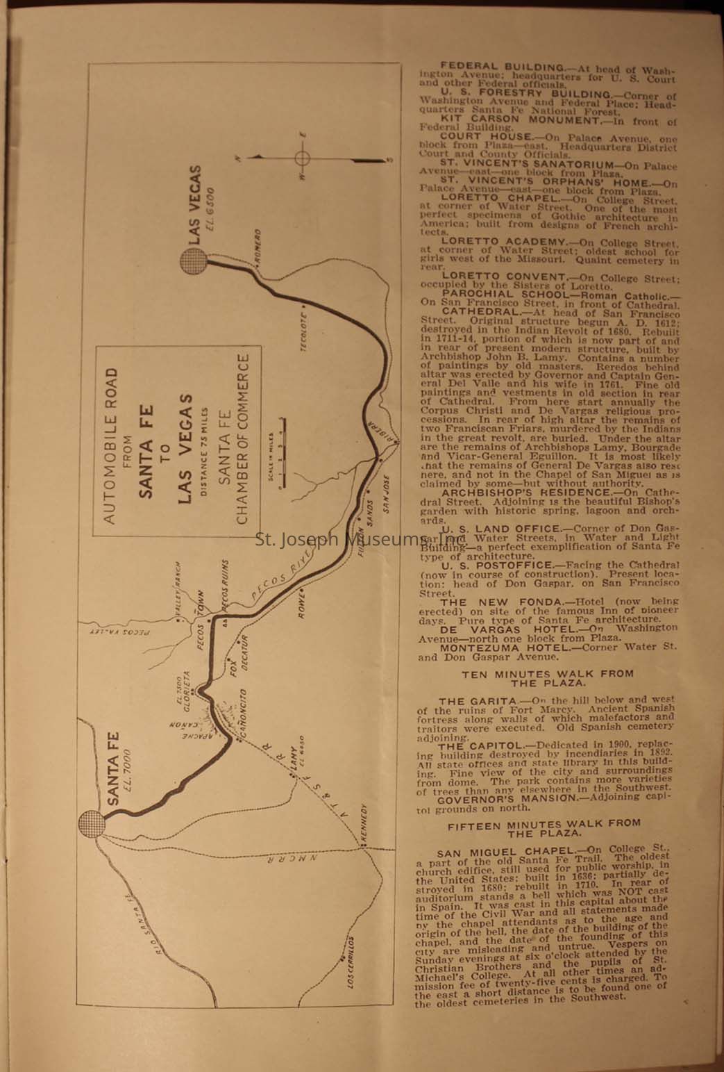
17.) An old map and text from a guide detailing the automobile road from Santa Fe to Las Vegas in New Mexico. The map highlights the route, including key points like Pecos River, Glorieta, and the surrounding landscape, indicating elevations and directions. To the right, there's detailed information about notable buildings and landmarks along the route, such as federal buildings, churches, hotels, and historical sites, providing historical and architectural insights.
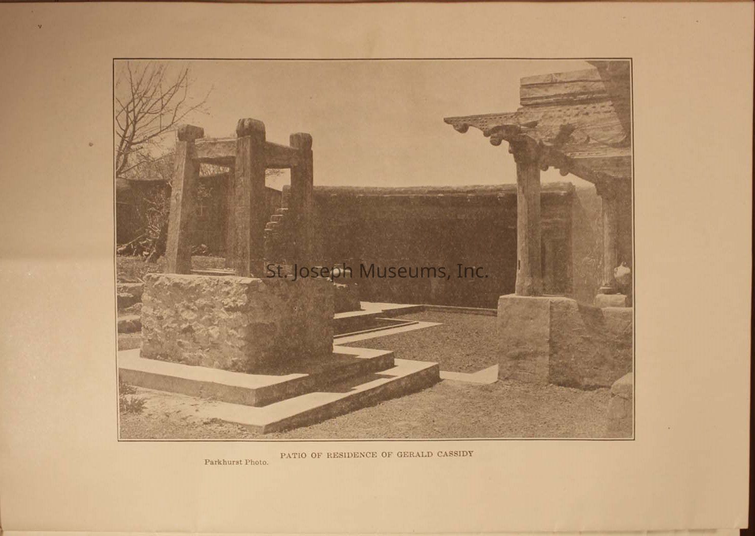
18.) The image depicts a rustic patio of the residence of Gerald Cassidy, showcasing a traditional stone and wood structure, with steps leading up to a raised platform and a central courtyard area, surrounded by walls that suggest an adobe or earth-built construction, and highlighted by a tree in the background, reflecting an architectural style typical of a historical or Southwestern setting.
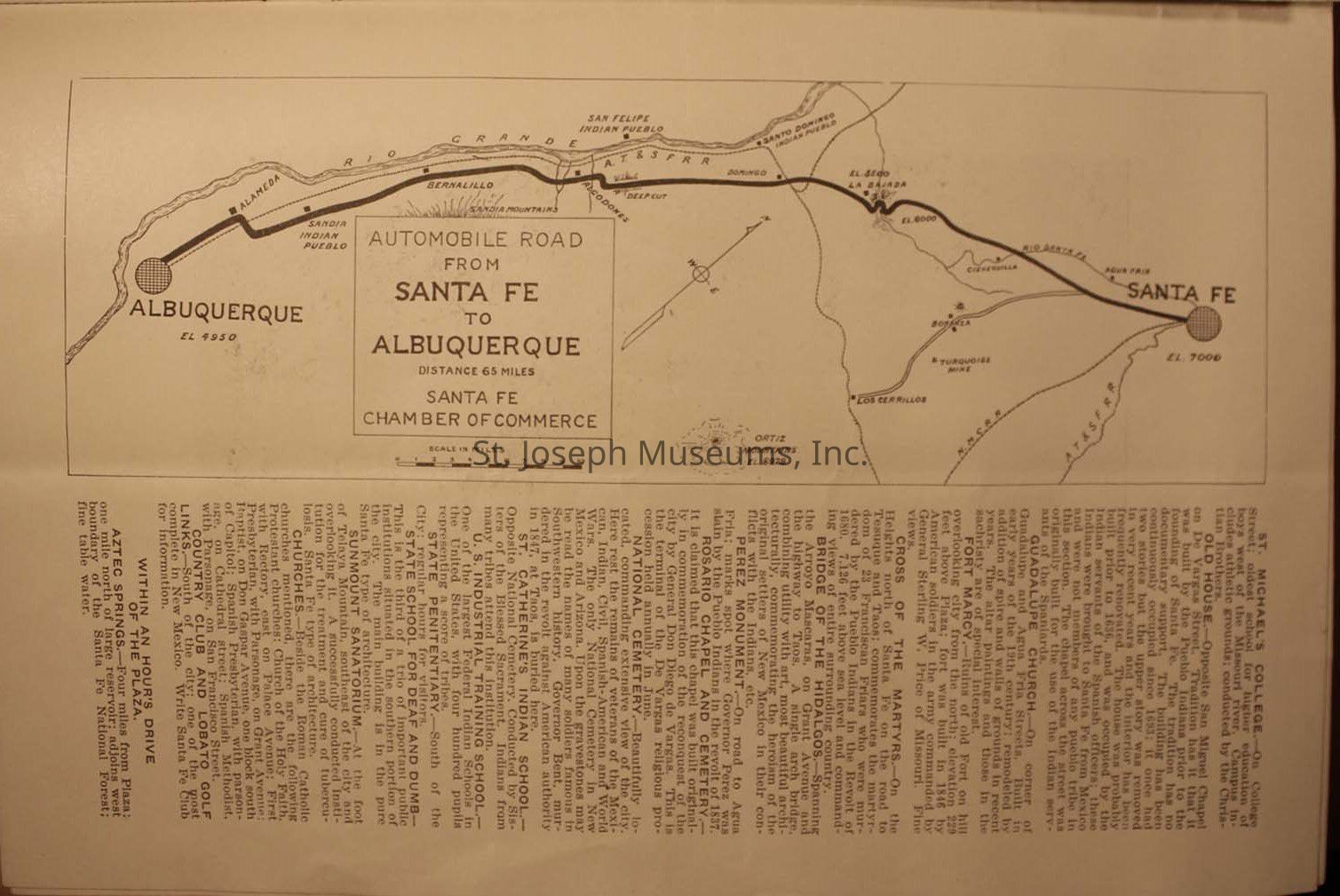
19.) The vintage map illustrating the automobile route from Santa Fe to Albuquerque, covering a distance of 65 miles as marked by the Santa Fe Chamber of Commerce, with prominent towns such as Bernalillo and various landmarks like the Sandia Indian Pueblo and the Rio Grande along the way, while the map is surrounded by text descriptions providing further context and information about the locations and features connected by this historical route.
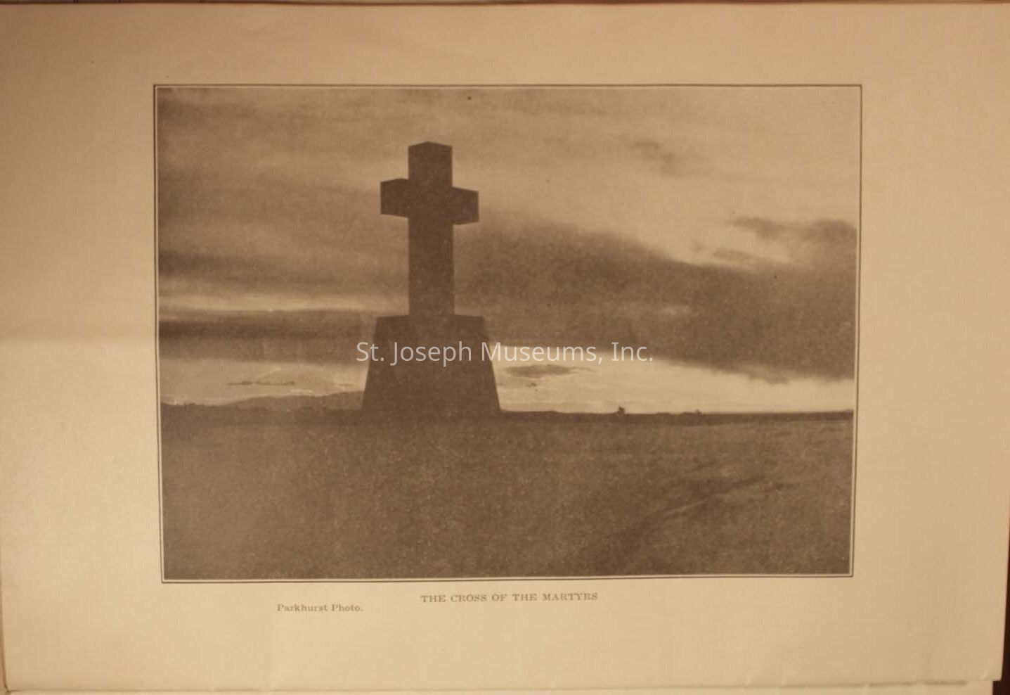
20.) The image displays a solitary stone cross silhouetted against a vast, dramatic sky, with clouds partially obscuring the setting sun, casting a serene yet solemn ambiance over the landscape, which appears to be expansive and barren except for the presence of the cross. The photograph, titled "The Cross of the Martyrs," conveys a sense of quiet reflection or remembrance, invoking emotions tied to history and sacrifice.
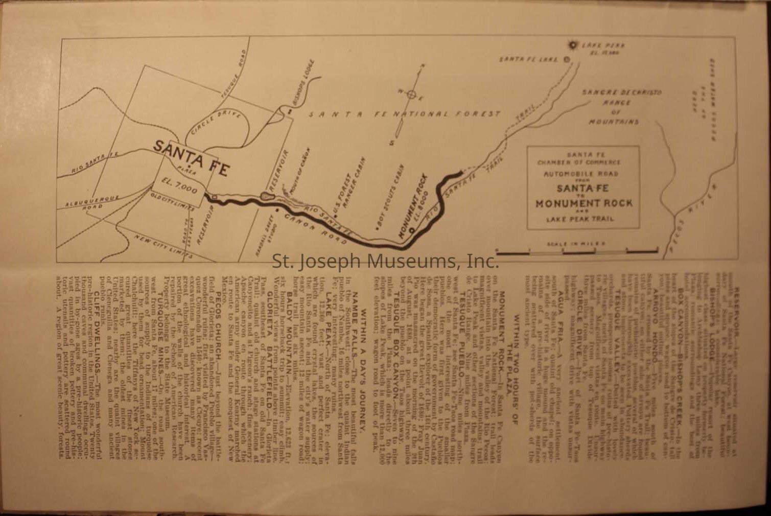
21.) An old map detailing the route from Santa Fe to Monument Rock and the Lake Peak Trail, produced by the Santa Fe Chamber of Commerce. Key locations like Santa Fe National Forest, Santa Fe Lake, and the Sangre de Cristo Range of Mountains are marked, with the map oriented using a simple compass rose. The map outlines road networks and geographical features, showing distances in miles. Beneath the map, there is a comprehensive description of nearby points of interest, historical sites, and natural attractions.
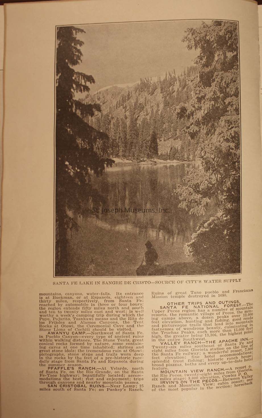
22.) The photograph framed in a rectangular border, showcases Santa Fe Lake nestled within the Sangre de Cristo Mountains, surrounded by dense, towering evergreens and reflecting a serene, mirror-like water surface, while the foreground includes a contemplative figure sitting by the lakeside. The text below the image provides information on various attractions and activities in the area, such as camping, exploring ruins, and visiting nearby ranches.
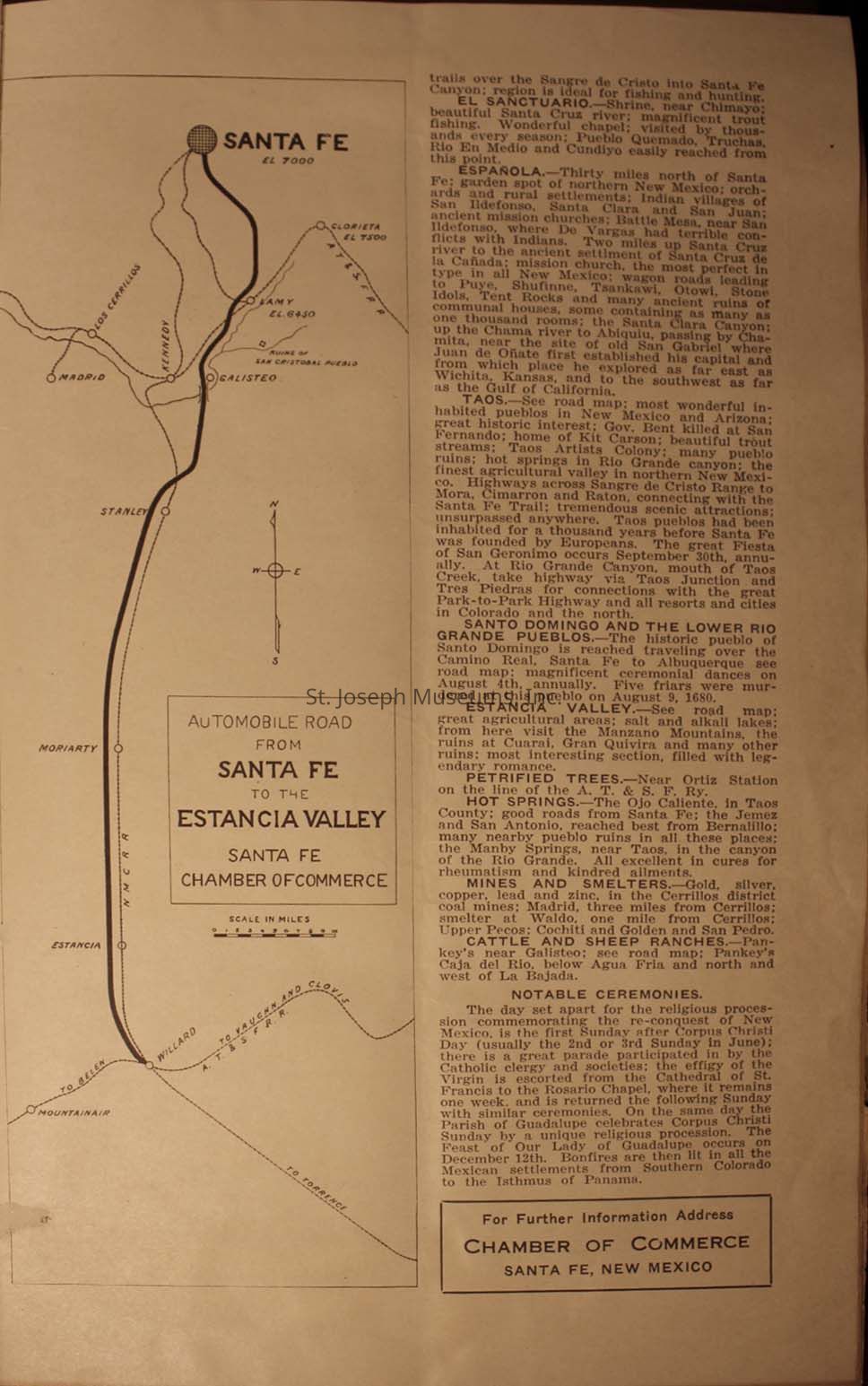
23.) This image features a vintage map detailing the automobile road from Santa Fe to the Estancia Valley, provided by the Santa Fe Chamber of Commerce, alongside descriptive text highlighting notable attractions and historical sites, including Española, Santo Domingo, and the Lower Rio Grande Pueblos, hot springs, petrified trees, and information on local mining and smelting industries, with additional notes on cattle ranches, nearby communities, and notable ceremonies in New Mexico, emphasizing the region's cultural and natural bounties.Subject
First National Bank
Santa Fe, New MexicoSubject Person/Organization
Harry L. George Collection