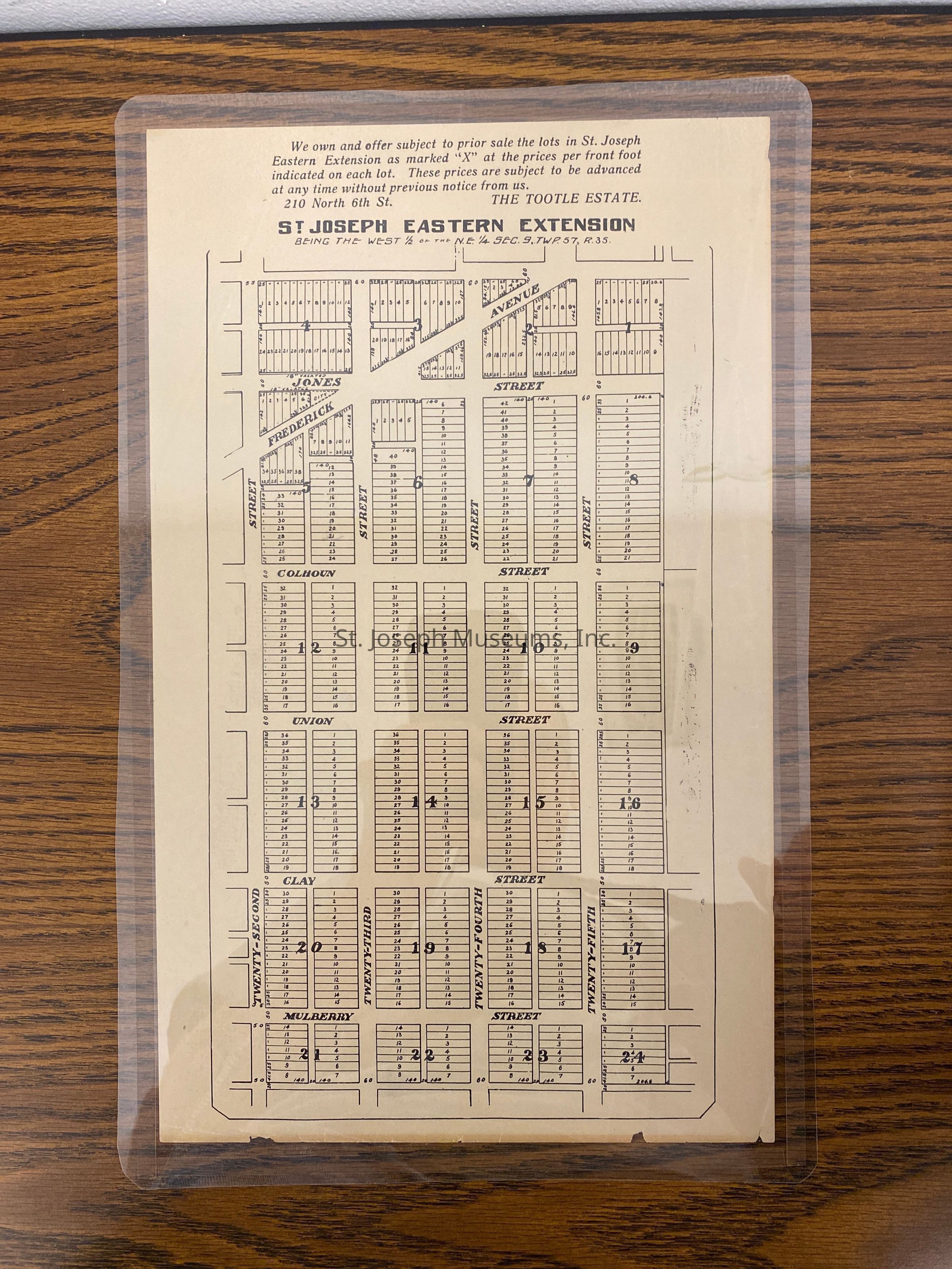
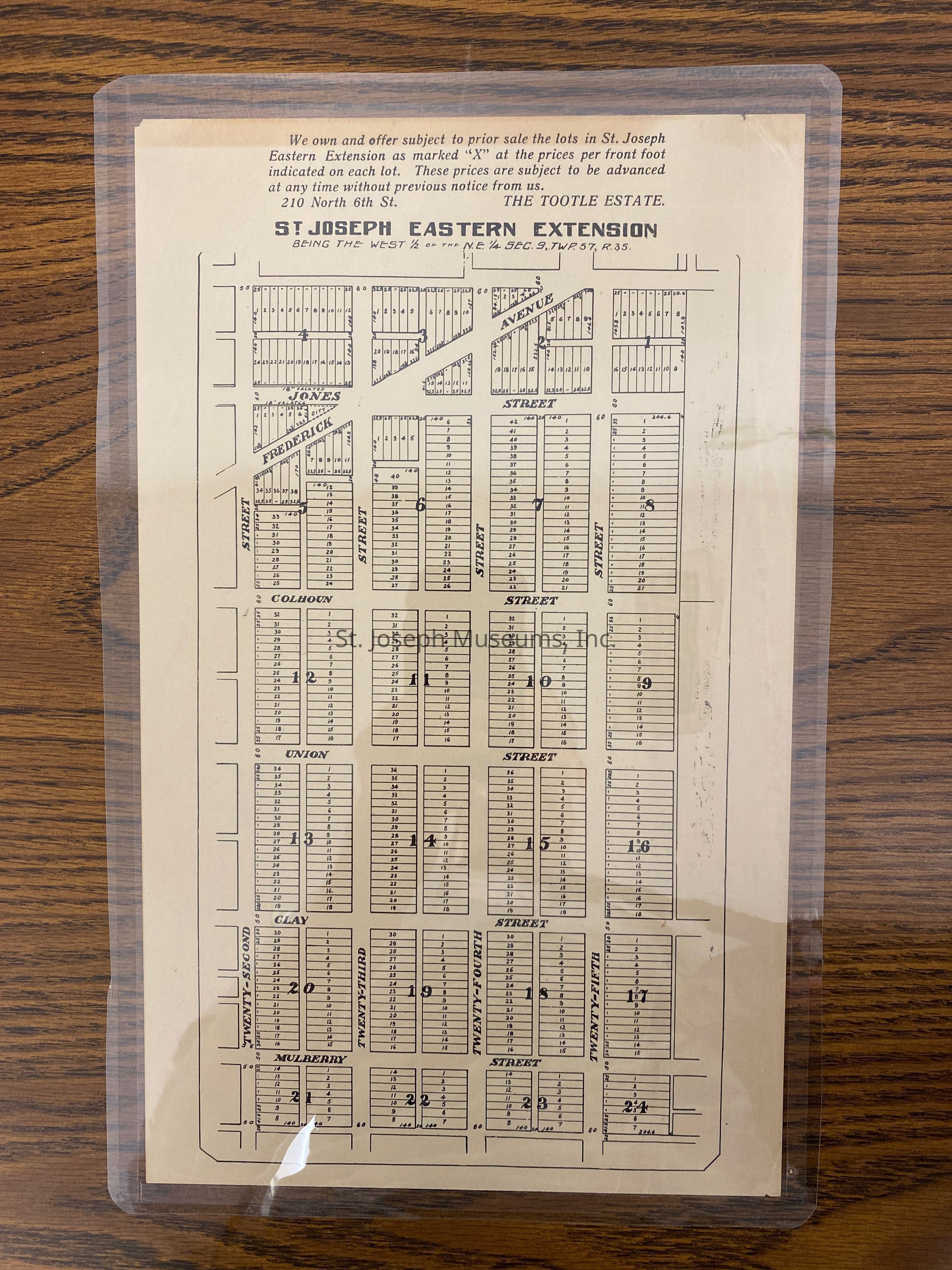
Estate, Tootle St. Joseph Eastern Extension Map, 1900
Entry/Object ID
AM1992.3.3AB
Scope and Content
Estate, Tootle St. Joseph Eastern Extension Map, 1900. This document is a flyer that advertises lots from the Tootle Estate. The lots are from St. Joseph Eastern Extension being the West 1/2 of the N. E 1/4 Sec.9, TWP. 57, R35.
The streets are Jones, Calhoun, Union, Clay, and Mulberry. The street on the side of the map is 22nd Street. Frederick Avenue angles off 22nd Street, across Jones Street. The flyer states: We own and offer subject to prior sale the lots in St. Joseph Eastern Extension as marked "X" at the prices per front foot indicated on each lot. These prices are subject to be advanced at any time without previous notice from us. The Tootle Estate.