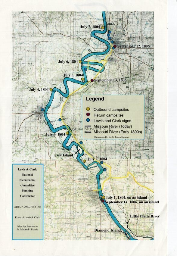
Copyright: 2019.1.20 Lewis & Clark Map, St. Joseph Area
Name/Title
Lewis & Clark Trail Map of St. Joseph Area, 2000
Entry/Object ID
AM2019.1.20
Scope and Content
Lewis & Clark Trail Map of St. Joseph Area, 2006. Created by National Bicentennial Planning Committee for April 27, 2000 Field Trip. Route of Lewis & Clark "Isles des Parques to St. Michael's Prairie." Color map.
Shows water route of the route taken up the Missouri River in July, 1804 and the return home in September, 1806. The various sites and dates of their visits marked on the map.
Lexicon
Nomenclature 4.0
Nomenclature Secondary Object Term
Map
Nomenclature Primary Object Term
Cartograph
Nomenclature Sub-Class
Graphic Documents
Nomenclature Class
Documentary Objects
Nomenclature Category
Category 08: Communication Objects
Search Terms
Lewis & Clark, Missouri River, Lewis & Clark in St. Joseph area, Lewis & Clark National Bicentennial Committee