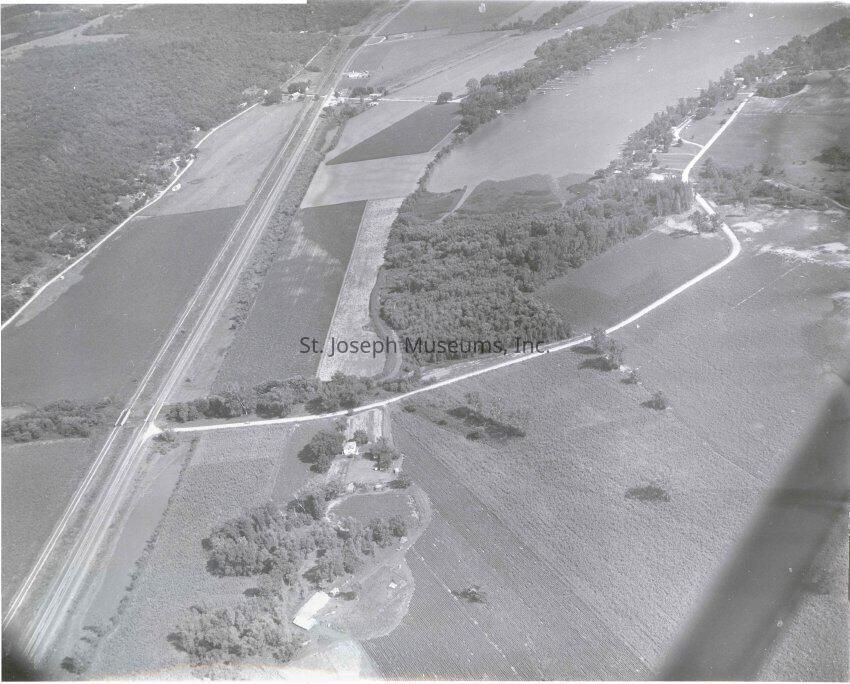
Missouri River Bottoms near Lake Contrary Aerial, c. 1960
A black-and-white aerial photo from the 1960s shows flat farmland intersected by a road, with a wooded area and a body of water, possibly Lake Contrary, in the top right corner.
Name/Title
Missouri River Bottoms near Lake Contrary Aerial Photos (3), c. 1960s
Entry/Object ID
P1998.50.9JJLL
Description
Missouri River Bottoms near Lake Contrary (possibly) Aerial Photos (3), c. 1960s. b/w. Photo of flat farm land intersected by road, body of water at photo top right.
Collection
Lewis C. Shady Photo
Made/Created
Artist
Lewis C. Shady
Date made
1960
Place
City
St. Joseph
State/Province
Missouri
Lexicon
Nomenclature 4.0
Nomenclature Secondary Object Term
Print, Photographic
Nomenclature Primary Object Term
Photograph
Nomenclature Sub-Class
Graphic Documents
Nomenclature Class
Documentary Objects
Nomenclature Category
Category 08: Communication Objects
Search Terms
Missouri River, Lake Contrary, Missouri River Bottoms
Dimensions
Height
11 in
Width
14 in
Condition
Overall Condition
Good
Maintenance
Maintenance History
Date
Aug 26, 2019
Provenance
Notes
Photos taken by Lewis C. Shady, Donated by his children. Shady was staff photographer for St. Joseph News-Press, late 1930's to c. 1960.