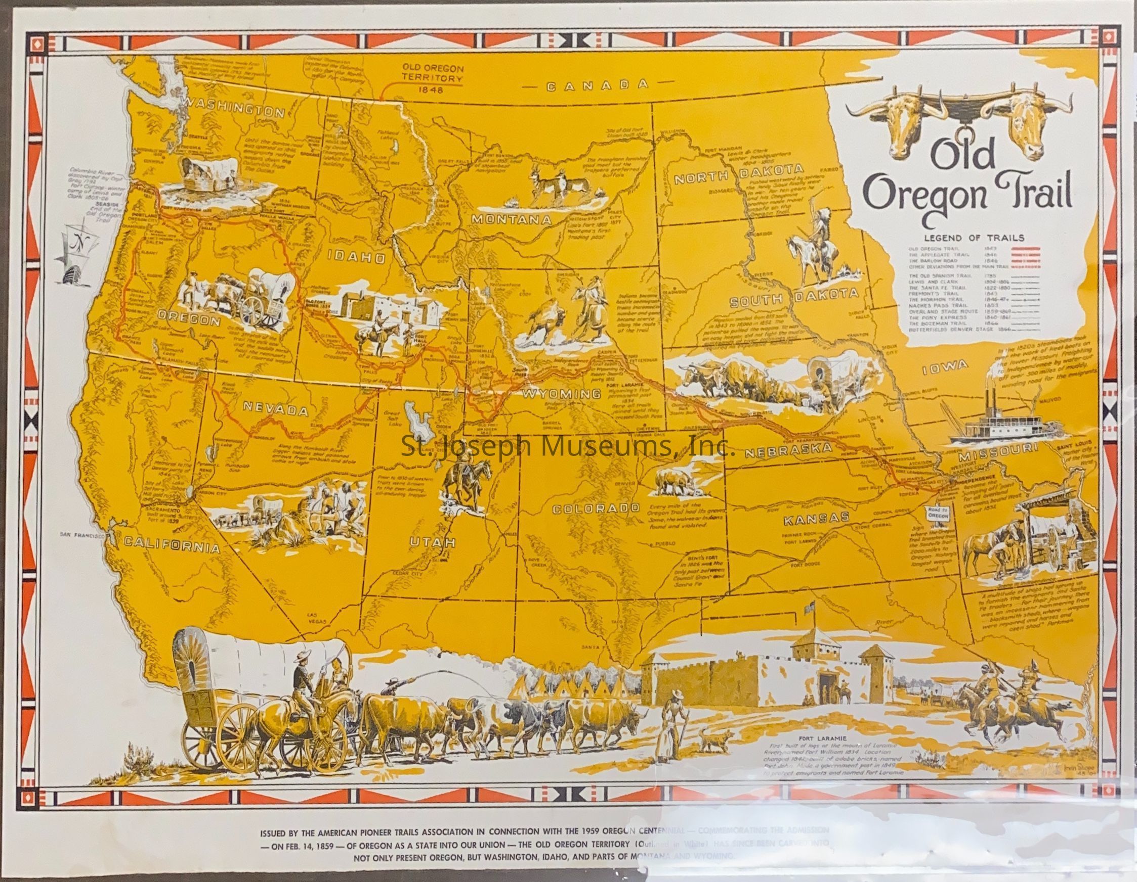
Old Oregon Trail Map by American Pioneer Trails Association, 1959

Name/Title

Old Oregon Trail Map by American Pioneer Trails Association, 1959

Entry/Object ID

AM1990.1.98

Scope and Content

Old Oregon Trail Map by American Pioneer Trails Association, 1959. Map of western United States from Missouri to California. Oregon & California Trails marked in red on orange background. Illustrations and explanatory text at important sites along trail. Issued by American Pioneer Trails Association in connection with the 1959 Oregon Trail Centennial--Commemorating the Admission--on Feb. 14, 1859--of Oregon as a State into our Union--The Old Oregon Territory (Outlined in white) has since been carved into not only present Oregon, but Washington, Idaho, and parts of Montana & Wyoming." Includes the following other trails: --Applegate --Barlow Road --Lewis & Clark --Old Spanish --Santa Fe --Fremont's --Mormon --Naches Pass --Overland Stage Route --Pony Express --Bozeman --Butterfield Denver Stage Map made by "Irvn Shope, '48.

Lexicon

Nomenclature 4.0

Nomenclature Secondary Object Term

Map

Nomenclature Primary Object Term

Cartograph

Nomenclature Sub-Class

Graphic Documents

Nomenclature Class

Documentary Objects

Nomenclature Category

Category 08: Communication Objects

Search Terms

Trails, Western Migration, Oregon Trail, California Trail, Applegate Trail, Barlow Road, Lewis & Clark Trail, Old Spanish Trail, Santa Fe Trail, Fremont's Trail, Mormon Trail, Naches Pass Trail, Overland Stage Route, Pony Express Trail, Bozeman Trail, Butterfield Denver Stage Route, Oregon Territory, American Pioneer Trails Association
Condition

Overall Condition

Good