Name/Title
PhotographEntry/Object ID
2020.25.1542Description
Circa: Pre-1961
AERIAL VIEW
North Belt Highway & Frederick
https://www.stjosephmemorylane.com/aerials/aerials.htmlContext
Circa: Pre-1961
AERIAL VIEW
North Belt Highway & Frederick
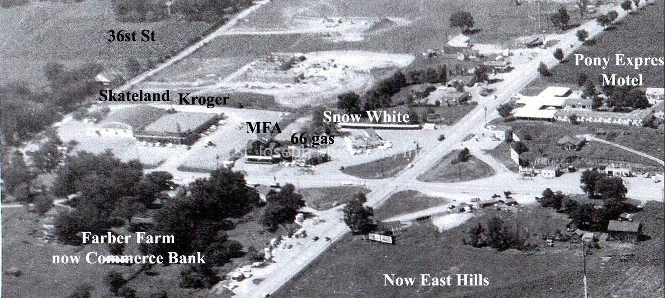
This is a cropped section of the photo below
The photo was taken sometime before 1961
I have marked some locations that I recognize
This is an aerial view of the Belt Highway (Highway 71) and US 36 Highway
Known points of interest from left to right: Skateland, Krogers Grocery, MFA Feed, Bill & Jim's 66 Service, Snow White, Pony Express Motel
The Farber farm as seen in the bottom left would later become Commerce Bank
Original photo was taken by Phil Okonski's father
The photo was submitted by Phil Okonski