Name/Title
PhotographEntry/Object ID
2020.25.1546Description
Circa 1950's
AERIAL VIEW
Old US 36 Highway
https://www.stjosephmemorylane.com/aerials/aerials.htmlContext
Circa 1950's
AERIAL VIEW
Old US 36 Highway
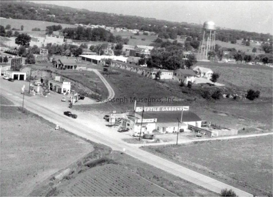
Aerial view of the old US 36 Highway a short distance from the North Belt Highway
US 36 highway has now been renamed to US 6
Flinchpaugh's Reptile Gardens and a couple gas stations are visible in the photo, it was located a short distance east of the US 71 and US 36 intersection
The water tower on North US 71 (North Belt Highway) is also visible in the distance
RE-ROUTING OF OLD US 36
Prior to the 1960's, people traveling on US 36 East from the Kansas side usually traveled through downtown St Joseph on US 36 Business Route
After zig zagging through town to Frederick Avenue, they would continue east on Frederick Avenue to the Highway 71 Junction
(Of course, if they knew their way through St Joseph, they could also take Messanie or Mitchell Avenue to Highway 71)
Once at US 71, if they wanted to go to Kansas City or Savannah, they could take Highway 71 at the junction of US 71 & US 36
If they continued east on old US 36, a two lane highway with many hills and curves (10 mile curve was a doozy) they would end up at US 31 about 13 miles away. You would turn south and US 36 East continued about 1/4 mile south of this junction
As the city expanded, this area became better known as Frederick Avenue and the highway was renamed to US 6 Highway
When the new Highway US 36 was constructed at the bridge, the new US 36 was a 4 lane highway and it took a fairly straight path across St Joseph
The State of Mo also built a new US 36 4 lane highway from St Joseph to US 31 where it connected into US 36 thus eliminating the many hills and curves
The new highway also eliminated the need to travel through downtown St Joseph, thus eliminating a lot of traffic through downtown