Name/Title
PhotographEntry/Object ID
2020.25.1583Description
Circa 1918
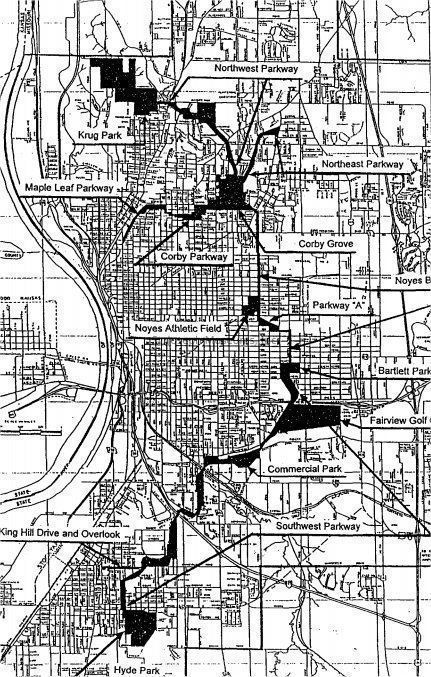
MAP OF ST JOSEPH PARKWAY SYSTEM
https://www.stjosephmemorylane.com/aerials/aerials.htmlContext
Circa 1918
MAP OF ST JOSEPH PARKWAY SYSTEM
The Parkway System was developed in 1918 by architect George Burnap
St Joseph was one of the first cities in the U.S. to develop such a parkway system
In 1995, our Parkway System was placed on the National Register of Historic Places
The St. Joseph Park and Parkway System is a connected group of parks and park system drives, running generally north/south from Krug Park on the north to Hyde Park on the south
The Parkway System winds through St Joseph for a total 26 miles of roadway
The distance from Krug Park to Hyde Park is 18.68 miles
It's a beautiful drive from one end of the city to the other end as it winds and snakes over the hills and past some residential areas
The Parkway system connects many parks and recreation areas throughout the city
The city is currently building and has built numerous walking/biking trails that parallel the Parkway. No motorized vehicles are allowed on the trails