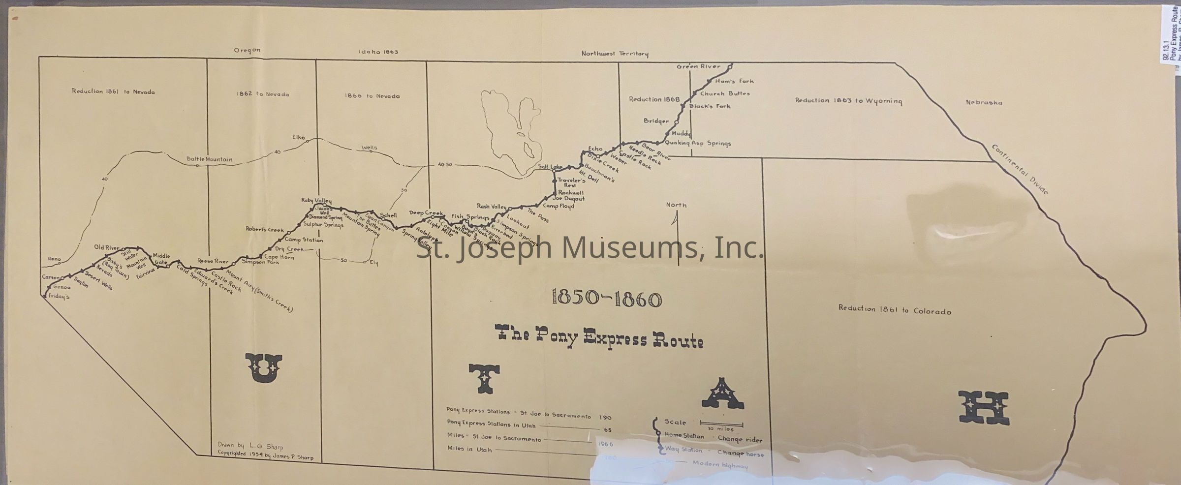
Pony Express Route in Utah, 1850-1860, James Sharp, Map, 1954
Entry/Object ID
AM1991.30.1
Scope and Content
Pony Express Route, 1850-1860, James Sharp, Map, 1954. Map of the Pony Express Trail west of the Continental Divide in Utah from Green River to Friday's station near Reno area. Lists names of stations. Drawn on broad outline map without specific U.S. Territory distinction, except for notes of when that section was reduced. Distinguishes between home stations and way stations.
Drawn by L.G. Sharp. Copyright, James P. Sharp, 1954. Handwritten above "To Roy Coy, James P. (Jim) Sharp."
Legend gives Pony Express Statistics:
":Pony Express Stations, St. Joe to Sacramento = 190
Pony Express Stations in Utah = 65
Miles- St. Joe to Sacramento = 1966
Miles in Utah = 760
Lexicon
Nomenclature 4.0
Nomenclature Secondary Object Term
Map
Nomenclature Primary Object Term
Cartograph
Nomenclature Sub-Class
Graphic Documents
Nomenclature Class
Documentary Objects
Nomenclature Category
Category 08: Communication Objects
LOC Thesaurus for Graphic Materials
Pony express
Search Terms
Pony Express Trail, Pony Express Trail in Utah, Utah Trails