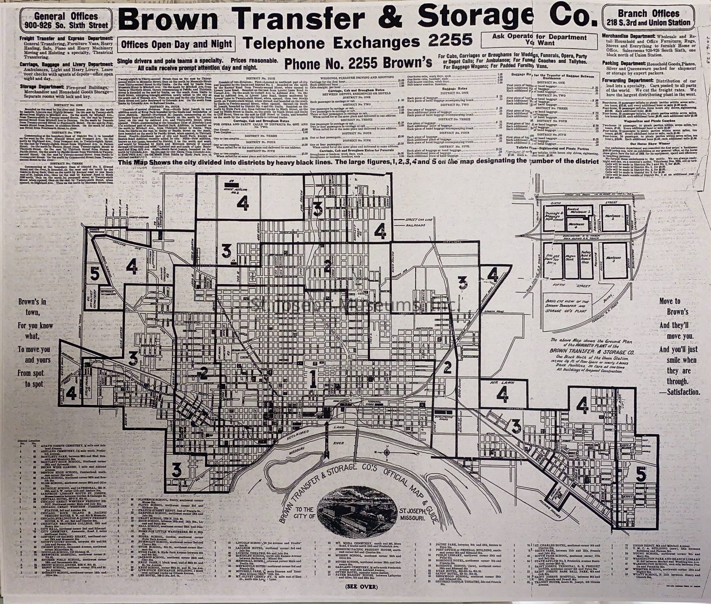
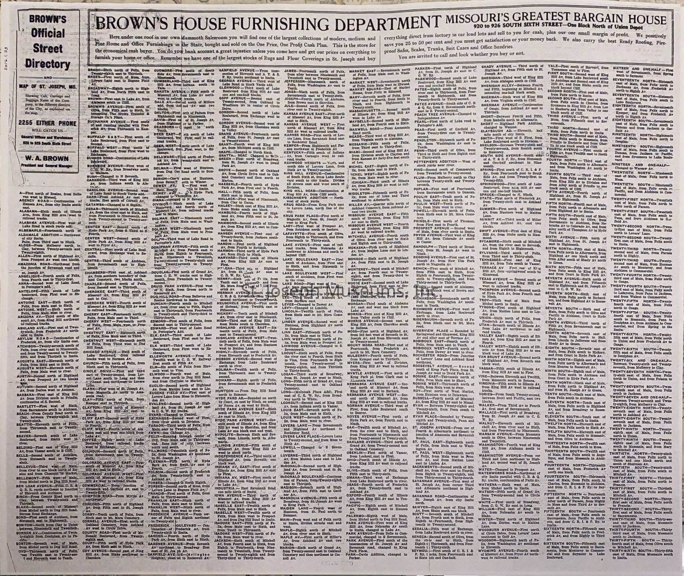
St. Joseph City Street & Business Directory Map. c. 1898
Entry/Object ID
AM2016.1.23
Scope and Content
St. Joseph City Street & Business Directory Map. c. 1898. Photocopy of Brown Transfer & Storage Co.'s Official Map and Guide to the City of St. Joseph, MO. Front side displays a map of city streets; Karnes Road on north, 36th St. on east, Alabama street on south and river on west.
Schools, parks, hospitals, cemeteries, hotels, etc. identified with numbers associated with legend below.
Rate chart for carriage, cabs, and broughams and baggage rates for Brown's above.
Back side: Official Street Directory
Lexicon
Nomenclature 4.0
Nomenclature Secondary Object Term
Map
Nomenclature Primary Object Term
Cartograph
Nomenclature Sub-Class
Graphic Documents
Nomenclature Class
Documentary Objects
Nomenclature Category
Category 08: Communication Objects
Search Terms
City Street Directory, St. Joseph, Missouri, Brown Transfer & Storage Co.