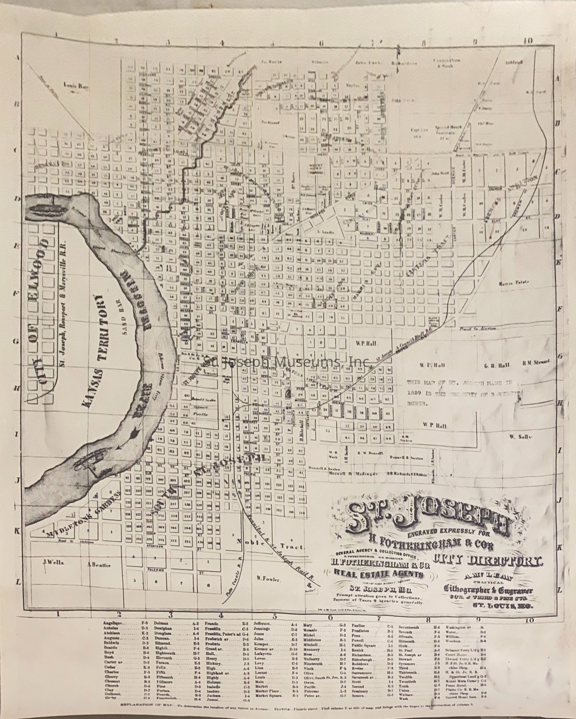
St. Joseph Missouri & Elwood Kansas Map from City Directory, 1860
Entry/Object ID
AM1970.2.1
Scope and Content
St. Joseph Missouri & Elwood Kansas Map from City Directory, 1860. Engraved for H. Fotheringham, & Co.
Map originally folded into City Directory. Street layout of St. Joseph with Additions named. City blocks are bounded by Highland on north, Palmero on South, Missouri River on west and approximately 36th St. on east. Kansas side of River is labeled Kansas Territory, but 2 blocks of Elwood included.
Also marked are:
Belmont Ferry
Elwood Ferry
Steamboat Landing
Hannibal & St. Joseph Railroad Machine Shop
Mt. Mora Cemetery
Patee Hotel
Scared Heart Institution
Courthouse
Lexicon
Nomenclature 4.0
Nomenclature Secondary Object Term
Map
Nomenclature Primary Object Term
Cartograph
Nomenclature Sub-Class
Graphic Documents
Nomenclature Class
Documentary Objects
Nomenclature Category
Category 08: Communication Objects
LOC Thesaurus for Graphic Materials
Courthouses
Search Terms
St. Joseph Map, Belmont Ferry, Elwood Ferry, Steamboat Landing, Hannibal & St. Joseph Railroad Machine Shop, Mt. Mora Cemetery, Patee House, Sacred Heart Convent, St. Joseph History, Elwood, Kansas, Kansas Territory