Name/Title
St. Joseph Statistic Report for Promotion & Development, 1957Entry/Object ID
L2001.24.61Description
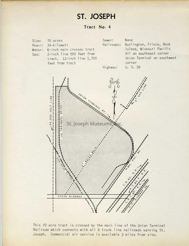
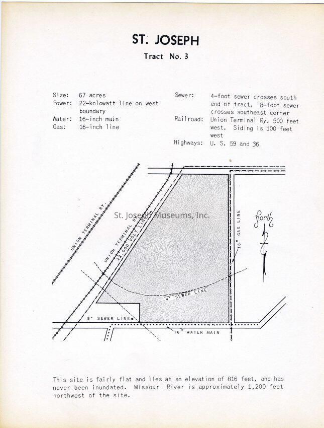
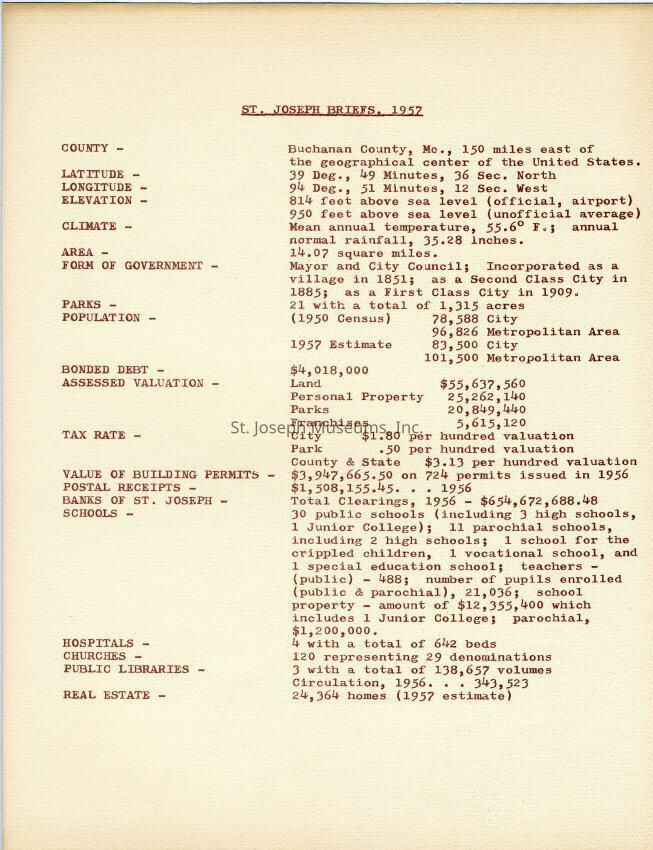
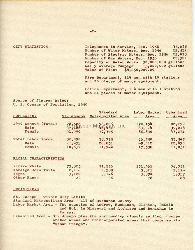
St. Joseph Statistic Report for Promotion & Development, 1957 Compilation of Maps, Statistics, City Fee Schedules, Demographics, Transportation & Utility Capacities, etc. 26 pages. May have been prepared for two industrial sites, Tracts No. 3 & 4, bounded by Union Terminal Railway lines, near the Missouri River. 26 images attached.
Loose leaf
A = Tract. No. 4 Map
B = Tract No. 3 Map
C & D = St. Joseph Briefs, Latitude/Climate/Population/Tax Rate/Value of Buildings, etc
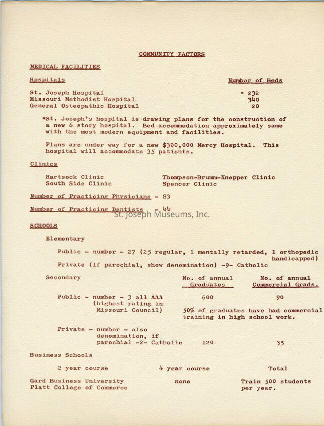
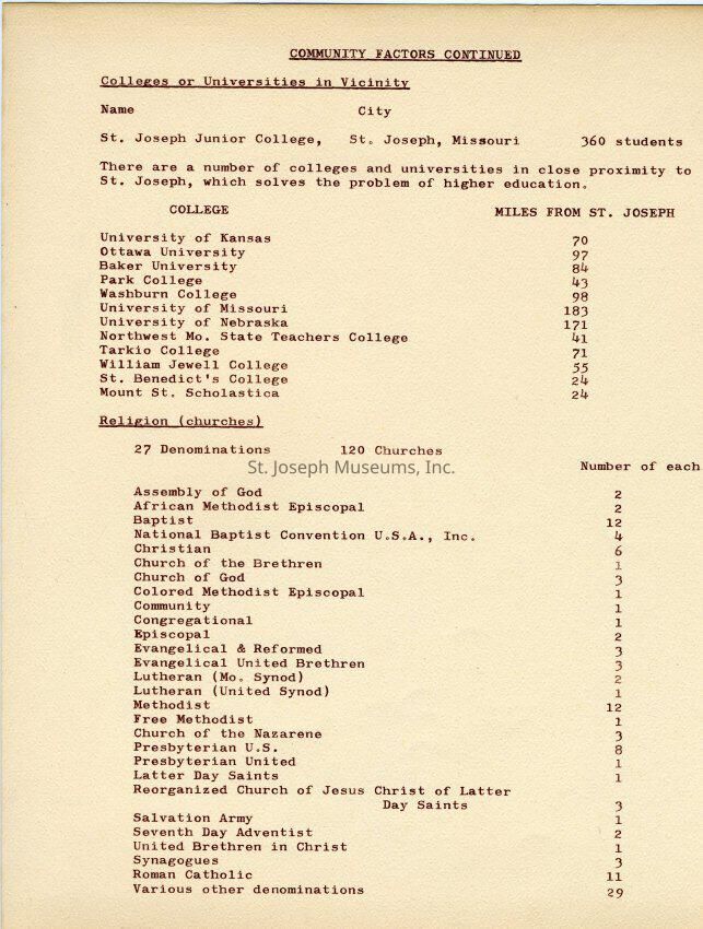
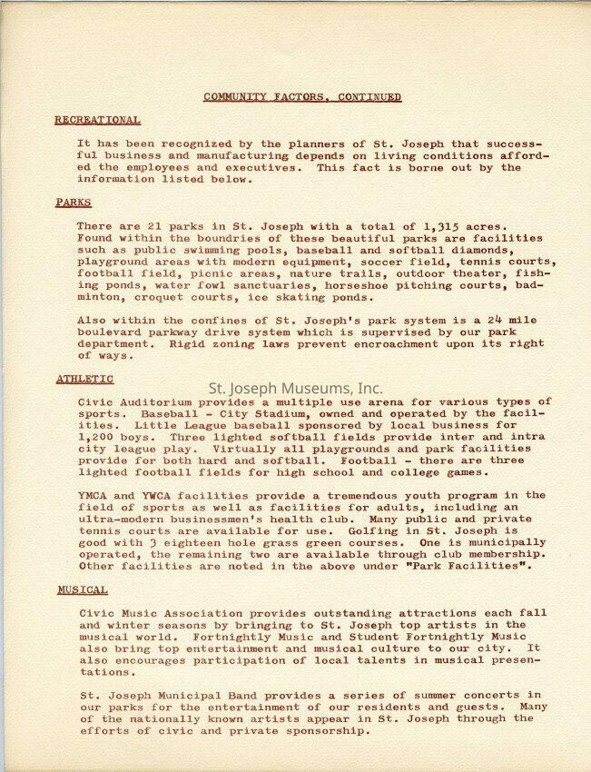
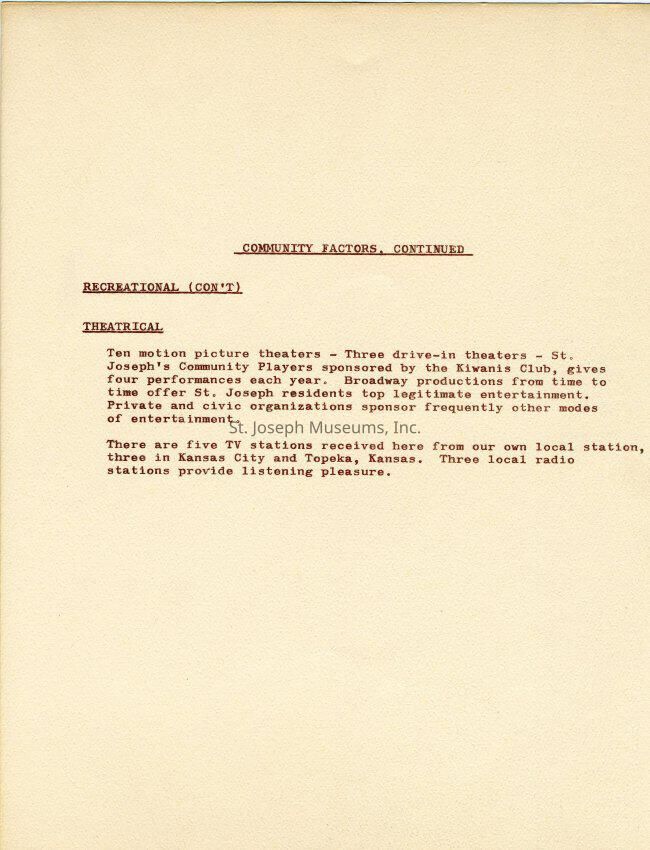
E -H = Community Factors
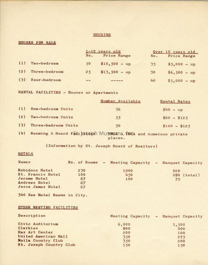
I = Housing Statistics
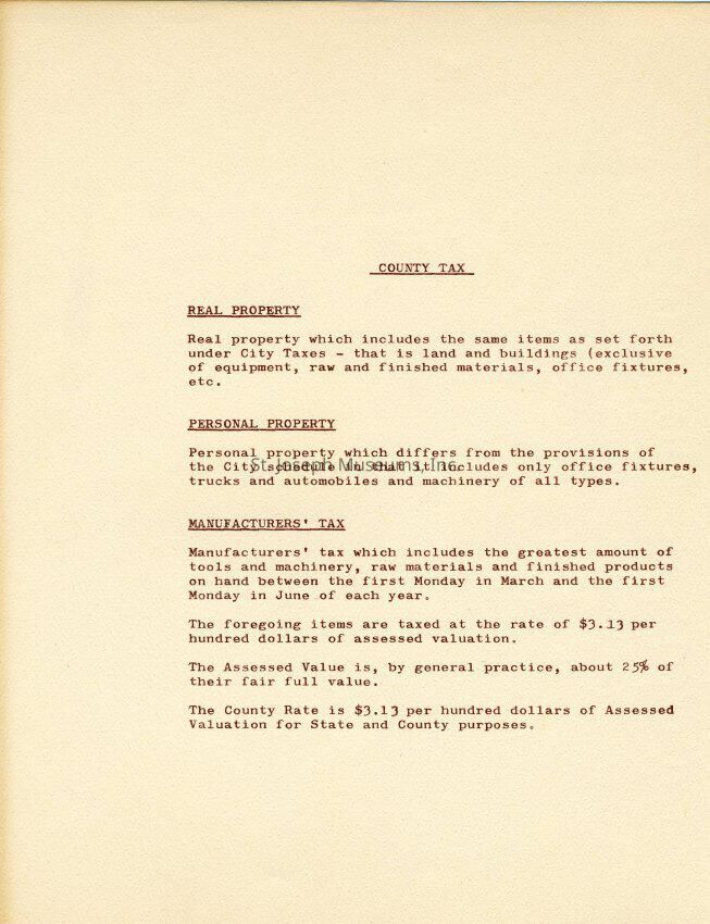
J = County Tax Rates
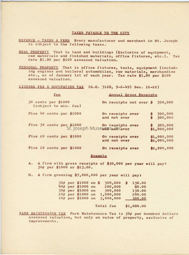
K = City Tax Rates
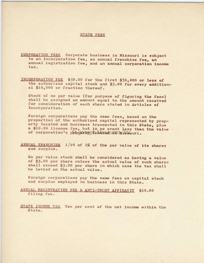
L = State Fees
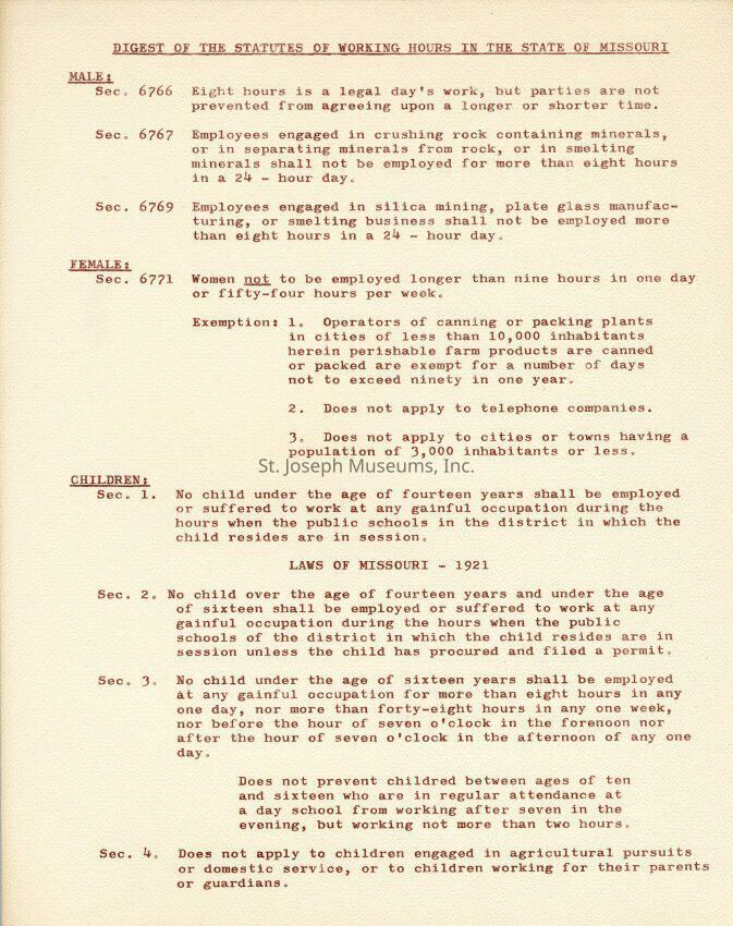
M = Working Hours Statutes in Missouri
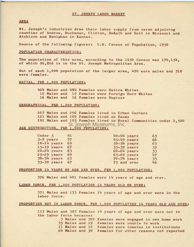
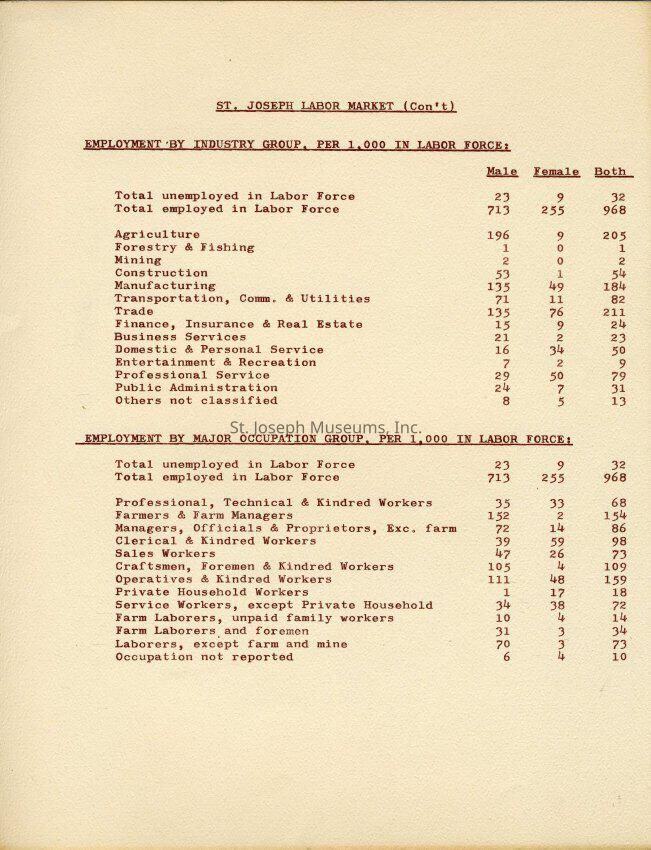
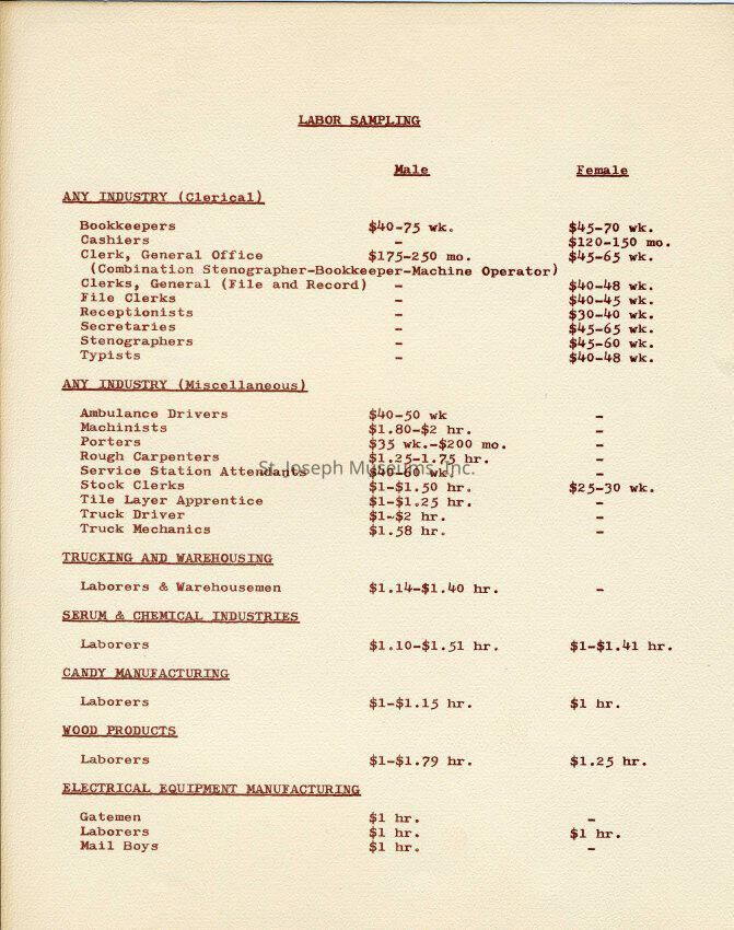
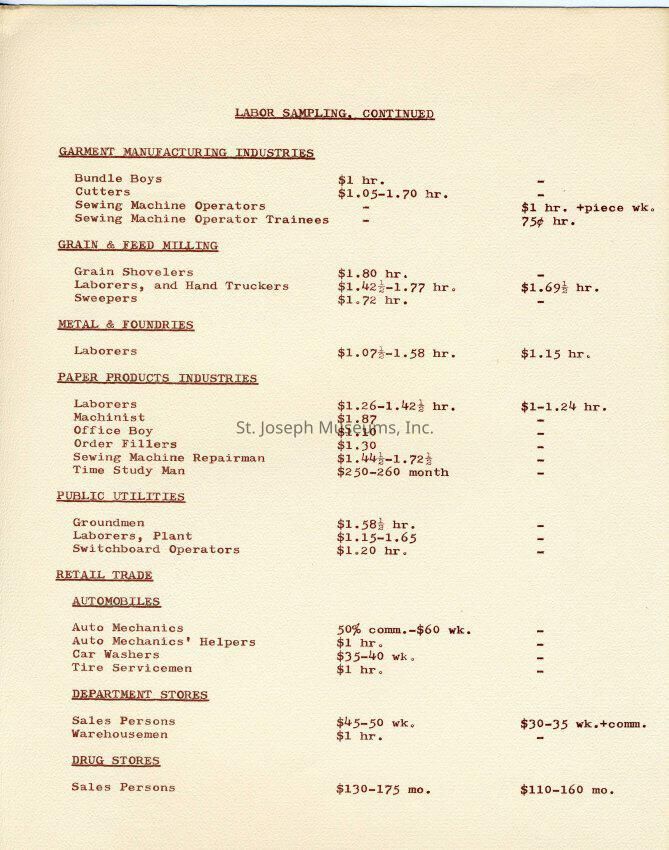
N - Q = St. Joseph Labor Market Statistics
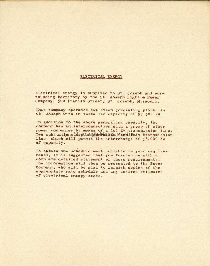
R = Electrical Energy Availability
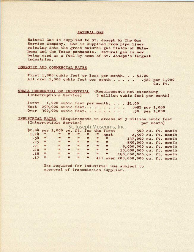
S = Natural Gas Availability
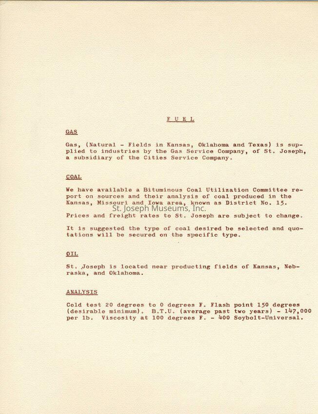
T = Fuel Statistics
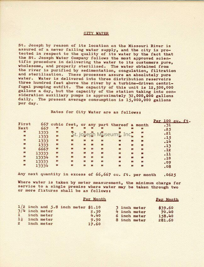
U = City Water Availability
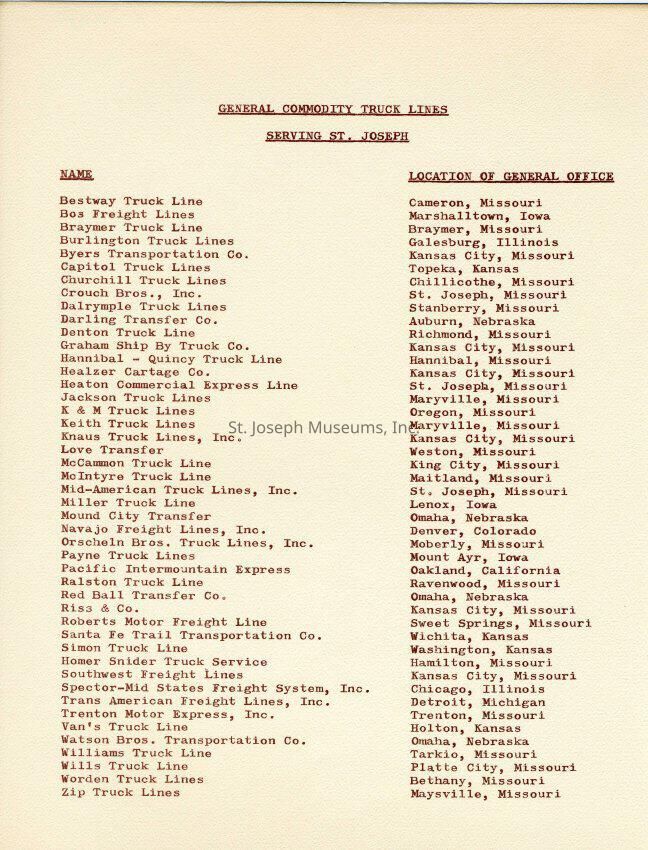
V = Truck Lines Serving St. Joseph
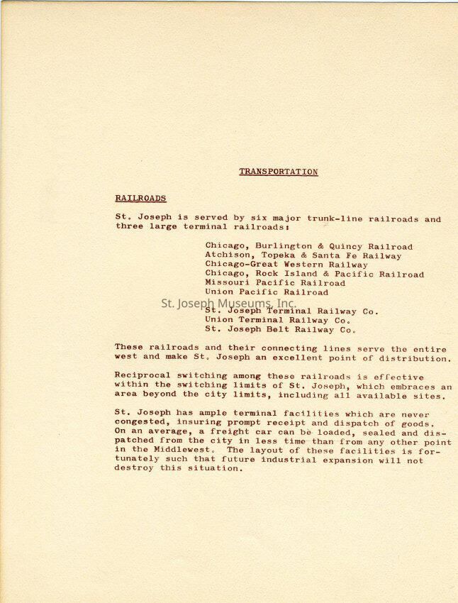
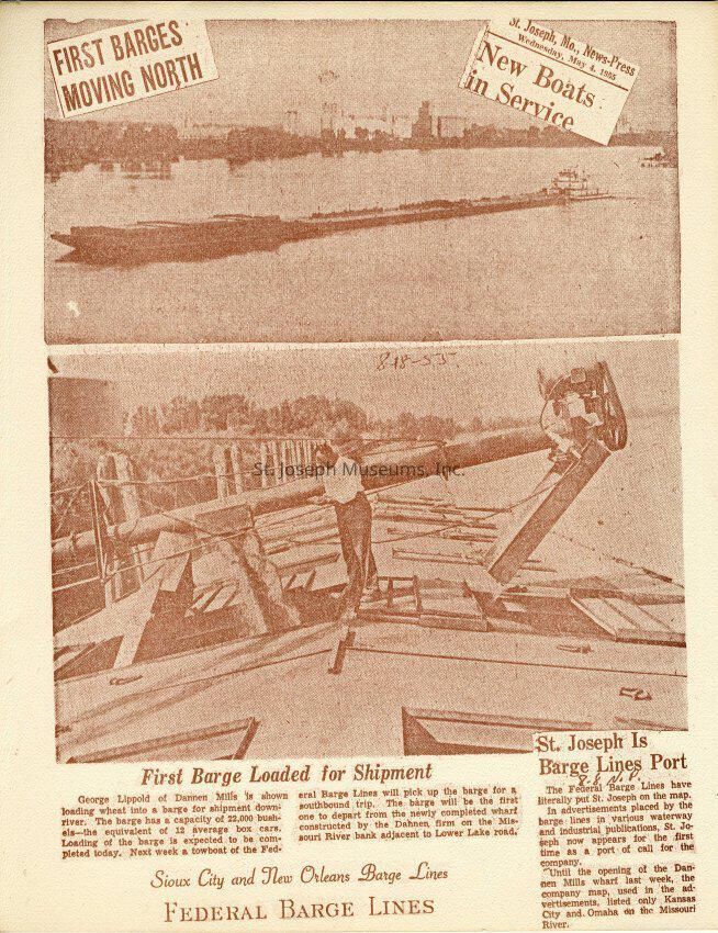
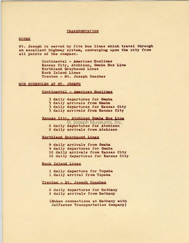
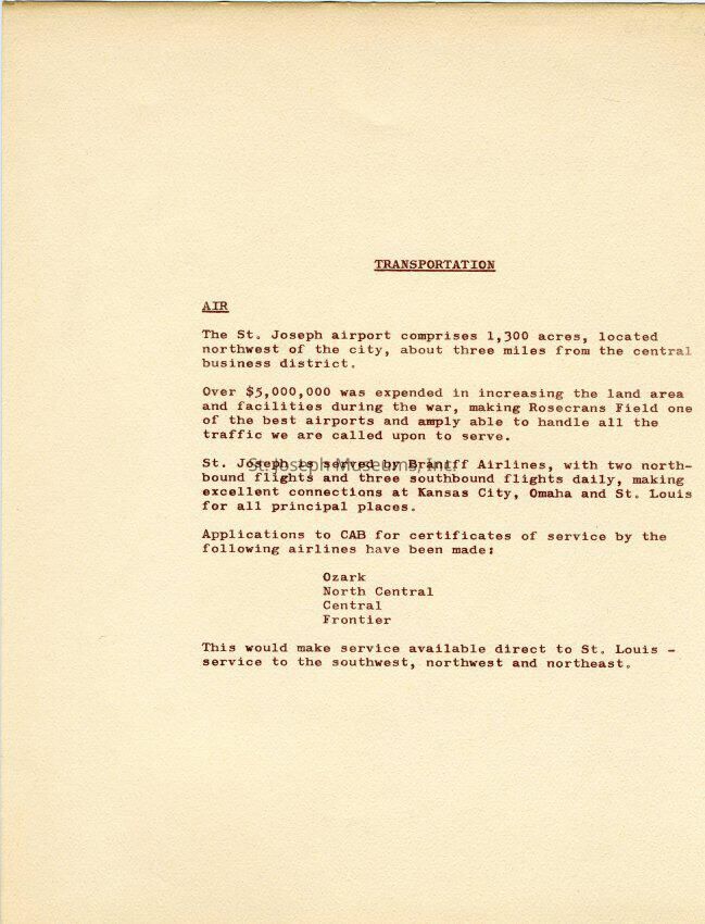
W- Z = Other Transportation Available. Railroads/barge/Air/BusLexicon
Nomenclature 4.0
Nomenclature Primary Object Term
ReportNomenclature Sub-Class
Administrative RecordsNomenclature Class
Documentary ObjectsNomenclature Category
Category 08: Communication ObjectsLOC Thesaurus for Graphic Materials
GovernmentSearch Terms
St. Joseph HistoryPublication Details
Author
City of St. JosephDate Published
1950Call No.
StJoArea ST