St.Joseph Aerial View of area around Smith Park Photo, c. 1920's
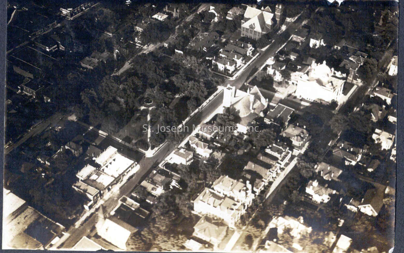
St.Joseph aerial view NE--Smith Park left center, c. 1920: Copyright: 354.18022.33 St.Joseph aerial view NE--Smith Park left center, c. 1920
St.Joseph aerial view NE--Smith Park left center, c. 1920

Copyright: 354.18022.33 St.Joseph aerial view NE--Smith Park left center, c. 1920

Name/Title

St.Joseph Aerial View of area around Smith Park Photo, c. 1920's

Entry/Object ID

P354.18022.33

Description

St. Joseph Aerial View of area around Smith Park Photo, c. 1920's. b/w. Aerial view of the area about the park that later became the site of St. Joseph City Hall. Francis Street is center in the photo, with the area bordered by 10th and 13th St. From Index: "St. Joseph air view to NE. Felix & Francis, 10th to 13th, Smith Park at left center. Christian Science Church upper right. Francis St. Methodist Church center. For Original digital scan see History 20 CD

Made/Created

Artist

MAX HABECKER

Date made

1920

Place

City

St. Joseph

State/Province

Missouri

Lexicon

Nomenclature 4.0

Nomenclature Secondary Object Term

Print, Photographic

Nomenclature Primary Object Term

Photograph

Nomenclature Sub-Class

Graphic Documents

Nomenclature Class

Documentary Objects

Nomenclature Category

Category 08: Communication Objects

Search Terms

St. Joseph Aerial View, Downtown, Smith Park

Condition

Overall Condition

Fair

Maintenance

Maintenance History

Date

Feb 6, 2019

Relationships

Related Person or Organization

Person or Organization

Max Habecker

Provenance

Notes

Photographs taken in c. 1920's by Max Habecker, St. Joseph News-Press Photographer, affixed in photo album.